I shared this photo waaaaaay back on August 19, 2009! Since my old posts are becoming inaccessible as the modern web leaves them behind, I’m trying to “save” at least one a week. I love Jim’s writings about the photos he takes and thought you would as well. Enjoy!
Fog rolls off of Lake Superior and up the Grand Sable Dunes on the Pictured Rocks Lakeshore as seen from the Log Slide Overlook west of Grand Marais in the Upper Peninsula Of Michigan. The Grand Sable Dunes are located on a five mile stretch between the Sable River and Au Sable Point in Alger County. The banks rise up to 275 feet high, created during the last ice age when sand and gravel filled in a deep rift in the glacier. Atop the gravelly banks, sand dunes rise another 80 feet. These are “perched dunes” because they are perched on top of another landform. They were probably formed when wind and waves piled up sand at the edge of Lake Nipissing, the forerunner of Lake Superior.
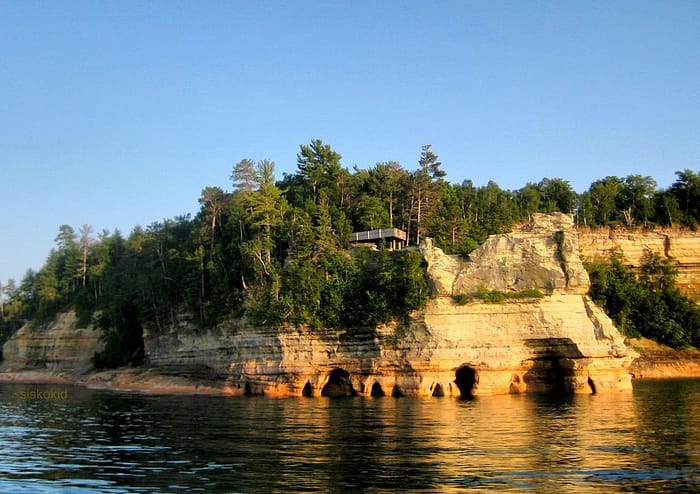
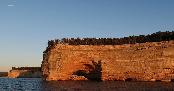
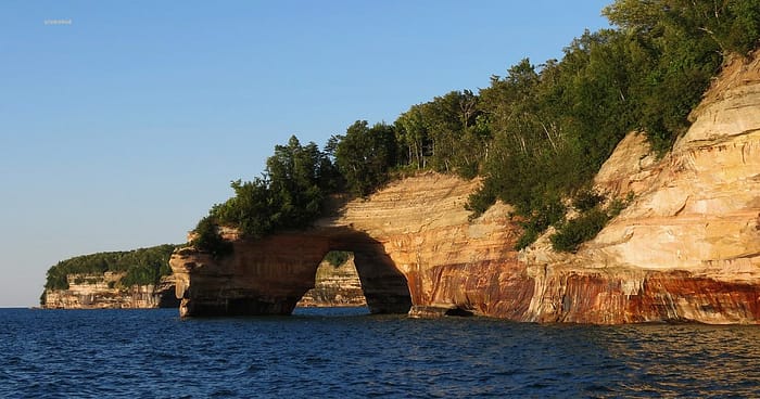
This distinct sandstone formation located on the south shore of Lake Superior northeast of Munising in the Upper Peninsula of Michigan is known as Miners Castle, for the turret-like shape caused by wind and wave erosion. Miners Castle was named by Englishman Alexander Henry’s employees when they were exploring the area for minerals in 1771. Though no minerals were ever found, the name “Miners” has endured. The nine-story-high rock formation is one of the Pictured Rocks National Lakeshore’s most popular attractions, despite the 2006 collapse of one of its signature “turrets”.Grand Portal Point is a well-known formation of rock that juts out into Lake Superior from the Pictured Rocks National Lakeshore located northeast of the Upper Peninsula town of Munising, Michigan. There was once a cavity at the end that was large enough for a good sized ship to sail through and it was perhaps a hundred feet or more in height from the surface of the water. That arch collapsed during the night of Sunday, September 16, 1900. Grand Portal Point suffered a second, significant collapse sometime between the fall of 1999 and spring of 2000. The arch is still there, but there’s now a rubble pile in the bottom large enough to inhibit any water traffic.My wife and I visited the Upper Peninsula town of Munising, Michigan recently and took a sunset cruise on Lake Superior to view the famous Pictured Rocks. One of the tour’s highlights is this imposing arch of rock that extends from the shoreline out to an outcropping located directly in Lake Superior. Lore has it that a couple displayed their love for one another by jumping off the top of this rock arch together.
Active dunes gradually advance over time. In some places trees and telephone poles have been buried in drifting sand over a period of several years. A common question is “How fast are the dunes moving?” Rates of sand movement vary from one place to another and from one year to the next. At the Dune Climb the average rate of advance has been about 4 feet (1.2 meters) per year over the past few years.
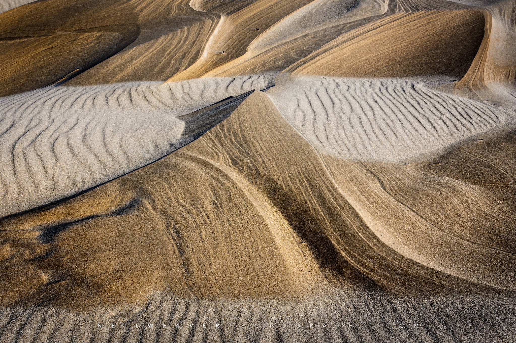
Direction of sand movement also varies from one place to the next. The shapes of dunes reveal the direction of the winds. Dry, loose sand can take on a maximum slope of 34 degrees, known as the angle of repose. As sand piles up on an unvegetated dune, the leeward (downwind) slope approximates the angle of repose, while the windward slope is more gradual. Ripples in the sand show a similar asymmetrical shape.
Dune sand moves primarily by a process called “saltation”, literally “jumping”. Wind forces grains of sand to roll, collide with other grains of sand, and in subsequent collisions some grains bounce into the air, are driven downwind as they fall, and upon landing strike other grains to produce a chain reaction. On a windy day you can see a hazy zone of sand moving just a foot or two above the ground.
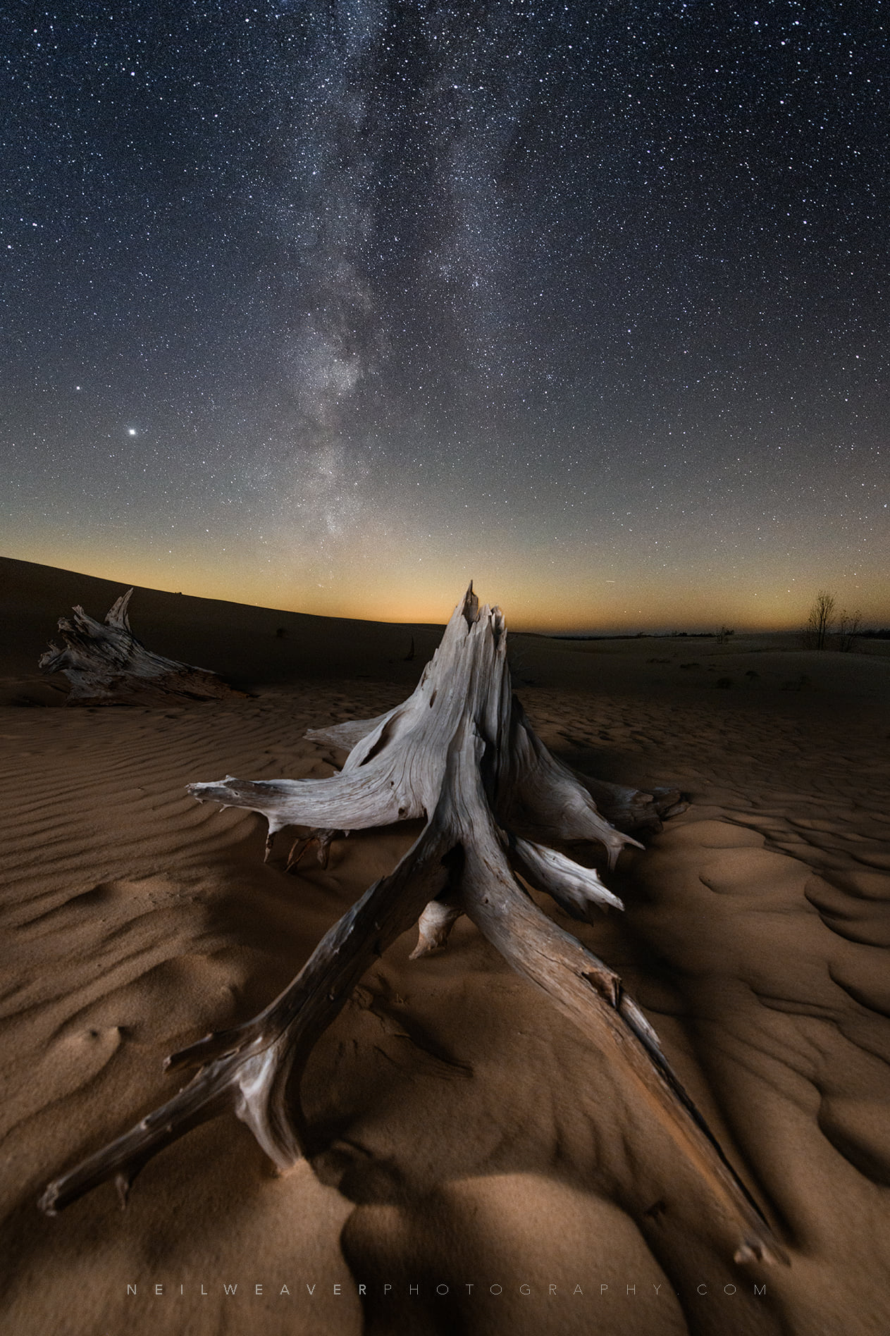
Neil took the photo above last year in late December & shared “One of the many things that I love about hiking around the sand dunes is finding miniature landscapes created by the strong winds. The textures and lines compose a true natural work of art!”
While this year doesn’t seem to be opening with as much hopefulness as 2021, here’s hoping that 2022 has all of us feeling like we’re walking on clouds!
John took this photo yesterday at Saugatuck Dunes State Park. See more in his Michigan 2021 gallery on Flickr.
Beginning in 1919 a small portion of what is now the national lakeshore was set aside as a state park. The idea of a national park in northwestern Michigan did not surface until the National Park Service’s Great Lakes Shoreline Survey visited the area in 1958. Between 1959 and 1970 there was a continuous and controversial effort in Congress to create a park unit around the Sleeping Bear Dune. The legislative leader of the Sleeping Bear park proposal was United States Senator Philip A. Hart. The senator’s persistence and patience in the end led to the creation of Sleeping Bear Dunes National Lakeshore on October 21, 1970.
Opposition to the creation of the lakeshore was very strong among local summer homeowners. More than 1,400 tracts of private land had to be acquired to create the lakeshore. A heavy-handed, poorly planned land acquisition program reinforced the bitterness that surfaced during the decade of struggle that preceded authorization. The legacy of those actions has been twofold. On one hand the National Park Service has been vilified by many local property owners and the park staff have had to work in an environment that is unnecessarily confrontational. On the other hand, the presence of an organized local populace wary of National Park Service policy has influenced for the better the development of the national lakeshore. Local sentiments played an important role toning-down the agency’s initial plans to intensively develop the area’s recreational assets. More recently local sentiment has influenced the agency’s approach to the lakeshore’s rural cultural landscapes. Unfortunately, resistance to the National Park Service in the region has also hindered opportunities to bring more land under protection and to develop scenic drives for park visitors.
The National Park Service conceived the Sleeping Bear Dunes lakeshore at a time when the shores of Lake Michigan were rapidly undergoing privatization. Subdivisions of vacation and year round homes threatened to keep ordinary citizens from enjoying Michigan’s broad, sandy shoreline. A nationalized lakeshore along the beaches and bluffs of the Sleeping Bear made available for all what might have been enjoyed only by a select few. The cost was millions of dollars of federal funds and the hopes and dreams of hundreds of small property owners. Sleeping Bear Dunes was a tragedy for the latter and a wise investment of the former.
It was hard to pick a photo for this post, but I ended up going with Thomas’s beautiful shot from June of 2016 of my favorite view in the Lakeshore atop the Empire Bluffs where you can see South Bar Lake, the southern end of the main dune complex, and the Manitou Islands in the distance. See more in Thomas’s 6/1-6/3/16 Grand Traverse & Leelanau gallery on Flickr.
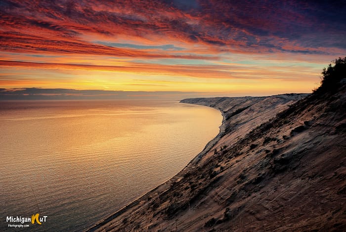
Sunrise overlooking Grand Sable Dunes in the Pictured Rocks National Lakeshore seems like a glorious way to start the day. See more from John at michigannutphotography.com or on the Michigan Nut Facebook page & have a wonderful week!!
In case any of you are feeling like me & longing for a little warmth, here’s a shot from a couple years ago at Silver Lake Sand Dunes. Head over to Charles’ Flickr for his latest!
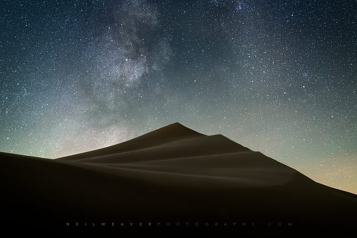
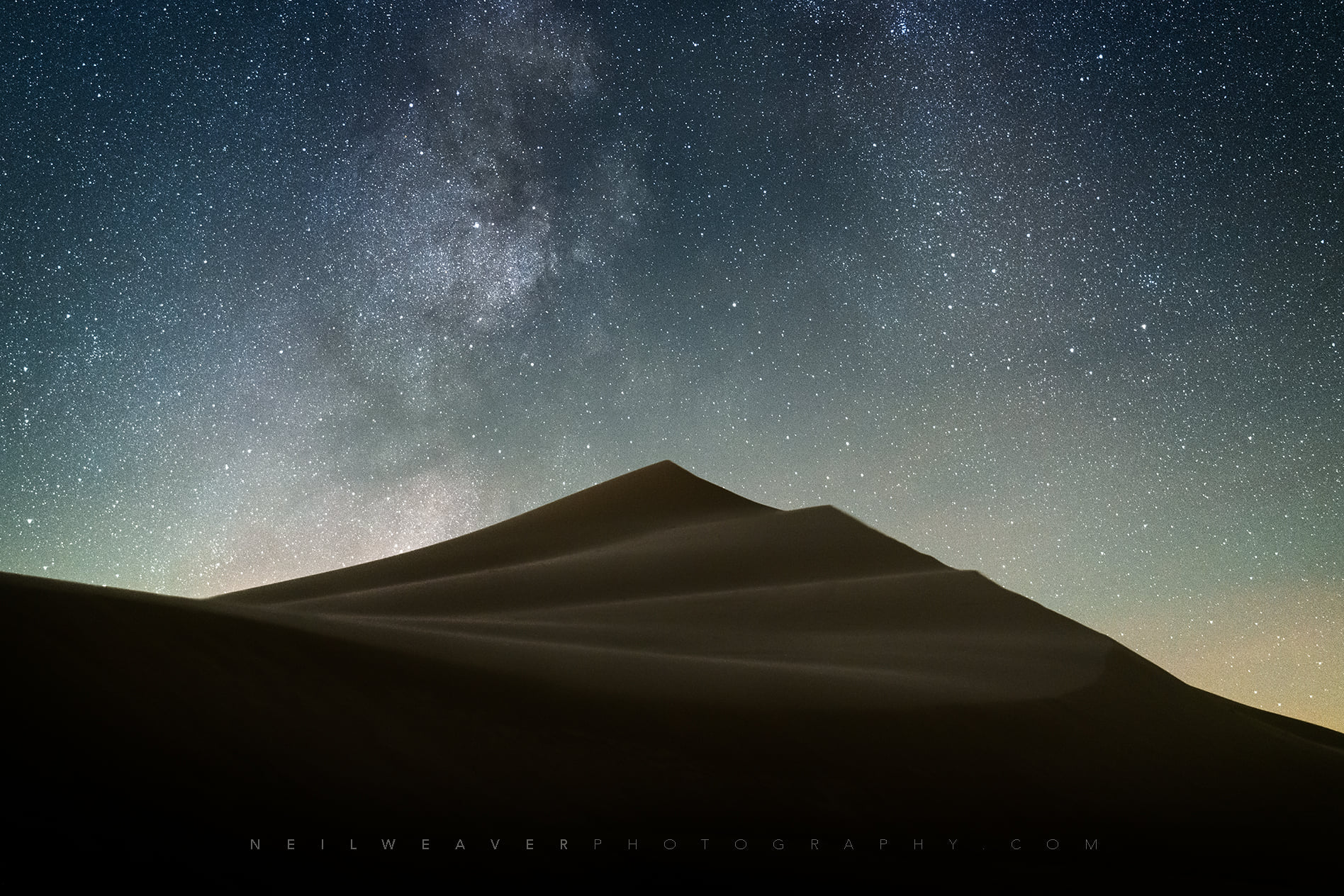
Neil captured this stunning shot of the galactic core of our Milky Way stretching across the night sky over Silver Lake Sand Dunes during a recent visit. Head over to neilweaverphotography.com or follow him on Facebook for more great pics!
Sleeping Bear Dunes National Lakeshore was established by Act of Congress October 21, 1970. Public Law 91-479 states, “…the Congress finds that certain outstanding natural features, including forests, beaches, dune formations, and ancient glacial phenomena, exist along the mainland shore of Lake Michigan and on certain nearby islands in Benzie and Leelanau Counties, Michigan, and that such features ought to be preserved in their natural setting and protected from developments and uses which would destroy the scenic beauty and natural character of the area.” The Congress also directed that “…the Secretary (of the Interior) shall administer and protect Sleeping Bear Dunes National Lakeshore in a manner which provides for recreational opportunities consistent with the maximum protection of the natural environment within the area.”
…The Lakeshore mission is to preserve outstanding natural features including forests, beaches, dunes and ancient glacial phenomena along 100 km (64 miles) of Lake Michigan shoreline, in order to perpetuate the natural setting for the benefit and enjoyment of the public, and to protect it from developments and inappropriate uses that would destroy its scenic beauty, scientific and recreational value.
I know that there’s few people in Leelanau who would disagree that the park has helped to maximally protect our area’s incredible natural beauty with over 60 miles of shoreline open & accessible to all as well as miles of forest, dune & farmland. Head over to the Sleeping Bear Dunes National Lakeshore Facebook page for all kinds of 50th Anniversary fun!





 Beginning in 1919 a small portion of what is now the national lakeshore was set aside as a state park. The idea of a national park in northwestern Michigan did not surface until the National Park Service’s Great Lakes Shoreline Survey visited the area in 1958. Between 1959 and 1970 there was a continuous and controversial effort in Congress to create a park unit around the Sleeping Bear Dune. The legislative leader of the Sleeping Bear park proposal was United States Senator Philip A. Hart. The senator’s persistence and patience in the end led to the creation of Sleeping Bear Dunes National Lakeshore on October 21, 1970.