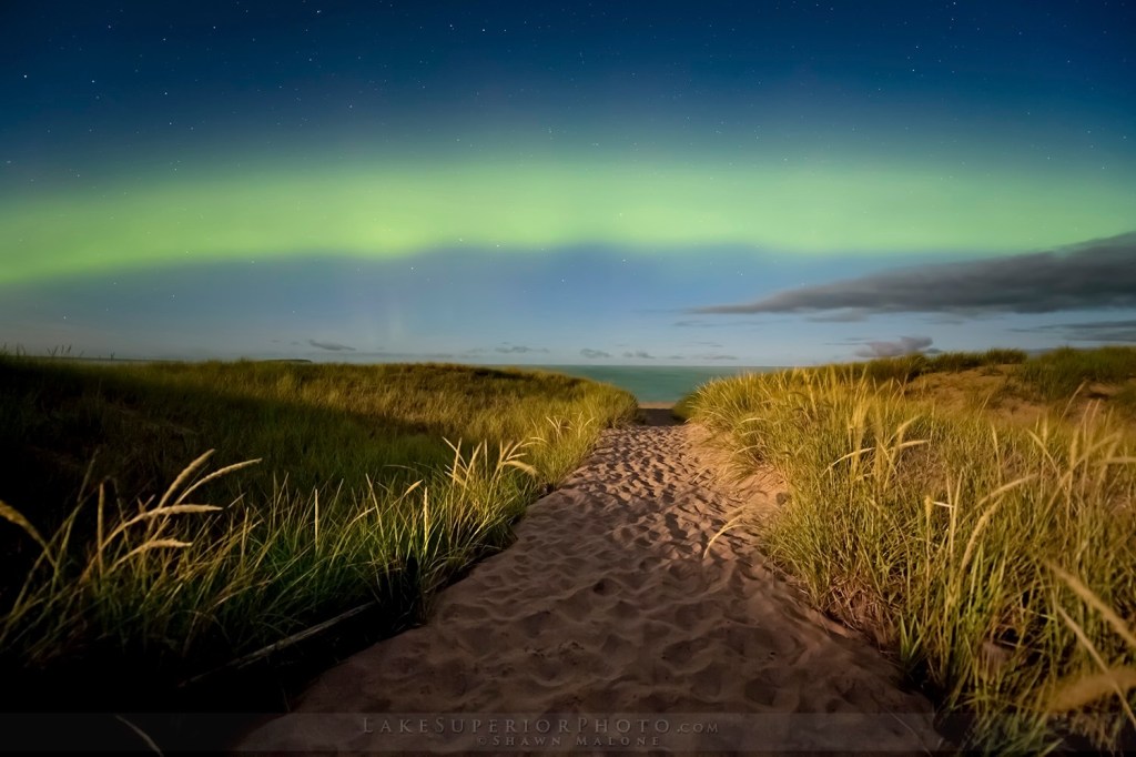
Barefoot Aurora by Lake Superior Photo
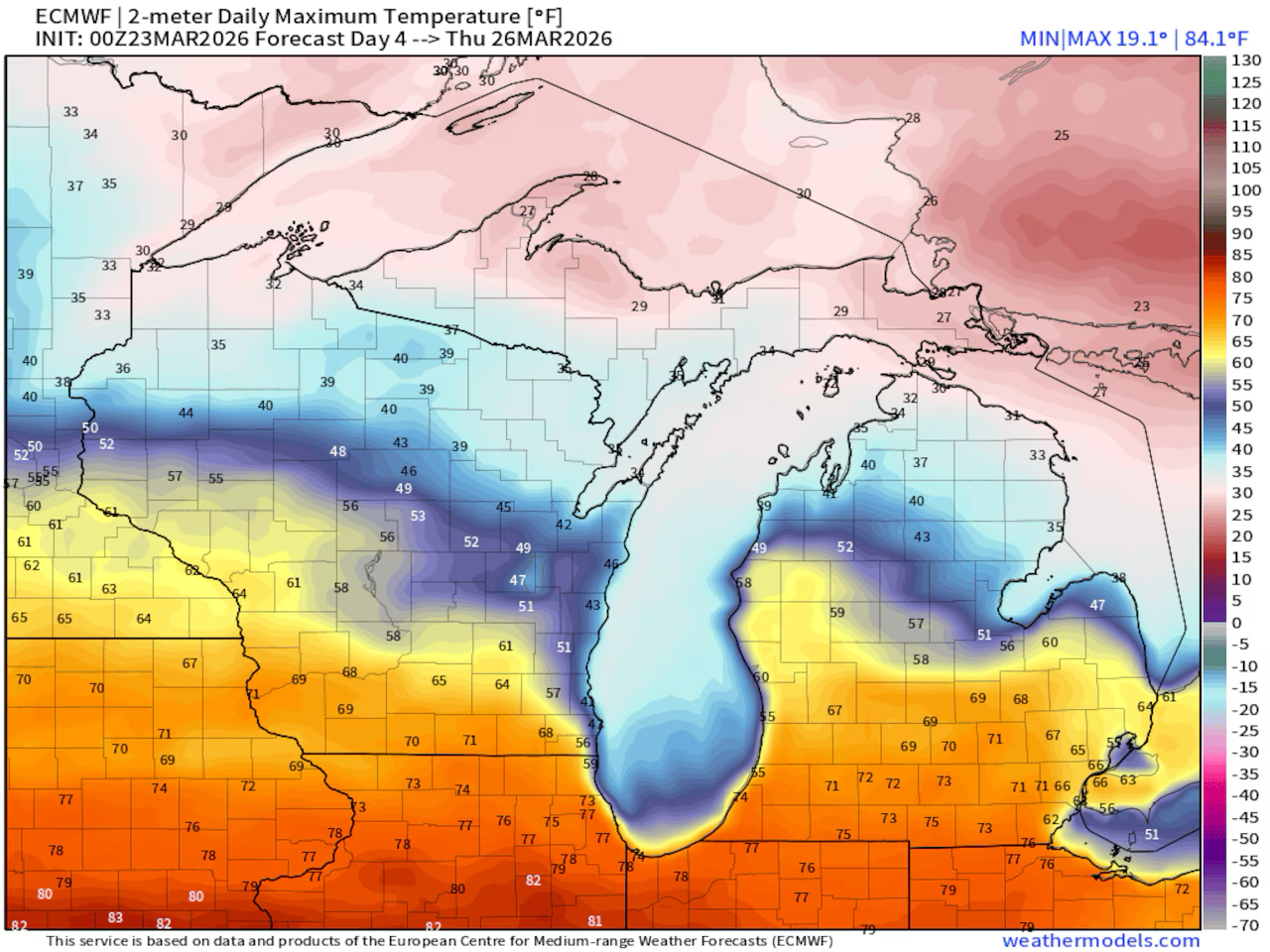
The weather has been getting a lot of (justifiable) bad press lately so I figured I’d try and put a little positive spin on news shared by Michigan Public that NOAA is forecasting a potentially strong El Niño weather pattern developing for Michigan this summer:
“Even though the evidence is still early, this could be a very significant event in 2026 and lingering into 2027,” says Daniel Swain, climate scientist with the University of California Agriculture and Natural Resources.
A strong El Niño would drive up average global temperatures. The hottest years on record generally occur in years when El Niño is active, because El Niño occurs when the Eastern Pacific is hotter than usual. “Its function in the global earth system is to release heat from the deeper oceans that has been temporarily stored there,” Swain says. “El Niño allows that subducted heat to be unearthed.”
That dynamic played out in a big way in 2023 and 2024, when a long, strong El Niño pattern helped shatter global temperature records. 2023 smashed the record for the hottest year ever recorded on Earth, only to be surpassed by temperatures in 2024.
Last week Shawn shared this photo saying that she’s eagerly anticipating the return of nights watching the aurora barefoot so it looks like El Niño is gonna help with that. You can see lots more amazing photos from Lake Superior Photo on Facebook. You can also visit the Lake Superior Photo website to view & purchase photos and for information about their Marquette gallery along with photography workshops, tours, and guiding.