I shared this photo waaaaaay back on August 19, 2009! Since my old posts are becoming inaccessible as the modern web leaves them behind, I’m trying to “save” at least one a week. I love Jim’s writings about the photos he takes and thought you would as well. Enjoy!
Fog rolls off of Lake Superior and up the Grand Sable Dunes on the Pictured Rocks Lakeshore as seen from the Log Slide Overlook west of Grand Marais in the Upper Peninsula Of Michigan. The Grand Sable Dunes are located on a five mile stretch between the Sable River and Au Sable Point in Alger County. The banks rise up to 275 feet high, created during the last ice age when sand and gravel filled in a deep rift in the glacier. Atop the gravelly banks, sand dunes rise another 80 feet. These are “perched dunes” because they are perched on top of another landform. They were probably formed when wind and waves piled up sand at the edge of Lake Nipissing, the forerunner of Lake Superior.
This distinct sandstone formation located on the south shore of Lake Superior northeast of Munising in the Upper Peninsula of Michigan is known as Miners Castle, for the turret-like shape caused by wind and wave erosion. Miners Castle was named by Englishman Alexander Henry’s employees when they were exploring the area for minerals in 1771. Though no minerals were ever found, the name “Miners” has endured. The nine-story-high rock formation is one of the Pictured Rocks National Lakeshore’s most popular attractions, despite the 2006 collapse of one of its signature “turrets”.Grand Portal Point is a well-known formation of rock that juts out into Lake Superior from the Pictured Rocks National Lakeshore located northeast of the Upper Peninsula town of Munising, Michigan. There was once a cavity at the end that was large enough for a good sized ship to sail through and it was perhaps a hundred feet or more in height from the surface of the water. That arch collapsed during the night of Sunday, September 16, 1900. Grand Portal Point suffered a second, significant collapse sometime between the fall of 1999 and spring of 2000. The arch is still there, but there’s now a rubble pile in the bottom large enough to inhibit any water traffic.My wife and I visited the Upper Peninsula town of Munising, Michigan recently and took a sunset cruise on Lake Superior to view the famous Pictured Rocks. One of the tour’s highlights is this imposing arch of rock that extends from the shoreline out to an outcropping located directly in Lake Superior. Lore has it that a couple displayed their love for one another by jumping off the top of this rock arch together.
July averaged 76.89 degrees Fahrenheit (24.94 degrees Celsius) across the Lower 48 states, eclipsing the Dust Bowl’s July 1936 by an eighth of a degree. Records go back to 1895.
“It’s not good when you’re breaking records from the Dust Bowl, which we are in this case,” said meteorologist Jeff Masters of Yale Climate Connections. “And that was a crazy sort of situation where you put tens of millions of people in motion. You had this great migration because of the drought and the heat that hit the center of the U.S. — just a cataclysmic event in U. S. history. If we’re exceeding records from The Dust Bowl, that says that we’re in deep trouble.”
Although it was unusually cool in Alaska, hotter-than-normal conditions blanketed the Lower 48, with the most excessive heat in the Mountain West, Southwest, Northern Plains and Southeast. The heat was so widespread that every one of the Lower 48 states was at least 1 degree Fahrenheit (nearly 0.6 degrees Celsius) warmer than the 20th century average, said Russ Vose, chief of monitoring at NOAA’s National Center for Environmental Information.
The heat in the Dust Bowl years was more concentrated in parts of the Midwest and was aggravated by agricultural practices at the time, Vose said. What’s happening now is due to the burning of coal, oil and gas, scientists said.
“Extremely high temperatures across the continental U.S. this summer, along with intense drought and fire conditions, are absolutely consistent with the climate change signal,’ said Katharine Jacobs, a climate scientist at the University of Arizona.
If you’ve been following Michigan in Pictures for a while, you probably recognize Corey Seeman as Michigan’s leader in squirrel photography. Corey shared this photo back in the summer of 2021. See his latest on Flickr!
Space.com has an interesting story about how the upcoming Perseid Meteor shower (peak August 11-13) came to be known as “The Tears of St. Lawrence” and also some of the science behind this annual August sky show:
Laurentius, a Christian deacon, is said to have been martyred by the Romans in 258 AD on an iron outdoor stove. It was in the midst of this torture that Laurentius cried out: “I am already roasted on one side and, if thou wouldst have me well cooked, it is time to turn me on the other.”
The saint’s death was commemorated on his feast day, Aug. 10. King Phillip II of Spain built his monastery place the “Escorial,” on the plan of the holy gridiron. And the abundance of shooting stars seen annually between approximately Aug. 8 and 14 have come to be known as St. Lawrence’s “fiery tears.”
…We know today that these meteors are actually the dross of the Swift-Tuttle comet. Discovered back in 1862, this comet takes approximately 130 years to circle the Sun. With each pass, it leaves fresh debris — mostly the size of sand grains with a few peas and marbles tossed in. Every year during mid-August, when the Earth passes close to the orbit of Swift-Tuttle, the bits and pieces ram into our atmosphere at approximately 37 miles per second (60 kps) and create bright streaks of light.
Ken captured these Perseid meteors eleven Augusts ago over a 2 1/2 hour period at the D.H. Day Farm in the Sleeping Bear Dunes National Lakeshore. He relates that the barn was being lit periodically by rogue lightning and that this is a composite of many meteor images, where each photo is rotated around the north star so that the ‘point of origin’ of the shower can be seen better.
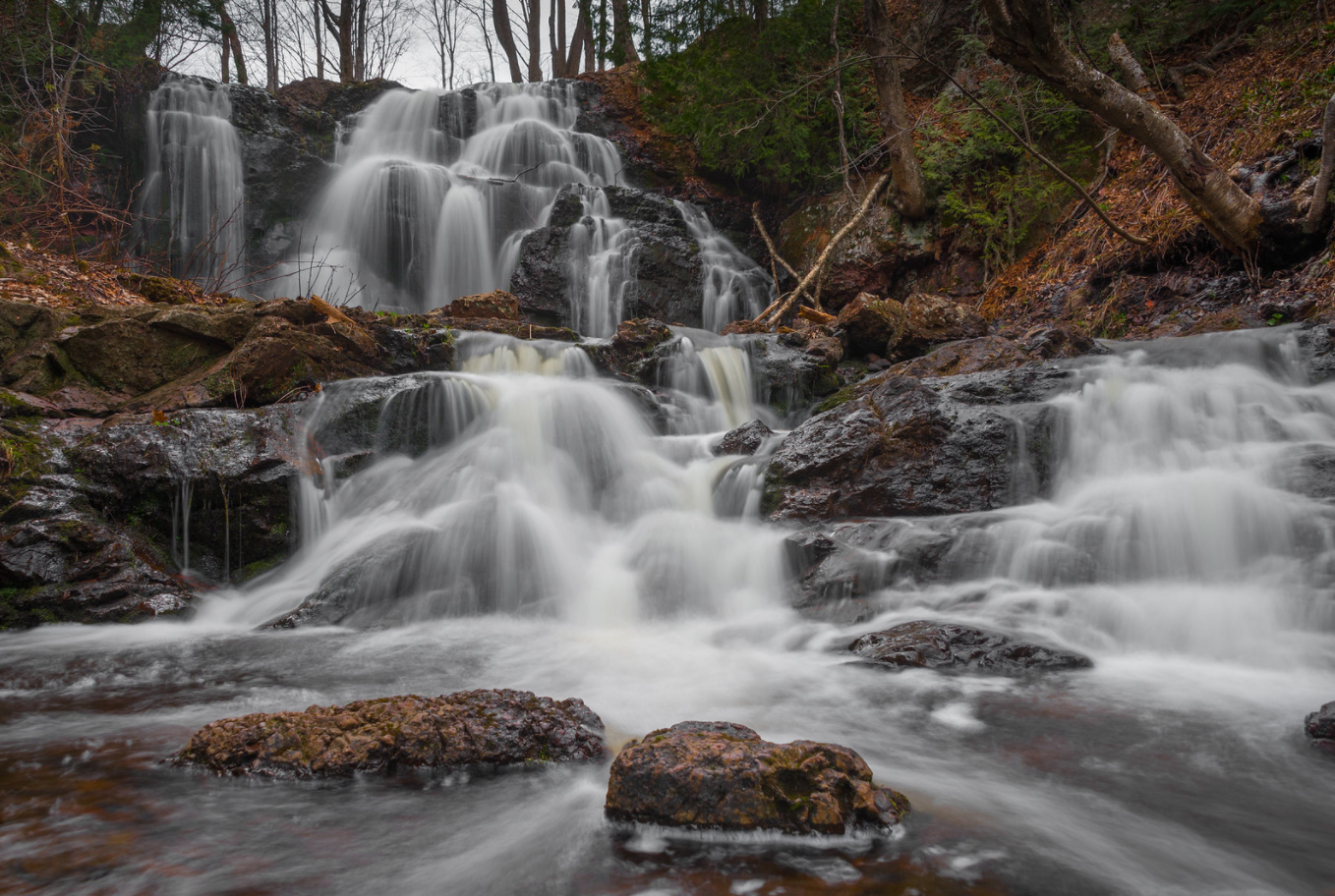
I shared this photo way back in 2015 with the comment that in addition to stalking the Petit Portal, it appeared I was stalking Eric Hackney as well. It’s been a minute since I have featured one of his photos, so I thought I would dust this post off & add some of my favorites from Eric that I’ve shared over the years along with still timely information about Gabbro Falls from GoWaterfalling:
Gabbro Falls is on the Black River and is as impressive, if not more impressive, than its more celebrated neighbors downstream along the Black River Scenic Byway. This is a largely wild waterfall with no fences or barriers of any kind. It consists of three separate drops. When the water is high there is a fourth drop that is the height of the other three combined. The main drop falls into a narrow crevice between two large rock formations.Gabbro Falls is relatively easy to find but there is some confusing information out there. The waterfall is also known as Baker’s Falls, and it is often mistakenly called Garbo Falls (gabbro is a type of rock). There is also a Neepikon Falls upstream, but it is just an unremarkable rapid.
Read on for tips on visiting and pages about nearby waterfalls on the Black River.
Our air quality begins to dip across the majority of the state as we head into the mid-afternoon hours today, July 15th, 2026. By sunset tonight, nearly the entire state will see 150+ μg/m³ AQI concentration, which translates to very unhealthy on the air quality index. Overnight, those winds out of the northwest do not stop, bumping parts of our area into the hazardous to everyone category at 250.5-500 μg/m³ AQI concentration if recent short-term model trends are correct.
Dangerous air quality levels like these are rare, so please take your respiratory health very seriously. Smoke concerns mixed with the already excessive heat concerns both today and tomorrow will also be a factor for higher mortality rates amongst all age/health groups, per research collected by the National Library of Medicine (NLM). All data shown is for fine particulate matter (PM2.5).
For sure follow Michigan Storm Chasers on Facebook and the MiStormChasers YouTube channel that often includes live reporting on Michigan weather events. You can also check out the smoke tag on Michigan in Pictures for a reminder of what last summer’s wildfire smoke was like.
The top pic from the Mackinac Bridge Authority webcam is a view looking north from Mackinaw City while the other is looking south across the Mighty Mac from St. Ignace.
Livestream from the Riviera Motel in Mackinaw City
Here’s what the webcam view looked like when I posted this…
We’ve all heard of f-stops, but look at this fawn f-GO!! I shared this photo eleven Julys ago but wanted to update it with even more Fun Fawn Facts:
Fawns average 6-8 lbs. at birth
Fawns are capable of walking within a few hours
Does usually remain within 100 yards of their fawns
A 3-week-old fawn can outrun most danger
The average number of spots on a fawn is 300 (gotta love scientists!)
The whitetail fawn loses its spots by the end of October of the same year it was born, or within 3 to 4 months after birth.
As the spots disappear, the fawn’s coat also changes from its reddish color to a grayish winter coat. The buck fawn’s face grows a bit darker in color but the belly remains white
Deer tend to live in female-led family groups of up to 25 deer and may live to ten years or more
When playing together, fawn games are suggestive of children’s games like tag. Mock fighting, aggressive postures, and scent marking helps fawns refine social behaviors
Young males leave their mother after one year, but young females usually stay with their mother for two years.
The area where the fawn is born normally becomes its adult habitat
Male fawns grow pedicles (the attachment point for antlers) that are typically about one inch in length
Fawns that live past the first week have a good chance of surviving to adulthood
I was 100% gonna save this smokin hot photo of Dodge Fountain on Detroit’s Hart Plaza for a post when the Pistons kick off next season, but when Sean shared this hilarious tweet from the National Park Service I knew it was time.
You do indeed know it’s hot simply by walking out the door. With the brutal conditions expected to last into the weekend, please take care of yourself & everyone in your life, especially children & pets who don’t understand the risks!
Michigan is under an extreme heat warning for the south and southwest regions, with an extreme heat watch for the east side of the state. Heat indexes are expected to reach 105 degrees, which is significant for Michigan’s climate despite being relatively common in southern states like Texas. An afternoon above 90 degrees is considered hot for Michigan in the middle of summer, and residents should take this heat seriously, regardless of comparisons to warmer climates. The warnings use a sliding scale based on what populations are accustomed to experiencing.
The hottest days of this heat wave will be Wednesday and Thursday, with temperatures reaching 90 to 95 degrees across most of the state. In the southeast, particularly in paved areas with lots of concrete and asphalt, temperatures may approach 100 degrees. This would be the first 100-degree reading in southeast Michigan since 2012, making it a 14-year gap. Tuesday through Thursday will see the state fully under the “hot dome,” with even northern areas like Traverse City reaching near 90 degrees. The capped atmosphere will be too hot to produce many thunderstorms during the peak heat.
I shared this photo that Charles took on Ottawa Beach in Holland with the 2020 post – felt perfect to bring it back. Check out his latest on his Flickr & stay cool everyone!
“Even though the evidence is still early, this could be a very significant event in 2026 and lingering into 2027,” says Daniel Swain, climate scientist with the University of California Agriculture and Natural Resources.
A strong El Niño would drive up average global temperatures. The hottest years on record generally occur in years when El Niño is active, because El Niño occurs when the Eastern Pacific is hotter than usual. “Its function in the global earth system is to release heat from the deeper oceans that has been temporarily stored there,” Swain says. “El Niño allows that subducted heat to be unearthed.”
That dynamic played out in a big way in 2023 and 2024, when a long, strong El Niño pattern helped shatter global temperature records. 2023 smashed the record for the hottest year ever recorded on Earth, only to be surpassed by temperatures in 2024.
Last week Shawn shared this photo saying that she’s eagerly anticipating the return of nights watching the aurora barefoot so it looks like El Niño is gonna help with that. You can see lots more amazing photos from Lake Superior Photo on Facebook. You can also visit the Lake Superior Photo website to view & purchase photos and for information about their Marquette gallery along with photography workshops, tours, and guiding.
The Sleeping Bear Dunes National Lakeshore is currently seeking summer interns interested in gaining hands-on experience in areas including wildlife and plant communities, history and cultural resources & outdoor recreation and stewardship while exploring one of the most beautiful places in the country.
Benefits include:
Cross-training opportunities in multiple fields
Contribute to meaningful projects that make a real impact
Lee took this while backpacking with his Boy Scout Troop on North Manitou Island way back in 2008. You can see more from the island & Leelanau County in his Manitou Island Backpacking gallery on Flickr.