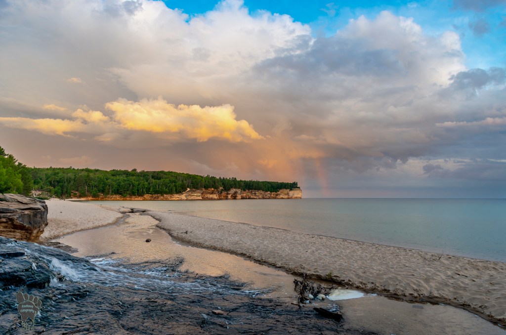
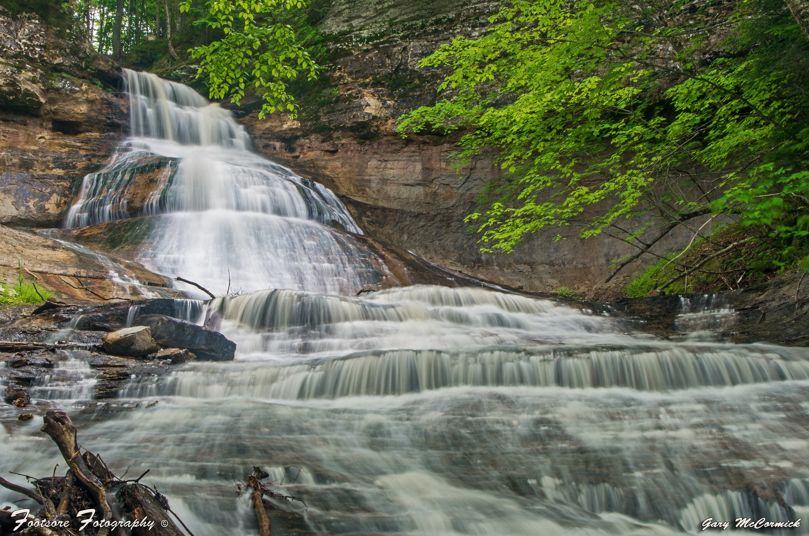
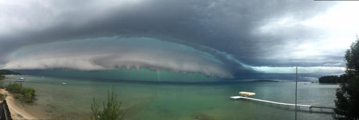
Although we were just in the neighborhood on Monday for the Seven Wonders of Michigan, I couldn’t resist encouraging you to take a look around at one of my favorite Michigan hikes when Gary shared this photo of a storm rolling into Chapel Beach yesterday! The river you see in the foreground is the Chapel River that flows from Chapel Falls (pictured below).
Because the summer of 2025 is not over, it’s not included in the rankings. But as of Aug. 14, the average daily temperature is 74.3 degrees – making it one of the hottest.
Here’s the difference: this year’s overnight lows have been some of the highest ever. The region has dealt with multi-day periods of sustained heat unlike any other year.
“When people talk about how hot it was back in 88, they’re right to do so,” FOX 2’s meteorologist Derek Kevra said. “But what they got was some relief days. We have had very few relief days this year.”
In the summer of 1988, there were seven days when overnight lows fell into the 40s and 26 days with overnight lows in the 50s. The summer this year has had barely any nights when temperatures fell that low. That included a 150-hour stretch where temperatures didn’t even fall below 70 degrees. Over the entire month of July, only three days have fallen into the 50s.
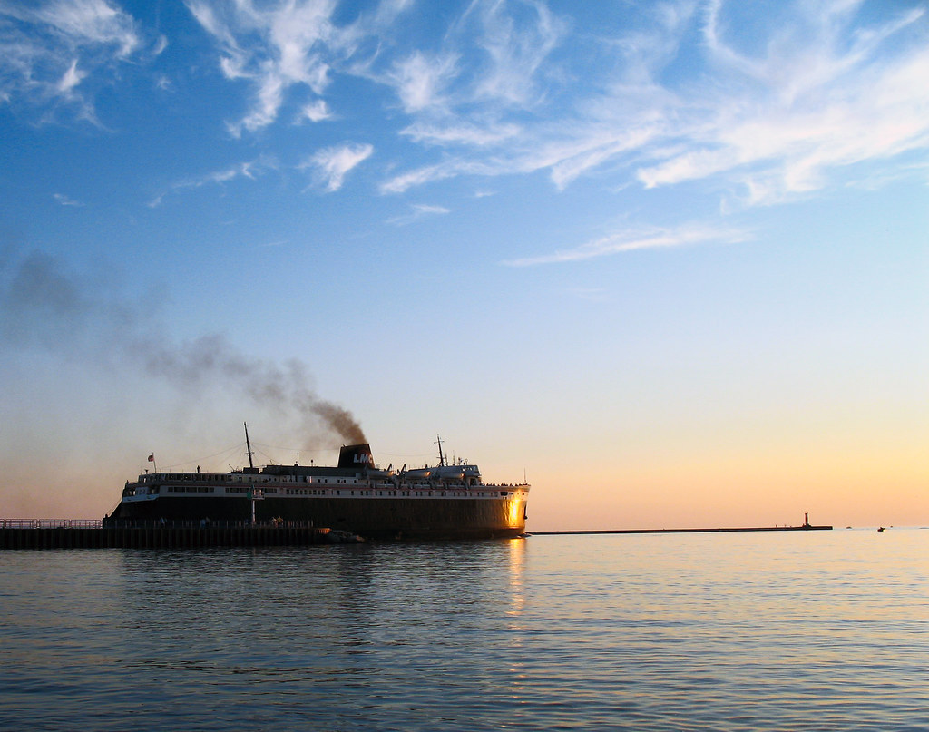
This isn’t the first time I’ve shared Diann’s photo of the coal powered SS Badger steaming out of its home port of Ludington back on Labor Day 2008 & it won’t be the last! Here are a few others that I’ve featured over the years – see more in her Third Coast gallery on Flickr.
So far, smoke-induced air quality advisories have been issued for more than 20 days. Last year, there were none due to wildfires.
…Atmospheric conditions and wind direction bring smoke from Canada into Michigan. High-and low-pressure systems are common ways smoke is transported, said Rebecca Hansen, a meteorologist at the National Weather Service Grand Rapids office. Most recently, all those cloudless skies—due to a high-pressure system—helped blow the smoke right into the state, she said. ‘”Due to the light winds moving around, that’s helping the smoke stay over the area too … Canada has been experiencing warmer and drier conditions, and that definitely increases the wildfire risk,” Hansen said.
“Breathing in the Canadian wildfires smoke cannot be the new normal,” said Candice Miller, Macomb County public works commissioner.
Since June, wildfires in Canada have caused decreased air quality in bordering states in the U.S., prompting the Michigan Department of Environment, Great Lakes, and Energy to so far issue ten advisories warning against unhealthy breathing conditions. Miller called for U.S. Ambassador to Canada Pete Hoekstra to press Canadian officials to increase efforts combating wildfires and improve forestry management.
“Ambassador Hoekstra needs to make some noise,” Miller said. “Smoke from Canada wildfires should not be a regular part or our summers but unfortunately that’s become the norm in our state and others. It’s unacceptable for our friends in Canada to simply say, ‘The fires will burn out’ or ‘Wait until December.’”
…During mid-afternoon on Thursday, the air quality index in central Macomb County was between 140 to 150, a range described as “unhealthy for sensitive groups.” “That description misses the mark, in my opinion. Smoke is unhealthy for all groups,” Miller said. At the same time in the Marquette area, the air quality index was 139, a day after measuring 161. In Seney, in the central portion of the Upper Peninsula, the reading was 160 during the morning of July 30, the highest in the state.
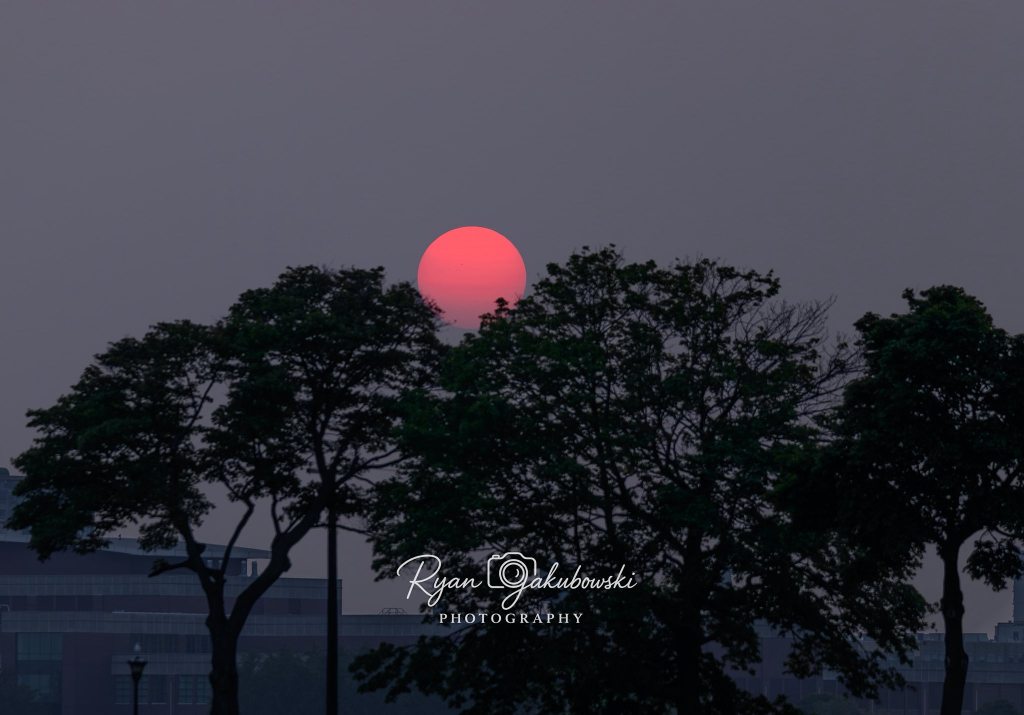
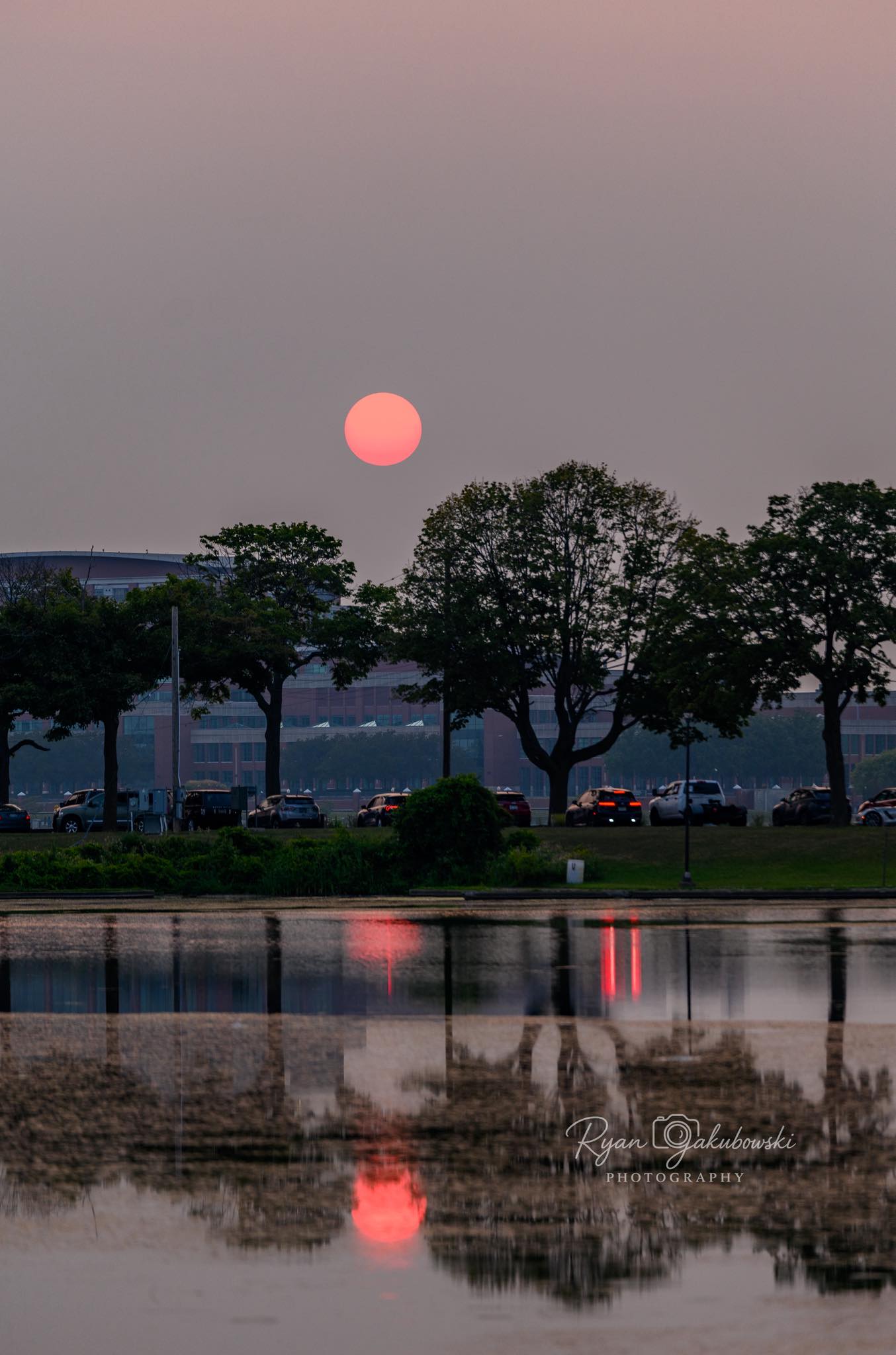
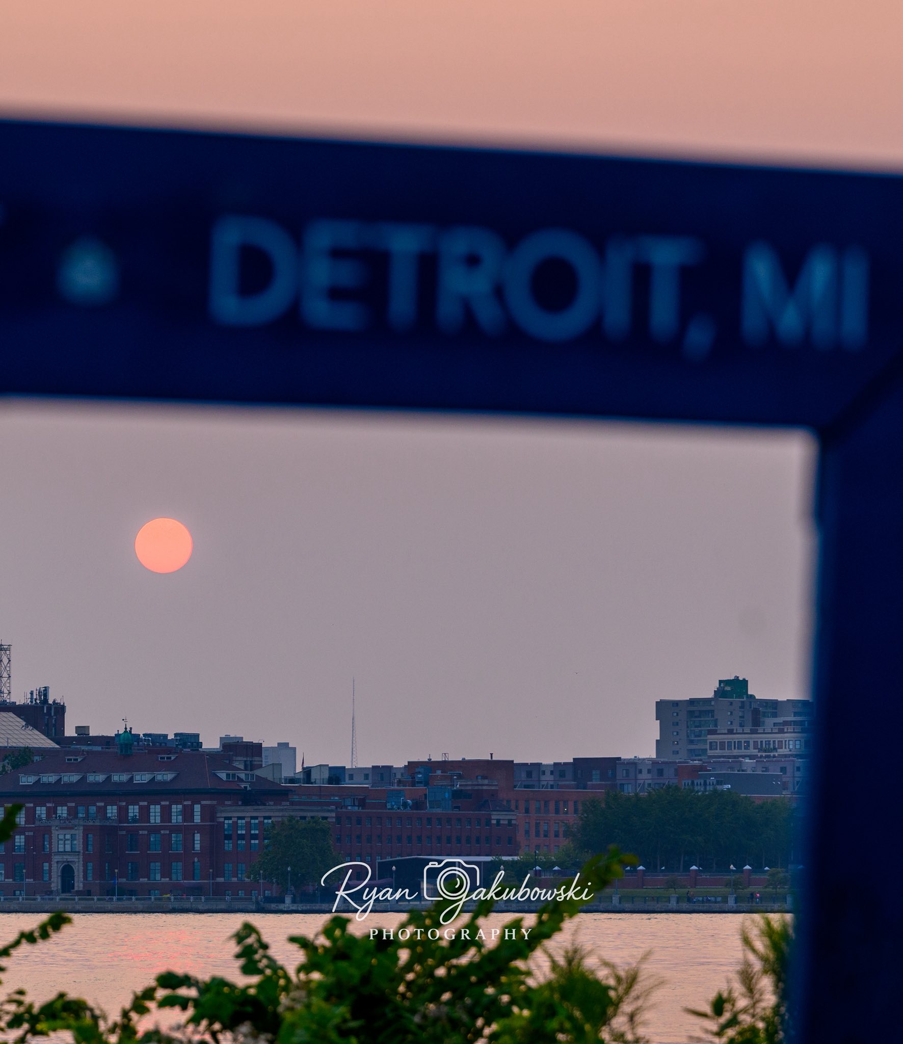
Ryan took these photos last night on Belle Isle at sunset. Click the pic above to follow Ryan & see more on Facebook and for sure check out J&C Photography to view & purchase his work and to hire him for photographic services including drone photography & some very cool 360 degree panoramas.
Michigan is in the grip of another heatwave or perhaps the same heatwave because honestly at this point who can tell? Temperatures today are expected to be in the 90s with heat indexes flirting with 100 degrees.
Since it’s not expected to break until a cold front comes through on Wednesday afternoon, I thought it would be an excellent time to bring back one of my favorite photos from 10 years ago! Check out Scott’s latest on Flickr and please STAY COOL!!
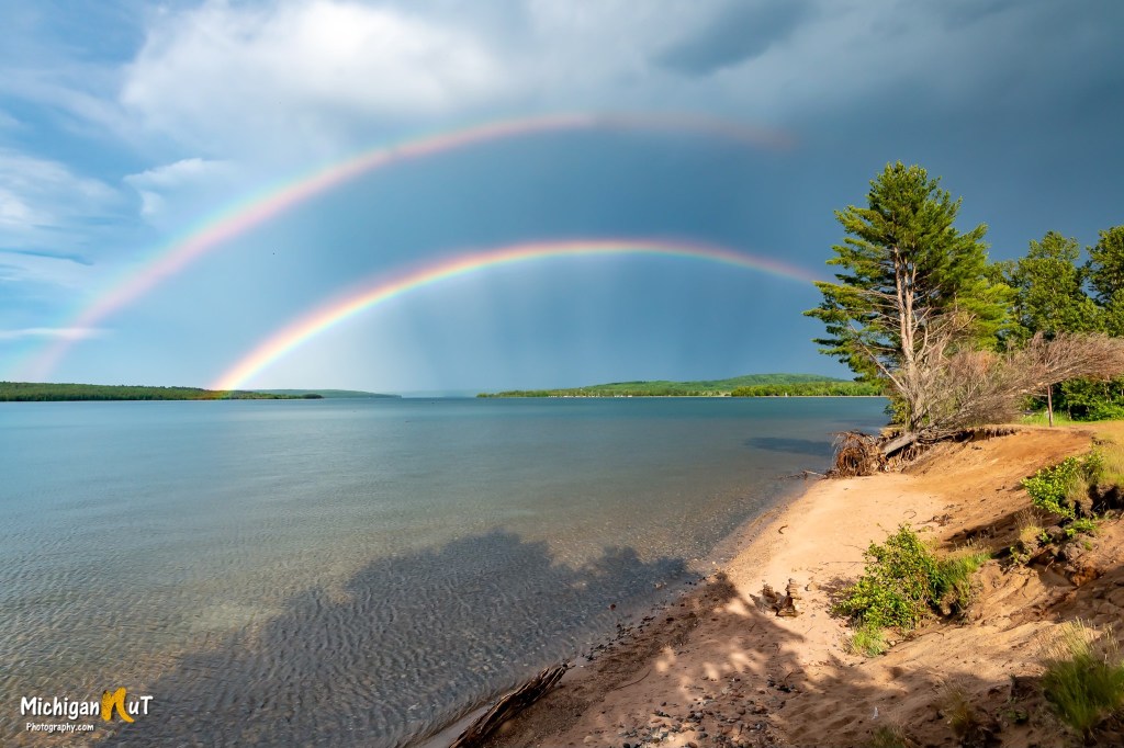
Sometimes we see two rainbows at once. Not all of the energy of the ray escapes the raindrop after it is reflected once. A part of the ray is reflected again, and travels along a different path inside the drop to emerge from the drop at a different angle. The rainbow we normally see is called the primary rainbow and is produced from one internal reflection. The secondary rainbow arises from two internal reflections and the rays exit the drop the second time at an angle of around 50 degrees, rather than the 42 degrees for the primary rainbow. This effect produces the secondary rainbow, with the colors reversed from the primary rainbow. It is possible for light to be reflected more than twice within a raindrop, but these additional rainbows are typically never seen under normal circumstances.
Atmospheric Optics (the OG rainbow site) adds that secondary rainbows appear broader than the primary rainbow, measuring approximately 1.8 times its width so the top rainbow is the copy!
John shared this photo of a doble rainbow over Lake Superior’s Munising Bay on his Facebook. For sure follow him there and view & purchase his work at michigannutphotography.com.
“Pollutants across the state are expected to reach the very unhealthy to unhealthy range in northern locations, with ranges of unhealthy to (unhealthy for sensitive groups) further south,” according to the service. Wildfire smoke from Canada is pushing into Michigan from till Monday. Increased fine particulate levels reached the western portion of the Upper Peninsula on Saturday afternoon.
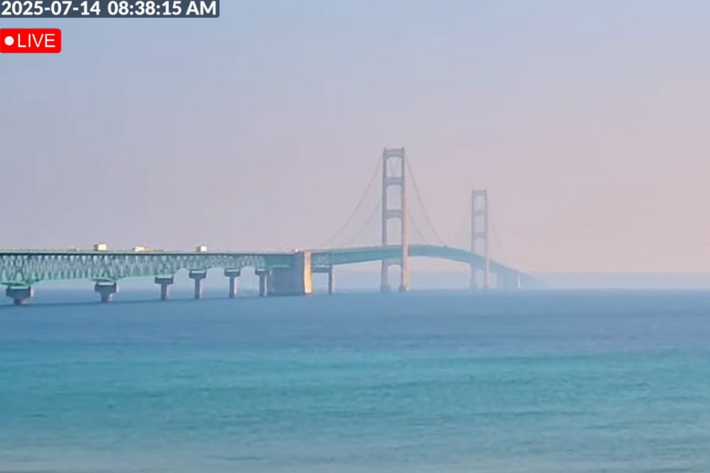
This zoomed in view of the live Mackinac Bridge webcam at the Riviera Motel shows how much the smoke from wildfires is impacting the view of the Bridge this morning in Mackinac City.
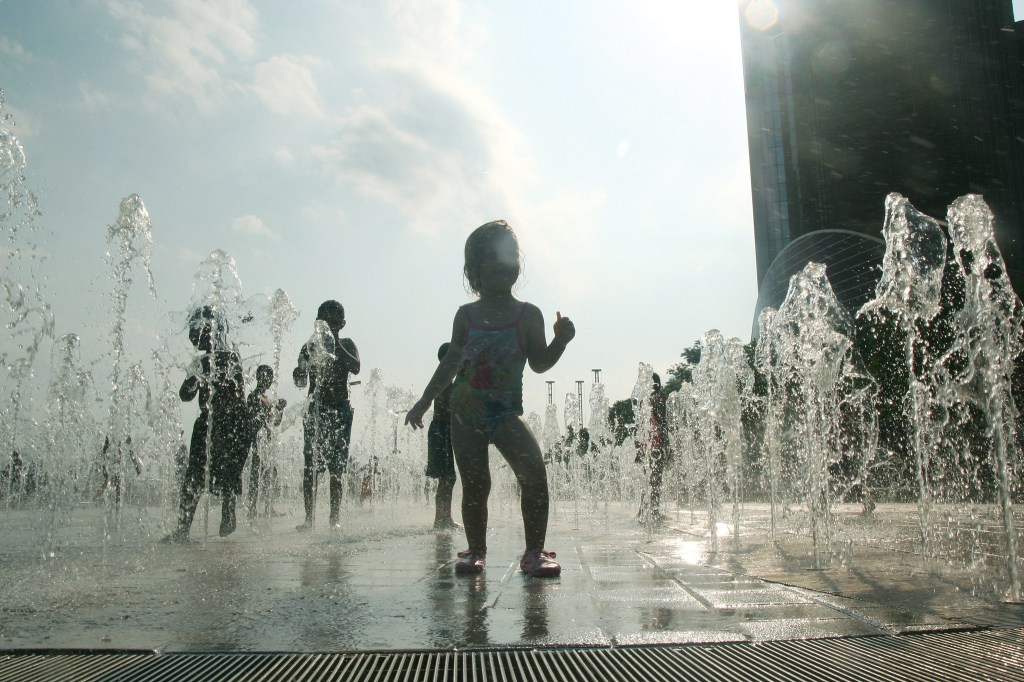
Michigan will emerge from an absolutely BRUTAL heat dome later today, but until them I hope you can find a large amount of cool water to hide in!
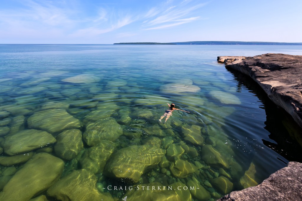
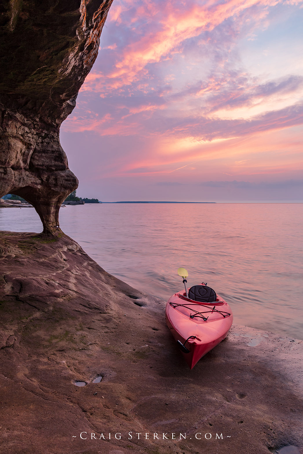
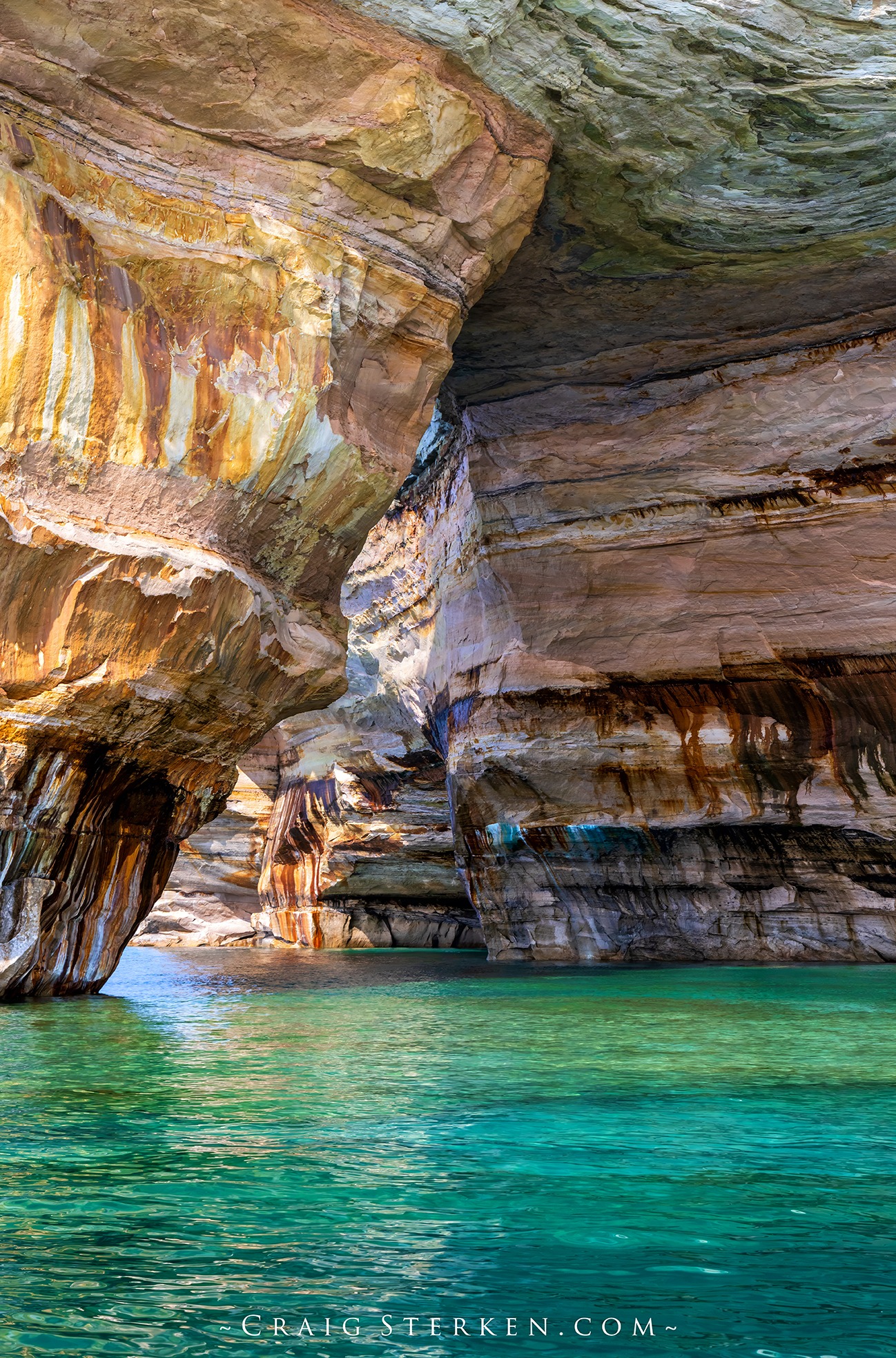
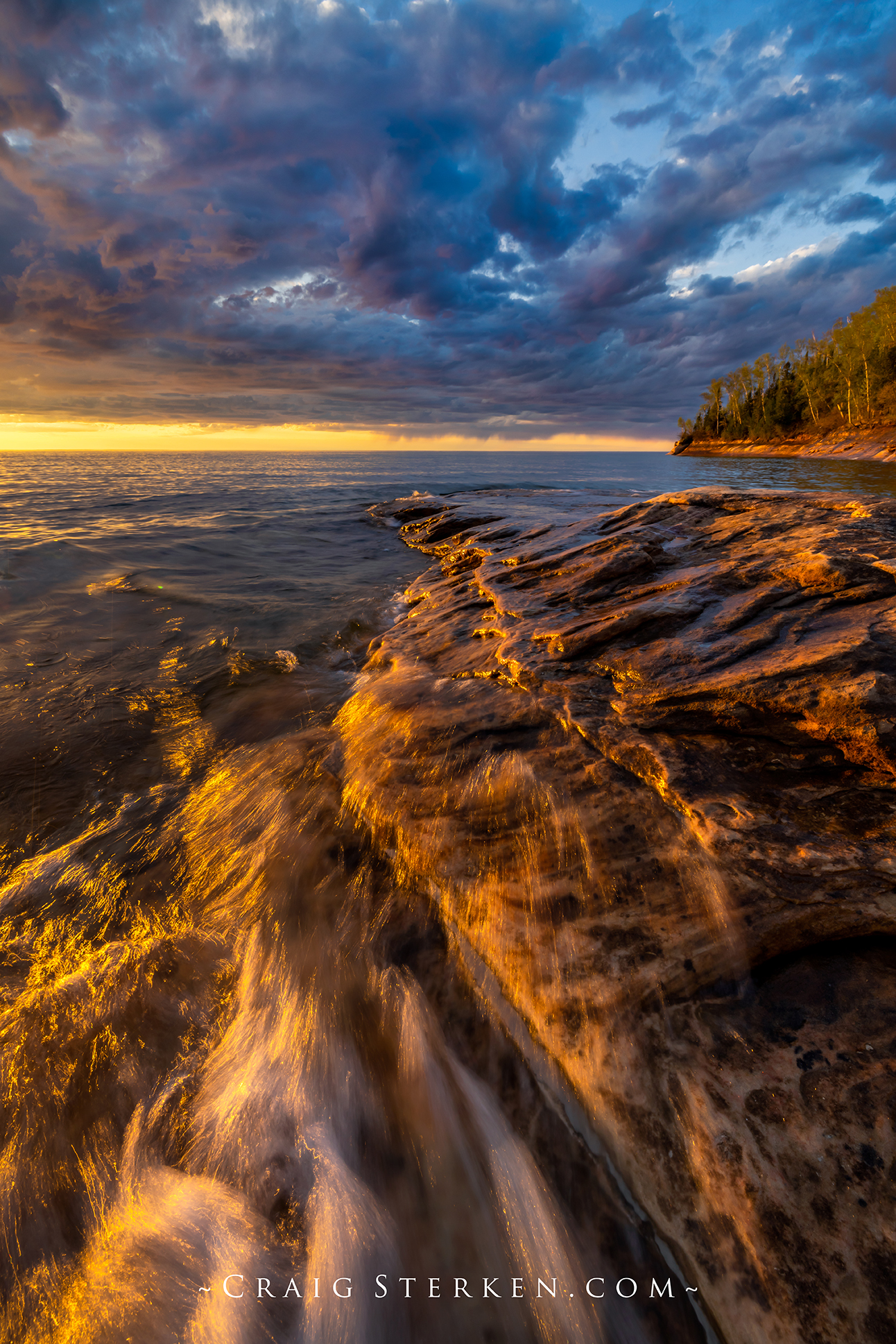
Craig took this photo a few years ago on Lake Superior, I think at Presque Isle Park where the water temp is currently 48.2 degrees! Here’s a couple recent pics from Pictured Rocks that he shared on Facebook. See more there and for sure view & purchase his work on his website!
Summer officially begins with the summer solstice at 10:42pm tonight, and to make sure we get the memo, Mother Nature is including a weeklong heatwave that starts today!