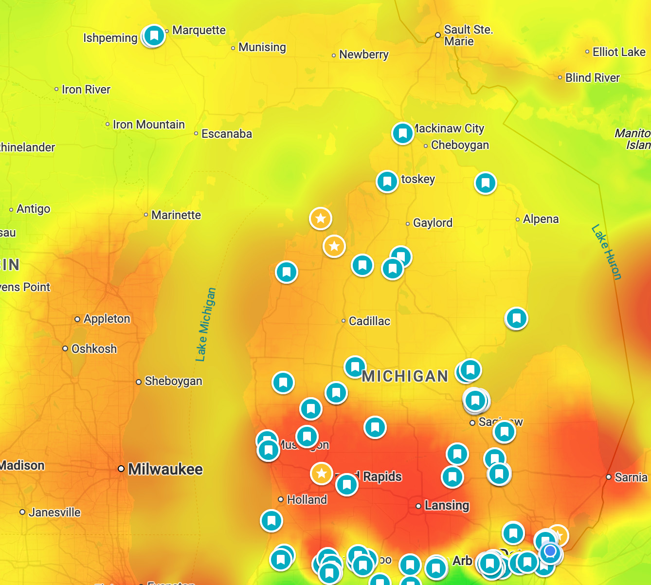
Our air quality begins to dip across the majority of the state as we head into the mid-afternoon hours today, July 15th, 2026. By sunset tonight, nearly the entire state will see 150+ μg/m³ AQI concentration, which translates to very unhealthy on the air quality index. Overnight, those winds out of the northwest do not stop, bumping parts of our area into the hazardous to everyone category at 250.5-500 μg/m³ AQI concentration if recent short-term model trends are correct.
Dangerous air quality levels like these are rare, so please take your respiratory health very seriously. Smoke concerns mixed with the already excessive heat concerns both today and tomorrow will also be a factor for higher mortality rates amongst all age/health groups, per research collected by the National Library of Medicine (NLM). All data shown is for fine particulate matter (PM2.5).
For sure follow Michigan Storm Chasers on Facebook and the MiStormChasers YouTube channel that often includes live reporting on Michigan weather events. You can also check out the smoke tag on Michigan in Pictures for a reminder of what last summer’s wildfire smoke was like.
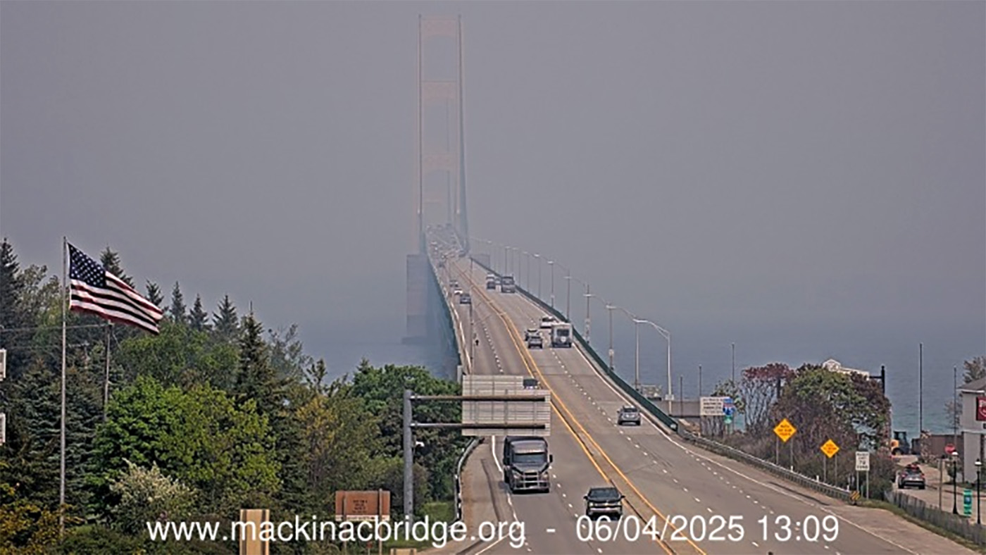
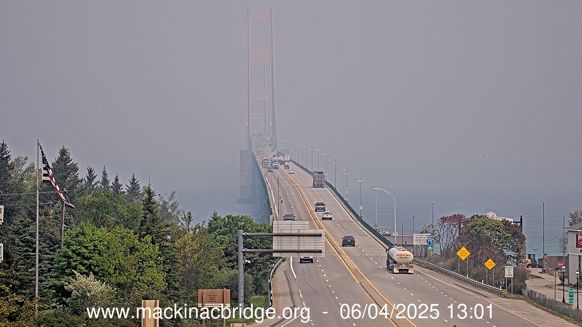
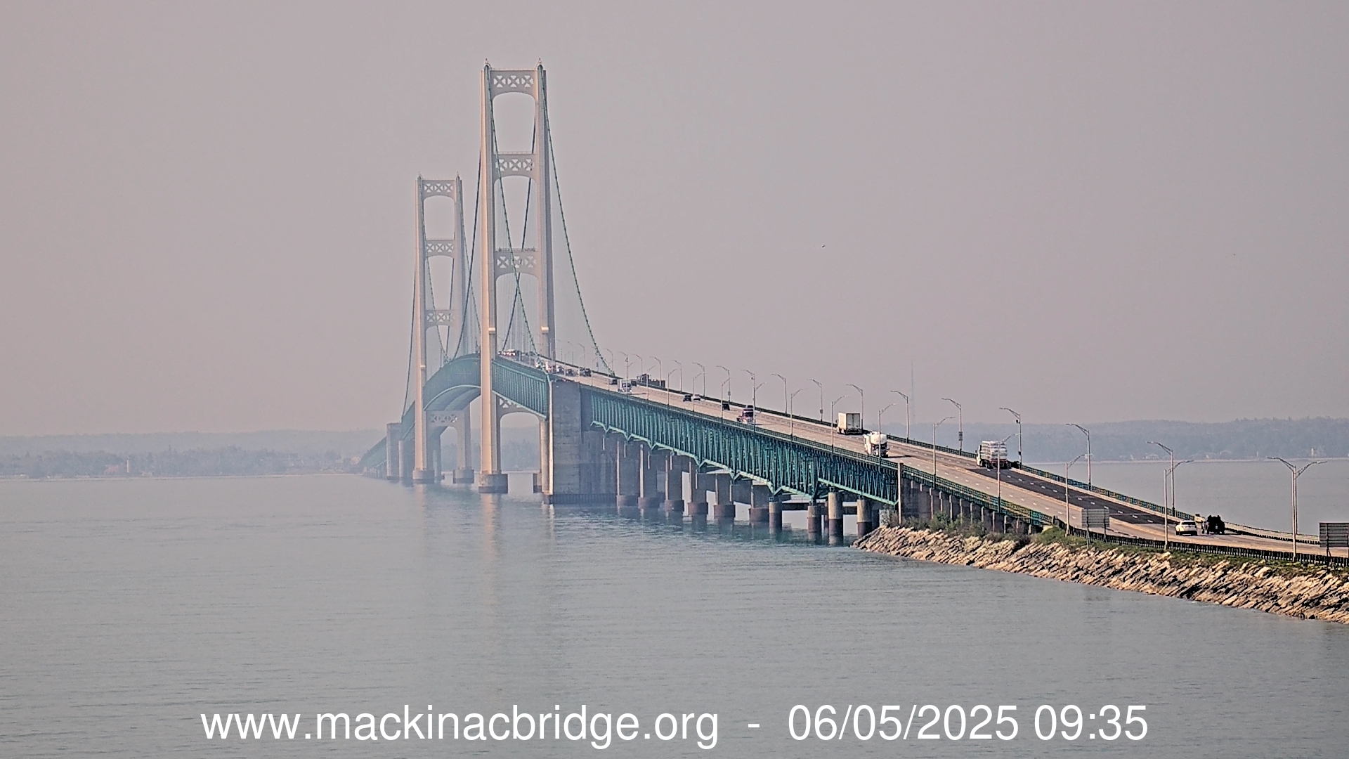
The top pic from the Mackinac Bridge Authority webcam is a view looking north from Mackinaw City while the other is looking south across the Mighty Mac from St. Ignace.
Livestream from the Riviera Motel in Mackinaw City
Here’s what the webcam view looked like when I posted this…
“Pollutants across the state are expected to reach the very unhealthy to unhealthy range in northern locations, with ranges of unhealthy to (unhealthy for sensitive groups) further south,” according to the service. Wildfire smoke from Canada is pushing into Michigan from till Monday. Increased fine particulate levels reached the western portion of the Upper Peninsula on Saturday afternoon.
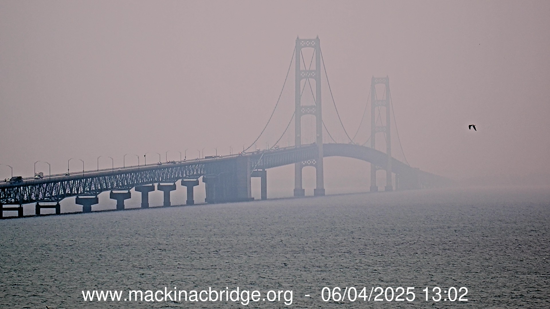
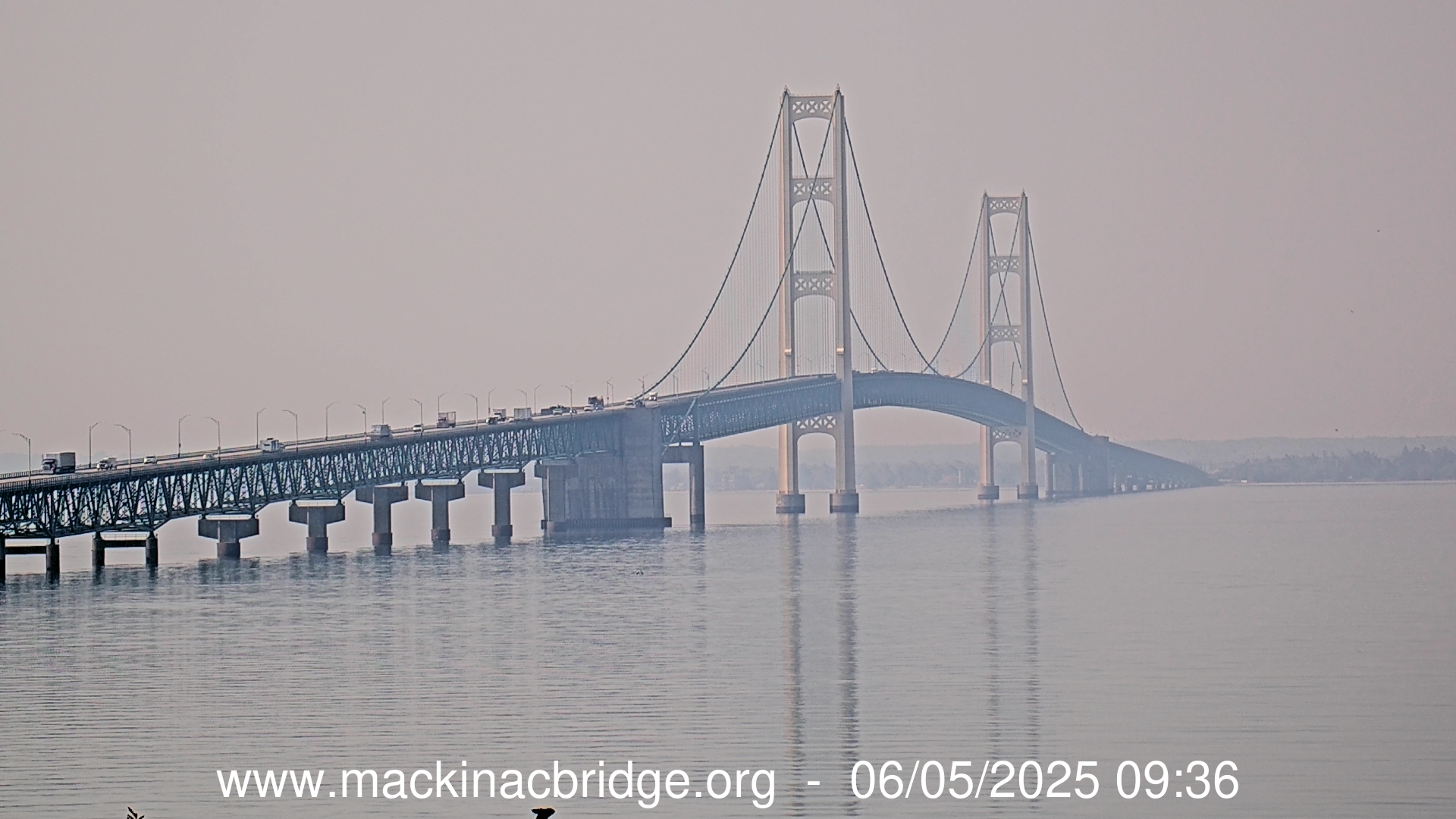
This zoomed in view of the live Mackinac Bridge webcam at the Riviera Motel shows how much the smoke from wildfires is impacting the view of the Bridge this morning in Mackinac City.
“Unfortunately, what you’re seeing today is not fog surrounding the Mackinac Bridge but smoke coming from the wildfires and our neighbors to the North.” -The Mackinac Bridge on X (which I won’t link to)
Yesterday morning the Mackinac Bridge Cam captured smoke so dense that it looked like the bridge was shrouded in fog! There’s less today but it’s still an astonishing amount of smoke so be sure to keep an eye on your local air quality because as the map shows, it’s not great right now!
While it looks like a dry weekend that should be sunny, there will likely be areas of high-level wildfire smoke. The exact timing of the smoke will be difficult. It does look like some time Saturday will have a thick blanket of smoke high in the sky. It won’t mean much to the big picture of the weather other than keeping our temperatures out of the high-80s.
One thing is sure this weekend. Our humidity will be fairly low. We can see that with the morning low temperatures. Saturday morning we will drop into the 50s.
These amazing sunsets we’ve been seeing lately are the result of smoke from Canadian & Alaskan wildfires – perhaps that’s what the mayor of Marquette trying to signal Seagull Man about!