#TBT Idle Moments on Torch Lake

Idle Moments on Torch Lake

Idle Moments – Torch Lake, photo courtesy Don Harrison/UpNorth Memories

I think the woman on the right is really glad that cell phones hadn’t been invented yet.

View Don’s photo background big, check out his slideshow, and definitely follow UpNorth Memories on Facebook!

More Throwback Thursdays and more funny business on Michigan in Pictures!

North Breakwater

Ludington North Breakwater Light

North Breakwater Light, photo by Mark Miller

The entry for Ludington North Breakwater Light at Terry Pepper’s Seeing the Light details a ton of the history of this lighthouse including the reason for its interesting appearance:

Over the summer of 1924, a unique structure took shape at the end of the North Breakwater. The main tower, fabricated of steel plates over an internal steel skeleton, took the form of a four-sided pyramidal tower with four round porthole windows on each of the three decks within. With plans calling for the installation of an air diaphragm fog signal operated by an electrically powered compressor, there was no need for a large fog signal building, and thus the signal building took the form of a relatively small structure integrated into the base of the landward side of the main tower. In order to help protect the structure from the force of waves crashing across the breakwater, the concrete foundation at the base of the structure was formed with angled surfaces designed to deflect the force of wave action up and away from the building.

The white painted tower was capped by a square gallery and an octagonal iron lantern installed at its center. Since the standard lantern design being used by the Lighthouse Service in new construction at this time was of circular conformation with diagonal astragals, it is likely (but unconfirmed) that the lantern used on this new light was transferred from the South Pierhead beacon which the new light was designed to replace.

Click through for more including a number of old photos.

View Mark’s photo background bigtacular and see more in his slideshow.

More lighthouses and more summer wallpaper on Michigan in Pictures.

Fourteen Foot Shoal Lighthouse in Lake Huron

14 foot shoal lighthouse by David Juckett

14 foot shoal lighthouse, photo by David Juckett

Terry Pepper’s Seeing the Light remains the gold standard for information about the lighthouses of the Great Lakes. Terry writes (in part) of the process of constructing Fourteen Foot Shoal Light near the entry into Cheboygan Harbor:

With completion of the work at Poe Reef in 1929, the work crew turned their attention to work at Fourteen Foot Shoal. While the new light was of a totally different design, and considerably smaller than the twin lights built at Martin and Poe Reefs, the construction of the crib proceeded in much the same manner, with the construction of a wooden crib at the shore station on the Cheboygan Pier. After an area on the shoal was leveled, the crib was eased down wooden ways into the water, and towed to the shoal by the Lighthouse Tender Aspen. Once over the leveled area, the crib was sunk to the bottom by filling its empty pockets with rocks and gravel.

This timber foundation then served as a core, upon and around which wooden forms were constructed and filled with concrete loaded from the Lighthouse Service scow. As was the case with both the Martin and Poe stations, the upper edge of the crib was formed into a graceful flare, designed to deflect waves away from the pier, in order to help protect the structures which would be erected on the deck. With the completion of the concrete work, the pier stood fifty feet square, and its deck level fifteen feet above the water.

The steel framework for the single story equipment building was erected at the center of the deck. Standing thirty-four feet by twenty-eight feet in plan, on completion, the entire exterior of the building was sheathed with 1/4-quarter inch steel plates, each riveted to the steel framework beneath. Centered on the roof ridge, a cylindrical steel tower was integrated into the roof, standing six feet in diameter and twenty-four feet above the ridge line. The tower was capped with an octagonal cast iron lantern and outfitted with a flashing white Fourth Order Fresnel lens.

Read on for lots more and photos!

View David’s photo background bigtacular and see more in his slideshow.

Many more Michigan lighthouses on Michigan in Pictures!

Top Dog: Detroit Michigan’s Coney Island Hot Dog

On Any Given Night Lafayette Coney Island

On Any Given Night, photo by Derek Farr

When mLive writer Emily Bingham realized that Michigan didn’t have an official state food, she set out to determine what their readers thought. The winner was the coney island hot dog which squeaked by my personal favorite, the pasty. Share what you think Michigan’s signature food is in the comments!

The Encyclopedia of Detroit entry for the Coney Dog says:

Many people think that the Coney dog, also called the Coney Island hot dog, got its start on Coney Island, NY where the hot dog was created. In actuality, this popular food got its start in Michigan, although the exact location is still disputed. Three locations in Michigan all claim to be the birthplace of Coney dogs: American Coney Island in Detroit, Lafayette Coney Island in Detroit and Todoroff’s Original Coney Island in Jackson.

In 1917, Gust Keros opened American Coney Island. A few years later Keros’s brother opened Lafayette Coney Island next door. Both of these Detroit Coney Islands are incredibly popular to this day, where there is an on-going argument over which establishment serves the best Coney dog. The dispute has been featured on several food television shows, including Food Wars and Man v. Food.

A Coney dog is a beef hotdog, topped with an all meat, beanless chili, diced white onions, and yellow mustard. A true Coney dog uses made-in-Michigan products.

Lots more about the coney dog on Absolute Michigan.

View Derek’s photo bigger where you can also read about the history of friendly competitors Lafayette Coney Island & American Coney Island. See more in his massive Signs & Billboards slideshow.

Michigan food on Michigan in Pictures!

2016 Chicago to Mackinac Sailing Race

Chicago to Mac Sailboats & Mackinac Bridge

Sailboats and Mackinac, photo by Alex Duncan

On July 23, 2016, over 350 sailboats will leave the Chicago Yacht club for the longest annual freshwater race in the world. 2016 marks the 108th annual Chicago Yacht Club Race to Mackinac aka the Chicago to Mac. On their Race History page the CYC shares that:

Starting in 1898 with a mere five boats, The Mac has evolved into a world-class sporting event. After the first race in 1898, the Race to Mackinac was not held for five years until the second race in 1904. By 1906, the race had developed a healthy following and, in that year, the original Mackinac trophy was purchased. The race has seen occasional sustained violent weather in the blows of 1911, 1937 and 1970. After gale force winds took down most of the fleet in the Mac of 1911, the finish in the 1912 and 1913 races was changed to Harbor Springs on Little Traverse Bay instead of Mackinac Island. Race organizers felt the shorter distance was safer.

From 1914 until 1916 the Mac was back to its full distance until WWI. From 1917-1920 there were no Mac races due to the strains of the War, which took away yachtsmen and put many boats out of commission. Since 1921, the Race to Mackinac has run consecutively every year, remains the longest annual freshwater distance race, and is recognized as one of the most prestigious sailing races in the world.

Read on for lots more including an account of the first race. If you’re wondering when to catch a glimpse of them, Pyewacket set the monohull record in 2002 with a time of 23 hours, 30 minutes and 34 seconds. The race starts at noon on Saturday and usually takes between 40-60 hours to finish.

View Alex’s photo from 2011 background bigtacular and see more in his Pure Michigan slideshow.

More summer wallpaper on Michigan in Pictures!

Ephraim Shay, the Shay Locomotive & Shay Days

Mancelona Logging and a Shay Locomotive

Mancelona MI Logging and possible Shay Steam Engine, photo by Don, the Up North Memories Guy

The Harbor Springs Area Historical Society holds their annual Shay Days celebration this Friday & Saturday (July 15-16, 2016). They share that inventor Ephraim Shay was likely retiring when he moved to town in 1888, but during his “retirement” he created over twelve miles of water mains to bring running water to the city, designed and constructed his unique Hexagon House, and started a railway known locally as the Hemlock Central.

They will celebrate his life and work with all kinds of engaging history including live steam model trains with the Michigan Small Scale Live Steamers group, games, historical photograph displays, and self-guided tours at the Shay Hexagon House. Shay himself will even be on hand Saturday so you can wish him a happy 177th birthday – click for all the details.

Shay Locomotives is an online book about the most widely used geared steam locomotives invented in Michigan lumber camps by Ephraim Shay. They share that Shay was born July 17, 1839 in Huron County, Ohio and received a better than average education for the day. After serving in the Union Army in the Civil War, Shay married his lifelong companion, Jane Henderson:

Shortly after their marriage, the Shays moved up to a farm in Ionia County, Michigan. Here Ephraim was known to have served as a clerk in the Township of Sebewa, 1867-1868. In 1869 the Shays were in the Township of Sunfield, Michigan and Ephraim was now operating a steam sawmill until 1873. Their son Lette was born here in January of 1870.

In 1873, with the tract of timber in Sunfield exhausted, the Shay family moved north to the Manistee river basin of Michigan and set up his sawmill and a general store near a lumber camp called Haring, newly settled only the year before.

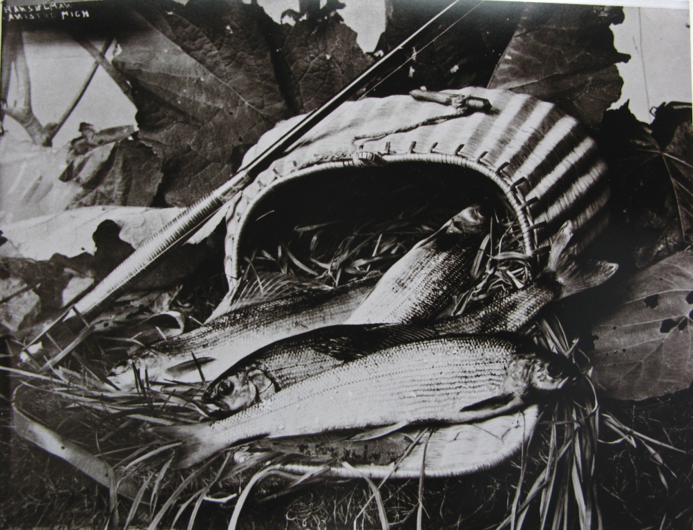
Logging in the 1870’s was far different than today. Essentially once all the trees along the rivers were harvested and floated down river to a mill, logging operations were done in the winter month as loggers depended on snow cover to more easily move the cut timber on sleds drawn by horse or oxen. This method naturally depended on the weather systems and if there were a mild winter there would be a low yield of lumber from the mills.

…What Ephraim Shay had invented was a locomotive capable of delivering equal torque directly to wheels on both sides of the engine at the same time. This over came the dynamic force of his common rod engine whose normal pistons strokes jerked the engine side to side on each stroke, delivering excessive force to the wood rails, especially on the curves.

Read on for much more about one of the pioneers of modern transportation – includes some great old photos!

View Don’s postcard background big and click for more of his Shay Locomotive photos.

More trains on Michigan in Pictures.

Port Crescent in Michigan’s Thumb

The Port Crescent Smokestack

The Port Crescent Smokestack, photo by Joel Dinda

One of the blogs I enjoy reading is ThumbWind, a blog about (you guessed it) Michigan’s Thumb. In A Ghost Town in the Thumb they tell the story of the town of Port Crescent that was within what is now Port Crescent State Park:

Walter Hume established a trading post and hotel near the mouth of the Pinnebog River in 1844. From these humble beginnings the area took the name of Pinnebog, taking its name from the river of which it was located. However, a post office established some five miles upstream also took its name from the river. To avoid confusion the town changed its name to Port Crescent for the crescent-shaped harbor along which it was built.

Port Crescent had two steam-powered sawmills, two salt plants, a cooperage whichPort Cresent manufactured barrels for shipping fish and salt, a gristmill, a wagon factory, a boot and shoe factory, a pump factory, a brewery, several stores, two hotels, two blacksmith shops, a post office, a depot and telegraph office, and a roller rink. Pinnebog employed hundreds of area residents. Others worked at blockhouses where they extracted brine from evaporated water to produce salt. At one time a this 17 block village boasted of a population of more than 500.

Read on for more and click for more about Port Crescent State Park.

View Joel’s photo background big and see more in his Port Crescent Vacation slideshow.

Houghton’s Keweenaw Upper Entrance Lighthouse

Keweenaw Upper Entrance Lighthouse Houghton Michigan

Homeward Bound, photo by Bobby Palosaari

Terry Pepper’s Seeing the Light is my go-to for Michigan lighthouse lore. His entry for the Keweenaw Upper Entrance Lighthouse says in part:

With the meteoric growth of copper mining in the Keweenaw between 1843 and 1968, increased shipping access to the twin cities of Houghton and Hancock became increasingly important. To this end, the Portage River Canal was cut through a tamarack swamp at its western end in 1860, creating a channel 10 feet deep and 80 feet wide, opening full Portage River navigation for the largest vessels of the day from western Lake Superior.

In 1874, to assist in safely guiding ships into this cut, a large gabled two-story brick dwelling with attached square 33 foot high brick tower was constructed on the west bank at the entrance to the canal. With increasing use of the canal, silting became a major problem, and tolls were levied for its use in order to cover the continuing expenses for repairs and dredging.

For reasons as yet undetermined, the original lighthouse was replaced with the existing fifty foot square steel Art Deco style tower at the end of the breakwater in 1950.

View Bobby’s photo background bigtacular and view & purchase more of his photos including this one at palosaariphotography.com.

Summer Solstice and a Strawberry Moon

Summer Solstice 2013 by Ken Scott

Summer Solstice … 2013, photo by Ken Scott

Today at 6:34 PM EDT, the summer solstice officially ushers in summer. EarthSky shares that the full Strawberry moon tonight for the solstice is the first full moon to fall on the summer solstice since June of 1967 and the Summer of Love.

Back in 2001, NASA’s Earth Science Picture of the Day (<–my favorite photo blog – subscribe!) shared the tale of Eratosthenes, the Solstice and the Size of the Earth:

Calculating the SolsticeIt was near the summer solstice of 240 BC that Eratosthenes, curator of the famed Library of Alexandria and renowned mathematician and geographer, performed his famous experiment in Egypt to calculate the diameter of the Earth. The bottom of a deep well in the city of Syene, Egypt (near the present day Aswan Dam and very near the Tropic of Cancer) was known to be illuminated by the sun directly at mid-day on the longest day of the year (the solstice). But on the same day, a vertical pole in Alexandria, some 800 km to the north, cast a distinct shadow. By measuring the shadow and applying the geometry of a sphere, Eratosthenes calculated the Earth’s diameter with remarkable accuracy. Sadly, the concept of a spherical Earth was lost from common thought for over a thousand years until Christopher Columbus and others proved the fact by sailing west to go east. The background reference image of Egypt and the Nile River is provided by the NASA MODIS instrument.

Sep 5, 2006 – Donald Etz notes: “From reading Jeffrey Burton Russell’s book, Inventing the Flat Earth (1991), I was persuaded that most educated Europeans of Columbus’ time believed the earth is round. The main debate seems to have been over its dimensions. Columbus ventured on his voyage because he believed the earth was much smaller than it is.” -ed

View Ken’s photo of the sunrise on the 2013 summer solstice bigger, see more in his Boat(s) slideshow, and definitely check out kenscottphotography.com to view and purchase his work.

More science on Michigan in Pictures.


Return of the Grayling to Michigan?

michigan-grayling

Michigan Grayling, photo courtesy Old Au Sable Fly Shop

The Michigan Department of Natural Resources is partnering with the Little River Band of Ottawa Indians to bring back the Arctic grayling. Grayling were native to Michigan but are long vanished from our waters. Slate blue in color with a sail-like dorsal fin, they are of the salmon family and efforts will begin in the Manistee River watershed.

Regarding the grayling, the Old Au Sable Fly shop says in part:

According to William J. Mantague, “One spring the Grayling were running up the Hersey. We noted they had some difficulty passing an obstruction in the stream, so we placed a canoe crosswise at that point and caught over seven hundred one afternoon.”

The Grayling were eaten. They were packed in ice, loaded onto railway cars, and shipped by the thousands of tons per year to the larger metropolitan areas. In some instances, they were tossed on the banks and buried in mounds.

At the same time, the lumbermen came and cut down centuries-old growth of virgin white pine. The land leading to the rivers was stripped as well, slashed and burned, and the logs floated downstream to the large mills and cities during the spring run-off. The rivers were cleared of logs and debris, places were the Grayling flourished. Shallow riffles were trenched out and deepened, and dams were built so that the flow of the river could be better controlled. Vegetation on the banks of the rivers was cleared as well, and the river slowly filled with sand. The sand filled the deepest pools and covered the Grayling’s spawning beds. By 1885, the Grayling had disappeared from the AuSable River. And in a period of ten to twenty years, a land unrivaled for its fishing and beauty, became a barren wasteland of stumps and empty pools.

More about graylings at the Old Au Sable Fly Shop where you can pick up gear and learn about fish & fishing on Michigan’s most storied fishing river.

More fish & fishing on Michigan in Pictures!

Support Michigan in Pictures with Patreon