Sunrise from Little Presque Isle Point

Sunrise from Little Presque Isle Point

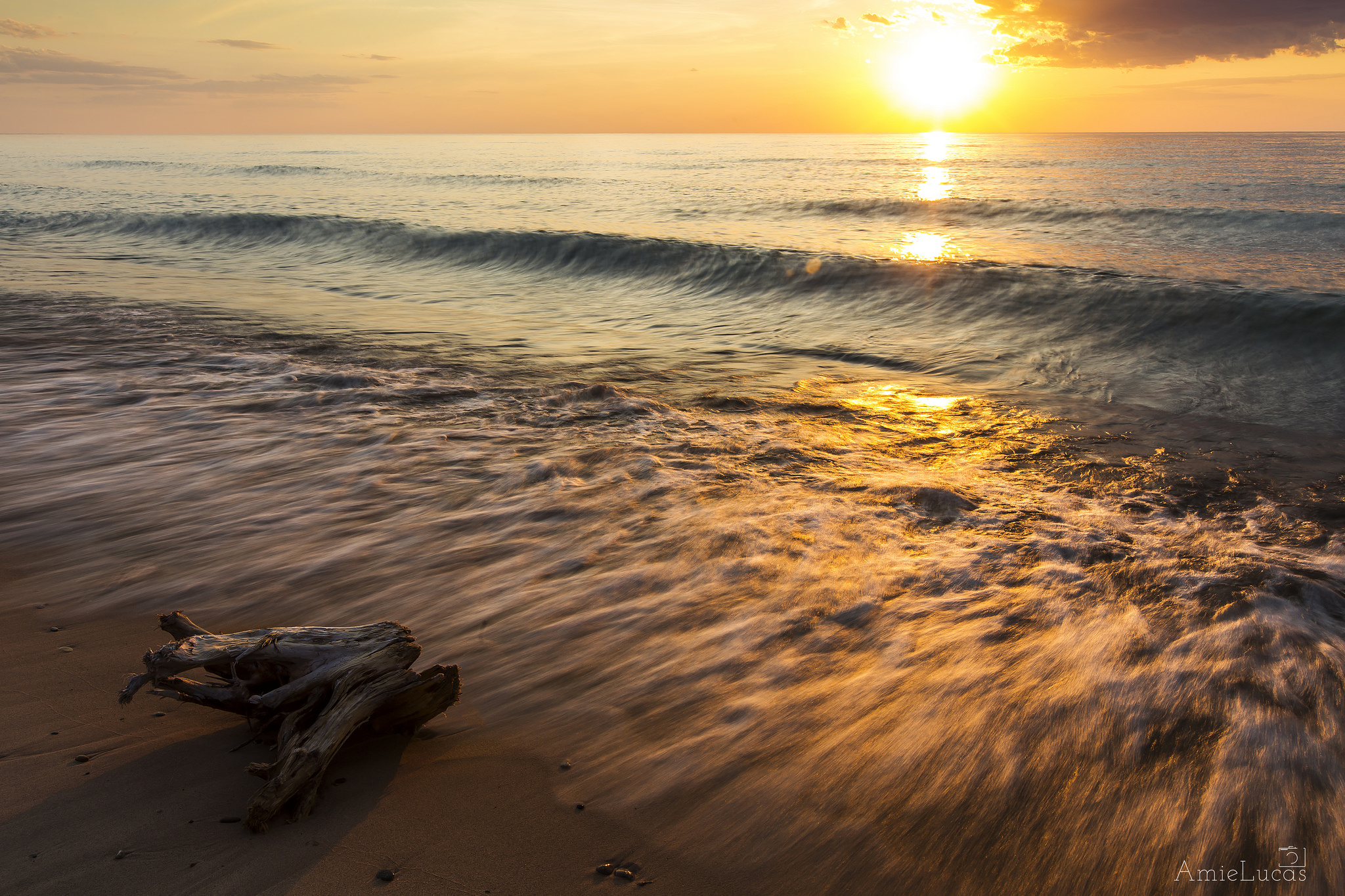
Sunrise at Little Presque Isle Point, photo by Neil Weaver Photography

The Michigan Department of Natural Resources says in part about a proposed Little Presque Isle Natural Area:

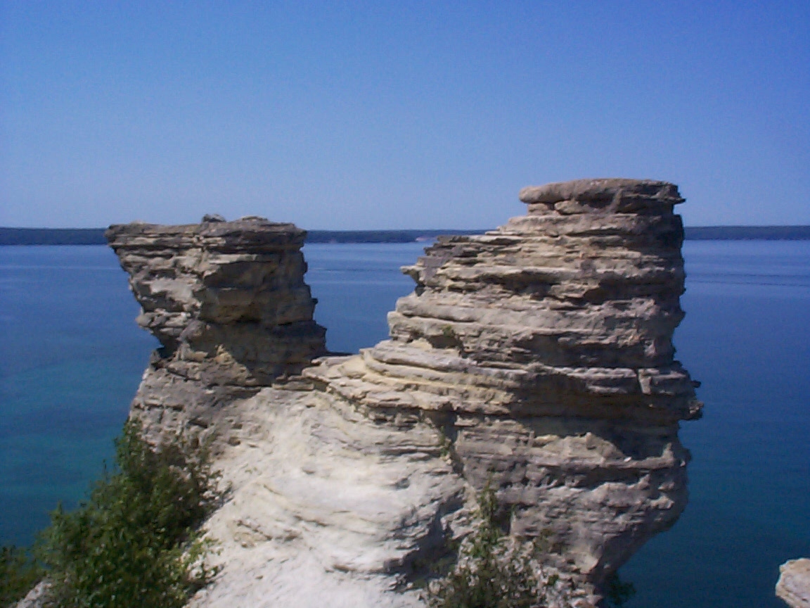
The Little Presque Isle tract is often called the crown jewel of Lake Superior, with its beautiful sand beaches, rugged shoreline cliffs, heavily timbered forests, and unmatched public views.

…The rock comprising the area represents some of the oldest exposed formations of its kind. More than a mile of bedrock lakeshore and cliffs adorns Little Presque Isle, including sandstone cliffs that reach nearly 60 feet high toward the base of Sugar Loaf Mountain. One kind of bedrock, granitic, that occurs here is the least common bedrock type along the Great Lakes shoreline, with less than eight miles occurring in total. This is one of three areas where the public can see these 2.3 billion year old formations in Michigan.

The proposed wilderness area is a local landmark, which has significant historical value. The island was reportedly connected to the mainland sometime prior to the 1930s and was a landing place for early explorers and native inhabitants. Roughly 100 yards off the mainland, the island is accessible by wading hip deep water and offers and opportunity for solitude in a unique and scenic setting.

View Neil’s photo background bigilicious, follow him on Facebook, and visit his website to view & purchase this picture and other Lake Superior photos (and also pics from lots of other cool Michigan locations).

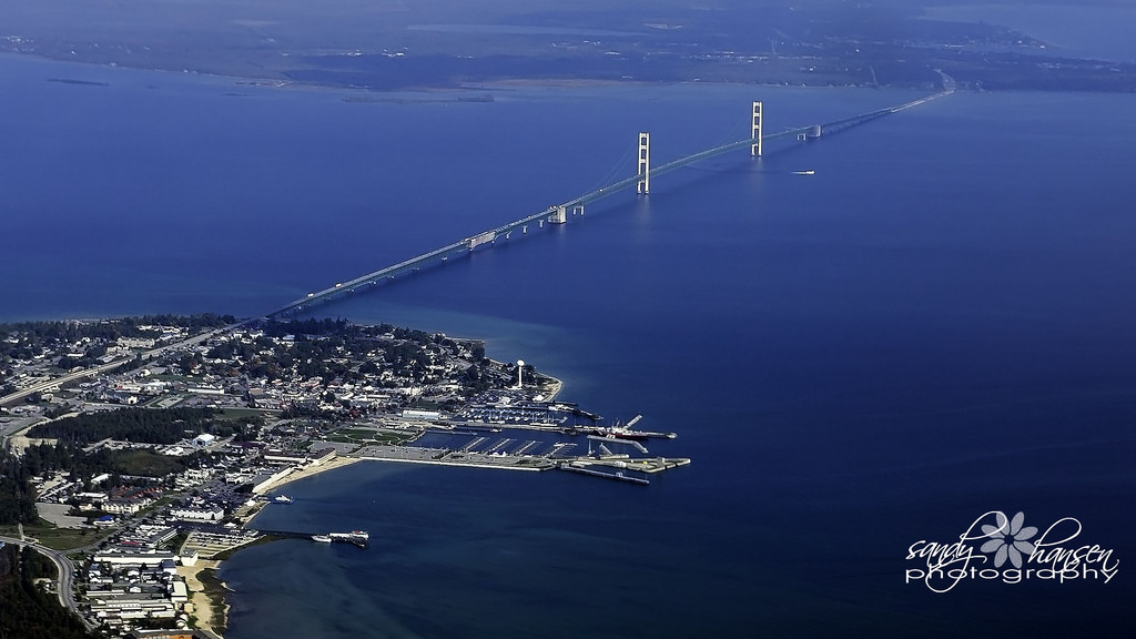
More islands, more sunsets, and more summer wallpaper on Michigan in Pictures.

Dive in, but look before you leap

High Dive

High Dive into Lake Superior, photo by Craig

I want to say some things about this photo.

First and foremost, how incredibly awesome is someone to leap into Lake Superior any time of the year? Pretty doggone awesome is the answer, and if you’re wanting to go into Michigan’s coldest lake, August (when this photo was taken) is a pretty good time!

On Michigan in Pictures I post a lot of photos of people doing amazing things in this four-season playground we are blessed with. While summertime is certainly the best season for flamboyant fun, in June especially, the waters of Michigan’s Great Lakes can get very cold. Cold enough to kill as this tragic story from Marquette earlier this month illustrates.

My safety tips would be to really check water you’re leaping into for depth, obstacles, temperature, and whenever possible ASK A LOCAL what they think about whatever ridiculousness you’re considering. Chances are they know a thing or two about currents, weather patterns, or at least a good place to grab a bite and a beverage after your epic stunt.

Remember – having fun is what it’s all about, so figure out how to do it right and then DO IT!

View Craig’s photo bigger, view & purchase work at Craig Sterken Photography, and be sure to follow him on Facebook.

More fun on Michigan in Pictures!

Know Your Michigan Fish: Northern Pike (Esox lucius)

Michigan Northern Pike Esox lucius

Northern Pike (Esox lucius), photo by Isle Royale National Park

The Michigan DNR’s Northern Pike page has this to say about this apex predator of the Great Lakes and Michigan’s inland lakes:

As predators, northern pike can have significant impact on their prey species. As with muskies, pike lurk in the cover of vegetation in the lake’s clear, shallow, warm waters near shore, although they retreat somewhat deeper in midsummer. Pike consume large numbers of smaller fish – about 90 percent of their diet – but seem willing to supplement their diet with any living creature their huge jaws can surround, including frogs, crayfish, waterfowl, rodents, and other small mammals. Their preferred food size is approximately one third to one half the size of the pike itself.

Great Lakes pike spawn in the shallows in April or May, right after the ice leaves, and before muskies reproduce. As a result of their eating habits, young pike grow rapidly in both length and weight. Females become sexually mature at age three or four years, and males at two to three years. Beyond sexual maturity, pike continue to gain weight, although more slowly. Great Lakes pike have an average life span of 10 to 12 years.

Pike eggs and new hatchlings (which stay inactive, attached to vegetation for their first few days of life) fall prey in large numbers to larger pike, perch, minnows, waterfowl, water mammals, and even some insects. Larger pike have two primary enemies – lampreys, and man. Spawning adult northern pike, exposing themselves recklessly in the shallows, are vulnerable to bears, dogs, and other large carnivores.

Northern pike flesh excels in flavor, thus making them a doubly rewarding game fish. Since their skin has heavy pigmentation and an unappetizing mucous coating, most people skin them or scale them carefully.

This photo was one of Isle Royale National Park’s “Wildlife Wonders of the Week.” They noted that a five pound female pike will lay about 60,000 eggs. Two weeks later fertilized eggs hatch, hungry for microscopic morsels. Once to the fingerling stage, food scarcity may force them to eat their own siblings for nourishment.

View it bigger on Facebook and definitely follow their page for the latest from one of Michigan’s coolest parks!

More Michigan fish on Michigan in Pictures.

Summer Solstice and a Strawberry Moon

Summer Solstice 2013 by Ken Scott

Summer Solstice … 2013, photo by Ken Scott

Today at 6:34 PM EDT, the summer solstice officially ushers in summer. EarthSky shares that the full Strawberry moon tonight for the solstice is the first full moon to fall on the summer solstice since June of 1967 and the Summer of Love.

Back in 2001, NASA’s Earth Science Picture of the Day (<–my favorite photo blog – subscribe!) shared the tale of Eratosthenes, the Solstice and the Size of the Earth:

Calculating the SolsticeIt was near the summer solstice of 240 BC that Eratosthenes, curator of the famed Library of Alexandria and renowned mathematician and geographer, performed his famous experiment in Egypt to calculate the diameter of the Earth. The bottom of a deep well in the city of Syene, Egypt (near the present day Aswan Dam and very near the Tropic of Cancer) was known to be illuminated by the sun directly at mid-day on the longest day of the year (the solstice). But on the same day, a vertical pole in Alexandria, some 800 km to the north, cast a distinct shadow. By measuring the shadow and applying the geometry of a sphere, Eratosthenes calculated the Earth’s diameter with remarkable accuracy. Sadly, the concept of a spherical Earth was lost from common thought for over a thousand years until Christopher Columbus and others proved the fact by sailing west to go east. The background reference image of Egypt and the Nile River is provided by the NASA MODIS instrument.

Sep 5, 2006 – Donald Etz notes: “From reading Jeffrey Burton Russell’s book, Inventing the Flat Earth (1991), I was persuaded that most educated Europeans of Columbus’ time believed the earth is round. The main debate seems to have been over its dimensions. Columbus ventured on his voyage because he believed the earth was much smaller than it is.” -ed

View Ken’s photo of the sunrise on the 2013 summer solstice bigger, see more in his Boat(s) slideshow, and definitely check out kenscottphotography.com to view and purchase his work.

More science on Michigan in Pictures.


Summer is Rushing In

Rushing In by Heather Higham

Rushing In, photo by Heather Higham

It looks like parts of Michigan will be close to the 90s tomorrow, so get out there and start soaking up some of Michigan’s summertime beauty.

View Heather’s photo bigger, see more in her Summer slideshow, and definitely follow her at Snap Happy Gal Photography on Facebook where she’s got some really incredible shots from the past few days!

Dwarf Lake Iris: Michigan’s State Wildflower

Dwarf Lake Iris

Dwarf Lake Iris, photo by Mark Swanson

The Michigan DNR relates that Michigan’s state wildflower, the Dwarf Lake Iris (Iris lacustris): grows nowhere else but in the Great Lakes region, and most within Michigan’s boundaries:

In Michigan, Dwarf Lake Iris is especially concentrated along certain stretches of the northern Great Lakes shoreline, where it may occur for miles, interrupted only by habitat destruction, degradation, or unsuitable habitat such as rocky points or marshy bays.

Dwarf Lake Iris usually occurs close to the Great Lakes shores on sand or in thin soil over limestone rich gravel or bedrock. It tolerates full sun to near complete shade, but flowers mostly in semi open habitats. These areas can be very long and narrow strips bordering the high water line, or large flat expanses located behind the open dunes of the Great Lakes shoreline. Many iris locations are on old beach ridges of former shores of the Great Lakes. Fluctuating water levels of the Great Lakes play a vital role in opening up new habitat for Dwarf Lake Iris. During high water years, trees and shrubs along the shoreline may be flooded out. This flooding may open up patches within the forest where the Dwarf Lake Iris may spread. It is usually found growing under White Cedar, although White Spruce, Balsam Fir, and Aspen are also frequently present.

…”Lacustris” translates literally to mean “of lakes” and refers to where this beautiful iris grows. Dwarf Lake Iris was first found on Mackinac Island in 1810 by Thomas Nuttall, a renowned naturalist and explorer. Nuttall reached Mackinac Island after travelling from Detroit by canoe with French Canadian voyagers and the surveyor for the Michigan Territory. At least 1/3 of the species that Nuttall reported from the Great Lakes were new to science.

Read on for much more.

Mark took this along the hiking trail in Riverview Park in St. Joseph. View it bigger and see more in his Michigan – Color slideshow.

More Michigan flowers & more Michigan state symbols on Michigan in Pictures.

Support Michigan in Pictures with Patreon

Drifting

Drifting

Drifting, photo by Aime Lucas

Amie took this last year in late May, and I’m posting this to let Mother Nature know that “35 degrees in May” is not what we’re looking for out of the month of May!

View Aime’s photo background bigilicious, see more in her Pictured Rocks National Lakeshore slideshow, and be sure to follow Aime Lucas Photography on Facebook.

More beach photos and lots more summery wallpaper on Michigan in Pictures!

Miner’s Castle, before it fell

Miner's Castle before it fell

Miner’s Castle before it fell, photo by spauldi1

Today is the 10th anniversary of the collapse of one of the turrets on the Miner’s Castle formation in the Pictured Rocks National Lakeshore.

On Thursday morning, April 13, 2006, the northeast turret of Miners Castle collapsed. One turret remains on Miners Castle, the best-known feature of Pictured Rocks National Lakeshore. The collapse was reported via cell phone by fisherman in the area, according to chief ranger Larry Hach. Most of the rock fell north and into Lake Superior, and there were no injuries. The lower overlook platform near Miners Castle appears to be unaffected.

While the rockfall at Miners Castle on April 13 was startling, such events are not rare along the Pictured Rocks escarpment.

Click for the full report on Absolute Michigan.

Sue took this back in 2003. View it background big and jump into her slideshow for more pics from “before the fall”at Miner’s Castle.

Line 5 and the Great Lakes

Mackinaw-City-and-Mackinac-Bridge

Mackinaw City and Mackinac Bridge, photo by Sandy Hansen Photography 

“There is a pipeline that‘s sitting at the bottom of the Straits of Mackinac. It was designed for a 50 year life and it’s been down there for 63 years. There’s a risk involved in this.”
-Mark Shriberg, National Wildlife Federation

In Line 5 puts Great Lakes at risk on Absolute Michigan via the University of Michigan (video below):

Up to 152 miles (245 km) of coastline in lakes Huron and Michigan could be fouled by a single oil spill at the straits, according to the simulations. When all 840 simulated spills are plotted on a map, a total of 720 miles (1,162 km) of shoreline in the U.S. and Canada are considered potentially vulnerable to spills that would require cleanup. Seven hundred twenty miles is roughly the distance from Detroit to Atlanta.

Areas at highest risk include Mackinac and Bois Blanc islands, as well as locations directly east and west of Mackinaw City. Communities also at risk include Beaver Island, Cross Village, Harbor Springs, Cheboygan and other places along the lakes Huron-Michigan shoreline.

…”Until now, no one knew exactly how much shoreline was vulnerable to spills in the Straits of Mackinac,” said Schwab, a research scientist at the U-M Water Center. “These findings show that under the right conditions, a spill in the Straits of Mackinac could affect a significant amount of shoreline and open-water areas in either Lake Michigan or Lake Huron, or both, very quickly.”

View Sandy’s photo bigger, see more in her aerial slideshow, and follow her on at Sandy Hansen Photography on Facebook.


Whipped Up Waves for the Weekend!

Whipped Up

Whipped Up, photo by Terry Clark

mLive reports that big waves are expected for parts of Lake Huron and Lake Michigan this weekend:

High winds and an arctic air mass are set to hit Michigan this weekend, and gales are in the forecast for the Great Lakes as a result.

A gale warning for much of Lake Huron’s offshore waters, issued by the National Weather Service, is scheduled for 8 p.m. Saturday, April 2 to 5 a.m. Sunday, April 3.

Winds are expected to reach up to 41 mph from the northwest with gusts up to 53 mph. According to the warning, waves will build up to 13 feet tall with the potential for an occasional 19-footer. The largest waves in an area 5 nautical miles off shore and out are expected around 1 a.m. Sunday on Lake Huron.

If you want to tune in, check out NOAA’s Great Lakes Coast Watch and the Great Lakes Webcam page.

View Terry’s photo background big and see more in his Wintry Scenes slideshow.

More waves and more wild weather on Michigan in Pictures!