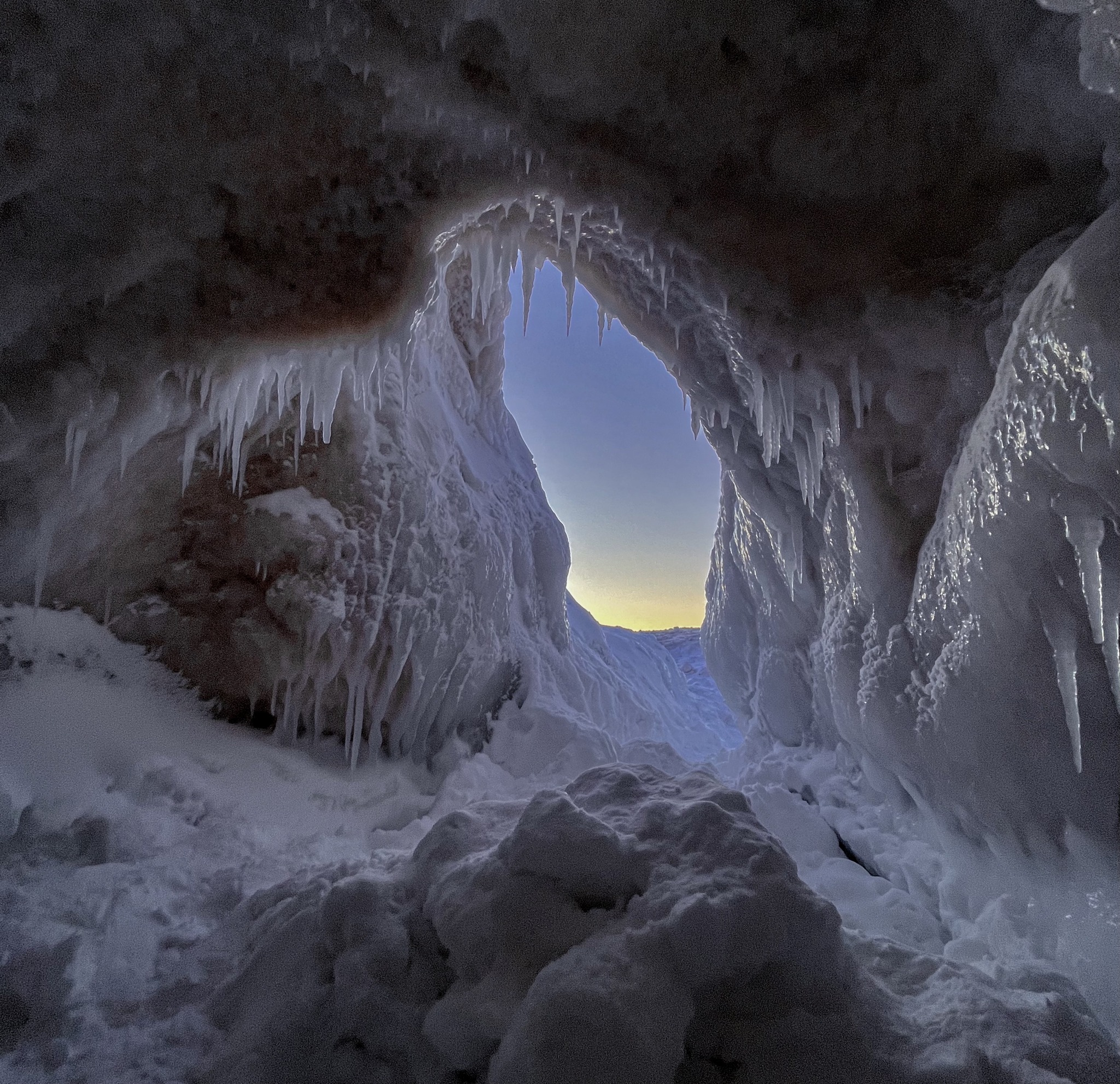
Robin shared these otherworldly shots of the ice caves on Empire Beach in the Sleeping Bear Dunes National Lakeshore earlier this week. Click the pics to see them bigger & follow her on Instagram for more!
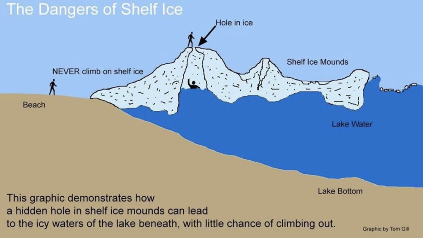
As with any time we share photos of ice caves, we need to caution you that you can 100% lose your life exploring ice caves. Be smart.
It can be dangerous because you might think you’re walking on solid ground, when actually you’re out over the water. Due to the layered nature of shelf ice, even if you’re out over four feet of water, if you were to fall through a thin spot in the ice, you could find yourself trapped in an ice cavern and even though you may not be fully submerged in the water, you’re unable to get out because the walls of the cavern are ice and impossible to climb.
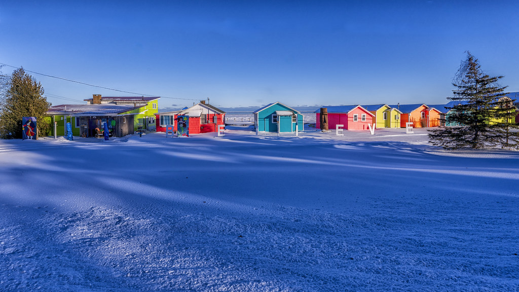
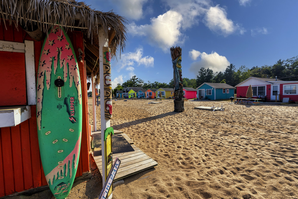
Here are two pics from Charles of the joyfully painted Mai Tiki Resort on Lake Huron in Oscoda demonstrating that you can find a little spot of summer in Michigan even on the coldest day. See his latest on Flickr & stay warm!
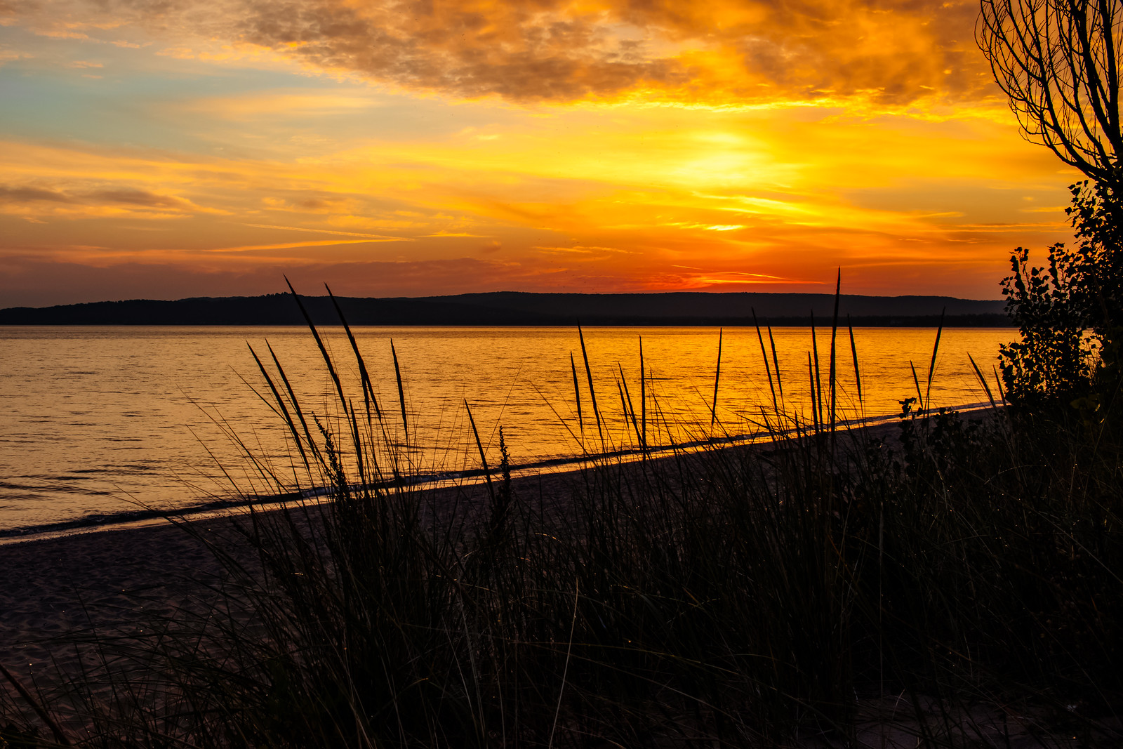
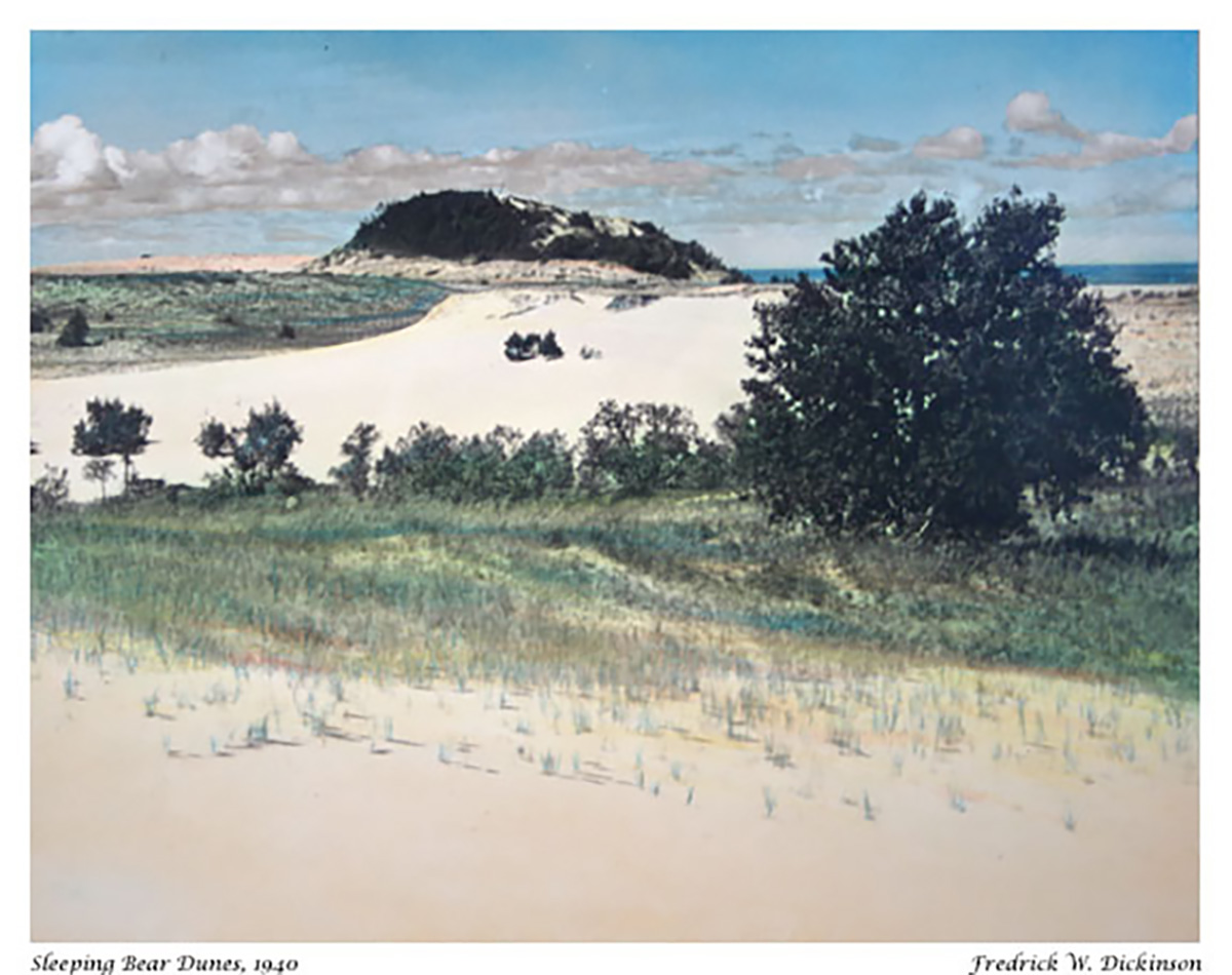
Today is the 55th birthday of the Sleeping Bear Dunes National Lakeshore. Normally, I would lead with a photo of the Dunes, but the creation of the National Lakeshore on October 21, 1970 preserved a whole lot more!!
Here is the tale of the tape on Michigan’s magnificent national lakeshore as of August 1, 2024!
Annual Visits – 1,589,248
Employees – 46 permanent, 83 seasonal
Volunteer Hours – 58,389 from 1,659 volunteers
Natural and Cultural Resources
Area – 71,318 acres
Lake Michigan Shoreline – 65 miles (35 miles on the mainland)
Inland Lakes – 26
Miles of rivers and streams – 12
Terrestrial plant species – 908
Bird species – 246
Federally threatened or endangered species – 6
Historic structures on List of Classified Structures – 369
Sites on National Register of Historic Places – 8
Cultural Landscapes – 9 (4,500 acres)
Prehistoric archeological sites – 150
Historic boats – 21
Lighthouse – 1
Historic artifacts – 70,158
Archived documents – 21,325
Infrastructure
Buildings – 370
Employee housing units – 38
Campgrounds – 9 (357 sites)
Picnic Areas – 5
Visitor Centers – 3
Outdoor ampitheaters – 2
Miles of roads – 23
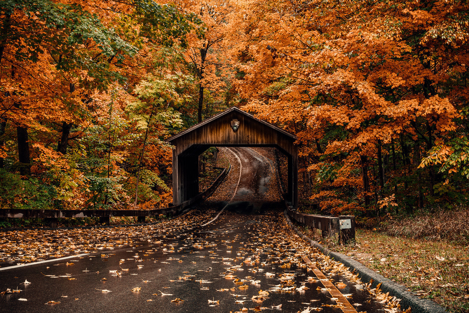
Covered bridge – 1 (Pierce Stocking Drive)
Miles of trails – 105
Lake access ramps – 9
Signs and wayside exhibits – 3572
Major photovoltaic power systems – 3
Motor vehicles in fleet – 54
Large boats – 8
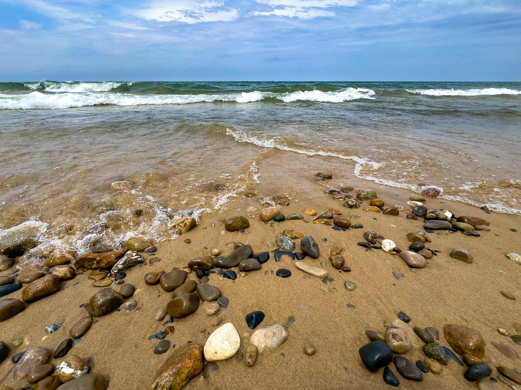
James took these in the Sleeping Bear Dunes National Lakeshore back in fall of 2023. See lots more great shots in his Top 100 gallery on Flickr!
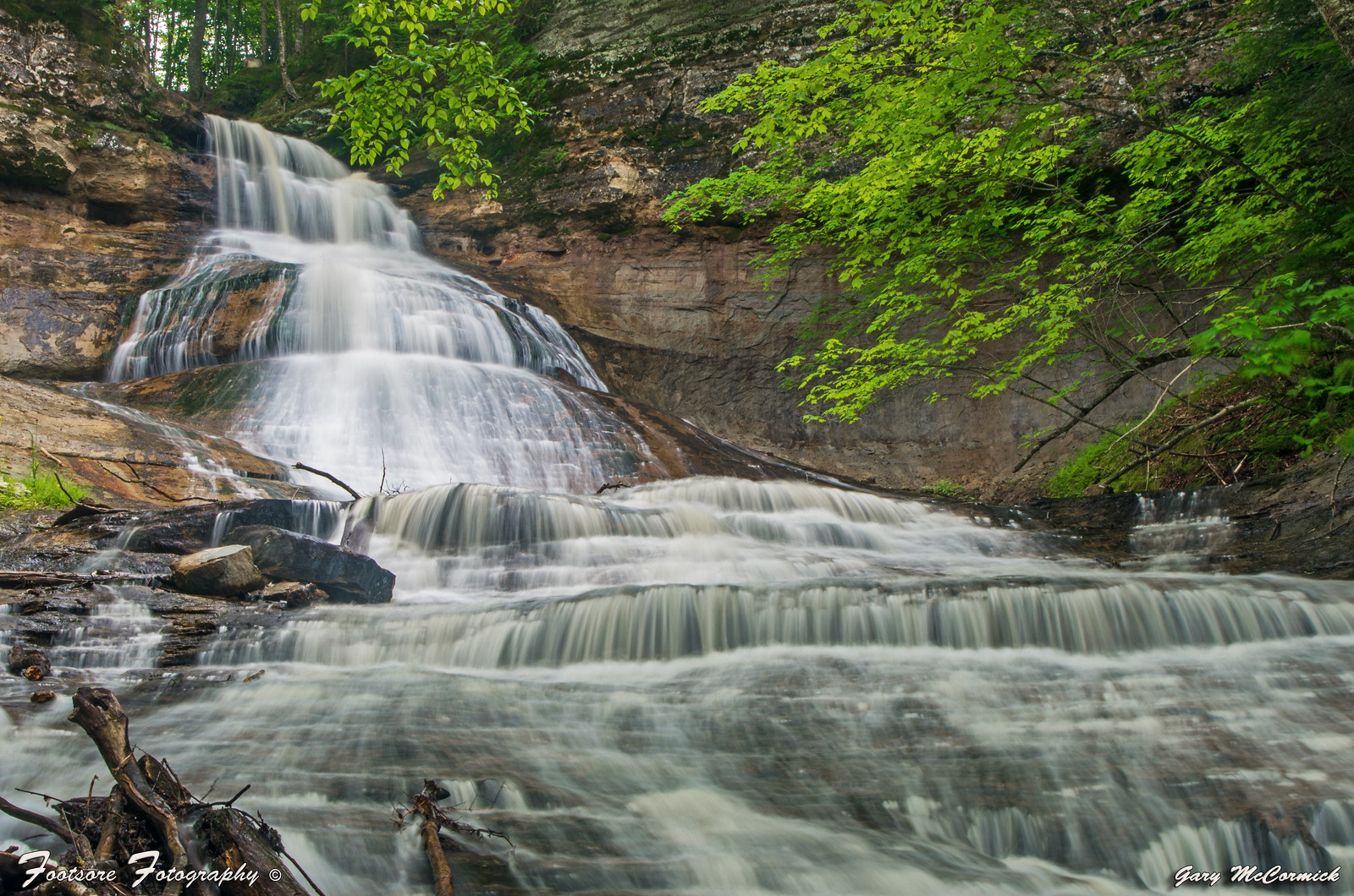
Although we were just in the neighborhood on Monday for the Seven Wonders of Michigan, I couldn’t resist encouraging you to take a look around at one of my favorite Michigan hikes when Gary shared this photo of a storm rolling into Chapel Beach yesterday! The river you see in the foreground is the Chapel River that flows from Chapel Falls (pictured below).
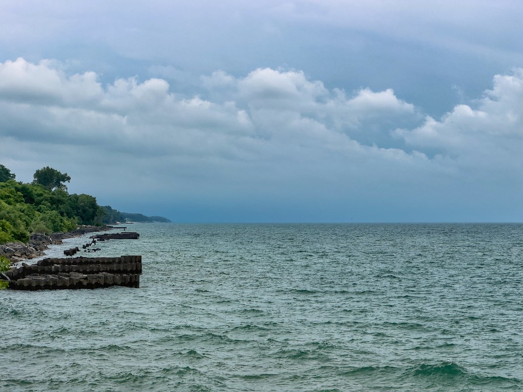
…“When we get 15 foot waves on Lake Michigan, I’m thinking, ‘Oh, my God. How much damage are they doing?’” says David Bunte, the supervisor for Chikaming Township, near the southern tip of Lake Michigan.
Water levels fluctuate naturally in the Great Lakes but intensifying climate change accelerates those changes. What used to be normal on a 20 year cycle is now happening in five or 10 years, says Mike Shriberg, an environmental policy researcher at the University of Michigan.
“We’re seeing record highs and then record lows much closer together,” says Shriberg, whose work focuses on Great Lakes water policy. “The Great Lakes has already experienced more water level change in the last decade than the saltwater coasts are expected to experience in the next 100 years.”
Ice normally acts as a buffer for the shoreline, absorbing the blows of powerful waves in winter storms, but as temperatures warm, diminished ice coverage in the Great Lakes is speeding up coastal erosion.
Read on for much more. If you’re not yet aware of Michigan Sea Grant , I encourage you to learn more about this cooperative program of the University of Michigan, Michigan State University, and the National Oceanic and Atmospheric Administration that funds research, education, and outreach projects designed to foster science-based decisions about the use and conservation of Great Lakes resources.
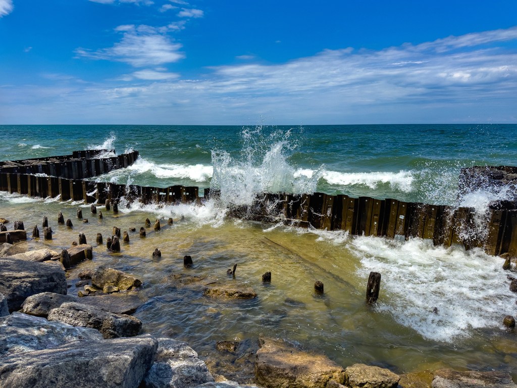
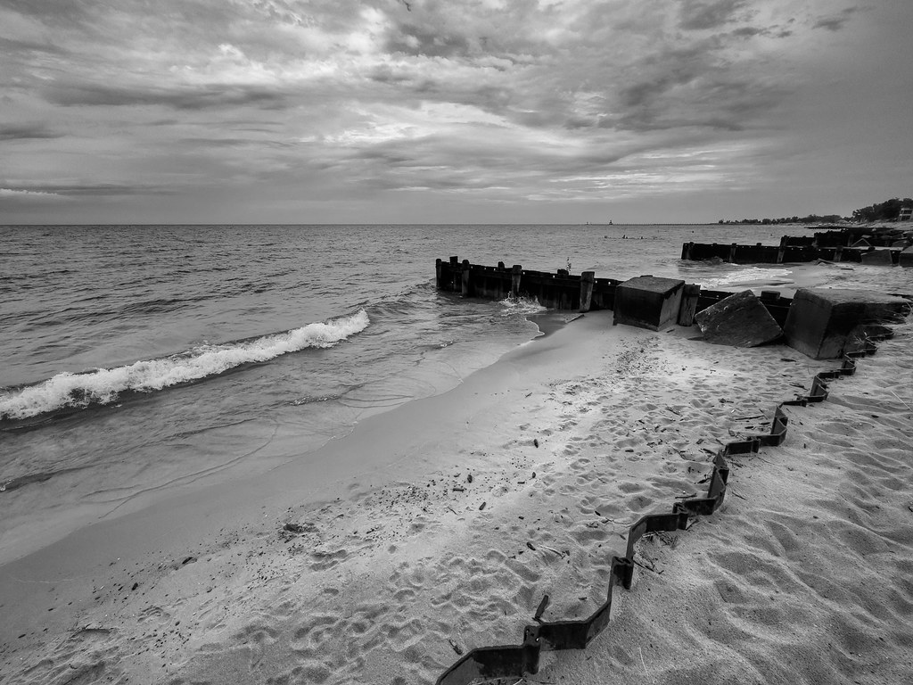
Mark took this photo at the beach in St. Joseph. Here’s a few more of Mark’s recent shots from the St Joseph’s Lake Michigan shoreline – note the crazy high water! See the latest in his 2025 gallery on Flickr!
9 years ago I started a Michigan in Pictures Patreon page to allow folks to throw me a few bucks in support of michpics. A big thank you to all who have done so – it means a lot to know you care.
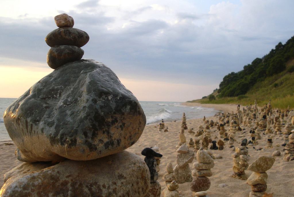
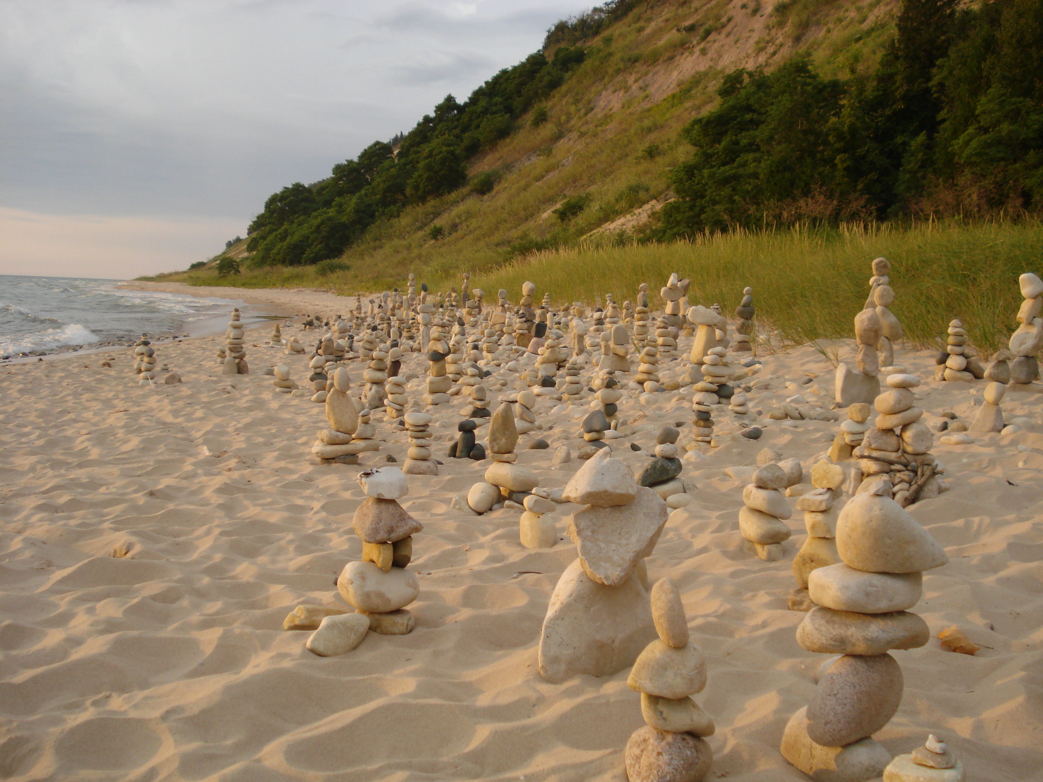
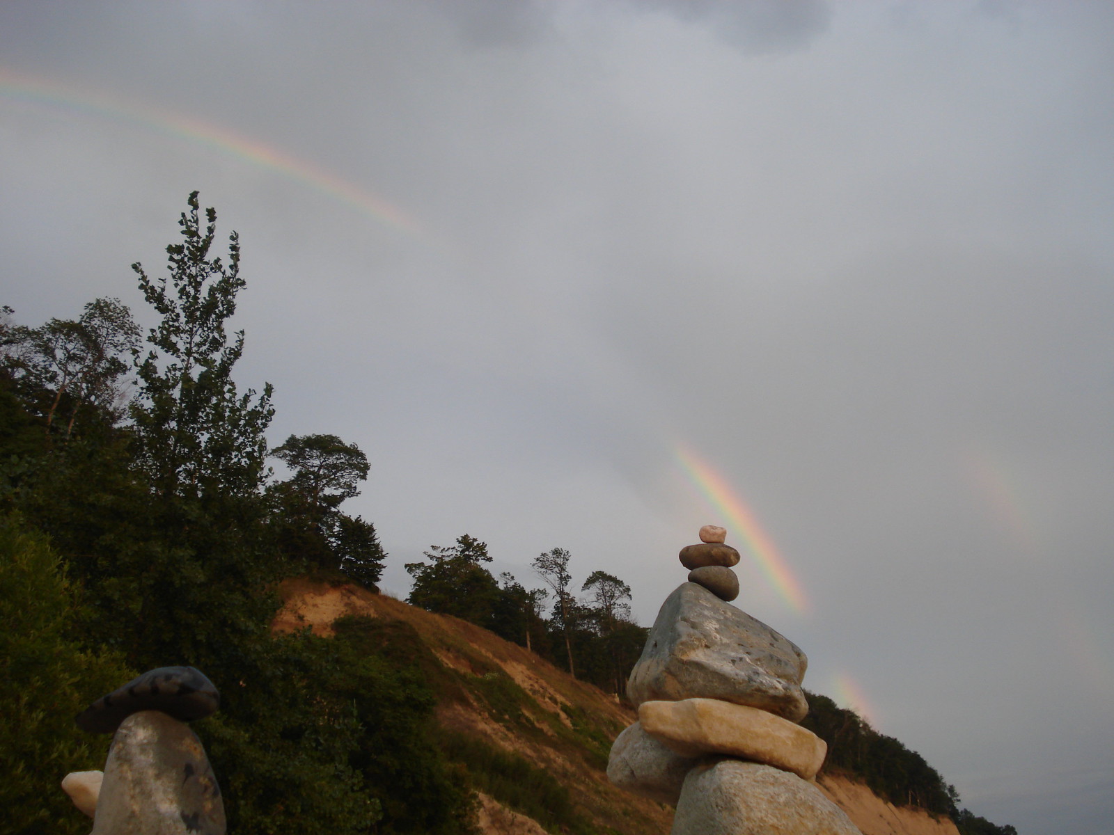
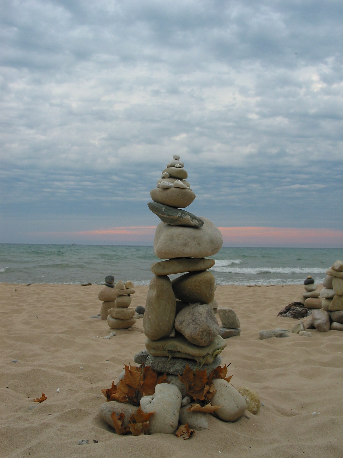
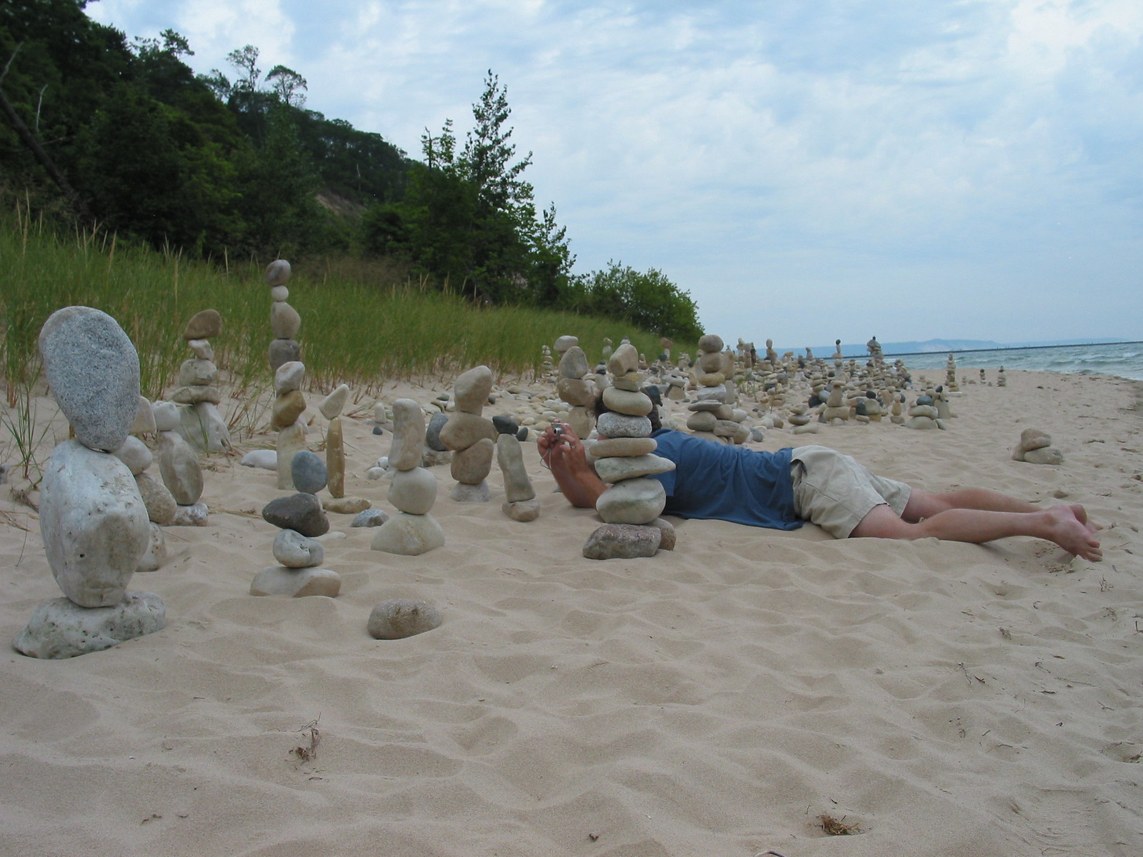
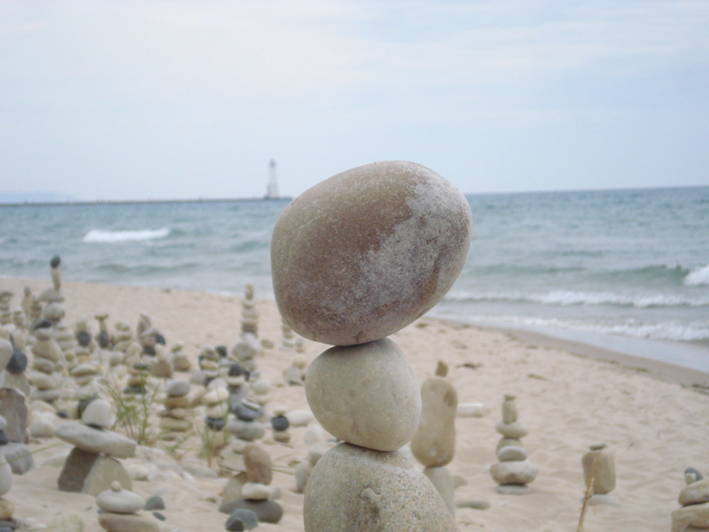
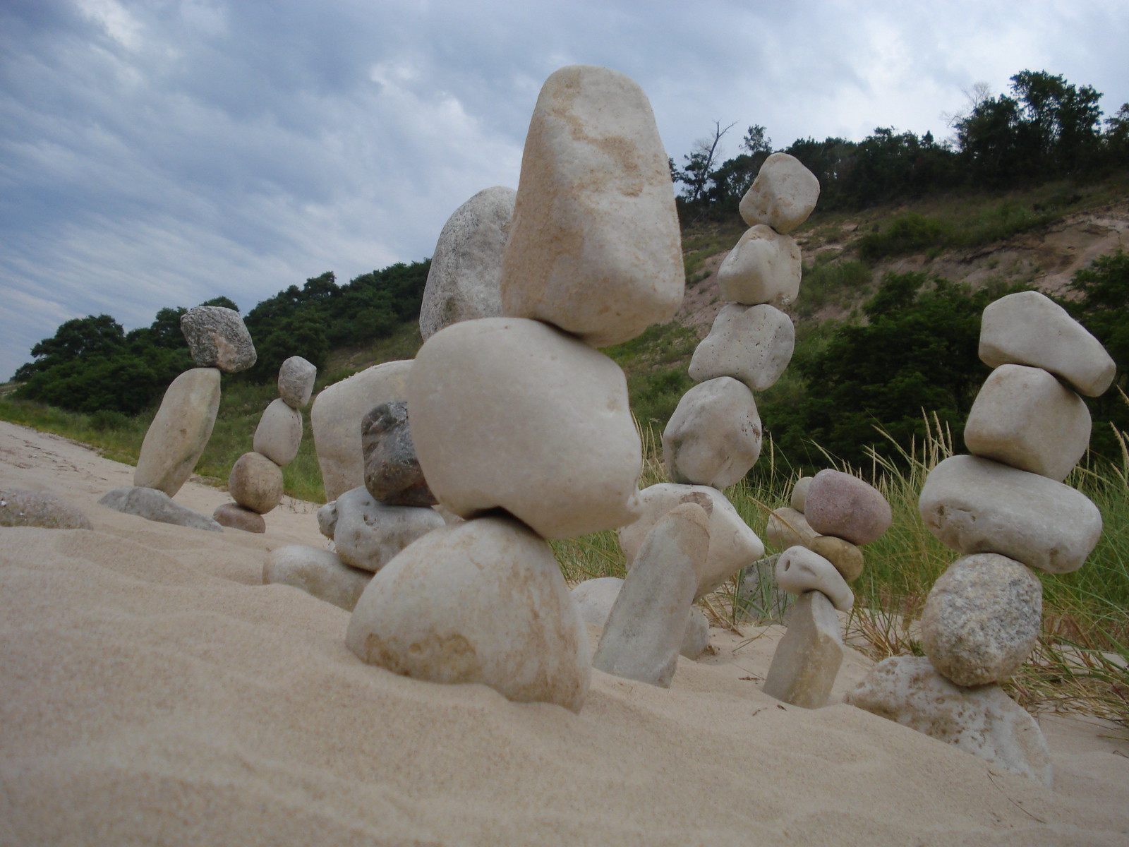
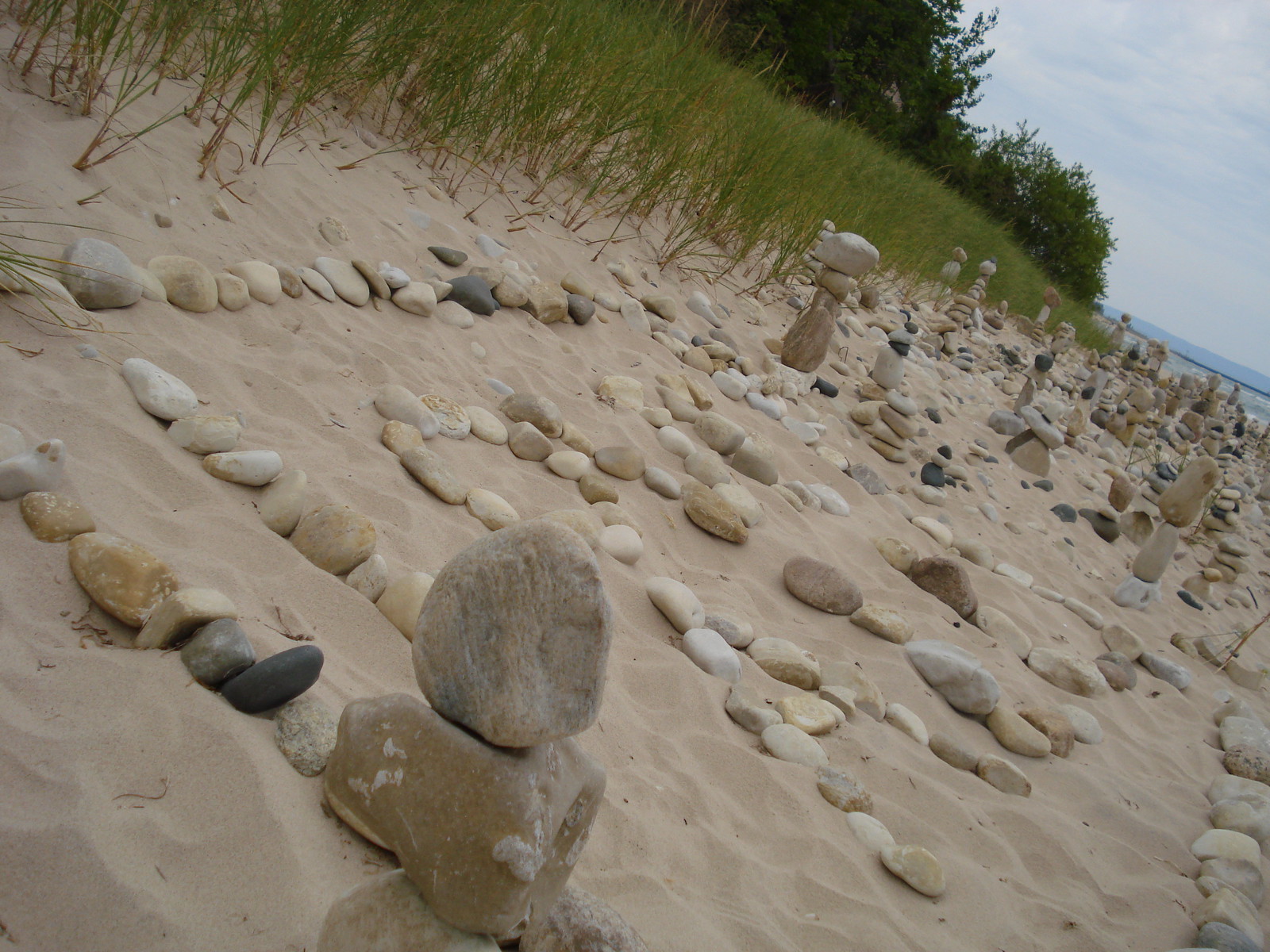
My best friend Ken who has since passed on & I took these photos way back in August of 2007 after an honestly incredible rock stacking event on the Lake Michigan shoreline just north of the village of Frankfort. I still have no idea who did this, but I know that I will never forget it!! I hope you enjoy these photos & the video and also that you’re able to make or discover magic in your corner of the Great Lakes State.
Waugoshance Point is easy to spot on a map, just look for the large peninsula jutting out from the northwestern corner of the lower peninsula: that’s it. If only for that reason it was an attractive place to want to take a hike. An added bonus was the fact that it marks the western end of the Mackinac Straits amidst three remote lighthouses and is completely devoid of trails. I simply couldn’t come up with a reason NOT to go.
Waugoshance Point is truly spectacular in the summer when the rock beaches are home to a myriad of waterfowl and a dizzying array of lake shore wildflowers. I just couldn’t wait though. The snow was gone and I needed to get out. The trail head, if there was a trail, is located at the end of Waugoshance Point Road which gives access to the back-country cabins of Wilderness State Park. From there I’d trust my topo-map to guide me along the shore out to the point. Though there are no hills or cliffs to speak of the area turned out to be quite diverse and beautiful, as you’ll see…
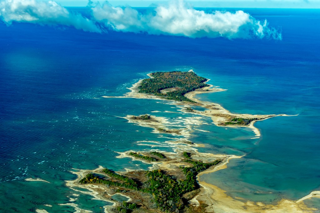
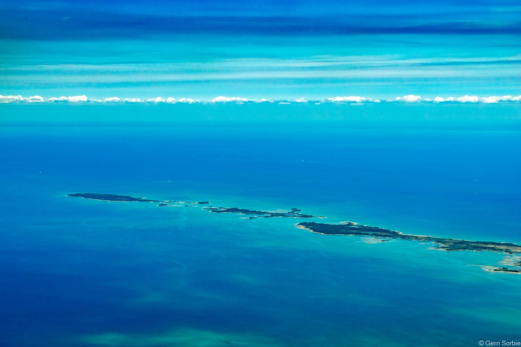
Here’s a great aerial photo by Jim – see more in his From the Air gallery on Flickr which also includes another view of the Point from August of 2022.
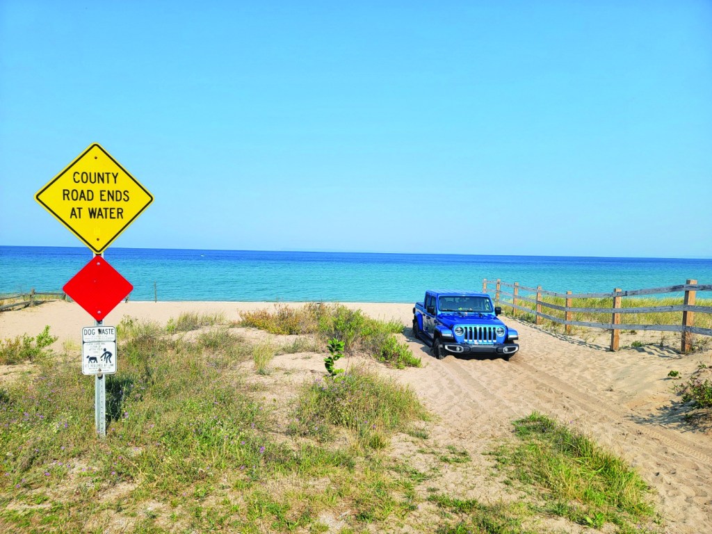
via Leelanau.com… The Glen Arbor Sun shared this photo a year ago, and I think it’s the perfect reminder for everyone to pay attention to your driving & traffic laws as we head into the Labor Day Weekend. Have fun and please don’t drink & drive – you simply don’t want to end up as a traffic statistic.
And yes, Jeep lovers, we know that you can deflate the tires to get out of a mess like this. The point is don’t break Federal law by driving on the beach in Sleeping Bear Dunes National Lakeshore or any of the other idiotic things that might seem like a good idea at the time!!
I just realized that summer is almost over, and I hope that we can all act accordingly!!
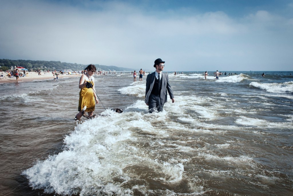
I have featured Jonathan’s photo of Grand Haven’s “Formal Day at the Beach” before & I will undoubtedly share it again!! Near as I can tell, the event no longer happens but it looks super fun. See the latest from Jonathan on his Flickr.
Now this is no shade to Manistee’s First Street Beach because for my money, it’s one of the best, especially for finding beach glass. I am for sure wondering if readers think this is our best beach or if they prefer another. Let me know in the comments or on the Michigan in Pictures Facebook!!
Manistee Tourism shared Tess’s photo on their First Street Beach + Douglas Park page. Visit for a live web cam and info about the three playgrounds, bathhouse & concessions, dog park/dog beach, and all kinds of other amenities!