#TBT: Icebound Car Ferries in Ludington

Carferries Icebound in Ludington 1913

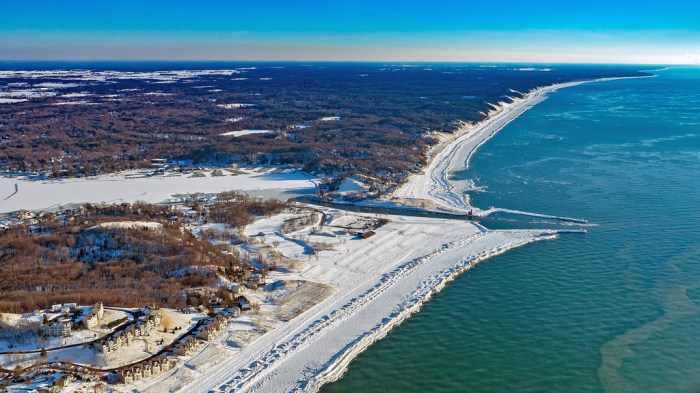
Icebound Carferries at Ludington, photo courtesy Karl Bahle

The caption reads “Carferries 15, 17, 18 and 19 – Fast in ice at Ludington, Mich March 22, 1913” and from that, I was able to dig up some tasty history! Carferries.com has great information on the Pere Marquette fleet of ferries that was based in Ludington. They say (in part):

At various times between 1897 and 1947, the Pere Marquette operated a total of 13 ferries on Lake Michigan, running between Ludington, Mich. and Milwaukee, Manitowoc and Kewaunee, Wis. These ships were then an efficient means of bypassing the congested rail yards in Chicago. They plied routes varying between 60 and 97 miles in length, and were often plagued by violent storms and heavy ice. Given the fact that most of the cross-lake runs were made at speeds of 12 to 14 miles per hour, a remarkable volume of freight was carried.

In those fifty years the Pere Marquette car ferries made well over 160,000 lake crossings and transported roughly 4.5 million railroad cars loaded with over 75 million tons of freight. Even these numbers are somewhat conservative, as early records no longer exist. They also carried approximately 1.6 million passengers and after the mid-1920’s, about 380,000 automobiles. Additionally, over the course of its history, the railroad operated a total of 4 river car ferries. These ran between Port Huron, Mich. and Sarnia, Ont., and between Detroit, Mich. and Windsor, Ont., connecting the PM’s Michigan and Canadian lines.

  • Pere Marquette 15 – launched in December of 1896 as the original Pere Marquette. She reportedly burned 30 tons of coal on an 1897 round trip from Ludington to Milwaukee. In 1924, the vessel was renamed Pere Marquette 15, and scrapped in Manitowoc in 1935.
  • Pere Marquette 17 – launched in 1901, hauled 2 “Jack Johnson” battleship guns in 1915, sold to the State of Michigan to be the car ferry “City of Petoskey” <-great info and photos there!
  • Pere Marquette 18 – here’s where the history gets a little murky, as the ship that was launched in 1902 sank in 1910 off Sheboygan, Wisconsin, so either the date is wrong on the photo above or that’s another ship! UPDATE: Karl informed me that the original 18 did sink in 1910, a new one was put into service in 1911 and sailed until 1954!
  • Pere Marquette 19 launched in 1903, ran aground numerous times before being sold for scrap in 1940. She was reduced to a barge profile and renamed the Hilda.

If you’re wondering “What happened to Pere Marquette 16?” that link has great info on the 16, only wooden car ferry in their fleet!

View Karl’s photo bigger and check out his Lake Boats album for many more photos!

Hygienic Dress League Corporation

Hygenic Dress League

Hygienic Dress League, photo by Jeff Caverly

You can follow the Detroit-based Hygienic Dress League on Instagram for more interesting public art and see a video about their artwork on Vimeo.

View Jeff’s photo from Huron County background big, see more in his slideshow, and also visit his photography website.

More art and more barns on Michigan in Pictures.

Morning Light at the Manistee Pierhead Light

Manistee Lighthouse

Manistee Morning Light, photo by Heather Higham

Terry Pepper’s Seeing the Light has an extensive entry on the history of the Manistee Pierhead Light with copious information and historical photos. Terry goes deep on Manistee’s history as a lumber port:

Although the first sawmill had been established on the banks of the Manistee in 1841, settlement in the area was not widespread until the Chippewa relinquished their reservation by treaty in 1849, and the federal government offered lands along the Manistee for public sale. It did not take lumber interests long to realize the incredible potential of the Manistee which snaked a hundred miles into the forests, and lumbermen soon began lobbying for federal funding to improve the harbor and to erect a lighthouse at the river mouth. With no appropriation forthcoming, the businessmen of Manistee took the matter into their own hands, erecting a pair of short stub piers at the river mouth in an attempt to stem the deposition of sand and silt.

In 1861, Congress instructed the Army Corps of Engineers to dispatch an Engineer Officer to Manistee to conduct a survey of the river entrance. Water depth in the opening between the piers was found to be from seven to eight feet, and a 250-foot long sand bar with a water depth of less than five feet above it was identified 600 feet off the end of the piers.

…To serve this burgeoning maritime commerce, the piers were extended an additional 150 feet in 1875, and the channel between them dredged to a minimum depth of ten feet. With the main light now standing a considerable distance to the rear of the pierheads, the decision was made to replace the shore light on the north bank with a pierhead beacon on the outer end of the longer south pier. Click to view enlarged image The new south pierhead light consisted of a timber-framed pyramidal beacon typical of the type being erected on pierheads throughout the Great Lakes. With its lower half open, the upper half immediately below the gallery was enclosed to provide a small service room for lamp maintenance. Equipped with windows, the service room also served as a sheltered area in which the keeper could stand watch during inclement weather. Standing 27 feet in height, the beacon was capped with a square gallery with iron handrails and an octagonal cast iron lantern installed at its center.

Read on for a whole lot more.

About the photo, Heather writes:

I still can’t believe I managed to drag myself out of bed this morning. There were 8 minutes of pink light – and a stunning sunrise to the east that I completely ignored – followed by about 90 minutes of interesting (if not sunrise) light.

View it bigger, see more in her Lighthouses slideshow and definitely add Snap Happy Gal Photography to your Facebook follows!

More Michigan Lighthouses and more sweet sunrises on Michigan in Pictures.

Below the Mighty Mac

Under the Mighty Mac

Mighty Mack, photo by vinnywalsh.com

Last week I shared how you can get driven across the Mackinac Bridge. Guessing you’re on your own if you want to cross the Straits of Mackinac at this level!

Vinny took this photo on Christmas Eve of 2005. If you want to check in with the current scene, the Mackinac Bridge Authority webcams have you covered with three different views.

Check his photo out bigger and see more at vinnywalsh.com.

Much more Mackinac Bridge on Michigan in Pictures.

Deer Michigan, I Love You

Deer Tracks - Kitch-iti-Kipi

Deer Tracks – Kitch-iti-Kipi, photo by John McCormick/Michigan Nut

Happy Valentines Day to all of you! I love Michigan even more than stupid puns. 

Someone else who loves this state is my friend John McCormick of Michigan Nut Photography. He’s on quite a tear right now with photos on many Pure Michigan billboards and being featured as an Instagram must-follow for Michigan lovers.

Kitch-iti-kipi means “The Big Spring” and it’s located in Palms Book State Park near Manistique. The park page shares what I’m realizing is kind of a dark story for Valentine’s Day. I do have past Valentine’s Day posts that are sweeter.

The legend of Kitch-iti-kipi is said to be about a young chieftain whose girlfriend got the best of him. He told her he loved her far above the other dark-haired maidens dancing near his birch bark wigwam. Prove it, she insisted. As a test of his devotion, she declared that he must set sail in his canoe on the pool deep in the conifer swamp. He was to catch her from his canoe as she leaped from an overhanging bough. His canoe overturned in the icy waters and he drowned. It turns out that the maiden was back at the village laughing at his foolish quest. According to legend, the Spring was named Kitch-itikipi in memory of the young chieftain who went to his death in the icy waters in an attempt to satisfy the vain caprice of his ladylove.

John observes that the deer that winter in this cedar swamp have a never ending supply of “Kitch-iti-Kipi Spring water.” View the photo bigger on Facebook, dive into his slideshow for some stunning winter shots from the UP, follow him at Michigan Nut Photography, and purchase photos from his website if you’re so inclined.

PS: I shared a summertime pic by John of Kitch-iti-Kipi with more info about this hidden Michigan gem!

Michigan Weird Science: The Menominee Crack

Birch Creek Michigan Crack in Forest

The Menominee Crack, photo courtesy Michigan Tech College of Engineering

Gizmodo reports that back in October of 2010 folks near Birch Creek in Menominee County heard a boom, felt the earth rock, and woke up to find a 360′ crack in the ground:

The first clue was the fact that the split happened at the top of a ridge. A pop-up isn’t a wrenching apart of some deep underground structure. It’s a large piece of ground suddenly pushing upwards, so that the ground above splits over it. The researchers discovered the pop-up by the sophisticated technique of slamming a sledgehammer against a metal ball sitting on the ground. The action caused sound waves to move through the rock beneath—and depending on the formation of the rock, the sound moves at different speeds. In this case, it moved in hugely different ways parallel to the crack, as compared to perpendicular to the crack. This indicated that there was a huge fracture in the limestone underneath the crack.

These sudden fractures occur due to extreme strain in the rock—strain that can be pent up for centuries. It’s more common around quarries, when removal of large pieces of rock can cause the rest to suddenly fracture and pop upwards. Other times, it can occur spontaneously. The Menominee Crack, as its now called, was probably the result of a spontaneous fracture—although the researchers speculate it might have happened due to the removal of a large tree from the area.

Read more at Gizmodo and check Michigan Tech for a detailed explanation of the Menominee Crack and Live Science for more photos. If you want to creep yourself out a little more, check out the probably related Wisconsin mystery booms!

Thanks Michigan Tech’s Engineering College for the photos and for all you do to help unravel the mysteries of Michigan!

If you like stuff like this, there’s plenty more Michigan weirdness on Michigan in Pictures!

News for the Nervous: Mackinac Bridge Driver’s Assistance Program

Mackinac Bridge Snow Winter

Mackinac Bridge, photo by Blondieyooper

Fun fact of the day: I have a mild fear of heights! While it’s not crippling enough to stop me from being able to drive over the Mighty Mac, I can definitely see where some people aren’t able to do that. For all of you, here’s a story (with a good video) about a little known service: The Mackinac Bridge Authority will drive you across!

The Mackinac Bridge Authority explains further:

The Mackinac Bridge Authority has a “Driver’s Assistance Program” that provides drivers for those uncomfortable with driving across the Mackinac Bridge. If you are traveling northbound, there is a phone at the south end of the bridge. Instructions for using the phone are posted in the phone box. If you are southbound, just ask a fare collector for assistance. There is no additional fee for this service.

The phone is located on the shoulder of I-75 just north of the Jamet Street exit to Mackinaw City (near Audies Restaurant). You do not need to exit the freeway. Just past the exit, you can pull over to the right and park on the shoulder. The phone box is located on the right-of-way fencing. The box is green and easily spotted. If this is still unclear, please call us at 906-643-7600.

View Blondieyooper’s photo background big and see more in her Gotta Love Winter slideshow.

Lots more about the Mighty Mac on Michigan in Pictures.

February at the Eben Ice Caves

Eben Ice Cave Entry

Ice Cave Entry, photo by Eric Hackney

On the Pure Michigan blog, guest blogger Jesse Land of Things To Do in the U.P. details how to get to the Eben Ice Caves in Michigan’s Upper Peninsula, writing in part:

Just outside of Marquette County, the Eben Ice Caves are one of Michigan’s prime winter attractions. Each winter, once the ice caves start to freeze up (usually sometime in December), visitor’s flock to the tiny town of Eben Junction to see the ice caves and, while they’re out there, support local businesses like the Eben Ice Caves concession stand, the Rock River Cafe and the New Moon Tavern.

The “Rock River Canyon Ice Caves” better known as the Eben Ice Caves, form when melting snow runs over the edge of a small cliff and freezes, forming “ice caves” Much like the large ice formations along Munising’s Grand Island and parts of Pictured Rocks National Lakeshore, if you were to visit here in the summer you would see little to no water running over the edge.

Sometimes I feel like Eric spends his time at all the cool Michigan places I never seem to make it to. View his photo bigger and see more in his 2-5-16: Eben Ice Caves II slideshow. Readers who are on the ball will wonder about #1 in the series – here’s 1-31-15: Eben Ice Caves that also includes pics of Munising Falls, MNA Memorial Falls and Tannery Falls!

Read more about the Eben Ice Caves in this Michigan in Pictures post featuring Nina of Black Coffee at Sunrise.

Happy Birthday Holland: Looking back on the Holland Channel

Looking Back on the Holland Channel

Looking Back at the Holland Channel, photo by Sandy Hansen Photography

February 9th is the 169th anniversary of the founding of Holland, Michigan. The History of Holland has some background about one of the prime factors for the city’s success, the Holland Channel:

From its very beginnings, Holland provided a refuge for those seeking freedom of expression and a more vibrant economy. Persuaded by religious oppression and economic depression, a group of 60 men, women, and children, led by Albertus C. VanRaalte, prepared for their 47-day trip from Rotterdam to New York. VanRaalte intended to purchase land in Wisconsin, but travel delays and an early winter caused the group to layover in Detroit. After hearing about available lands in west Michigan, VanRaalte decided to scout the territory. They reached their destination on February 9, 1847 on the banks of Black Lake—today’s Lake Macatawa.

The hundreds of Dutch immigrants that followed expected to find their promised land, but instead found a swamp and insect-infested forest. Although food was scarce, and the log sheds they built were unable to hold everyone, the settlers persevered. VanRaalte realized the practical and economic potential of the dense forest: trees could be felled to build homes and businesses, while the excess lumber could be sold to purchase farming supplies.

In the early years of Holland history, the settlers set out to conquer several projects. They knew that if Lake Michigan was to provide growth and development, it had to be made accessible by an adequate channel. After trying in vain to receive government aid, the determined Hollanders took up picks and shovels and went about digging the channel themselves. The immigrants also cleared a one-block square of land in the center of the colony—today’s Centennial Park—to serve as a market square.

Read on for more and click for a live webcam of the Holland Channel.

View Sandy’s photo bigger, see more in her Aerial slideshow, and follow her on Facebook too!

More aerial photos and more from Holland on Michigan in Pictures.

Back into the freezer, Michigan

Ice Palace Grand Haven Lighthouse

Winter Wonderland, photo by David Behrens

mLive meteorologist Mark Torregrossa says that severe & sustained cold temps plus heavy lake effect snow are coming to Michigan this week:

Most of the heavy lake effect this winter has come on a northwest wind. The lake effect this week will be brought by a more northerly wind. So the lake effect will fall closer to the Lake Michigan shoreline. The heaviest snow will likely fall in the far southwest corner of Lower Michigan from St. Joseph to Michigan City, IN and South Bend, IN. Also heavy lake effect should fall from Traverse City, Leelanau County and southward to just west of Cadillac.

The heaviest areas of lake effect snow should easily have 6″ of snow, with spots getting up to a foot of snow.

…No area will escape the deep cold. This cold snap won’t be like the other cold snaps this winter that only lasted a few days. This cold snap will start Tuesday and gradually get colder each day into next weekend. By the time temperatures bottom out this weekend, we’ll freeze with highs in the teens and low temperatures in the single digits above or below zero.

The wind will push wind chill temperatures down to -10° to -20° at times in the second half of the week.

David took this last winter at Grand Haven. Check it out bigger and see more in his Home Sweet Home slideshow.

More about the Grand Haven Pier Light along with a crazy photo of the waves that make these ice formations on Michigan in Pictures!