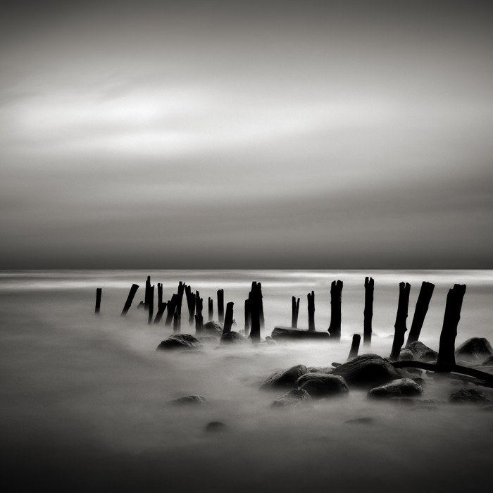
November is Shipwreck month on Absolute Michigan, and today we have one of the best Weird Michigan features ever, The Ghost of Minnie Quay, which tells a haunting tale of love and loss from Forester, Michigan.
Today is the opening day of deer season, and around much of Michigan businesses, schools and streets will be empty as people head to the woods in search of whitetail deer. Deer season, however, is about more than just filling the freezer with venison: it’s about deer camp. And deer camp, as Ronnie writes (and this photo show), is often about beer:
We all know that when men work hard, we tend to develop a mighty thirst. Just ask anyone who loves to go deer hunting, and they will tell you that just thinking about the next day’s hunt, can make your mouth feel dryer than a Georgia cotton plantation, during a scorching heat wave with a 10 year drought already in place. Therefore, its imperative that one must procure plenty of liquid refreshment to prevent dehydration during these primeval events. Such was always the case whenever my Uncle Bob went deer hunting in Michigan’s Upper Peninsula.
Everyone who went hunting with my uncle, chipped in on a beer fund to help offset the total costs. More often than not, someone would have to drive into the nearest town and buy even more by mid-week. Nevertheless, check out these vintage beer boxes from Bosch, Schlitz, and Stroh’s. The former of the three has a very interesting story. You can read more about the colorful and interesting history of the Bosch Brewing Company, once located in Michigan’s Keewenaw Peninsula until its demise in 1973.
The photo was shot Little Shag Lake near Gwen Lake, outside of Negaunee, Michigan on November 15, 1956 and you can see it (and others) bigger in Ronnie’s slideshow.
Wikipedia’s entry for Lake Huron says that Lac Huron was named by early French explorers after the Huron people inhabiting the region. Lake Huron is the second largest of the Great Lakes and the third largest fresh water lake on earth with a surface area of 23,010 sq mi, a volume of 850 cubic miles and a shoreline length of 3,827 mi.
The Great Lakes Information Network page on Lake Huron pegs it as the 5th largest lake in the world and adds:
It has the longest shoreline of the Great Lakes, counting the shorelines of its 30,000 islands.
It contains Manitoulin Island, largest freshwater island in the world.
Georgian Bay and Saginaw Bay are the two largest bays on the Great Lakes.
Huron was the first of the Great Lakes to be discovered by European explorers. Since its French discoverers knew nothing as yet of the other lakes, they called it La Mer Douce, the sweet or fresh-water sea. A Sanson map in 1656 refers to the lake as Karegnondi, simply meaning “lake” in the Petan Indian language.
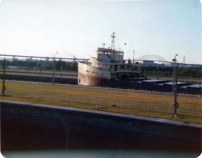
What I suspect that a lot of people forget (because I know I do) is that the S.S. Edmund Fitzgerald was just one of many ships plying the Great Lakes. About the photo above, Bill writes:
My father-in-law took this shot. He told my wife that he wasn’t taking a picture of the Big Fitz; he just wanted a photo of the locks, and this happened to be in the photo. Unfortunately, the negative is long gone and this photo was printed on some sort of rough-coated matte paper so that it could be mailed as a postcard.
My father-in-law didn’t realize until months after the sinking that he had a picture of this vessel.
The photo was taken in August 1975; the Edmund Fitzgerald sank November 10th of that year. It was, ironically, the sinking that made this ship famous. After it was built in 1958, until 1971, it was the largest ship on the Great Lakes, but other than that, it was just another anonymous working vessel plying the waters between Wisconsin and Michigan.
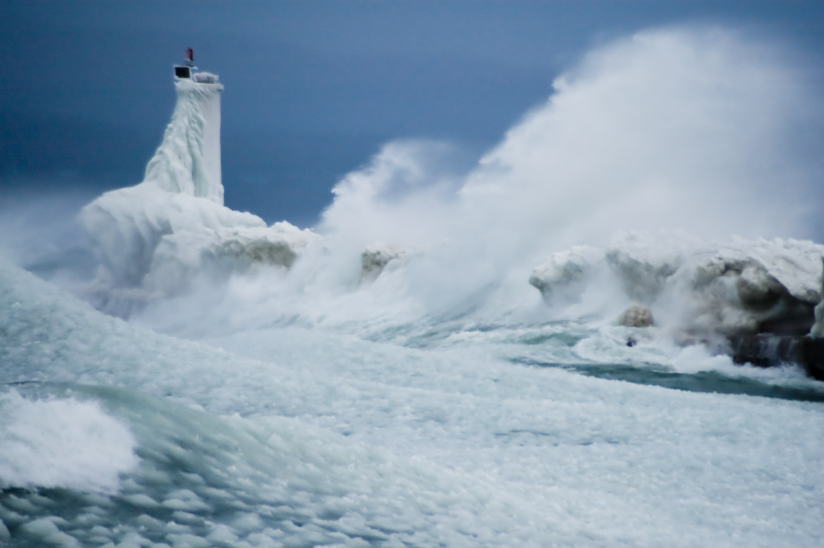
“No lake master can recall in all his experience a storm of such unprecedented violence with such rapid changes in the direction of the wind and its gusts of such fearful speed! Storms ordinarily of that velocity do not last over four or five hours, but this storm raged for sixteen hours continuously at an average velocity of sixty miles per hour, with frequent spurts of seventy and over.
Obviously, with a wind of such long duration, the seas that were made were such that the lakes are not ordinarily acquainted with. The testimony of masters is that the waves were at least 35 feet high and followed each other in quick succession, three waves ordinarily coming one right after the other.
~Report from the Lake Carriers Association in the wake of the Great Lakes “White Hurricane”
97 years ago the Great Lakes region reeled under the deadliest storm in its history. Known as the “Big Blow” and the “Freshwater Fury”, was a blizzard with hurricane-force winds that devastated the Great Lakes Basin in the Midwestern United States and the Canadian province of Ontario from November 7 through November 10, 1913. Read on for more!
Dear wife and Children. We were left up here in Lake Michigan by McKinnon, captain James H. Martin tug, at anchor. He went away and never said goodbye or anything to us. Lost one man yesterday. We have been out in storm forty hours. Goodbye dear ones, I might see you in Heaven. Pray for me. / Chris K. / P.S. I felt so bad I had another man write for me. Goodbye forever.
~A message found in a bottle 11 days after Plymouth disappeared, dictated by Chris Keenan, federal marshal in charge of the barge.
Wikipedia says that the Great Lakes Storm of 1913, also known as the “Freshwater Fury“or the “White Hurricane”, was a blizzard with hurricane-force winds that ravaged the Great Lakes November 7-10, 1913. With the sinking of 19 ships, the stranding of another 19 and a death toll of at least 250, it remains the deadliest and most destructive natural disaster in Great Lakes history.
Major shipwrecks occurred on all but Lake Ontario, with most happening on southern and western Lake Huron. Lake masters recounted that waves reached at least 35 feet (11 m) in height. Being shorter in length than waves ordinarily formed by gales, they occurred in rapid succession, with three waves frequently striking in succession. Masters also stated that the wind often blew in directions opposite to the waves below. This was the result of the storm’s cyclonic motion*, a phenomenon rarely seen on the Great Lakes.
In the late afternoon of November 10, an unknown vessel was spotted floating upside-down in about 60 feet (18 m) of water on the eastern coast of Michigan, within sight of Huronia Beach and the mouth of the St. Clair River. Determining the identity of this “mystery ship” became of regional interest, resulting in daily front-page newspaper articles. The ship eventually sank, and it was not until early Saturday morning, November 15, that it was finally identified as the Charles S. Price. The front page of that day’s Port Huron Times-Herald extra edition read, “BOAT IS PRICE” DIVER IS BAKER “SECRET KNOWN”. Milton Smith, the assistant engineer who decided at the last moment not to join his crew on premonition of disaster, aided in identifying any bodies that were found.
Remembering Tiger Manager George “Sparky” Anderson on Absolute Michigan recounts how the Hall of Fame coach who managed the Tigers from 1979-1995 and was the first manager to win a World Series for both a National League and American League team. His 1,331 wins are the most in Tigers’ history
Read on for all kinds of columns and video about this Detroit Tiger legend.
When Michigan became a state in 1837, 32-year-old Douglass Houghton was appointed as the first State Geologist. Houghton began a comprehensive geological exploration of the state to determine the extent of its mineral resources, visiting the Upper Peninsula in 1839 and 1840. This report to the Michigan legislature noted the probable extent of copper deposits in the Keweenaw Peninsula and stimulated new interest in Northern Michigan.
Publication of Houghton’s report of the mineral-rich Keweenaw Peninsula awakened the attention of eastern businessmen. The nation’s escalating need for brass (an alloy of copper and zinc) prompted further exploration of the area for exploitable copper resources….
Many of the earliest travelers to Keweenaw Point stayed only until their dreams of quick riches disappeared. But some stayed on to settle the area and a few of the current townfolk and shop owners are descendants of those first rugged settlers. Early Copper Harbor became the administrative center for a group of remote copper mining locations spread through the forst of Keweenaw Point. Later, the Harbor rang to the sound of axes and crosscut saws as the growing region required vast quantities of pine logs to support mine shafts and provide housing for a growing influx of immigrants. Today the Harbor still has the feeling of its frontier origins.
Here’s more about the history of copper mining at Copper Harbor and you can check out the official site for things to see and do around Copper Harbor in the present day.
Michigan’s Otherside has some great stories to put you in the Halloween frame of mind. Corn mazes are a popular attraction that many Michigan farmers put a lot of time into, but as Ghosts in the Cornfield warns, sometimes corn fields have their own haunts:
As a teenager I lived in a multilevel house right on M66 in Battle Creek close to the Pennfield schools. A couple of times I was walking along the rows of corn in the cornfield just behind my home when I had a paranormal experience. I was only about four or five rows back, walking parallel to the back of my house when I saw a farmer in blue jeans and a red flannel shirt walking towards me in the row closer to my house. I was too scared to look up to see his face. There was no sound from his footsteps or his arms hitting the dried leaves on the cornstalks. I had massive goose bumps! A couple of weeks later I was walking along the corn rows in about the same spot and this time I saw the farmer with a hound dog. Once again, I was too scared to look up. He was between me and the safety of my home. I kept my eyes down, held my breath and hoped he wouldn’t say or do anything to me. They passed silently and my heart rate slowed back down. My sisters and I loved to play in the cornfields.
Years later, one of my sisters admitted she had seen the farmer. He is probably still walking the fields every Fall as he had in life…
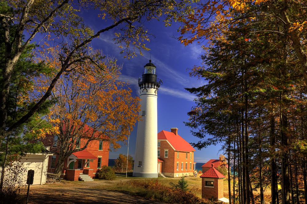
The Au Sable Light Station is located in the Pictured Rocks National Lakeshore, and I think that it is the most peaceful setting of any lighthouse I’ve ever visited. Terry Pepper’s Seeing the Light page on Au Sable Point Lighthouse agrees, saying that the Lake Superior coastline between Whitefish Point and Grand Island attracts tons of tourists & stands as one of the most beautiful stretches of shoreline in all of the Midwest. However:
It is difficult to imagine that during the 1800’s this stretch of seemingly bucolic coastline was known to mariners as “The Shipwreck Coast,” with the hulks of innumerable vessels pushed onto the rocks by violent storms out of the north, or lost in the pea soup fogs which frequently enveloped the area.
While a Light at Whitefish Point had marked the eastern end of this stretch since 1849 and the western limit had been marked by the North Light on Grand Island since 1856, the 1860’s found mariners forced to blindly navigate the intervening 80 miles through some of the most treacherous waters in all of the Great Lakes. Bowing to increasing pressure from the maritime community, the Lighthouse Board finally took up the mariners call in its 1867 annual report, requesting a Congressional appropriation of $40,000 for the construction of a new coast light at a point between the Grand Island and Whitefish Point Lights.
It took five years for Congress to appropriate funds for the light. Pepper notes that in 1910 official government documents stopped referring to the station as “Big Sable,” and began listing it as “Au Sable,” likely to eliminate confusion with Big Sable Point on Lake Michigan. Definitely click through to Seeing the Light for much more about this lighthouse including old photos!