Tinder by Kevin Ryan
A sky of flame, of smoke a heavenful, the earth a mass of burning coals, the mighty trees, all works of man between and living things trembling as a child before a demon in the gale. To those who have seen, the picture needs no painting.”
-a history of Sanilac County
The Chicago Fire of 1871 which started on October 8th gets (justifiably) a great deal of attention, but something that is not as well known is the fact that it was only one of a number of major fires across the Midwest that burned millions of acres in October of 1871 and caused over 1200 deaths. Michigan was dealt grievous blows from “The Fiery Fiend” as fires swept across the state, wiping out or endangering entire cities, towns and villages including Holland, Manistee, Grand Rapids, South Haven and Port Huron doing millions of dollars worth of property damage and killing hundreds.
It’s probably impossible for us to fathom what the threat of fire was like in those days. This brief excerpt from a terrifying account account of the burning of Manistee might give a glimmer:
…A bright light came up out of the south, directly in rear of the town, and the fierce gale bearing it on directly toward the doomed city. Those who resided in that part of town, including the writer, rushed to the new scene of danger, the full extent of which few comprehended. The fire had originated two miles south of the city, on the lake shore. It first came upon the farm of L.G. Smith, Esq., which it devoured. Eighty rods north the extensive farm and dairy of E.W. Secor shared the same fate, with all his barns and forage. Another quarter of a mile, and the large farm buildings of Mayor R.G. Peters were quickly annihilated. Here the column of fire divided, the left hand branch keeping to the lake shore hills, and coming in at the mouth; the other taking a northeasterly course and coming in directly south of the town, as before described. Here a small band of determined men, fighting with the energy of despair to protect their homes, kept it at bay till past midnight. But all was vain – at 12:30 o’clock the gale became a tornado, hurling great clouds of sparks cinders, burning bark and rotten wood through the air in A Terrific, Fiery Storm.
Every man now fled to his own house. The fire now came roaring through the dead hemlocks south of the blocks included between Maple and Oak Streets, in the Second Ward. The flames leaped to the summits of the great hemlocks, seventy, eighty or ninety feet high, and threw out great flags of fire against the lurid heavens. The scene was grand and terrible beyond description. To us, whose homes and dear ones and all were in the track of the fire, it was heart-rending.
Read more of these amazing journal style entries from the history of Manistee County. The cause of these fires has been given as a hot dry summer, too many leavings from timbering operations and of course Mrs. O’Leary’s firebug of a cow. There is an interesting theory, however, that the root cause was the earth passing through the tail of a comet. You can read all about it at The Comet and the Chicago Fire where it’s noted that even a steamship passing the Manitou Islands in Lake Michigan noted that they too were on fire.
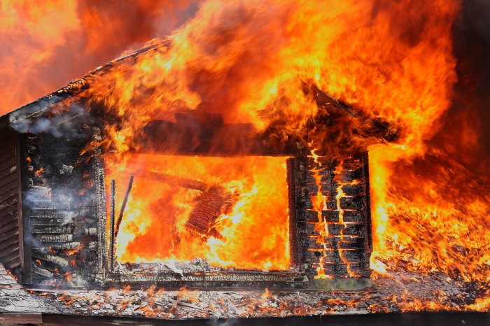
Kevin took this back in 2009 at a firefighter training in Grand Haven. See more in his Other gallery on Flickr.

Share Michigan in Pictures:

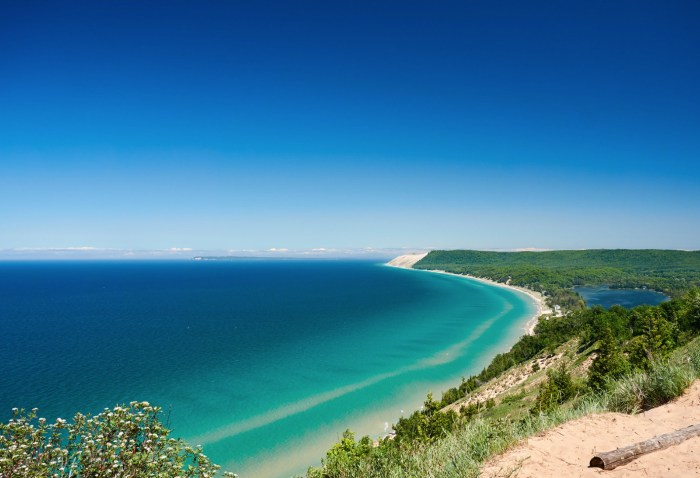
 Beginning in 1919 a small portion of what is now the national lakeshore was set aside as a state park. The idea of a national park in northwestern Michigan did not surface until the National Park Service’s Great Lakes Shoreline Survey visited the area in 1958. Between 1959 and 1970 there was a continuous and controversial effort in Congress to create a park unit around the Sleeping Bear Dune. The legislative leader of the Sleeping Bear park proposal was United States Senator Philip A. Hart. The senator’s persistence and patience in the end led to the creation of Sleeping Bear Dunes National Lakeshore on October 21, 1970.