Superior Weather

Superior Weather

Superior Weather, photo by corydalus.

Cory Dalus writes “Lake Superior in a storm is awesome in the true sense of that abused word. Quite a spectacular first snow of the season.”

This photo of Lake Superior at Whitefish Point (home of the Great Lakes Shipwreck Museum) is part of a great set of photos titled Around Lake Michigan (with a side trip north).

runs through it

runs through it

runs through it, photo by amy_kilroy.

This photo of the Miners River at Miners Beach where it empties into Lake Superior is one of a gorgeous set of photos of Pictured Rocks National Lakeshore by Amy Kilroy.

Yeah, it makes pretty good wallpaper too and is part of the Michigan in Pictures Michigan Fall Wallpaper series!

Stones on Beach, 2002

Stones on Beach, 2002

Stones on Beach photo by Greg Seman

Greg Seman is a photographer from Traverse City. Visit his web site for more photos of the Sleeping Bear, northern Michigan and other locations.

Red Skies over Muskegon

Muskegon clouds at sunset
Untitled, photo by EVOgraphy

From the Small World Files: on Monday evening (at just about the time this picture was taken) my wife and I watched small tornados drop from the clouds over Lake Michigan (about 150 miles north of where this photo was taken).

Sailplanes on the Frankfort Beach

Sailplanes on the Frankfort Beach
This photo shows a sailplane being winch-launched from the beach near Frankfort in the 1930s. It is one of many photos that appears in Soaring and Gliding: The Sleeping Bear Dunes National Lakeshore Area by Jeffery P. Sandman and Peter R. Sandman. The 127 page, oversized softcover uses archival photographs from the 1920s to the present day along with brief text passages to tell the story of the rise of the Sleeping Bear Dunes area in northwest Michigan as a soaring and gliding mecca.

Reprinted with permission from Soaring and Gliding: The Sleeping Bear Dunes National Lakeshore Area by Jeffery P. Sandman and Peter R. Sandman. Available from the publisher online at www.arcadiapublishing.com or by calling 888-313-2665.

Placidity

Placidity

Placidity, photo by SpringChick.

SpringChick writes:

pla*cid”i*ty (n): 1: a feeling of calmness; a quiet and undisturbed feeling.A thin blue line marks the horizon in a tranquil sea of blue; Lake Superior at Superior Point near the Wisconsin/Michigan border.

Here’s hoping your weekend has all the placidity you need!

40 Mile Point Lighthouse

40 Mile Point Lighthouse

40 Mile Point Lighthouse, photo by midmichphotos

According to the 40 Mile Point Lighthouse Preservation Society, the lighthouse is located on the shores of Lake Huron in Presque Isle County’s Lighthouse Park (about 7 miles north of Rogers City).

In 1889, the Lighthouse Board recommended that $25,000 be appropriated for construction of a new light and fog signal near Hammond Bay on Lake Huron … Major Milton B. Adams, Eleventh District Engineer selected and surveyed a site approximately 40 miles southeast of Old Mackinaw Point and 40 miles northwest of Thunder Bay.

The main lighthouse structure models the Big Bay lighthouse which was being constructed simultaneously near Marquette in the Upper Peninsula. 40 Mile Point is a two-story duplex with a tower incorporated into the center of the side-wall facing Lake Huron. Its footprint measures 35 feet by 57 feet.

Lighthouse photographer Terry Pepper has some great historical information (and photos) about Forty Mile Point Lighthouse in his Seeing the Light.

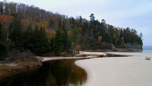
As a side note, I had to search to find this photo again and the photos Flickr pulled up for a “40 mile point” search are really cool!

along the dock at lake michigan

untitled, photo by puja.

This picture wasn't exactly what I expected when I went looking for the most popular "michigan beach" picture on Flickr from the summer 2005.

Perhaps there's a message in there about respecting the power of the Great Lakes when enjoying them in the summer. It's always sad for me when I hear about someone who got caught in a riptide and drowned while enjoying swimming in the waves.

Water Safety & Rip Currents from Michigan Sea Grant has some great advice for how to avoid rip currents (which apparently grab 40,000 swimmers a year from US beaches and are deadlier than lightning or tornados). They also tell you how to handle yourself if you do get caught in one of these powerful currents: stay calm, don’t fight the current and swim parallel to the shoreline.

Right Down The Street

Right Down The Street

Right Down The Street, photo by Just an Idea.

The Lake Michigan beach near (in?) Muskegon.

On a totally unrelated note, Exposure.Detroit has their Premier Opening TONIGHT (June 23, 2006) at Karras Bros. Tavern in Detroit. A number of photographers who have been featured on Michigan in Pictures are in the show and you can get all the details at the link above. Enjoy your weekend!

South Haven Pier

South Haven Pier

South Haven Pier, photo by Paladin27.

This is one of a great set of aerial photos of South Haven and Van Buren State Park. If you're wondering what this would look like from WAY above, here's a link to the geotagged location on Google Maps!

UPDATE: Here's part 2 of a 2 part video from Eric's flight on YouTube