Michigan Shoreline Tour: Van Buren State Park

Van Buren State Park

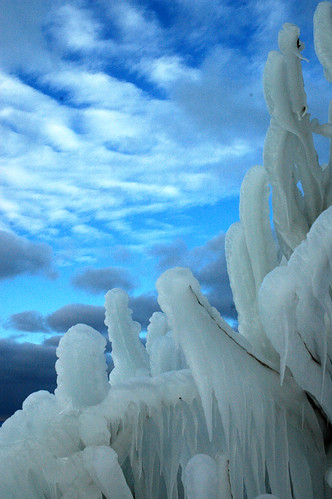
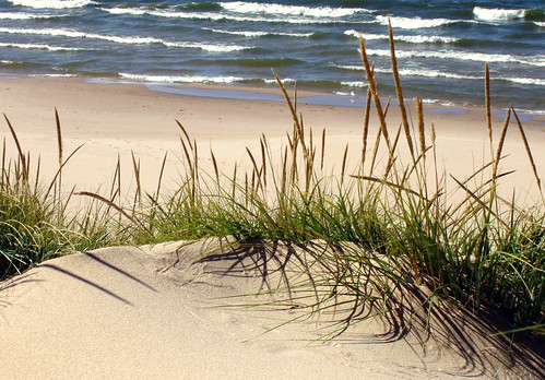
Van Buren State Park, photo by Paladin27.

A little over a year ago, I blogged another photo from Paladin27’s Flying to South Haven set.

It might be cheating to go to the well twice, but it’s hard to find a way to convey the awesome scope of Michigan’s shoreline dunes without getting above them (and moving along them). Be sure to check out Part 1 and Part 2 of his video on YouTube of the flight.

The official page on Van Buren State Park (which makes the park look like it recently escaped from prison) says:

Van Buren State Park offers approximately 400 acres of land located along the Lake Michigan shoreline in northern Van Buren County. The focal points of the park are its high dune formations and one mile of sandy beach. Van Buren became a state park in May of 1965 when the original 167-acre plot was purchased from the Harry LaBar Drake family. Since then two other land purchases have been made to make up the current park.

The Wikipedia entry for Van Buren State Park needs some help as well. Anyone have some knowledge about the park and a little time?

The park has camping on over 200 sites, hiking on miles of trails and great sandy beaches. Here’s a Flickr photo map and also the Google Map for Van Buren State Park (looks like they caught a boat on the satellite flyover!)

Michigan Shoreline Tour: Silver Beach, St. Joseph, MI

Silver Beach, St. Joseph, MI

Silver Beach, St. Joseph, MI, photo by lucasseidenfaden.

Lucas has a panorama of Silver Beach in St. Joseph that you have to check out, and you better have a look at his other beach and landscape photos too.

You can view more photos from St. Joseph on this Flickr map and there’s also a whole bunch of St. Joseph information posted today in the Berrien County, Michigan article on Absolute Michigan.

Michigan (Shoreline) in Pictures

You can see Chicago from 42 miles away! by by TRVentura

You can see Chicago from 42 miles away! by TRVentura

This summer, Absolute Michigan will be taking a tour of Michigan’s shoreline, looking at the heritage and attractions of the communities along Michigan’s Great Lakes shoreline.

Michigan in Pictures will be going along, trying to point out some of the beauty along the way.

We’d really like it if you’d help us by telling us what not to miss. If we do miss something – and with 3000+ miles of coastline, that’s pretty likely – then please feel welcome to post a comment or a link at the place where we missed it.

And if you want to climb in the car (or on the bike or in the kayak) and join the tour and let us know what you found, well that would be very cool too.

The above photo was taken at the beach in Michiana, Michigan (and Yahoo/Flickr geotagged photo map). I’m always a little surprised to find that you can’t see the state line from space.

Lake Michigan Shore

Lake Michigan Shore

Lake Michigan Shore, photo by Anthony Bergman.

About 10 miles south of Grand Haven … highly recommended as wallpaper for the cabin feverish.

104

104

104, photo by Cara Jo Miller.

Cara Jo explains that this is a double exposure of the same negative – done in the dark room.

She is a photography & web design at Northern Michigan University. You can see a lot more of her work on Flickr and at her web site, cara-jo.net.

Lake Michigan Ice

Lake Michigan Ice

Lake Michigan Ice, photo by ojoyous1.

She has a few more shots of the icy Lake Michigan shoreline.

ice forms

ice forms

ice forms, photo by taterfalls.

Taterfalls (Tate King) says that this photo is of bushes that have been sprayed by crashing Lake Michigan waves at Pt. Betsie.

And speaking of Muskegon bald eagles, which we were very recently, he has a great shot there too!

Dancing Water at the Grand Haven Lighthouse

Dancing water

Dancing water, photo by curlyson.

The Grand Haven Lighthouse is one of a shrinking number of still active Michigan lights. I think I read somewhere that due to its easy accessibility and the beauty of the area, it is the most photographed lighthouse in the world.

Dave Wobser wrote a nice little article at Boatnerd (with more pics) and Terry Pepper has detailed information on the light’s construction and history. The lighthouse is located in the Grand Haven State Park and there’s also a webcam to view the beach, pier & lighthouse. If you want to visit, try the Grand Haven Chamber of Commerce.

Quiet Motion

Quiet Motion by oldbrushes

Quiet Motion by oldbrushes

This photo from Kirk Park, Grand Haven, is part of a set of photos of Michigan beaches & shoreline dunes. In addition to the fact that it’s a great photo, we’re featuring it because we have an in-depth article on Absolute Michigan today titled Protecting Lake Michigan’s Sand Dunes that explores the threats facing Lake Michigan’s geologically unique sand dunes.

Ludington: Lifeguard not on duty

Ludington

Ludington, photo by Hilarywho.

That’s probably OK as NOAA Station LDTM4 in Ludington reports that the current water temperature is just 44 degrees.

The National Oceanic and Atmospheric Administration National Data Buoy Center is a network of on and offshore weather stations that deliver real-time wind, wave and water data. The Great Lakes region is served by the Western Great Lakes Buoy Network (Lake Michigan & Superior and the Straits of Mackinac) and the Eastern Great Lakes Buoy Network (Lake Huron, Erie & Ontario).