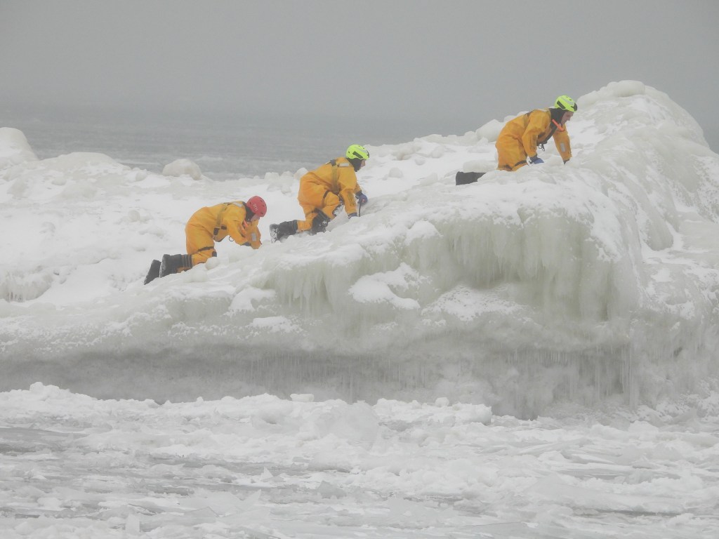
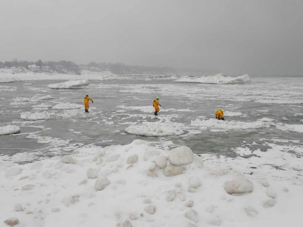
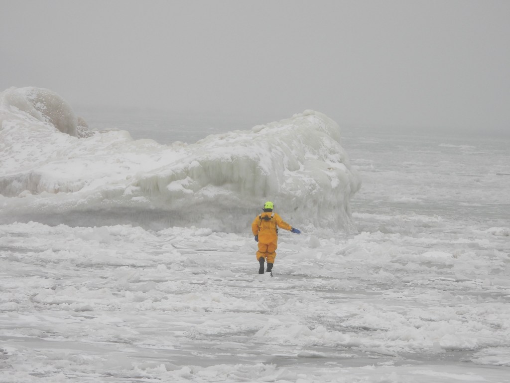
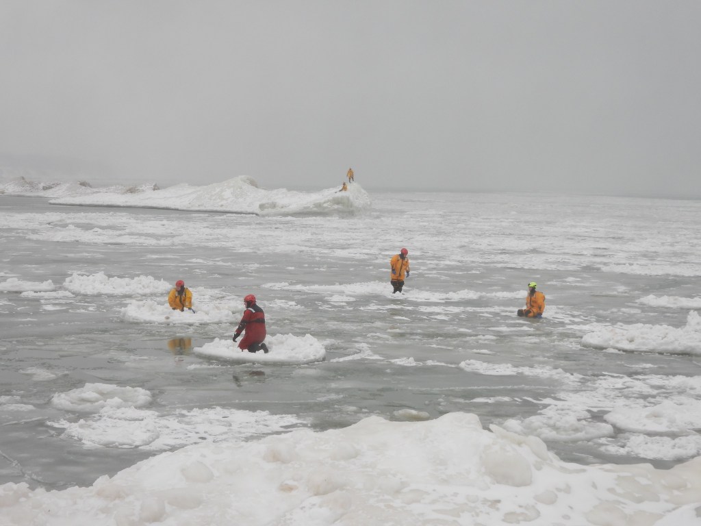
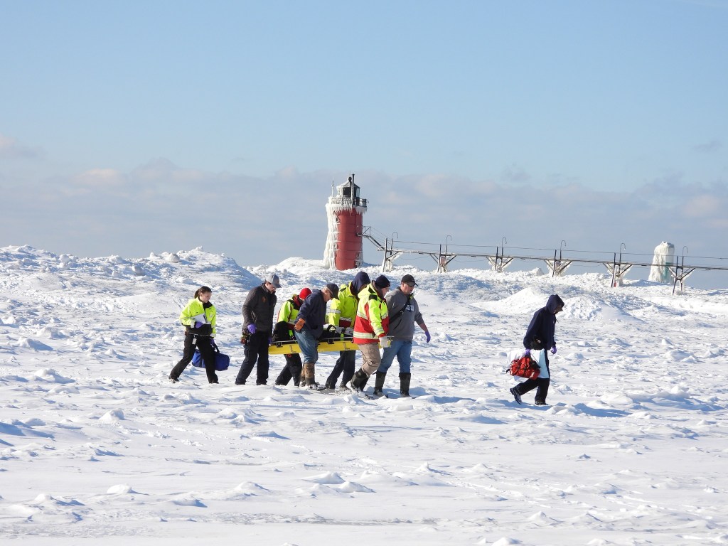
Preparedness for all kinds of emergency situations is vitally important for first responders. While the fantastic forms wrought by wind & water draw folks onto Great Lakes ice, they also risk creating nightmare scenarios for rescue. South Haven Area Emergency Services shared these photos from the other day when several staff donned cold water suits and ventured into frigid Lake Michigan and onto the ice formations along the shoreline to practice rescue techniques.
Here’s a few more photos from the training and another from an actual rescue of a person fell who while on the Lake Michigan ice shelf approximately 100 yards offshore! Follow them on Facebook for the latest.
While most of the nation turns its eye towards Punxsutawney Phil, true Michiganders know there’s only one source for your winter woodchuck weathercast: Howell Nature Center’s own Woody the Woodchuck. Woody has been a fixture at the nature center since (at least) 2017 when I shared the photo from John Heinz Jr of lil Woody figuring out if something was or wasn’t food.
If you’re in the neighborhood, their free Groundhog Day Celebration is already underway, but you can also tune into their Facebook livestream that starts at 8:20 am!
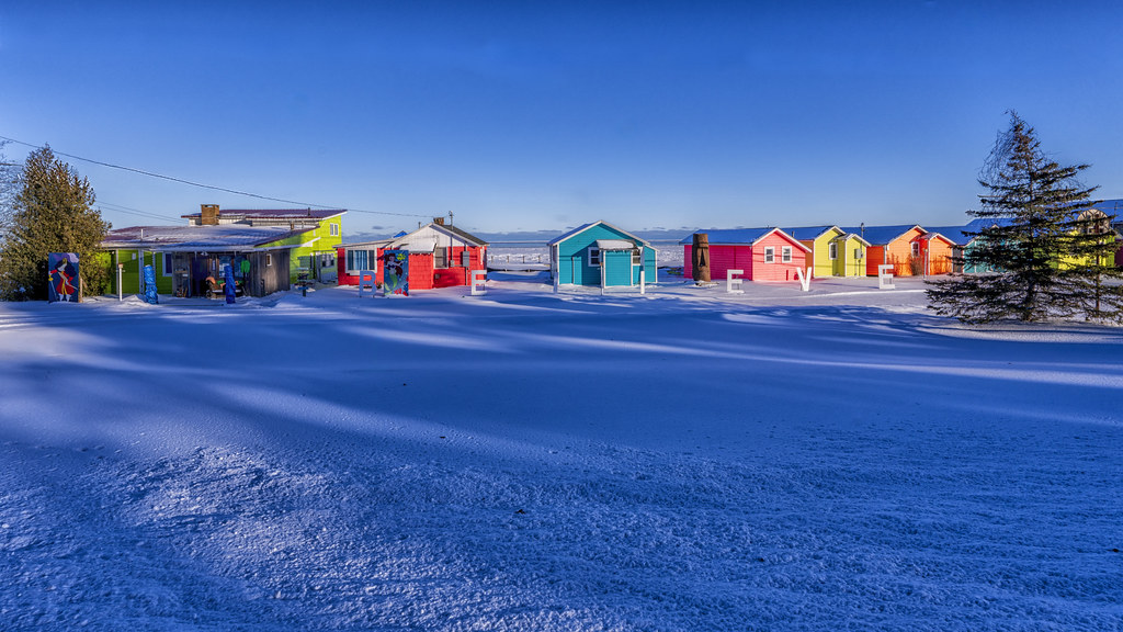
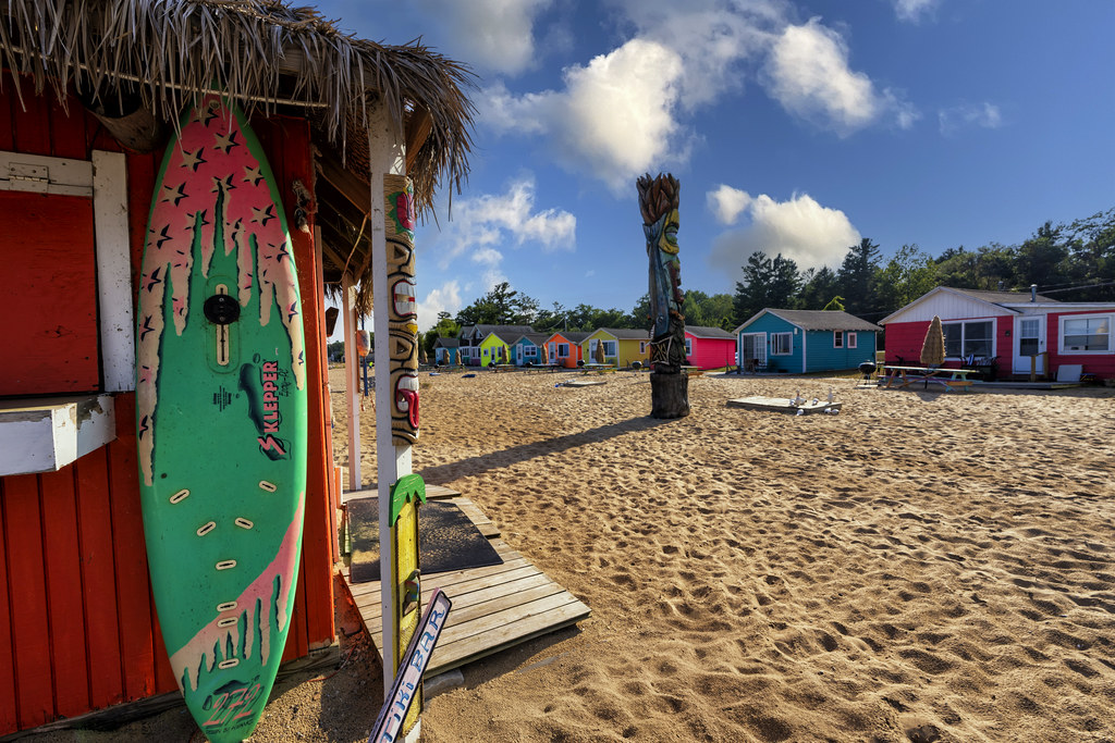
Here are two pics from Charles of the joyfully painted Mai Tiki Resort on Lake Huron in Oscoda demonstrating that you can find a little spot of summer in Michigan even on the coldest day. See his latest on Flickr & stay warm!
Like many businesses & individuals across the nation, Michigan in Pictures will be participating in the nationwide Ice Out of Everywhere general strike on Friday, January 30th. The protest calls on Americans who believe that the Administration’s immigration enforcement campaign is violating our Constitution and national fabric to voice their displeasure with a nationwide day of no school, no work and no shopping.
You of course are free to do whatever you want, but if this post offends you, trust that I will almost certainly offend you again.
No post Friday – stay safe & see you next week everyone!
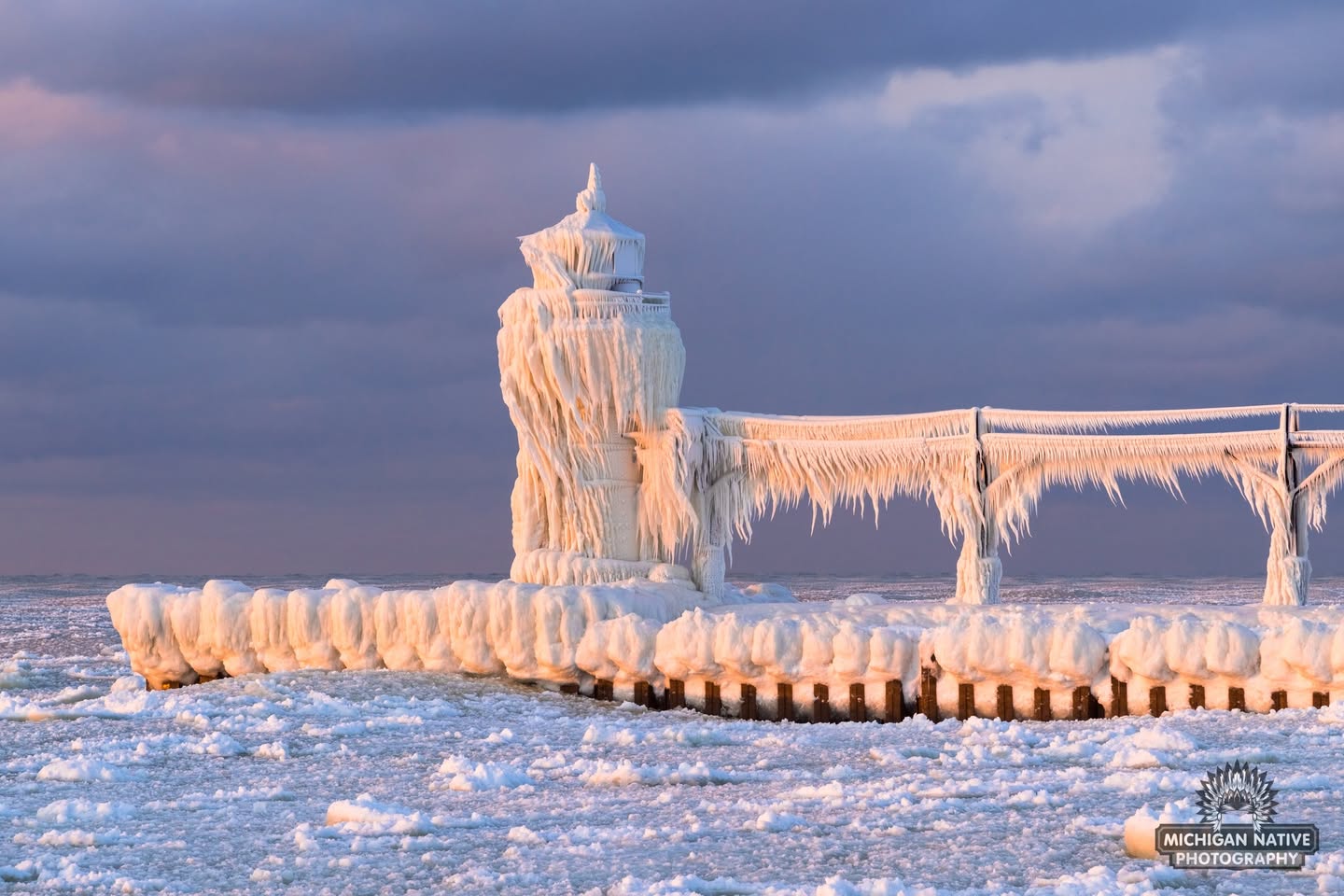
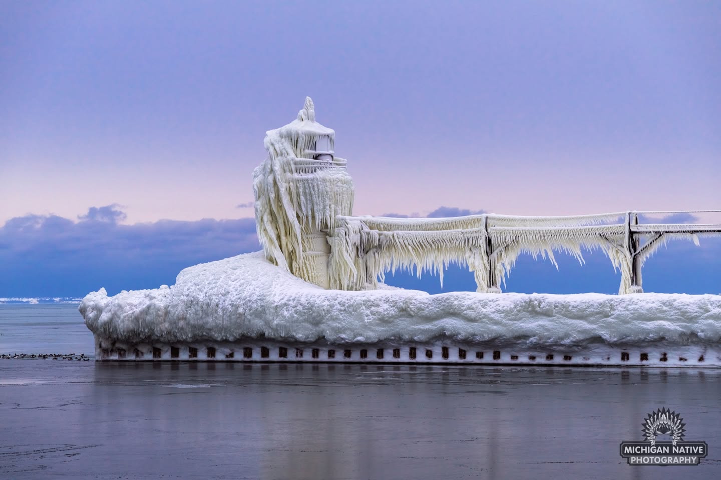
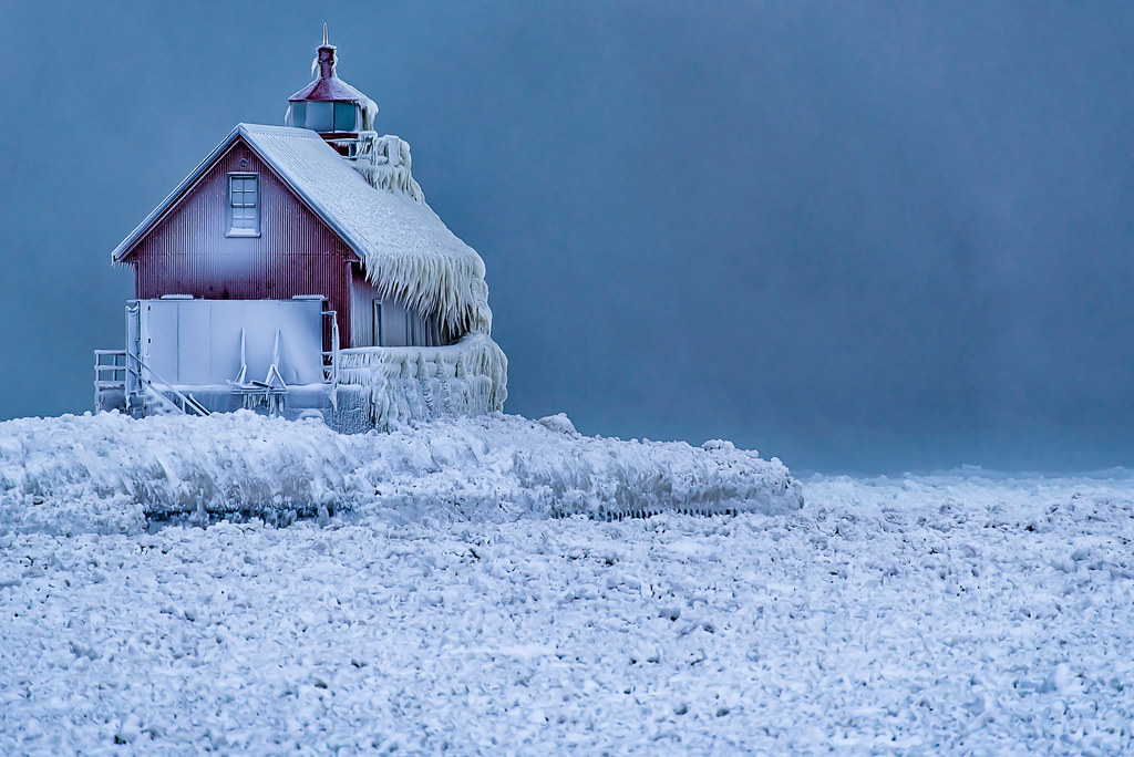
These photos of the St. Joseph North Pier Outer Lighthouse on Lake Michigan taken just four days apart provide a dramatic example of how fast cold weather & high winds can build ice! For sure follow Michigan Native Photography on Facebook for their latest & more great Michigan photos.
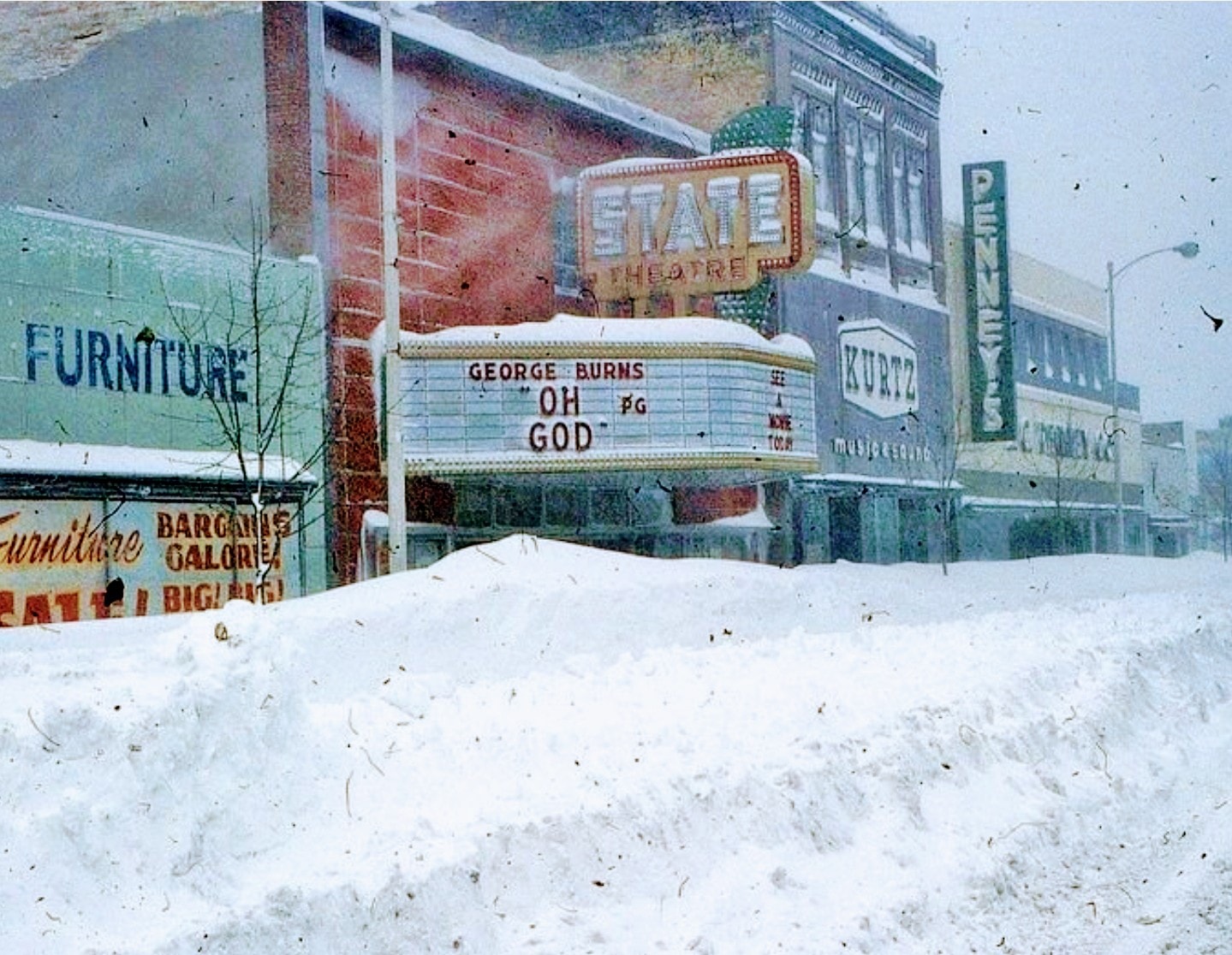
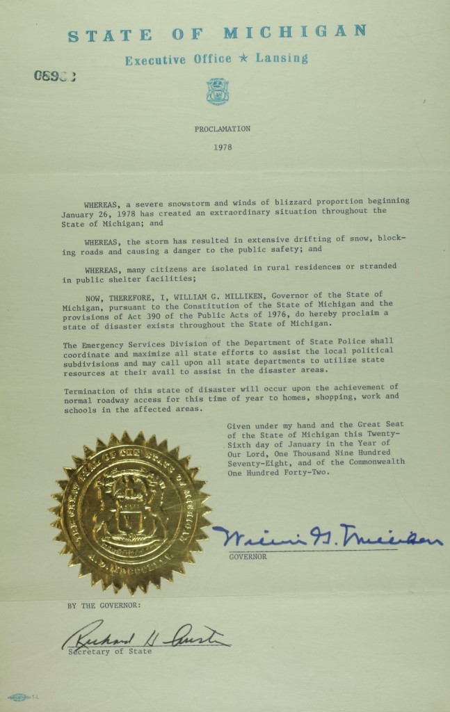
“The most extensive and very nearly the most severe blizzard in Michigan history raged throughout Thursday January 26, 1978 and into part of Friday January 27. About 20 people died as a direct or indirect result of the storm, most due to heart attacks or traffic accidents. At least one person died of exposure in a stranded automobile. Many were hospitalized for exposure, mostly from homes that lost power and heat. About 100,000 cars were abandoned on Michigan highways, most of them in the southeast part of the state.” -National Weather Service Ann Arbor Meteorologist in Charge, C.R. Snider on January 30th, 1978
48 years ago one of the most powerful blizzards in Michigan history brought the state to a standstill. In her feature on historical Michigan snow days in the now defunct Seeking Michigan, Jessica Miller of the Archives of Michigan related:
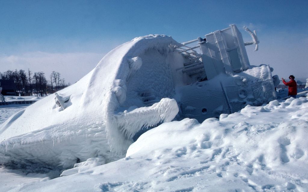
On January 26-27, 1978, snowstorms with fifty-to-seventy-mile per hour winds pummeled much of Michigan. Snowfall totals ranged from eighteen inches in Lansing to an incredible fifty-one inches in Traverse City. More than 100,000 cars were abandoned on roads and highways, and travel was impossible for days. Governor William G. Milliken declared a state of emergency on January 26 (See the image below.) and activated the National Guard to assist with the cleanup. The governor also requested financial assistance from the federal government and estimated damage totals to be more than $25 million, not including lost productivity from workers who were unable to get to their jobs.
Regarding the photo, John wrote: Marty Lagina stands on the frozen pier at the Great Lakes Maritime Academy on January 29, 1978, viewing the capsized training vessel Allegheny, which capsized from ice buildup during the Blizzard of ’78. This image was on assignment for TIME magazine, who had seen my b&w image on the UPI wire and wanted a color image. Marty and I were lucky – the sky cleared and the wind stopped for about 20 minutes, then the storm began again. I wondered at the time who TIME knew to make that happen…
The only places not under an Extreme Cold Warning are the Southeast corner of the state – from Saginaw and The Thumb down to Flint, Ann Arbor and Detroit, as well as the Lansing and Jackson area along the southern rim of Michigan. Those southern and eastern spots are under a Cold Weather Advisory, as the cold is not expected to be quite as severe there.
The Extreme Cold Warning now covers the Upper Peninsula – where wind chills could plummet to -45 degrees over the next couple of days – and all of Northern Michigan and West Michigan. This extreme warning covers Grand Rapids, Holland, Muskegon, Traverse City, Gaylord and the Tip of the Mitt, too.
That’s a big yikes from me! Brian took this when we were deep in the polar vortex of January of 2019 from the South Pier in Grand Haven. See his latest on Flickr and STAY WARM!
PS: If you want to tune into the current scene in Grand Haven, check out the Grand Haven South Pier Cam!
mLive shares that although Lake Michigan will still help “warm” lower Michigan this week, it will still be dangerously cold. The coldest air will come around the south end of Lake Michigan and plunge wind chills for southern Michigan into the -25 to -35 degree range Monday into Tuesday morning & it’s not much better for the rest of the state!
Detroit, Ann Arbor and Southeast Michigan: Sub-zero wind chills on Monday and Tuesday, falling as low as -15 degrees.
West Michigan: Monday and Tuesday’s wind chills could hit -20 degrees.
Northern Michigan: Wind chills could fall to -25 by Tuesday morning.
Upper Peninsula: “High confidence (>75%) for wind chills near or below -25F Monday morning and Tuesday morning for most of the U.P.,” the National Weather Service in Marquette said.“ Cold Weather Advisory for northern Houghton and Keweenaw Counties Monday morning.”
Andrew got these photos of freezing fog & spray turning the M/V John J. Boland into a floating icebox on Lake Michigan as she headed towards Indiana back in December. Follow him on Facebook and for sure visit his website for photos and information about his drone photography services!
Often mistaken for their more familiar cousins, the Cedar Waxwings, Bohemian Waxwings differences are quite noticeable. Slightly larger, with muted gray bodies and warm cinnamon accents beneath their wings, tail and on their lores. Their soft, almost melted waxy looking plummage complements winter’s softer light.
…They arrived the way waxwings always do—suddenly and together. A flock descended on a cluster of trees heavy with berries, moving with a quiet, choreographed urgency. Waxwings are communal feeders, virtually overtaking a tree before moving on. They arrive, thrive, and leave—often as quickly as they appeared.
That fleeting time of when then move south combined with their behavior is what makes these encounters feel so rare. Seeing Bohemian Waxwings each winter is never a guarantee. Some years they pass unseen. Other years, luck and timing intersect, and I find myself standing in the cold, bundled and unmoving, watching bird life unfold just feet away.
Aubrieta shared this incredible shot of a sunset over Lake Superior in the Pictured Rocks National Lakeshore. Follow Michigan scenery on Facebook for her latest and view & purchase her work on her website.