Winter Is Coming … apparently tonight

North Country Girls

North Country Girls, photo by Michael

While El Niño is predicted to bring a milder winter for Michigan in 2016, it looks like things will kick off early with a chance of a dusting of snow tonight & tomorrow:

The coldest air of the season will pour into state on Friday and into the weekend. The cold air will bring widespread lake-effect rain showers to West Michigan. The rain may mix with some wet snow over parts of the state late Friday into Saturday afternoon.

A better chance of accumulating snow will be over the higher terrain of Norther Lower Michigan and parts of the Upper Peninsula.

I should add that although you may want to see it from your car with the heater cranked, color around the state is still really nice!

Michael took this last January when Detroit was locked in the grip of the White Walkers. View it background bigtacular and see more in his slideshow.

More Detroit and more winter on Michigan in Pictures!

Knockout storm packs 100 MPH winds & huge hail

Road Closed in Glen Arbor

Road Closed in Glen Arbor, photo via the Glen Arbor Sun

One more day of storm reporting from my neck of the woods…

In Glen Arbor Hit By Knockout Storm, Jacob Wheeler of the Glen Arbor Sun lays out a diary of the destruction of the storm and wrote:

In the storm’s wake yesterday, Glen Arbor residents immediately recognized that the destruction they witnessed was unprecedented for our town. This was worse than the 1987 storm, people said. In fact, it was far worse. The storm was more powerful and more destructive than any other Glen Arbor storm ever recorded. And now we have stats to prove it.

I spoke late this afternoon to Jeff Lutz, meteorologist with the National Weather Service (NWS) in Gaylord. While Lutz clarified that yesterday’s storm was not a tornado (you can blame some of the hyperbole on this newspaper) he did confirm that the straight-line winds which accompanied the sudden thunderstorm reached speeds of 100 miles per hour. That’s strong enough to be called a tornado. More significantly, it blows away the previous wind velocity record for Leelanau County. According to the NWS, on Sept. 13, 2005, a barrage of wind traveling at 63 miles per hour hit Leland and Empire, but not Glen Arbor. But 63 is not 100. Not even close. Nope, yesterday’s storm was the strongest to ever hit Leelanau County, since records were kept starting in 1950.

You can click through to the Sun for more pics and storm coverage and get even more on their Facebook. Jacob also shared the National Weather Service’s Aug. 2 severe weather recap:

  • Multiple rounds of severe weather impacted northern Michigan on August 2nd, 2015. The first severe thunderstorm warning was issued 10:34 am with an additional 27 warnings being issued before the last warning of the day expired at 8:00 pm.
  • The largest hail reported was 4.25″, or the size of a softball, seven miles north of West Branch at 4:55 pm. The large hail was reported by trained spotters and members of the public. There were several reports of damage to vehicles and other property. At the time of the event, a Severe Thunderstorm Warning was in effect for all of Ogemaw County, issued at 4:33 pm. Additional reports of 1.00″ to 2.00″ hail were received from law enforcement, emergency managers, trained spotters and the public across multiple locations in northern Michigan.
  • The 4.25″ hail observed seven miles north of West Branch was the largest documented hail stone ever to impact northern Michigan since records began in 1950 and the largest since 1998 when a 3.50″ hail stone was recorded in Arenac County.
  • Hundreds of downed trees and power lines were reported on Sunday as 60-80 mph (locally 90-100 mph) straight-line winds accompanied the severe thunderstorms.

Lots more at that link including some pics of that hail.

Stay Cool, Michigan

Stay Cool in Detroit and Michigan

Untitled, photo by Steve Swartz

mLive reports that today and this weekend are poised to bring very hot temperatures to Michigan:

The temperatures are building out west, and winds will turn to blow out of the south starting Friday to bring the heat our way.

Wednesday and Thursday will be comfortable, with temperatures in the 70s, but Friday will be much different, as the south wind should help boost temperatures to near 90 in the afternoon. Leftover clouds from morning storms will likely prevent breaking that mark, but the humidity should make it feel like 90 degrees.

Saturday should make it into the low 90s in all of the southern half of Lower Michigan. It might even make it to 90 degrees in parts of northern Lower Michigan. The humidity will also be higher, making it feel like mid-90s in southern Michigan.

Sunday will also be a hot, sticky day. Some spots will hit 90 degrees, while many spots will be humid and warm to 88 or 89 degrees. How hot we get Sunday will depend on how much sunshine we have and if storms hold off until Sunday evening.

If we have two 90-degree days in a row, it will be the first time in any Michigan city since July 19, 2013.

View Steve’s photo background bigtacular and see more in his Summer 2012 slideshow.

More summer wallpaper on Michigan in Pictures!

Stormy Monday

Tornado Warning

Tornado Warning, photo by Jeffrey Smith

WZZM says that severe weather is becoming more likely Monday afternoon as a cold front sweeps through the state:

Monday will begin with sun but storms will develop to the west and advance quickly into West Michigan by late afternoon/early evening time frame. Models are suggesting the atmosphere will be unstable with abundant moisture by Monday afternoon, meaning storms will have a favorable environment to grow.

The NOAA Storm Prediction Center has most of Lower Michigan in the ‘enhanced risk’ area (orange) on Monday meaning several thunderstorms could reach severe levels. To read more about the convective outlook Monday, click here.

Threats from this round of thunderstorms include damaging wind, hail, lightning, isolated tornadoes, and brief heavy downpours. Thunderstorms reach severe criteria when winds are at least 58 mph, hail is one inch in diameter, or a tornado is produced.

Read the detailed forecast for severe weather and you’d like to get more alarmed, check in with Fox 17 West Michigan’s Kevin Craig.

View Jeffrey’s photo bigger and click for more of his clouds photos.

Stormy Monday, T Bone Walker…. and for good measure, B.B. King.

Above the Fog at the Mackinac Bridge

Mighty Mac in Fog

Mighty Mac in the Fog, photo by Lake Superior Photo

Shawn writes that she crossed a very mysterious looking Mackinac Bridge on Sunday – no shortage of fog lately!

View the photo bigger on Facebook and see more & purchase prints in Lake Superior Photo’s Mackinac Bridge Gallery.

More fog & mist on Michigan in Pictures.

Rainbow Season

Another Amazing Sky

Another Amazing Sky, photo by Ben Thompson

Gotta love Spring!

View Ben’s photo bigger and see more in his Weather/Clouds slideshow.

More Michigan weather fun and more Ann Arbor on Michigan in Pictures.

Frozen February: 2015 3rd coldest February for Michigan

Standing against the biggest lake

Standing against the Greatest Lake, photo by Jay

The Grand Rapids Press reports that February 2015 was the coldest recorded for the city:

If you were alive in 1978, perhaps the similarity was striking.

Grand Rapids’ average temperature last month was 13.3 degrees, making it the coldest February in the city’s recorded weather history — a record dating back 37 years, according to the National Weather Service. The previous record was a balmy 14.3 degrees.

Overnight low temperatures dipped below zero eight times throughout the month, with highs not able to warm too much beyond the teens. In fact, the thermometer touched the 30-degree mark only four times when the seasonal average is just around freezing.

The Great Lakes region can thank the frequent blasts of arctic air for these records. Visitors to area beaches, too, should give the colder than normal conditions credit for some spectacular scenes of ice formations and caves along the shore.

Much of the state saw a near record cold as well, which has also pushed Great Lakes ice coverage near 90%.

View Jay’s photo big as the biggest lake and jump into his slideshow for some absolutely stunning shots from the Pictured Rocks shoreline in mid-February.

More winter wallpaper and also more about the Pictured Rocks.

Since 1880, 2014 was warmer

1880_Michigan_Wolverines_football_team

1880 Michigan Wolverines Football Team, photo courtesy Wikipedia

EarthSky’s Matt Daniel writes that NASA, NOAA, and Japan Meteorological Agency all report 2014 as Earth’s warmest year since modern-day record-keeping began in 1880.

Put in more tangible terms, since at least the days when University of Michigan footballers wore uniforms like this, there has not been a warmer year.

What’s more May, August, September, October and December of 2014 were ALL the warmest for that month since 1880! I’d like to suggest that global warming/climate change be shifted from a political issue to a survival issue. You are of course free to draw your own conclusions.

NASA has a snappy video that boils it down to a minute and a half.

Wikipedia says that these stylish gents played just one game, defeating the team from the University of Toronto, 13 to 6, at the Toronto Lacrosse Club. Michigan scored two touchdowns and one goal; Toronto scored three safety touchdowns.

Click the link for more and click the photo above to view it big as the big House.

Frozen in Time, 2014 edition

Frozen in Time

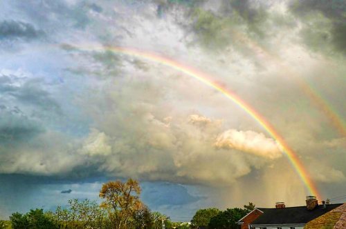
Frozen in Time, photo by photofrenzy2000

2014 will never come this way again, so for better or worse, here are some 2014 highlights from Michigan in Pictures…

Cougar CamThe most popular post was Cougar Cam Confirmation, which was published on November 7th. Since I’ve been sounding the “cougars live in Michigan” horn for several years now, it’s gratifying that the DNR is now on board.

Isle Royale Star BreezeWith 77,000 views on Facebook, the cougar cam was the most popular post there too, followed very closely by Space Weather and Starbreeze that benefited from the Lake Superior Photo bump!

Paradise is the nickname of this placeShawn of Lake Superior Photo checked in with the second most popular pic, Paradise is the nickname of this place, a photo that features one of the amazing & out-of-the-way Michigan gems that I learned about in 2014.

Ice Caves Leelanau Peninsula by Ken ScottThe third most popular picture & story was one from close to my home, the astonishing The Ice Caves of Leelanau that drew tens of thousands of people to the Leelanau Peninsula last winter to see them. You can click that link to see Ken’s photos or save yourself the time and head over to his site to purchase his book, The Ice Caves of Leelanau.

Winter at Tahquamenon Falls John McCormickWeighing in at number four was Winter at Tahquamenon Falls by John McCormick aka MichiganNut. While this photo didn’t make his 2015 wall calendar, a dozen other great ones did!

Shadow Moon by Michael SeabrookClosing out the top five was the Blood Moon and the Lunar Eclipse Tetrad by Michael Seabrook. The first two of these four total lunar eclipses are in the books, but April 4 & September 28, 2015 are still to be seen.

Polar Vortex Cabin FeverThe top commented post was Michigan in Pictures is a blog, folks, which I posted after getting a bunch of negative comments after sharing a photo from a group working against the Keystone XL Pipeline coming through Michigan. It made me very happy to get support for protecting the beautiful natural heritage features on Michigan in Pictures from so many readers … and also to share the awesome photo of our cats!

View this photo from December of 2010 at the St. Joseph Lighthouse bigger and jump into photofrenzy2000’s slideshow for more awesome shots!

Winter is Coming

Hesperia Propane Tanks by John Mickevich

Hesperia Propane Tanks, photo by John Mickevich

“Winter is Coming.”
~ House Stark

A little reminder to soak up summer while we have it. If you need a little more, the Old Farmer’s Almanac says:

Published Wednesday, the New Hampshire-based almanac predicts a ‘super-cold’ winter in the eastern two-thirds of the country. The west will remain a little bit warmer than normal.

Publishers claim their forecasts–based on a ‘secret’ formula that looks at weather and astronomical trends–have an 80 percent accuracy rate.

‘Colder is just almost too familiar a term,’ Editor Janice Stillman said. ‘Think of it as a refriger-nation.’

John says this row of propane tanks caught his eye on a recent drive down M-20 near Hesperia. View his photo bigger and see more in his Ilford film slideshow.

More black & white photography on Michigan in Pictures.