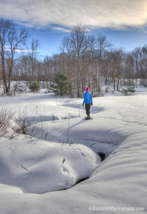
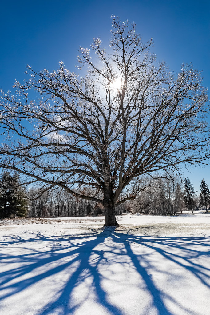
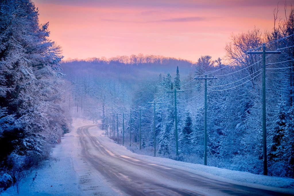
Longtime readers know that “Back Into the Woods Day” is one of the invented Michigan holidays we celebrate on Michigan in Pictures. It’s an annual December 1st holiday that celebrates the end of firearm deer hunting season & the return of (mostly) gun free hiking trails.
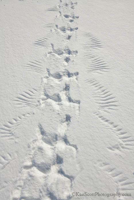
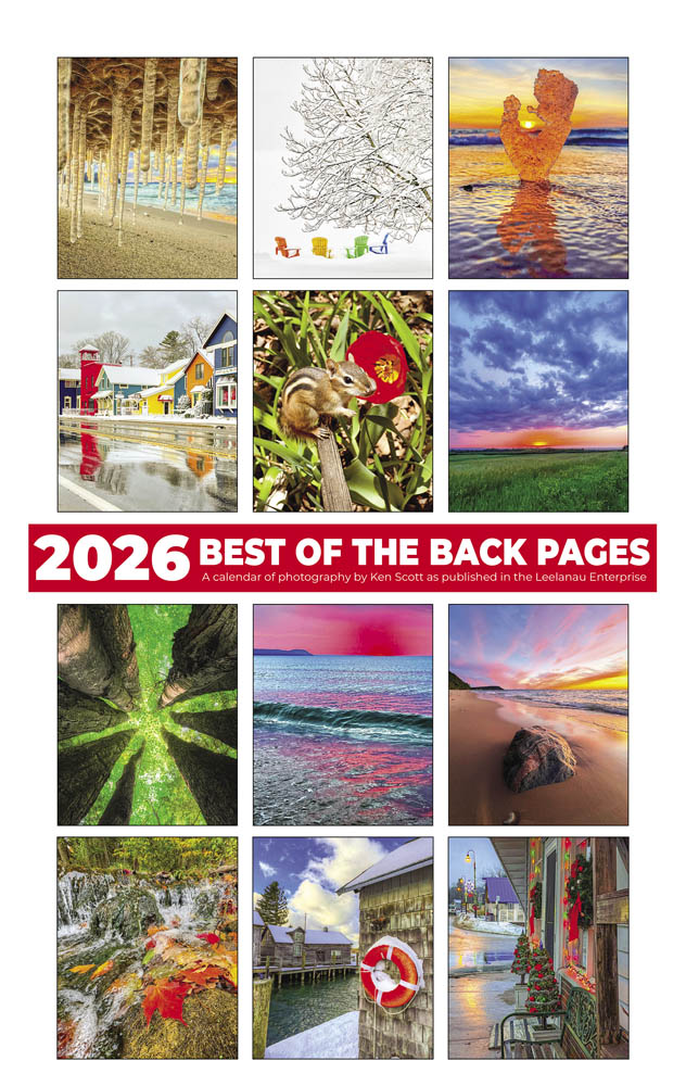
Today’s photo is from Leelanau photographer Ken Scott, and I’d like to be sure to highlight his 2026 “Best of the Back Pages” Calendar that features some of his great photos from the back page of the weekly Leelanau Enterprise. See a few more below including these amazing snowy owl tracks and many in Ken’s massive snow gallery on Flickr.
“It was one of those March days when the sun shines hot and the wind blows cold: when it is summer in the light, and winter in the shade.“
-Charles Dickens
…and it is also winter in the UP! While rains are expected to wash much of the snow from Michigan today, mLive Chief Meteorologist Mark Torregrossa shares that the National Weather Service is predicting 10-15″ of snow for areas of the Upper Peninsula including as much as TWO FEET of snow for the western UP!
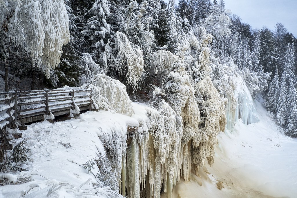
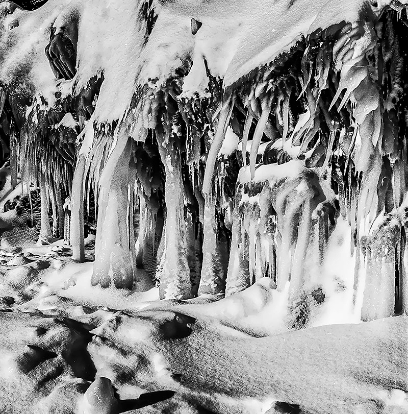
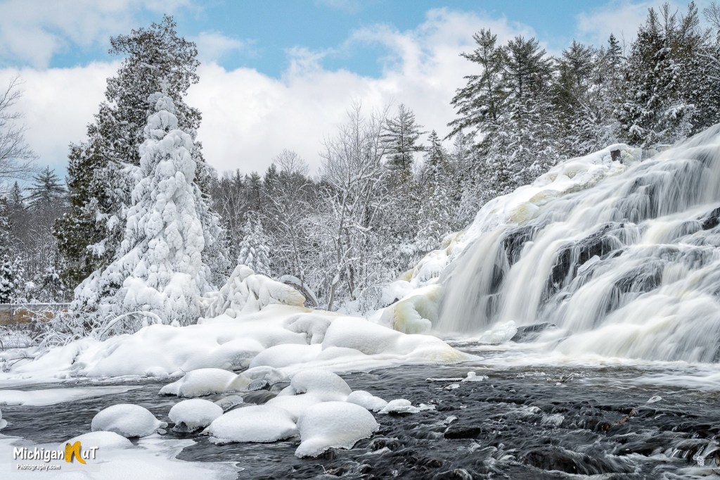
twurdemann shares that this incredible winter wonderland is created by freezing spray/mist from the waterfall at Michigan’s Tahquamenon Falls State Park & the brown tannins in the water. Check out more in their Winter gallery on Flickr that includes some KNOCKOUT ice cave photos from the Canadian shore of Lake Superior!
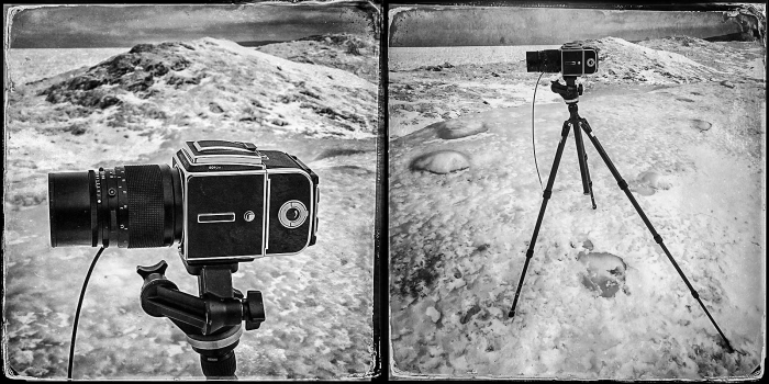
One of my favorite things about Michigan in Pictures is seeing some of the incredible cameras people are using.
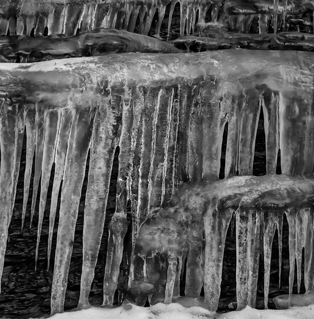
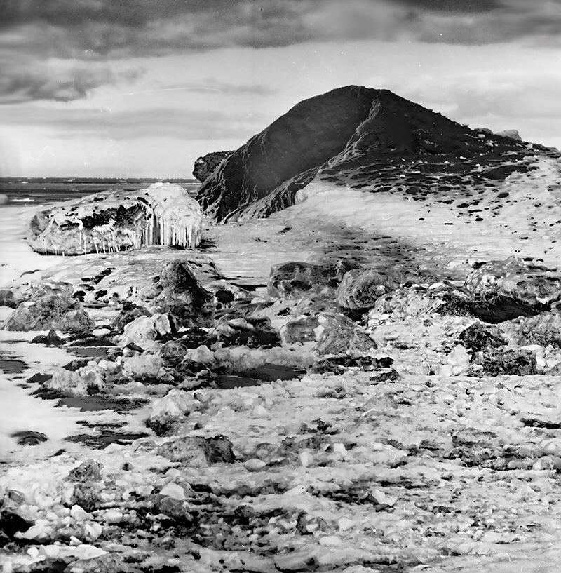
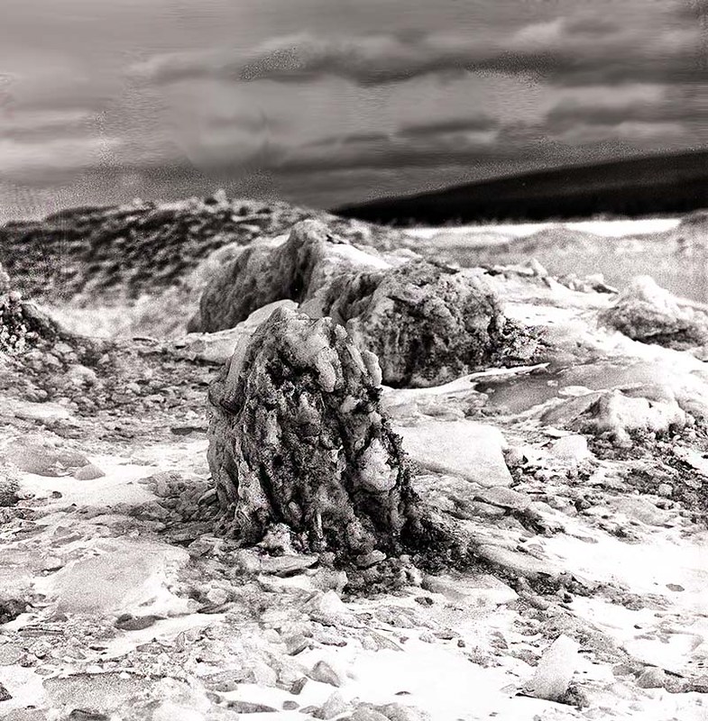
One man who has some sweet gear is Kirt E. Carter and he has been bringing some incredible Hasselblad pics to the Absolute Michigan group on Flickr for the better part of a decade. I figured today was a good day to bring attention to his amazing work. The large one below of icicles on the Eagle Harbor shoreline – see more in the Hasselblad search in the Absolute Michigan group & for sure head over to his website to view & purchase his work!
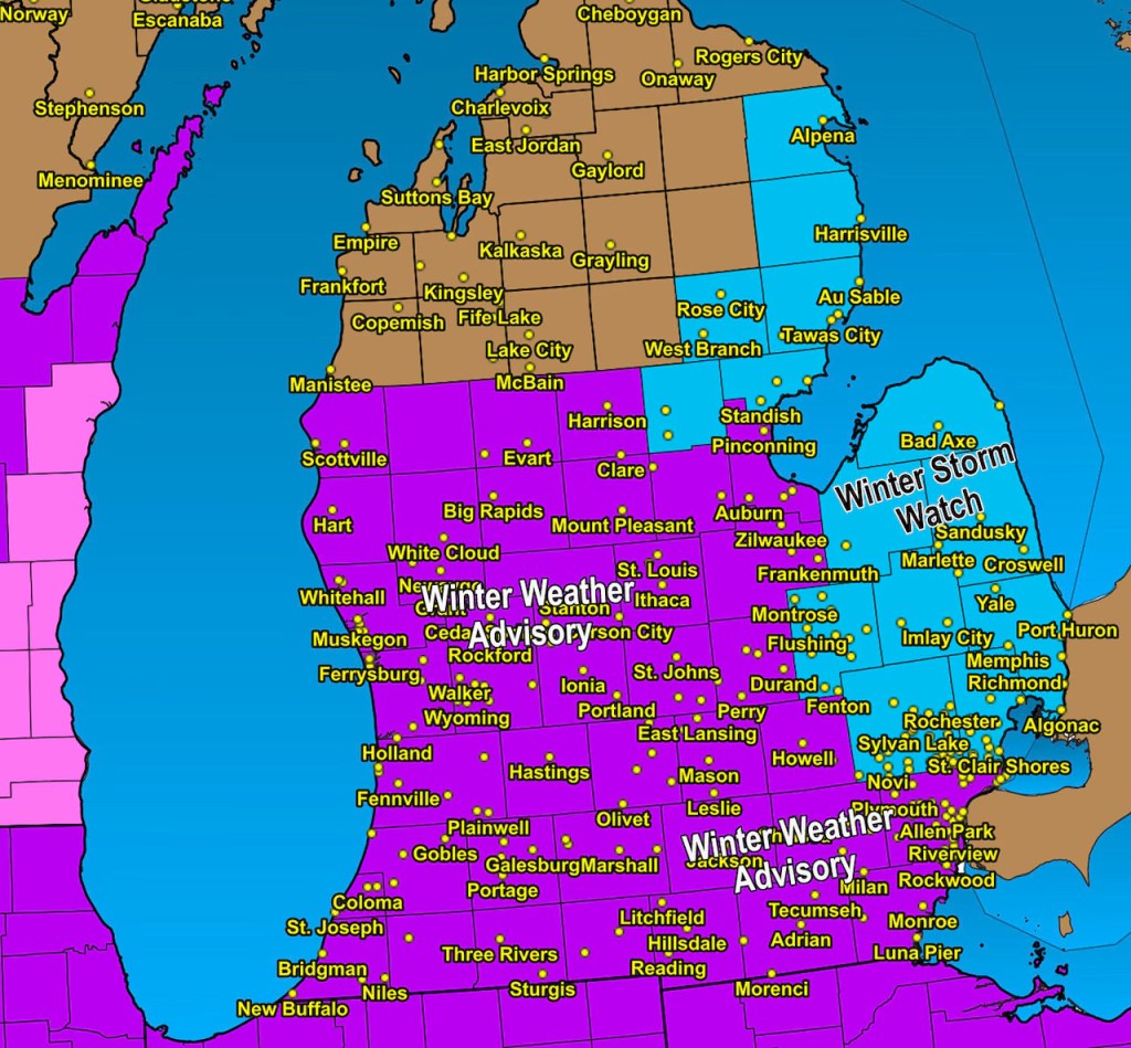
A winter storm watch is usually issued when a storm system is one to two days from starting. This long lead time is used to help you get ready if you have to make travel or work changes. Eventually as the storm gets closer, the winter storm watch either turns to a winter storm warning or a winter weather advisory.
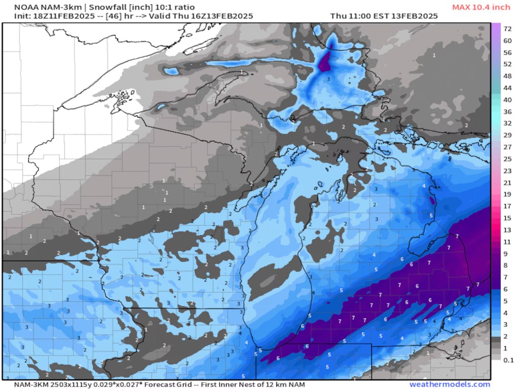
The map above shows how the large winter storm watch area earlier today has been fine-tuned to mostly winter weather advisories. A winter storm watch still exists for the Thumb and northeast shoreline until the next round of data shows which way to go on the watch. There should be some lake enhancement of the snow totals in the Thumb and northeast shoreline, possibly putting those areas over the six inch winter storm warning criteria.
Latest revision (3:26 p.m. Tuesday) of the winter storm watch to mostly winter weather advisories in purple. There still is a waiting game with the winter storm watch in blue for the Thumb, Oakland county, Macomb County and the northeast shoreline. image by NOAA
Total snow forecast from the North American Model (NAM) through Thursday afternoon.NOAA
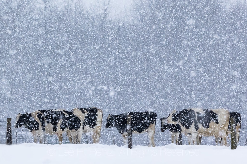
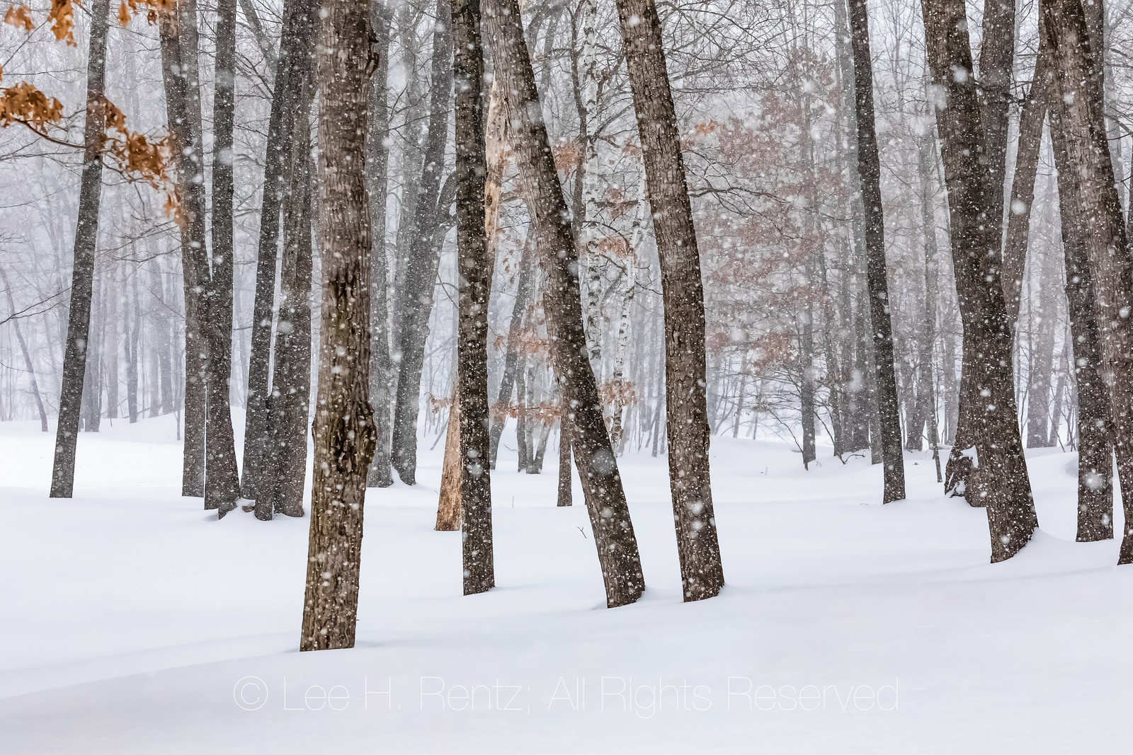
Lee shared this photo of Holstein cattle on an Amish farm riding out a winter snowstorm in Mecosta County to the Absolute Michigan group on Flickr last January. When I did a quick Google search because I had forgotten if Lee was a he or a she, I realized that he had a lot more photos in excellent essay entitled FALLING SNOW: A Landscape Transformed on his blog:
When I see snow falling, dissolving the landscape into a place entirely different, I am enthralled by the veiled look of the land. Every surface is softened and sounds are muffled and most people have retreated indoors. The familiar is transformed.
The pictures in this photographic essay were taken near my Michigan home, where I love to venture into the heaviest snow squalls, finding barns and forests transformed by the falling snow. I am fortunate to live near an Amish community, where their barns and buggies and homes are often featured in my winter photography. Enjoy the photographs, and find a new appreciation for winter.
mLive’s Mark Torregrossa shares that the winter storm bearing down on Michigan overnight is expected to bring a solid band of freezing rain from Jackson to Ann Arbor to Detroit and south to Michigan’s southern border that could have up to one-tenth of an inch of ice accumulation. Based on radar, the iciness will be worst from 4am – 9am Thursday
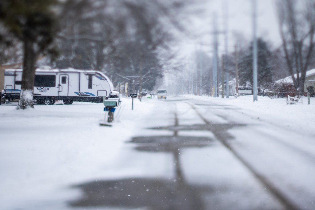
Mike captured this great shot of a mail truck delivering in Port Huron on a winter day with a Nikon Zfc & TTArtisan 50mm Tilt shift lens 1.4. I hadn’t heard of this lens befor which the manufacturer says transforms ordinary scenes into captivating ‘Lilliput’ landscapes with selective focus and beautiful bokeh.
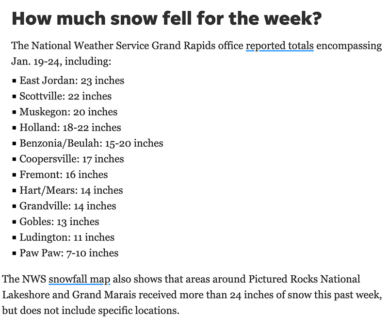
“This snowy week is nearly at an end, including a visit from real Arctic air, and many towns near Lake Michigan and Lake Superior got a foot or two of fresh snow as a result,” the NWS said. “Clearly, the vast majority of snow was a result of lake effect, as plenty of other parts of Michigan only saw an inch or two at best.”
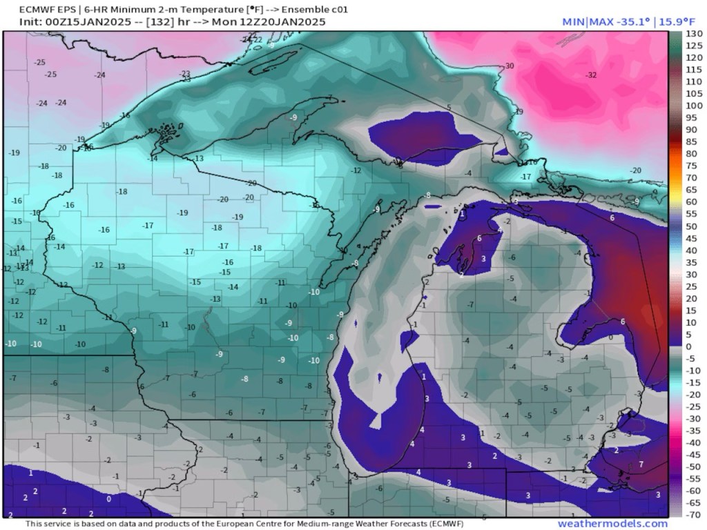
Air temperatures in Michigan fell below zero Jan. 18-22. In some cases, the thermometer didn’t read above zero for two days. The coldest reading in the state came Monday night when Stambaugh, in the western UP, registered minus 30 — before wind chill. The town also saw minus 28 on Tuesday night while Ironwood’s NWS observer recorded minus 27.
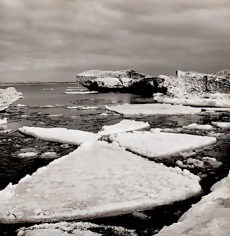
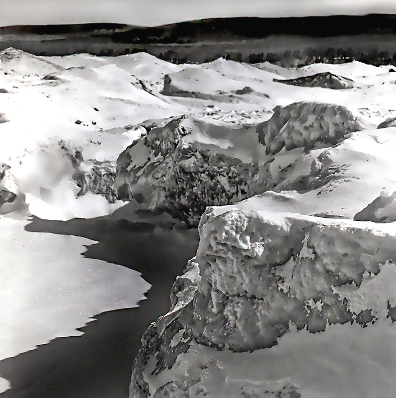
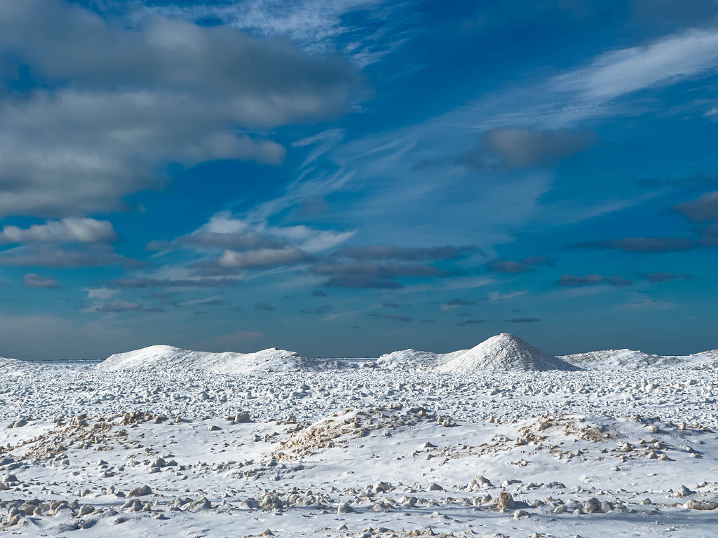
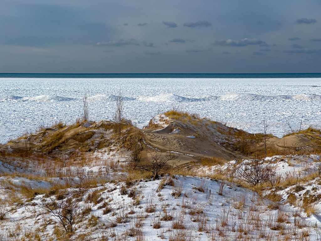
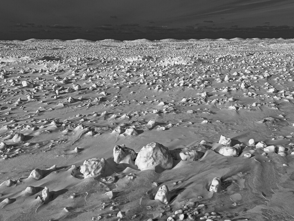
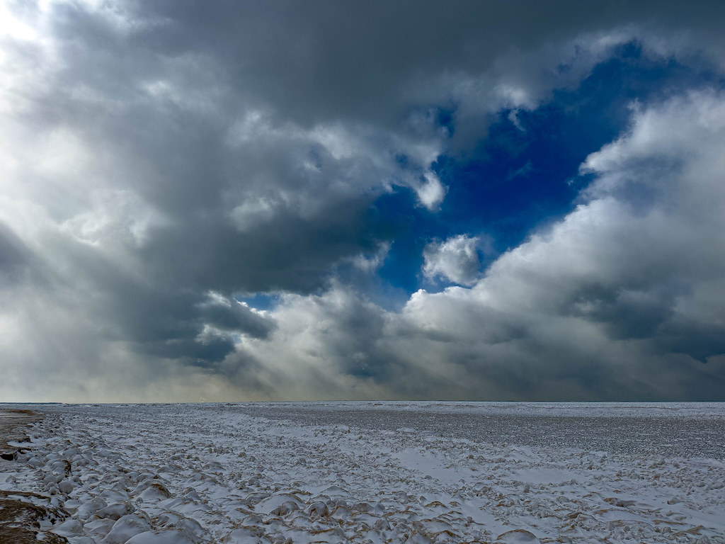
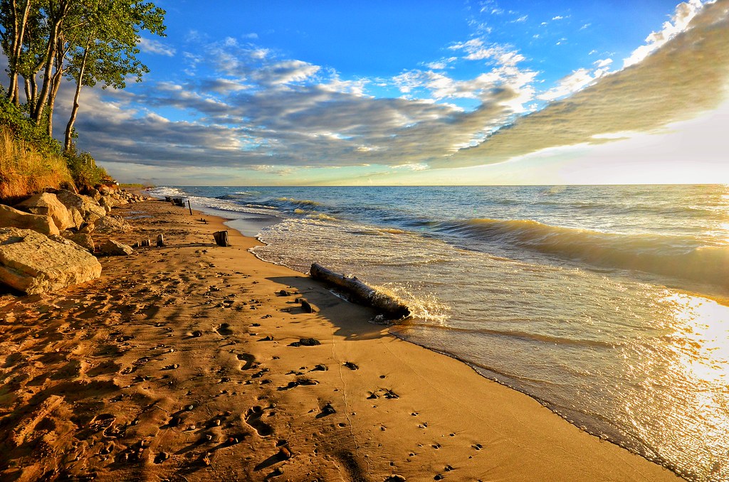
You can see that the conditions have also piled up shoreline ice in these pictures that Mark took over the weekend at Lincoln Township Beach just north of Grand Mere State Park. Here are some more recent ones and a shot from summer of 2016 below. More in Mark’s 2025 gallery on Flickr!
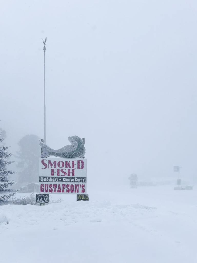
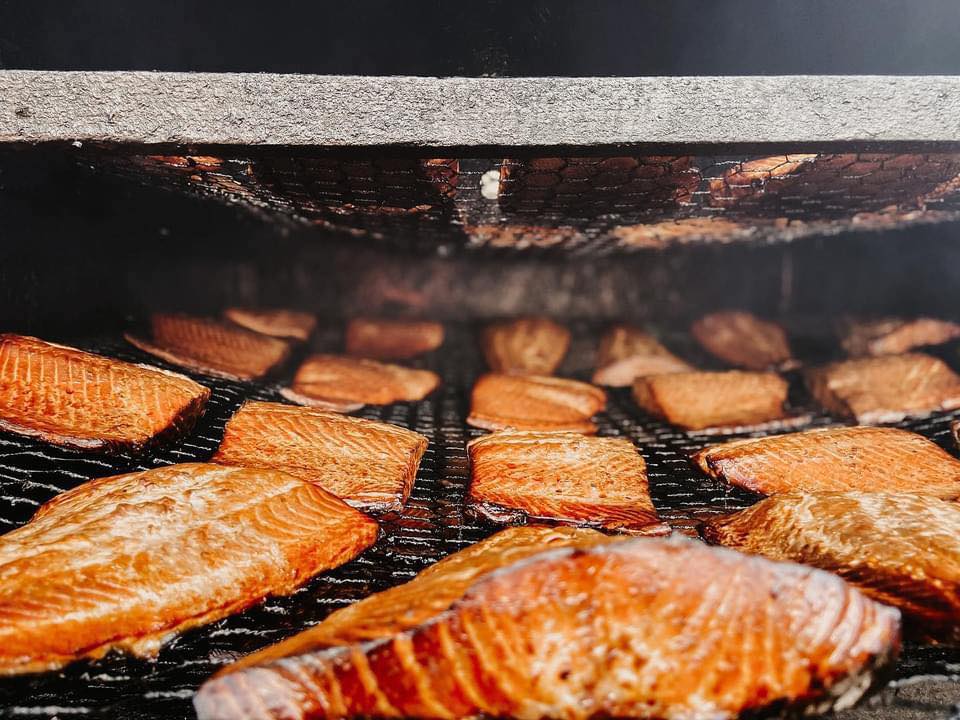
Gustafson’s Smoked Fish shared this photo yesterday from their Facebook as they closed due to generally horrible conditions. They are open again today & located about a half hour west of the Mackinac Bridge on US-2 along the northern shore of Lake Michigan. The family has been making and selling smoked fish, jerky & cheese curds for nearly 50 years, and they have always been one of my favorite post-Bridge stops!
Now here’s a shot of their delicious salmon. If anyone is driving past do you mind picking up a couple pounds for me?
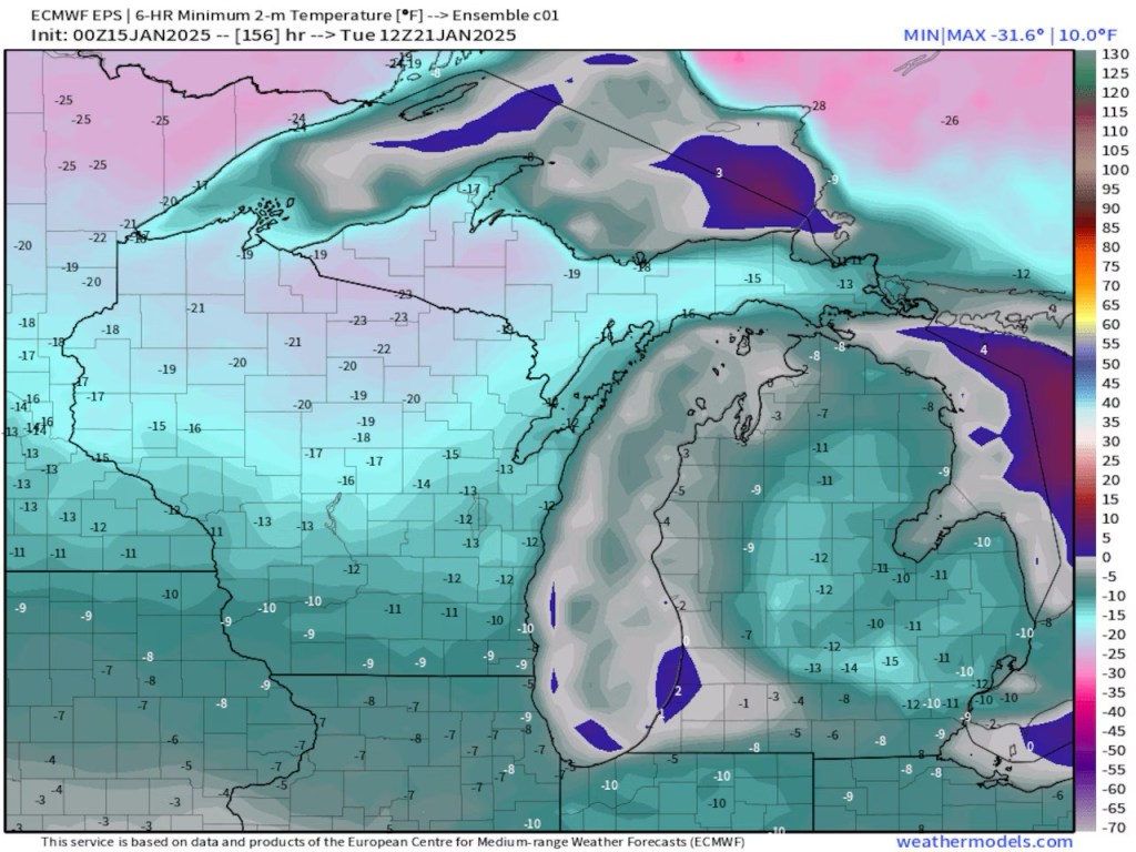
When we get our normal cold here in Michigan the air moves from southwest Canada, across the northern Plains and into the Great Lakes region. A little stiffer brand of cold comes from northwest Canada in the Yukon Territory. Our most dangerous cold comes straight from the north. If the air is really cold it will originate in Siberia, cross over the North Pole and then pour south into the Great Lakes and Northeast.
We are probably just lucky the Great Lakes still have 35 degree to 40 degree surface waters. This same Arctic outbreak of cold would take us 10 degrees colder if it happened with colder Great Lakes’ waters. In looking at the pattern I wouldn’t be surprised to see another Arctic outbreak in a week or two when the lake water is colder.
Lucky indeed because even with the temperature moderation of the Great Lakes, the temps Monday & Tuesday do not look fun!
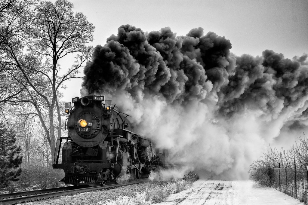
Charles is one of Michigan in Pictures’s most enduring photographers. He took the photo below earlier this week in Leland’s Fishtown & you can see more in his Steam Engine, Railroad Photos gallery on Flickr.
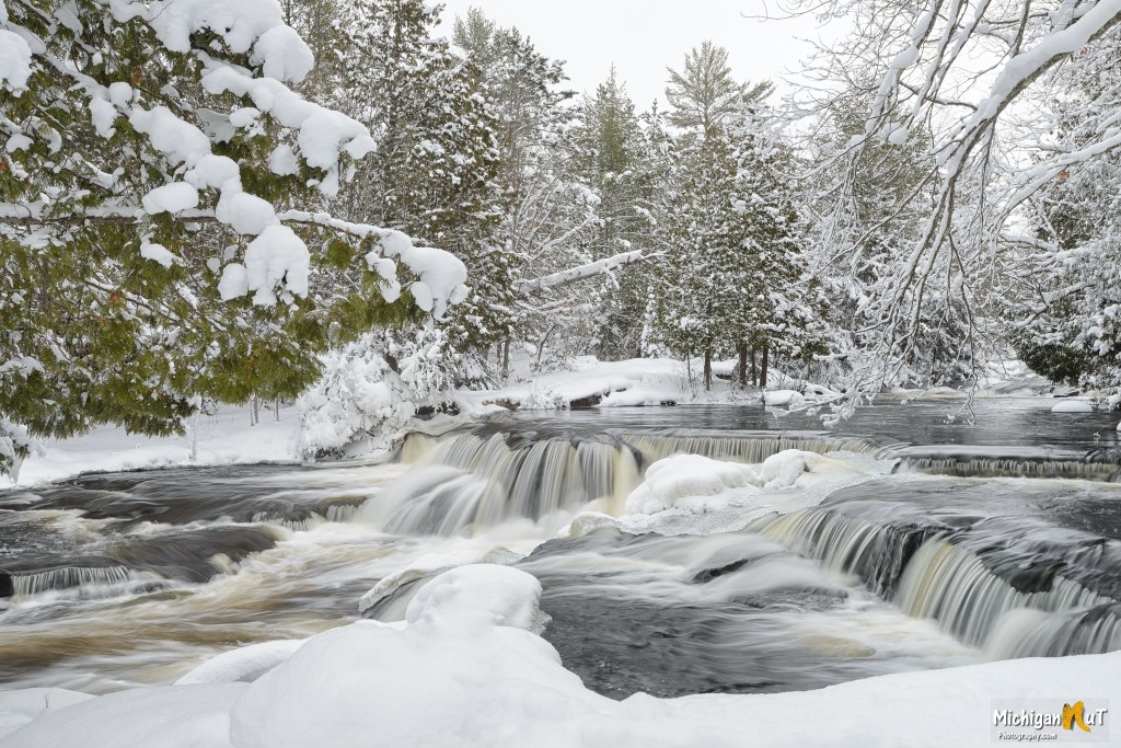
Pure Michigan shares that lower Bond Falls is a scenic and popular waterfall in the Upper Peninsula’s Ontonagon County that is created by the middle branch of the Ontonagon River tumbling over a thick belt of fractured rock that divides it into numerous small cascades. Total drop of the falls is approximately 50 feet & you can get directions & more from the DNR page for Bond Falls Scenic Site.
I originally saw this photo posted by a Facebook page not affiliated with the photographer, something that has become increasingly common. I really hope we can all endeavor to share info & links for the photos we share and to block & report pages that steal photos from actual photographers!
You can view & purchase more Michigan waterfall pictures including these on John’s website, and also get prints, canvas, puzzles, photo coasters, note cards, and Michigan calendars at michigannutphotography.com so what are you waiting for?