Climate Change devouring Great Lakes beaches

Breakwall by Mark Swanson

Breakwall by Mark Swanson

Michigan Sea Grant shares a recent Science Line story about how extreme changes in water levels, fierce storms, decreasing ice coverage, and infrastructure that interferes with the natural coastal cycle are washing away beaches & baffling local officials charged with protecting Great Lakes beaches:

…“When we get 15 foot waves on Lake Michigan, I’m thinking, ‘Oh, my God. How much damage are they doing?’” says David Bunte, the supervisor for Chikaming Township, near the southern tip of Lake Michigan.

Water levels fluctuate naturally in the Great Lakes but intensifying climate change accelerates those changes. What used to be normal on a 20 year cycle is now happening in five or 10 years, says Mike Shriberg, an environmental policy researcher at the University of Michigan.

“We’re seeing record highs and then record lows much closer together,” says Shriberg, whose work focuses on Great Lakes water policy. “The Great Lakes has already experienced more water level change in the last decade than the saltwater coasts are expected to experience in the next 100 years.”

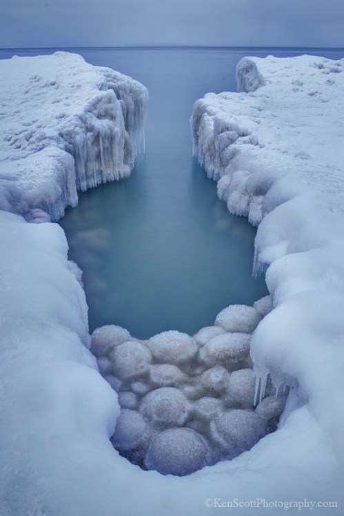
Ice normally acts as a buffer for the shoreline, absorbing the blows of powerful waves in winter storms, but as temperatures warm, diminished ice coverage in the Great Lakes is speeding up coastal erosion.

Read on for much more. If you’re not yet aware of Michigan Sea Grant , I encourage you to learn more about this cooperative program of the University of Michigan, Michigan State University, and the National Oceanic and Atmospheric Administration that funds research, education, and outreach projects designed to foster science-based decisions about the use and conservation of Great Lakes resources.

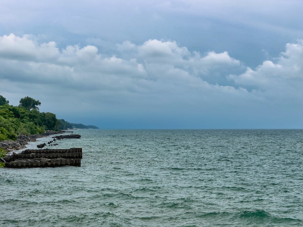
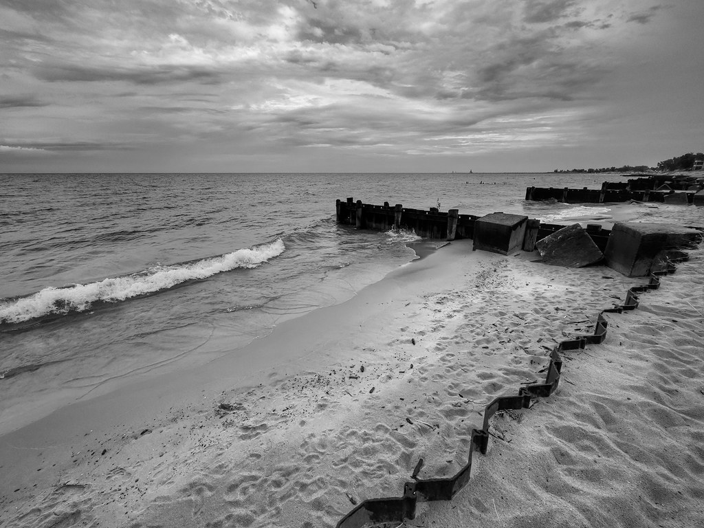
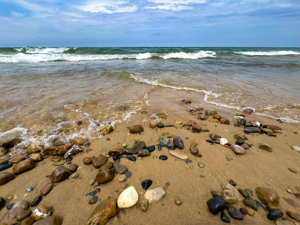
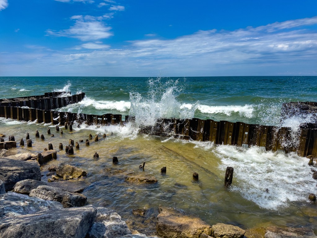
Mark took this photo at the beach in St. Joseph. Here’s a few more of Mark’s recent shots from the St Joseph’s Lake Michigan shoreline – note the crazy high water! See the latest in his 2025 gallery on Flickr!

Support Michigan in Pictures with Patreon

Caribbean of the North

Carribean of the North

Caribbean of the North, photo by Cory Genovese

A while back I featured this as the cover photo on twitter.com/michpics. It’s so great I had to share it here as well! Cory wrote:

A day trip kayak cruise with a couple of friends on Lake Superior resulted in us finding ourselves in the “Caribbean of the North”…albeit with the pool heater unplugged ;)

Indeed! View the photo bigger and see more Lake Superior amazingness from Cory and be sure to follow him at facebook.com/PhotoYoop!

Ice Balls on the Sleeping Bear Lakeshore

Lake Michigan ... ice balls III

Lake Michigan … ice balls III, photo by Ken Scott

You may recall the Lake Michigan ice balls that were seen at the Sleeping Bear Dunes lakeshore last March.  Well, they’re baaaaack. You can see a great video of the ball ice at Accuweather. Here’s the explanation of how balls ice form that I  put together from AIR PHOTO INTERPRETATION OF GREAT LAKES ICE FEATURES by Ernest W. Marshal & Frazil ice at Wikipedia:

Ball ice consists of roughly spherical masses of slush and frazil ice that accrete in turbulent water. Frazil ice is a collection of loose, randomly oriented needle-shaped ice crystals that form in open, turbulent, supercooled water. Lumps that form in the less turbulent zones are typically flattened discs, while those formed in the extremely turbulent zone near the shoreline ice where wave action is strongest form into spheres.

The author explains that ball ice is a feature common to all of the Great Lakes and can occur at any time during the winter where water turbulence breaks up a slush layer. You can read more about this in Great Lakes Ice Features.

View Ken’s photo bigger, check them out in his ice balls slideshow and see this shot with Ken in it for a sense of the scale.

See Battleship Row on Pictured Rocks Day – June 15, 2013

Pictured Rocks National Lakeshore - May 2013

Pictured Rocks National Lakeshore – May 2013, photo by gbozik photography

Battleship Row is one of the many unique formations you can see on the Pictured Rocks cruises. ABC 10 reports that this Saturday, June 15 is Yooper Day for Pictured Rocks Cruises:

Around 1,000 U.P. residents cruised Pictured Rocks National Lakeshore free of charge in a single day last June. The free cruises were so popular that the company is bringing them back.

“This year in conjunction with the Chamber (of Commerce) and the National Lakeshore, to promote the area, and that day we give free rides to Upper Peninsula residents with a valid Upper Peninsula I.D.,” John Madigan said, who is a co-owner and manager of Pictured Rock Cruises.

On June 15, the Alger County Chamber of Commerce is hosting Pictured Rocks Day. Bayshore Park in Munising will be filled with family activities and eleven hours of live music. “I think they have 35-40 exhibitors. They’ll be selling different products,” Madigan said.

The free cruises will leave the Munising City Pier every hour, on the hour, from 10 a.m. to 7:00 p.m., weather permitting. Tickets will be available on a first-come, first-served basis.

FYI the cruises are just $35 for a 2-3 hour cruise that packs a huge amount of scenic entertainment!

Check it out big as a battleship and see a couple more shots in his Travels in the U.P. slideshow.

Much (much) more about the Pictured Rocks on Michigan in Pictures.