Only Getting Hotter

Eye in the Sky by Noah Sorensen

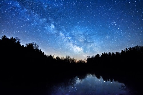
Eye in the Sky, photo by Noah Sorensen

“The heat is rising and only getting hotter, ready to blow
I think I’ll pour myself a glass of water, let it flow
She’ll show you what she’s made of
Yeah she’s comin’ for ya
She’s gonna try to break ya
Yeah she’s comin’ for ya
No, she don’t mess around”
-Cage The Elephant, Mess Around

You know that when I pull out Cage the Elephant lyrics, I’m probably going to say something that will anger a slice of Michigan in Pictures readers, so be warned! Longtime readers will also know that I am pretty committed to saying what I want to say, so it’s probably good keep that in mind as well.

Speaking of warnings, the National Aeronautics and Space Administration (NASA) spends a lot of time looking at the Earth and crunching data from an extensive satellite and – in conjunction with the National Oceanic and Atmospheric Administration (NOAA). Anyway, these folks – literally rocket scientists – have reported (based on science and data) that the Earth is warming at an unprecedented rate:

The planet is warming at a pace not experienced within the past 1,000 years, at least, making it “very unlikely” that the world will stay within a crucial temperature limit agreed by nations just last year, according to Nasa’s top climate scientist.

This year has already seen scorching heat around the world, with the average global temperature peaking at 1.38C above levels experienced in the 19th century, perilously close to the 1.5C limit agreed in the landmark Paris climate accord. July was the warmest month since modern record keeping began in 1880, with each month since October 2015 setting a new high mark for heat.

But Nasa said that records of temperature that go back far further, taken via analysis of ice cores and sediments, suggest that the warming of recent decades is out of step with any period over the past millennium.

“In the last 30 years we’ve really moved into exceptional territory,” Gavin Schmidt, director of Nasa’s Goddard Institute for Space Studies, said. “It’s unprecedented in 1,000 years. There’s no period that has the trend seen in the 20th century in terms of the inclination (of temperatures).”

Read on for more. I’d like to go on record as a parent and member of the human race that I’m really alarmed by this, and also the fact that what appears to be a serious emergency is being ignored.

View Noah’s photo background bigtacular and see more in his slideshow.

I would really like to share the video of Mess Around from Cage the Elephant because I really like the band. In the interests of responsibility however, here’s a 30-second video showing the temperature rise of the last 145 years:

North Bar Lake in Sleeping Bear Dunes

North Bar Lake Sleeping Bear Dunes

North Bar Lake, Sleeping Bear Dunes, photo by jdehmel

The Sleeping Bear Dunes National Lakeshore pages on North Bar Lake and the North Bar Lake Overlook say (in part):

The small lake below is North Bar Lake. The name describes how the lake formed: it is ponded behind a sand bar. At times, the sand bar builds up and separates North Bar Lake from Lake Michigan. At other times, a small connecting channel exists between the two lakes. North Bar Lake occupies part of a former bay on Lake Michigan. This ancient bay was flanked by headlands on both sides: Empire Bluffs on the south and Sleeping Bear Bluffs on the north. Shorelines have a natural tendency to become straighter with time. Wave action focuses on the headlands and wears them back, while shoreline currents carry sediment to the quiet bays and fill them in. Deeper parts of the bay are often left as lakes when sand fills in the shallower parts. The same process that formed North Bar Lake also formed many of the other lakes in northern Michigan: Glen, Crystal, Elk and Torch Lakes, for example.

…North Bar Lake is one of the most popular beaches in the Lakeshore because it has shallow, clear water over a sandy bottom makes for warmer swim than in Lake Michigan. But for those who like the refreshing cool water and wave action of the big lake, you can walk across the low dunes that separate the two lakes in just a couple of minutes. The beaches of pure sand and the small outlet to Lake Michigan is ideal for the kids to play.

View jdehmel’s photo background bigilicious and see more in his Sleeping Bear Dunes slideshow.

More dunes and more summer wallpaper on Michigan in Pictures.

Why is Ice Blue or Green?

The Blue Ice

The Blue Ice, photo by Charles Bonham

The Causes of Color answers the question: What causes the blue color that sometimes appears in snow and ice?

As with water, this color is caused by the absorption of both red and yellow light (leaving light at the blue end of the visible light spectrum). The absorption spectrum of ice is similar to that of water, except that hydrogen bonding causes all peaks to shift to lower energy – making the color greener. This effect is augmented by scattering within snow, which causes the light to travel an indirect path, providing more opportunity for absorption. From the surface, snow and ice present a uniformly white face. This is because almost all of the visible light striking the snow or ice surface is reflected back, without any preference for a single color within the visible spectrum.

The situation is different for light that is not reflected, but penetrates or is transmitted into the snow. As this light travels into the snow or ice, the ice grains scatter a large amount of light. If the light is to travel over any distance it must survive many such scattering events. In other words, it must keep scattering and not be absorbed. We usually see the light coming back from the near surface layers (less than 1 cm) after it has been scattered or bounced off other snow grains only a few times, and it still appears white.

In simplest of terms, think of the ice or snow layer as a filter. If it is only a centimeter thick, all the light makes it through; if it is a meter thick, mostly blue light makes it through. This is similar to the way coffee often appears light when poured, but much darker when it is in a cup.

Click through for lots more about light & color!

Charles took this photo last March off Gills Pier on the Leelanau Peninsula when there was a whole lot more ice than there is this winter. View it background bigilicious and see more in his Leelanau Peninsula slideshow.

More winter wallpaper and more amazing ice on Michigan in Pictures.

Michigan Weird Science: The Menominee Crack

Birch Creek Michigan Crack in Forest

The Menominee Crack, photo courtesy Michigan Tech College of Engineering

Gizmodo reports that back in October of 2010 folks near Birch Creek in Menominee County heard a boom, felt the earth rock, and woke up to find a 360′ crack in the ground:

The first clue was the fact that the split happened at the top of a ridge. A pop-up isn’t a wrenching apart of some deep underground structure. It’s a large piece of ground suddenly pushing upwards, so that the ground above splits over it. The researchers discovered the pop-up by the sophisticated technique of slamming a sledgehammer against a metal ball sitting on the ground. The action caused sound waves to move through the rock beneath—and depending on the formation of the rock, the sound moves at different speeds. In this case, it moved in hugely different ways parallel to the crack, as compared to perpendicular to the crack. This indicated that there was a huge fracture in the limestone underneath the crack.

These sudden fractures occur due to extreme strain in the rock—strain that can be pent up for centuries. It’s more common around quarries, when removal of large pieces of rock can cause the rest to suddenly fracture and pop upwards. Other times, it can occur spontaneously. The Menominee Crack, as its now called, was probably the result of a spontaneous fracture—although the researchers speculate it might have happened due to the removal of a large tree from the area.

Read more at Gizmodo and check Michigan Tech for a detailed explanation of the Menominee Crack and Live Science for more photos. If you want to creep yourself out a little more, check out the probably related Wisconsin mystery booms!

Thanks Michigan Tech’s Engineering College for the photos and for all you do to help unravel the mysteries of Michigan!

If you like stuff like this, there’s plenty more Michigan weirdness on Michigan in Pictures!

A Snowflake’s Life: How Snowflakes Get Their Shape

A Snowflakes Life

A Snowflake’s Life, photo by Shawn Malone/Lake Superior Photo

“Lives are snowflakes – unique in detail, forming patterns we have seen before, but as like one another as peas in a pod (and have you ever looked at peas in a pod? I mean, really looked at them? There’s not a chance you’d mistake one for another, after a minute’s close inspection.)”
Neil Gaiman, American Gods

One of my favorite websites is EarthSky, and they explain how snowflakes get their shape:

The shape of snowflakes is influenced by the temperature and humidity of the atmosphere. Snowflakes form in the atmosphere when cold water droplets freeze onto dust particles. Depending on the temperature and humidity of the air where the snowflakes form, the resulting ice crystals will grow into a myriad of different shapes.

…Kenneth Libbrecht, Professor of Physics at the California Institute of Technology, has made extensive observations of how water molecules get incorporated into snow crystals. In his research, he has observed that the most intricate snowflake patterns are formed when there is moisture in the air. Snowflakes produced in drier conditions tend to have simpler shapes.

Temperature also has a large effect on the formation of snowflakes according to Libbrecht’s research. Snowflakes formed in temperatures below – 22 degrees Celsius (- 7.6 degrees Fahrenheit) consist primarily of simple crystal plates and columns whereas snowflakes with extensive branching patterns are formed in warmer temperatures.

Bottom line: Temperature and humidity influence snowflake formation. The most intricate snowflake patterns are typically formed during warm and wet conditions.

Read on for more including some links & photos!

Shawn writes that she can totally relate to this snowflake’s imperfect life. View it background big on Facebook, check out more including a kickin’ video of the Northern Lights at the Mackinac Bridge on her Lake Superior Photo page, and view and purchase photos from LakeSuperiorPhoto.com.

More winter wallpaper and more snow on Michigan in Pictures.

PS: Congrats to Shawn for passing 200,000 subscribers on her Facebook page – wowzas!!

PPS: Neil Gaiman‘s American Gods is an incredible work of modern day fantasy.

A Rainbow Primer

Incomplete

Incomplete, photo by Jamie MacDonald

I’ve never found a better website for information about rainbows and other optical phenomena than Atmospheric Optics. They have information about all flavors of rainbows including the primary rainbow, and explain that rainbows are disks of light rather than sets of coloured rings:

Early morning and late afternoon are the best times to see them because the sun must not be too high. Rainbows are always opposite the sun and their centres are below the horizon at the the antisolar point. The lower the sun the higher is the bow.

Red is always outermost in the primary bow with orange, yellow, green and blue within. Occasionally, when the raindrops are small, fainter supernumerary arcs of electric greens, pinks and purples lie just inside the main bow.

A rainbow is not just a set of coloured rings. The sky inside is bright because raindrops direct light there too. The primary bow is a shining disk brightening very strongly towards its rim.

About this particular rainbow, Jamie writes:

This is the first time I have ever seen part of a rainbow in open skies. Look to the sky above the barn and you can just make out the missing portion of the rainbow.

View his photo bigger and see more in his Landscapes slideshow.

More rainbows on Michigan in Pictures!

#TBT: Comet Biela and the Great Michigan Fire of 1871

House fire

House fire, photo by Ogedn

“The proponents of the cometary explanation cite many fascinating details confirmed by eye witness reports: the descent of fire from the heavens, a great ‘tornado’ of fire rushing across the landscape and tearing buildings from their foundations, descending balls of fire, a rain of red dust, great explosions of wind accompanied by blasts of thunder, buildings exploding into flame where no fire was burning, and a good deal more.”
~thunderbolts.info

We all probably know of Mrs. O’Leary’s cow and the Chicago Fire that burned over three miles of the city to the ground, but perhaps you’d care to take “Fires beginning October 8, 1871” for $500? Four fires began 144 years ago on this day in 1871: the Great Chicago Fire, the Great Michigan Fire, the Peshtigo (Wisconsin) Fire and the Port Huron Fire.

I’m going to let the crew of thunderbolts take it away with an excerpt from their fascinating feature The Comet and the Chicago Fire:

Contrary to popular folklore, the Chicago fire is not the worst in U.S. history. It was not even the worst to occur on October 8 that year. The same evening—in fact, at the same time, about 9:30—a fierce wildfire struck in Peshtigo, Wisconsin, over 200 miles to the north of Chicago, destroying the town and a dozen other villages. Estimates of those killed range upward from 1200 to 2500 in a single night. It was not the Chicago fire but the simultaneous “Peshtigo Fire” that was the deadliest in U.S. history.

And there is more. On the same evening, across Lake Michigan, another fire also wreaked havoc. Though smaller fires had been burning for some time—not unusual under the reported conditions—the most intense outburst appears to have erupted simultaneously with the Chicago and Peshtigo fires. The blaze is said to have then burned for over a month, consuming over 2,000,000 acres and killing at least 200.

Concerning the Michigan outburst, it is reported that numerous fires endangered towns across the state. The city of Holland was destroyed by fire and in Lansing flames threatened the agricultural college. In Thumb, farmers fled an inferno that some newspapers dubbed, “The Fiery Fiend.” Reports say that fires threatened Muskegon, South Haven, Grand Rapids, Wayland, reaching the outskirts of Big Rapids. A steamship passing the Manitou Islands reported they were on fire.

There can be no doubt that weather conditions at the time favored wildfires. But never before, and never since, has the U.S. seen such wildly destructive simultaneous conflagrations. This “coincidence”, combined with many unusual phenomena reported by eyewitnesses, has led some to conclude that an extraordinary force, one not of the earth, was a more likely “arson” than either a misbehaving cow or a regional drought.

In 1883, Ignatius Donnelly, author of Ragnarok: the Rain of Fire and Gravel, suggested that in early historic times our Earth suffered great catastrophes from cometary intruders. To this claim he added: “There is reason to believe that the present generation has passed through the gaseous prolongation of a comet’s tail, and that hundreds of human beings lost their lives”. He was referring to the conflagration of 1871.

Definitely read on for much more about the possibility of a comet’s tail, perhaps Comet Biela, fueling the fires.

Ogedn took this photo of a controlled burn by the local fire department, who practiced on this house before letting it burn. View the photo background big and see this and lots more in their slideshow.

Tons more Michigan history on Michigan in Pictures.

PS: I definitely did more research on this than I should have on this, and while the cometary theory and Comet Biela was observed to be broken apart on its pass in 1846, it may be that Biela’s Comet returned in September of 1872. In any case check the article out and also their Picture of the Day for a lot more than you’ve probably thought about.

The Science of Sand Waves, Silver Lake Dunes Edition

Sand Waves

Sand Waves, photo by Charles Bonham

Confession: I probably don’t give Silver Lake Dunes State Park enough love. What an incredible place.

In Scientific American Robert S. Anderson, associate professor of earth sciences at the University of California at Santa Cruz explains why regular, wavelike shapes form when the wind blows over the sand on the beach for a long time:

Ripples in sand, found on both beaches and dunes, are one of nature’s most ubiquitous and spectacular examples of self-organization. They do not result from some predetermined pattern in the wind that is somehow impressed on the surface, but rather from the dynamics of individual grains in motion across the surface. They arise whenever wind blows strongly enough over a sand surface to entrain grains into the wind. The subsequent hopping and leaping of these grains is called saltation. Saltating grains travel elongated, asymmetric trajectories: Rising relatively steeply off the bed, their path is then stretched downwind as they are accelerated by drag forces. They impact the sand surface centimeters to tens of centimeters downwind, typically at a low angle, around 10 degrees. It is this beam of wind-accelerated grains impacting the sand surface at a low angle that is responsible for ripples.

“An artificially flattened sand surface will not remain flat for long. (Try it on the beach or on the upwind side of a dune and see for yourself.) Small irregular mottles in the sand surface, perhaps a couple centimeters in wavelength, rapidly arise and grow once the wind starts to blow hard enough to initiate saltation. They then slowly organize themselves into more regular waves whose low crests are aligned perpendicular to the wind direction and begin to march slowly downwind. Typical ripple spacing is about 10 centimeters, whereas the typical height of the crests above the troughs is a few millimeters. The pattern is never perfect, but instead the ripple crests occasionally split or terminate, generating a pattern that looks remarkably like one’s fingerprint.

Read on for a whole lot more including Michigan Sea Grant educator Walt Hoagman explaining how the speed of wind (and water) over sand influences the waves.

View Charles’s photo background bigilicious and definitely check out his incredible Silver Lake Dunes photos.

More science, more dunes and more summer wallpaper on Michigan in Pictures.

Milky Way, Otter Creek & Sally Ride

Milky Otter

Milky Otter, photo by Heather Higham

The stars don’t look bigger, but they do look brighter.
~Sally Ride

Google reminded me this morning that today would have been astronaut & physicist Sally Ride’s 64th birthday. The Wikipedia entry for Sally Ride says that on June 18, 1983, she became the first American woman in space. Along with her NASA career, Ride also wrote a number of books aimed at encouraging children to study science, something I strongly believe that all of us should remember to do with the young girls & boys who look up to us.

To put a Michigan bow on this, be sure to check out the Women in Aviation and Space exhibit at the AirZoo in Portage. The exhibit honors women including astronaut Sally Ride and aviation pioneer Amelia Earhart. It includes original uniforms, a visual history mural, photo collages, a timeline and a unique mosaic, which includes each of the 1,102 WASP plus Jacqueline Cochran, founder of the Women in Aviation and Space organization.

Heather took this incredible shot at Otter Creek in the Sleeping Bear Dunes National Lakeshore. View her photo bigger and see more in her Night Sky slideshow.

PS: If you want to get your Night Sky fix at the Sleeping Bear Dunes National Lakeshore, check out their Your Park After Dark program this summer!

North Bar Lake

North Bar Lake by Sarah Hunt

North Bar Lake, photo by Sarah Hunt

Who’s ready for a break from snow & ice? The Sleeping Bear Dunes National Lakeshore page on the North Bar Lake Overlook says (in part):

The name describes how the lake formed: it is ponded behind a sand bar. At times, the sand bar builds up and separates North Bar Lake from Lake Michigan. At other times, a small connecting channel exists between the two lakes. North Bar Lake occupies part of a former bay on Lake Michigan. This ancient bay was flanked by headlands on both sides: Empire Bluffs on the south and Sleeping Bear Bluffs on the north. Shorelines have a natural tendency to become straighter with time. Wave action focuses on the headlands and wears them back, while shoreline currents carry sediment to the quiet bays and fill them in. Deeper parts of the bay are often left as lakes when sand fills in the shallower parts.

The same process that formed North Bar Lake also formed many of the other lakes in northern Michigan: Glen, Crystal, Elk and Torch Lakes, for example.

Here’s more about the geology of the Sleeping Bear and more about North Bar Lake, to which I’d add that the lake is a great place for skim boards because the channel between North Bar & Lake Michigan is only a few inches deep!

Sarah took this photo last summer. Click it to view background bigalicious and check out lots more of her incredible and adventurous photography at instagram.com/oni_one_.

PS: If you’re still not full-up on winter and ice, might I suggest this pic she took in this area of Sleeping Bear last week!