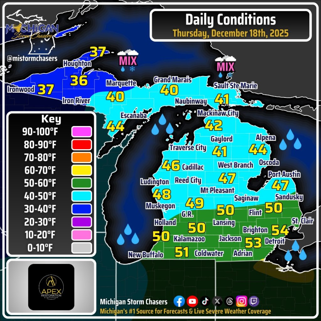
The folks at Michigan Storm Chasers share a detailed statewide Michigan weather forecast every morning that you should definitely incorporate into your daily feed. On Facebook they share that although we will see temps above freezing for most of the state, even topping 50 degrees in southern Michigan, temps will drop later in the day, potentially precipitously in what is known as a “flash freeze”. A flash freeze happens when rain has fallen, completely stopped, and then shortly afterward air temperatures drop from the 40s or 50s down into the 20s or colder. Ryan explains is all in their excellent video.
Michael shared this photo 13 years & one day ago on December 17, 2012, remarking that it was strange to see rain in December in the UP. Here are a couple more he shared to our Absolute Michigan group on Flickr, and you can see more in his The UP Eh! gallery.
“It is always safe to dream of spring. For it is sure to come; and if it be not just as we have pictured it, it will be infinitely sweeter.” ― L.M. Montgomery
Paul has been a member of the Absolute Michigan group on Flickr for a long time. He shared this incredible photo from May 2024 that makes me long for spring a few weeks ago. He took it in , so in the interests of being seasonally balanced, here’s one of his most popular photos on Flickr from way back in 2013 at the Grand Haven Lighthouse. Head over to his Flickr for lots more!
Tropical rain such as the heavy rain we are having tonight and Wednesday originates from a different part of the globe compared to most all other rains in Michigan. The rain now has some moisture in it from Africa, the Atlantic Ocean, the Gulf of Mexico and the deep southern states of the U.S. Most of our rain has moisture gathered from the air over the Pacific Ocean or the western and central United States.
…. The tropical clouds typically have a lower base, sometimes only one thousand to two thousand feet above the ground. You may feel like you can reach up and touch the clouds. Our ordinary rains would have a low base at five thousand feet and many bases are higher than five thousand feet.
…Now think about the different things that can be in a raindrop from Africa and the tropics. I haven’t seen any actual research on this but tropical rains can carry more and different nutrients within the drop. I call this rain, “the great green-up.” Look at your grass. Look at your vegetable and flower garden after the rain. If it’s not drowned out, your garden with go through robust growth this week. It will be like you fertilized it. It’s about to get nature’s “Miracle-Gro.”
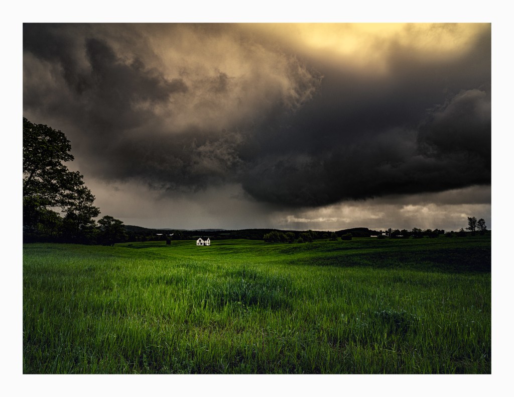
Jeremy took this way back in the summer of 2011 in Edwardsburg, way down in southwest Michigan. See more in his Landscapes gallery on Flickr & stay dry!!
Thinking there’s been a lot of rain lately? You’re not wrong! Michigan has experienced a lot of rain over the last few weeks, and mLive meteorologist Mark Torregrossa shares that there are three weather conditions all combining over the Great Lakes that keep the rain machine running:
Over the next 10 days there should be three weather systems moving through the Great Lakes region. Each of these storms should have one to two inches of rain in the heaviest swath of precipitation.
The cause of the wet weather starts with numerous storm systems being born over the northern Pacific Ocean. These storms are hitting the Pacific Northwest coast every three to five days. The storm systems then cross the hotter than average Rockies and drop south into the base of a “U”-shaped bend in the jetstream. This U-shaped area is where storms spin faster and intensify. It’s the area along the jetstream where large-scale weather systems are at their strongest.
The final part to this wet weather scenario is what we call a “wide-open Gulf of Mexico.” Southern winds from the Gulf of Mexico into the Midwest and Ohio Valley bring high amounts of water vapor northward. The strong storm systems use that water vapor to produce heavy rain.
…The total rainfall forecast over the next week, through July 4, 2017 shows NOAA forecasters expect a swath of five to six inch total rain. We will just have to watch where this heaviest rain sets up. Right now it is expected to fall south of the flooded areas in Michigan. It could easily shift north or south a few hundred miles.
Michigan Radio’s Stateside program interviewed Dr. Larissa Larsen of the Urban and Regional Planning Program at the University of Michigan about how our warming climate & heavier rains impacts how we plan & manage cities. It’s an interesting concept and another financial eventuality we’ll need to include in our long-term planning … assuming we ever do any of that.