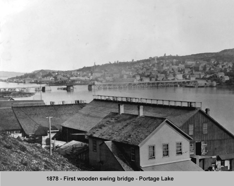
In 1897, the Mineral Range Railroad Company built a new iron swing type bridge, replacing the old wooden bridge. This bridge also featured a two lane roadway, with a railroad crossing underneath. New reconstructed support cribs were also sunk. But on August 15, 1905, disaster struck, when the steamer Northern Wave (Mutual Transit Lines), en route to the Quincy Smelter to pick up copper ingots, smashed into the center section, destroying much of it. The mishap was apparently caused by a mixup in signals.
Original Portage Wooden Swing Bridge Taken from the north side of Ruppe Dock and Warehouse in Hancock, 1878
The bridge would be replaced one year later, again with an iron bridge, and center swing section, and a control house above the roadway, over the center turnstile. This new bridge would have 118 ft. of clearance on the north maritime passage, and 108 ft. on the south side passage. (Newspaper accounts of the period, gave maritime traffic at 6,000 bridge openings per year, and up to 40 daily train crossings per day, both of which began to taper off by 1920). Although almost struck again in 1940 by the Steamer Maritana (Hutchenson Lines), it narrowly avoided the collision by dropping its anchors which caught the submarine telephone cables, stopping it just short of the bridge. (This would happen again 20 years later). Light signaling was added during WWII, to augment the steam whistles already in use. The bridge served the communities until 1960.
In the late 1950s, the Michigan Department of Transportation began studies on how best to replace the aging bridge, with a more modern one, that would accommodate the now much larger ships plying the waterway. It was decided to build what would be become the worlds heaviest aerial lift bridge, which was under construction by 1959, just to the West of the then current bridge. This new bridge, with 4 traffic lanes above, and a railroad crossing below, had its ribbon cutting on Saturday, June 25, 1960. But it almost didn’t happen. During the night before, the Steamer J.F. Schoelkoff (American Steamship Company), traveling westward, signaled for the bridge to open, but the signals were not acted on. Dropping all their anchors, they snagged the submarine telephone cables in an eerie repeat of 20 years previously. Onlookers for the ribbon cutting ceremonies were treated to the spectacle of a large freighter jammed crossways in the waterway, just a quarter mile from the Bridge. Area phone service was disrupted for nearly three days. Telephone service to the bridge, and marine radios were installed shortly. That incident not withstanding, the new Portage Lake Lift Bridge continues to well serve the area, as the possibility of adding yet another new bridge may be explored.
Fun fact of the day: I have a mild fear of heights! While it’s not crippling enough to stop me from being able to drive over the Mighty Mac, I can definitely see where some people aren’t able to do that. For all of you, here’s a story (with a good video) about a little known service: The Mackinac Bridge Authority will drive you across!
The Mackinac Bridge Authority has a “Driver’s Assistance Program” that provides drivers for those uncomfortable with driving across the Mackinac Bridge. If you are traveling northbound, there is a phone at the south end of the bridge. Instructions for using the phone are posted in the phone box. If you are southbound, just ask a fare collector for assistance. There is no additional fee for this service.
The phone is located on the shoulder of I-75 just north of the Jamet Street exit to Mackinaw City (near Audies Restaurant). You do not need to exit the freeway. Just past the exit, you can pull over to the right and park on the shoulder. The phone box is located on the right-of-way fencing. The box is green and easily spotted. If this is still unclear, please call us at 906-643-7600.
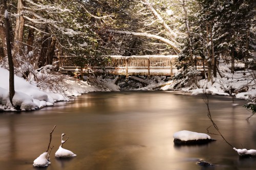
Known for its spectacular waterfalls, idyllic beaches, scenic hiking trails and tranquil campground, the Black River Harbor Recreation Area is a popular destination throughout the year. Originating in Wisconsin, the Black River flows through forested areas of large pine, hemlock and hardwood trees. The River has a series of scenic waterfalls as it drops in elevation to meet Lake Superior. Tannin (tannic acids) from hemlock trees is what gives it its unique color.
The Harbor offers one of the area’s few access points to Lake Superior, with boating being a major summer time activity. The boat ramp can accommodate almost any craft trailered in. There is no launching fee. Boat fuel and snacks are available through the concessionaire. Parking for trucks and boat trailers is ample.
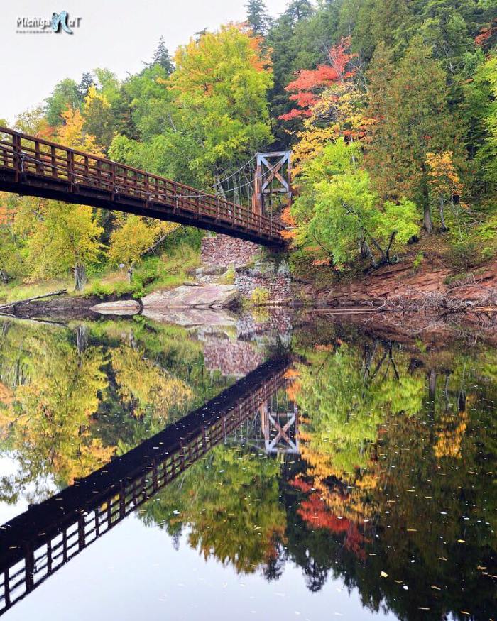
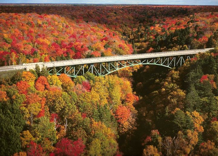
John took this photo a few days ago. Check it out bigger and definitely follow Michigan Nut Photography on Facebook for more great fall color and lots more of Michigan at its best!
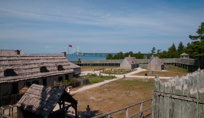
French soldiers constructed the fortified community of Michilimackinac on the south side of the Straits of Mackinac in 1715. The community grew and prospered over the coming years as Michilimackinac became an important center of the Great Lakes fur trade. Every summer, thousands of Native Americans and French-Canadian voyageurs gathered at the post, which served as transfer station for furs trapped in the western Great Lakes and trade goods shipped in from eastern cities such as Montreal and Quebec. Michilimackinac came under British control in 1761, but the fur trade and community life remained relatively unchanged.
Fearful that the post was vulnerable to attack by American rebels, the British disassembled the fort and community and moved it to Mackinac Island in 1779-81.
One factor in the move may also have been an event that happened 252 years ago on June 2, 1763. The fort was captured by Ojibwa & Sauk warriors who gathered to play a huge game of baggatiway. Elizabeth Edwards of Traverse Magazine wrote a great article about the massacre that begins:
Under an unusually hot sun on a late spring day on the Straits of Mackinac, British Major George Etherington, commandant of Fort Michilimackinac, was suffering from an acute case of cultural blindness. And there was no excuse for it. Relaxed at the sidelines of a rousing game of baggatiway (similar to lacrosse) outside the fort, the major should have seen the danger signs in this Ojibwe versus Sauk contest of sweaty, half-naked bodies painted with white clay and charcoal.
The 30-year-old officer was born in the colonies, and most likely grew up on stories of Indian uprisings. He’d even served in the just-ending French and Indian War, in which the English had wrested control of North America from the French—a victory that had put this previously French fort in Etherington’s care. Though the major had been raised on American soil and had fought on it, he was still English. And in that country, a battle was a battle, and a sporting event was a sporting event.
Perhaps that explains why the major missed the clues…
Joel adds that almost every building at Colonial Michilimackinac is a reconstruction, with only two or three minor exceptions. View his photo background bigtacular and see more from the fort and surrounding area in his Straits of Mackinac slideshow.
If you want to call this the world’s most beautiful bridge, you’ll get no argument from me.
View Dan’s photo background bigtacular and settle into his slideshow for a couple more amazing shots from Michigan. Then – because everyone needs a vacation every so often – keep watching for some jaw-dropping pics from Alaska. Seriously: wow, wow, WOW.
“I hope that in this year to come, you make mistakes. Because if you are making mistakes, then you are making new things, trying new things, learning, living, pushing yourself, changing yourself, changing your world. You’re doing things you’ve never done before, and more importantly, you’re doing something.” ~Neil Gaiman
Happy New Year everyone! Here’s hoping for health & happiness for all of you, but also a mistake or two as the incomparable Mr. Gaiman prescribes.
Spring Disney shared this photo from Elizabeth Park in Trenton for the 2011 New Year. View it bigger on Flickr and see more (including some absolutely stunning owl photos) in her My Favorites slideshow.
AAA Michigan reports that about 1.5 million Michiganders are heading over the river and through the woods for the Thanksgiving holiday. The good news is that gas prices are the lowest since 2009 – down 40 cents from last year. The bad news is another weather system that’s dropping freezing rain & snow, closing schools and
Among Michigan’s largest and most well-known historic bridges is the iconic Cut River Bridge, which is listed on the National Register of Historic Places. This bridge is large enough that MDOT actually has maintained this bridge as an area attraction. Surrounding the bridge is a roadside park and a series of trails around the bridge. The intent to make this bridge something more than just a crossing goes back before this bridge’s status as a historic bridge to its initial construction. The bridge was designed as an attraction even when it was built, since sidewalks above the bridge in this rural area are present. Also, a set of stairways, part of the original design, take pedestrians under the bridge where they can view the supporting trusses. The abutments and piers were also given unusually exceptional detail, in particular the use of decorative stone facing. The two main piers give the appearance are attractive cut stone arches.
The bridge includes a total of 888 tons of steel and its height over the Cut River is 147 feet. It offers views of Lake Michigan from its deck. The bridge was originally painted a silver color, but is today painted green. This bridge is a steel deck cantilever truss bridge. This structure type is much more common in more hilly states like Pennsylvania, but is extremely rare in Michigan. The structure has visual complexity as a result of the extensive lattice and v-lacing on its riveted, built-up members, which are all very massive, typical for both a bridge of its size and its age. The bridge retains original standard-plan metal guardrails (Michigan’s “signature” type R4 railings) on the sidewalks that flank the roadway on each side. It also retains standard Michigan State Highway Department plaques.
Read on for lots more about this bridge that was constructed in the early 1940s. If you do make it to Cut River, do yourself a favor and hike down – it’s very cool!
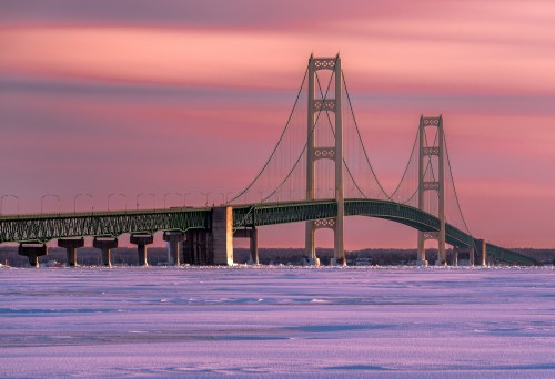
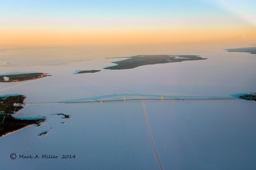
OK, we’re not throwing back too far for this Thursday, but I wanted to share a really cool view that Mark took this February of the Mackinac Bridge and the Straits of Mackinac locked in the grip of the Polar Vortex.
Canadian Transport Minister Lisa Raitt and Michigan Gov. Rick Snyder have called a news conference Wednesday about the planned new $2 billion bridge linking Detroit and Windsor, Ontario.
Snyder’s office said Tuesday that Raitt and the governor “will make an announcement regarding the New International Trade Crossing” at 10:30 a.m. Wednesday at the Canadian Club Heritage Center in Windsor.
The governor’s and transport minister’s offices declined immediate comment Tuesday on the nature of the announcement.
Michigan and Canadian leaders have agreed to build the bridge over the Detroit River between Windsor and Detroit’s southwest side.
Officials say Canada would finance construction of the bridge, which would open in 2020.