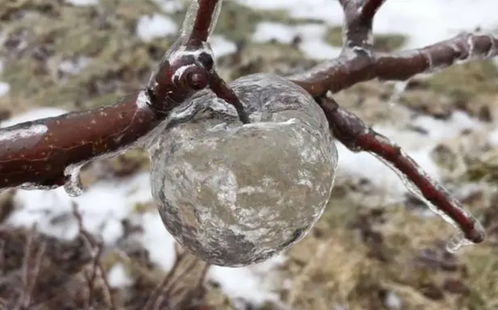
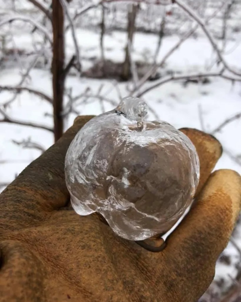
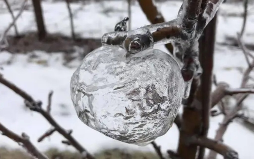
This rare winter phenomenon was captured in the Fruit Ridge area of Kent County, Michigan when freezing rain coated apples still hanging on the trees. The fruit eventually fell away, leaving behind these wild, hollow ice apples ❄️ Moments like this are uncommon, these photos were taken several years ago during just the right conditions 🧊🍎
I confess that even though I grew up surrounded by orchards that I have not, and it is extremely cool! Here are a couple more shots from Robinette’s Facebook post!
A reader commented that they had seen lightning & heard the rumble of thunder yesterday, an observation shared by numerous folks around the state. Although a lot of the online articles are hyping up thunder snow as a dangerous or abnormal phenomenon, it’s not.
The NOAA National Severe Storms Laboratory’s Severe Weather 101 explains that although thunderstorms are less common in the winter, sometimes lightning does occur within a snowstorms and is called thundersnow. Thundersnow can be found where there is relatively strong instability and abundant moisture above the surface, such as above a warm front. Thundersnow is sometimes observed downstream of the Great Salt Lake and the Great Lakes during lake-effect snowstorms too.
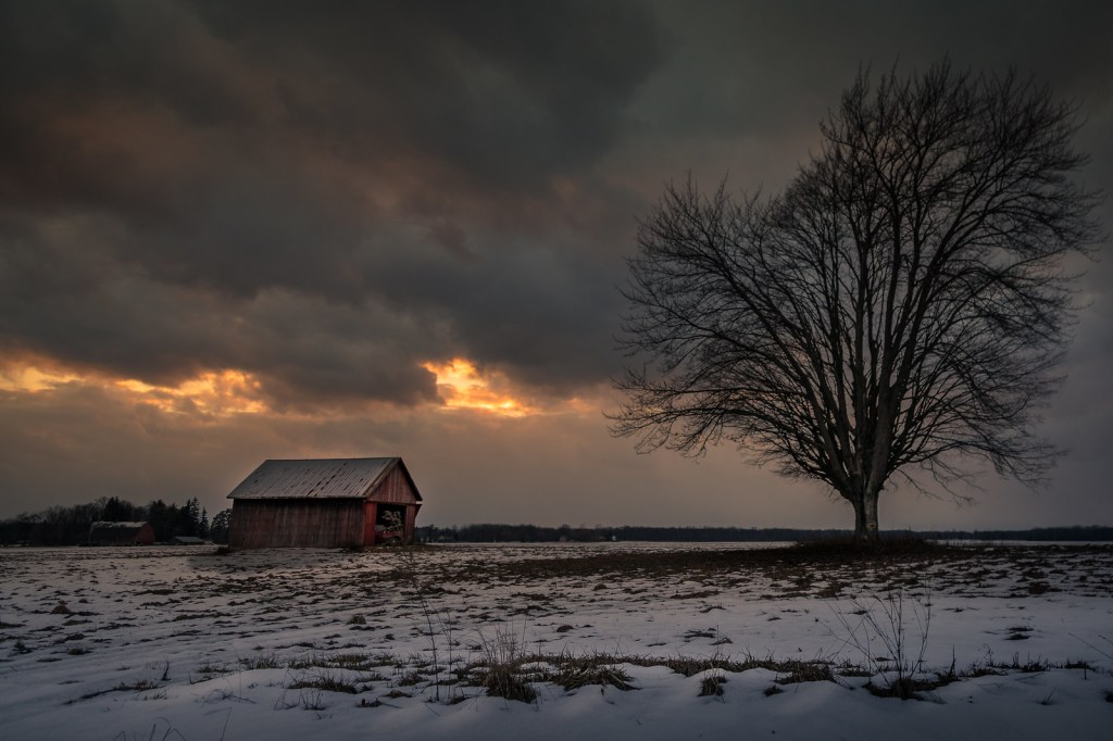
Christian took this back in February if 2017. See more in his barns – graneros gallery on Flickr.
Somewhere around Saginaw, Bay City, Clare and Traverse City, we could have a big shock going from temperatures in the 50s to temperatures near freezing.
Imagine going from Ann Arbor to Bay City to visit family Wednesday afternoon. You open the door in Ann Arbor to see what it’s like outside. It’s a common ritual at this time of year. It’s very nice. It’s 61 degrees, which right now feels like a spring dream. So you put on a light jacket and start driving north. You get out of your car in Bay City, and you freeze.
Definitely a day to keep an eye on the updated forecast!!
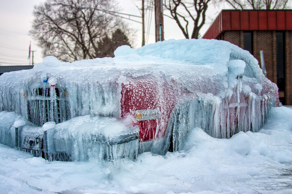
Tom captured this ice covered beauty in Utica way back in 2015. See more in his Winter gallery on Flickr!
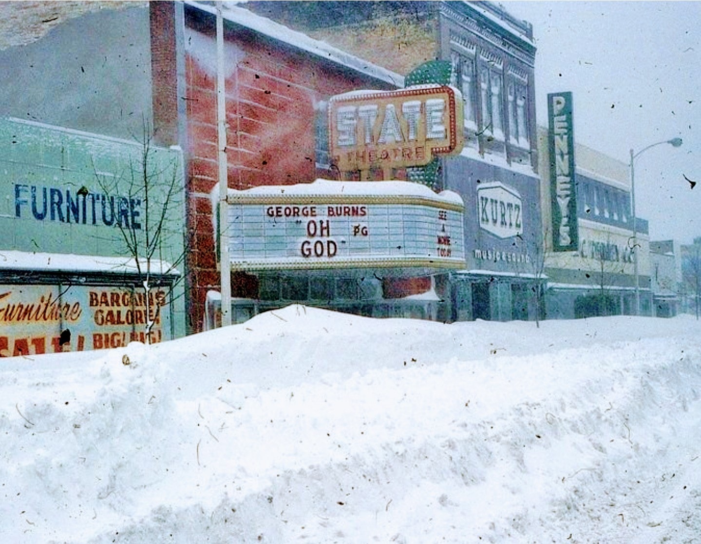
“The most extensive and very nearly the most severe blizzard in Michigan history raged throughout Thursday January 26, 1978 and into part of Friday January 27. About 20 people died as a direct or indirect result of the storm, most due to heart attacks or traffic accidents. At least one person died of exposure in a stranded automobile. Many were hospitalized for exposure, mostly from homes that lost power and heat. About 100,000 cars were abandoned on Michigan highways, most of them in the southeast part of the state.” -National Weather Service Ann Arbor Meteorologist in Charge, C.R. Snider on January 30th, 1978
48 years ago one of the most powerful blizzards in Michigan history brought the state to a standstill. In her feature on historical Michigan snow days in the now defunct Seeking Michigan, Jessica Miller of the Archives of Michigan related:
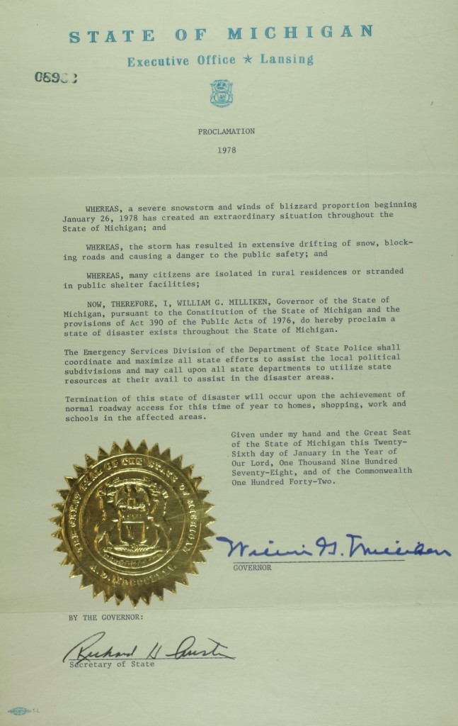
On January 26-27, 1978, snowstorms with fifty-to-seventy-mile per hour winds pummeled much of Michigan. Snowfall totals ranged from eighteen inches in Lansing to an incredible fifty-one inches in Traverse City. More than 100,000 cars were abandoned on roads and highways, and travel was impossible for days. Governor William G. Milliken declared a state of emergency on January 26 (See the image below.) and activated the National Guard to assist with the cleanup. The governor also requested financial assistance from the federal government and estimated damage totals to be more than $25 million, not including lost productivity from workers who were unable to get to their jobs.
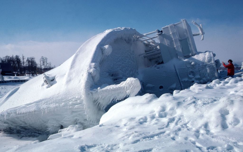
Regarding the photo, John wrote: Marty Lagina stands on the frozen pier at the Great Lakes Maritime Academy on January 29, 1978, viewing the capsized training vessel Allegheny, which capsized from ice buildup during the Blizzard of ’78. This image was on assignment for TIME magazine, who had seen my b&w image on the UPI wire and wanted a color image. Marty and I were lucky – the sky cleared and the wind stopped for about 20 minutes, then the storm began again. I wondered at the time who TIME knew to make that happen…
The only places not under an Extreme Cold Warning are the Southeast corner of the state – from Saginaw and The Thumb down to Flint, Ann Arbor and Detroit, as well as the Lansing and Jackson area along the southern rim of Michigan. Those southern and eastern spots are under a Cold Weather Advisory, as the cold is not expected to be quite as severe there.
The Extreme Cold Warning now covers the Upper Peninsula – where wind chills could plummet to -45 degrees over the next couple of days – and all of Northern Michigan and West Michigan. This extreme warning covers Grand Rapids, Holland, Muskegon, Traverse City, Gaylord and the Tip of the Mitt, too.
That’s a big yikes from me! Brian took this when we were deep in the polar vortex of January of 2019 from the South Pier in Grand Haven. See his latest on Flickr and STAY WARM!
PS: If you want to tune into the current scene in Grand Haven, check out the Grand Haven South Pier Cam!
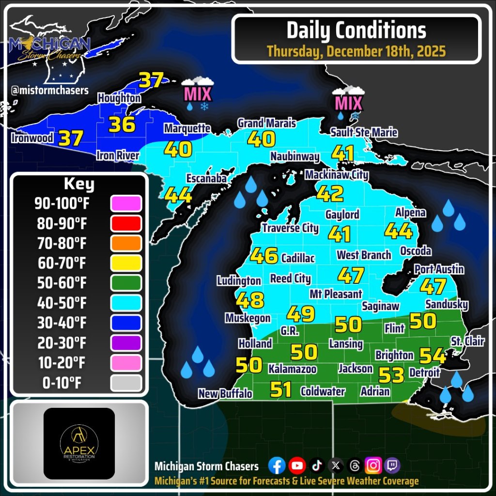
The folks at Michigan Storm Chasers share a detailed statewide Michigan weather forecast every morning that you should definitely incorporate into your daily feed. On Facebook they share that although we will see temps above freezing for most of the state, even topping 50 degrees in southern Michigan, temps will drop later in the day, potentially precipitously in what is known as a “flash freeze”. A flash freeze happens when rain has fallen, completely stopped, and then shortly afterward air temperatures drop from the 40s or 50s down into the 20s or colder. Ryan explains is all in their excellent video.
Michael shared this photo 13 years & one day ago on December 17, 2012, remarking that it was strange to see rain in December in the UP. Here are a couple more he shared to our Absolute Michigan group on Flickr, and you can see more in his The UP Eh! gallery.
“This Arctic air outbreak can be attributed to a displacement of the polar vortex,” AccuWeather Lead Long-Range Meteorologist Paul Pastelok said. “The outbreak this week will be the first of probably three such rounds with it. Another cold blast is likely next week and a third the week after that,” Pastelok explained. “The waves of Arctic air will lead to significant surges in energy demands.”
I originally shared this photo way back on April 1, 2010 along with a pretty funny spoof, and I am very happy to bring it back along with several more that Jill shared from The Heidelberg Project in Detroit, a truly astonishing work of activist art. See many more in her excellent Detroit gallery on Flickr & stay warm people!!
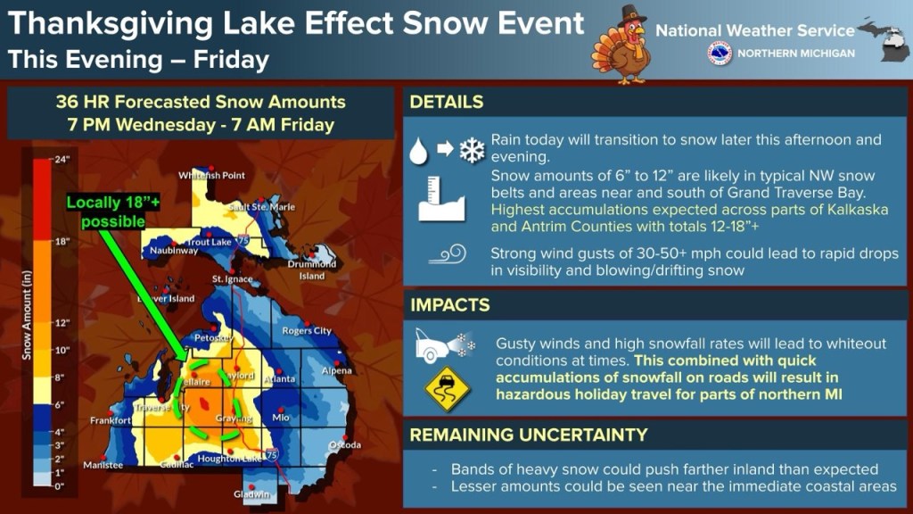
Bridge Michigan reports that AAA Michigan is predicting that 2.3 million Michigan residents will drive at least 50 miles between Nov. 25 and Dec. 1, a 1.4% increase from last year that could be higher given continuing air travel delays. mLive shares that the roads could be quite a bit less than optimal with a powerful winter storm expected along with tumbling temps on Wednesday. Snow totals over 3 FEET are possible in the UP with as much as 1 to 2 inches per hour falling. The Lower Peninsula (see NWS Weather Story below) will have high winds as well & wet, heavy snow close to 2 feet in inland Northern Michigan with less as you move south and east. All in all, it looks like a good time to allow more time for your holiday travels!!
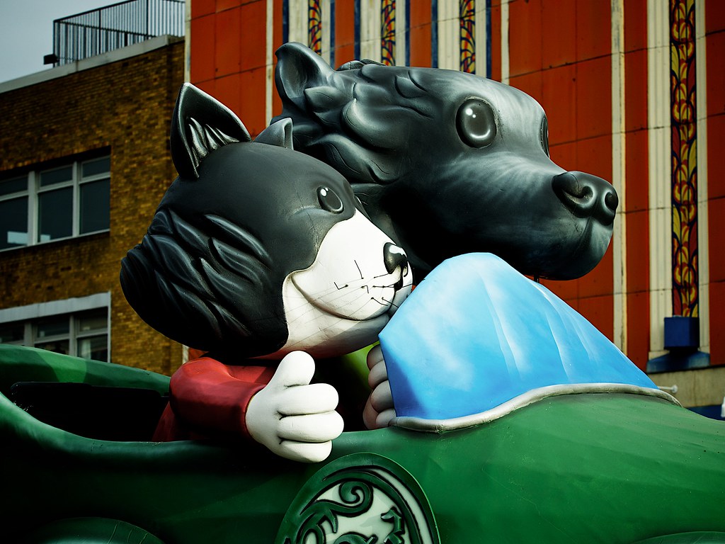
Joel has more photos of the parade including the frankly disturbing giant head parade corps in his Detroit Thanksgiving Parade 2014 gallery on Flickr. I also shot a video last year of many of the Big Head Marchers last year!
just don’t look into their eyes by Joel WilliamsBig Head Blessings by Joel Williams
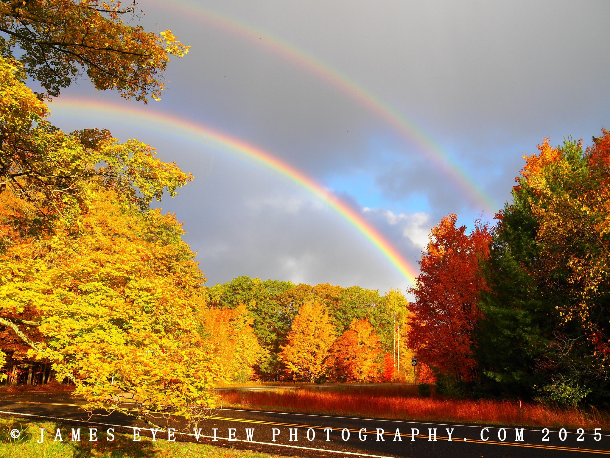
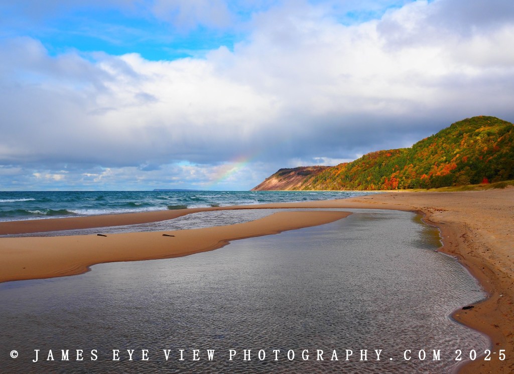
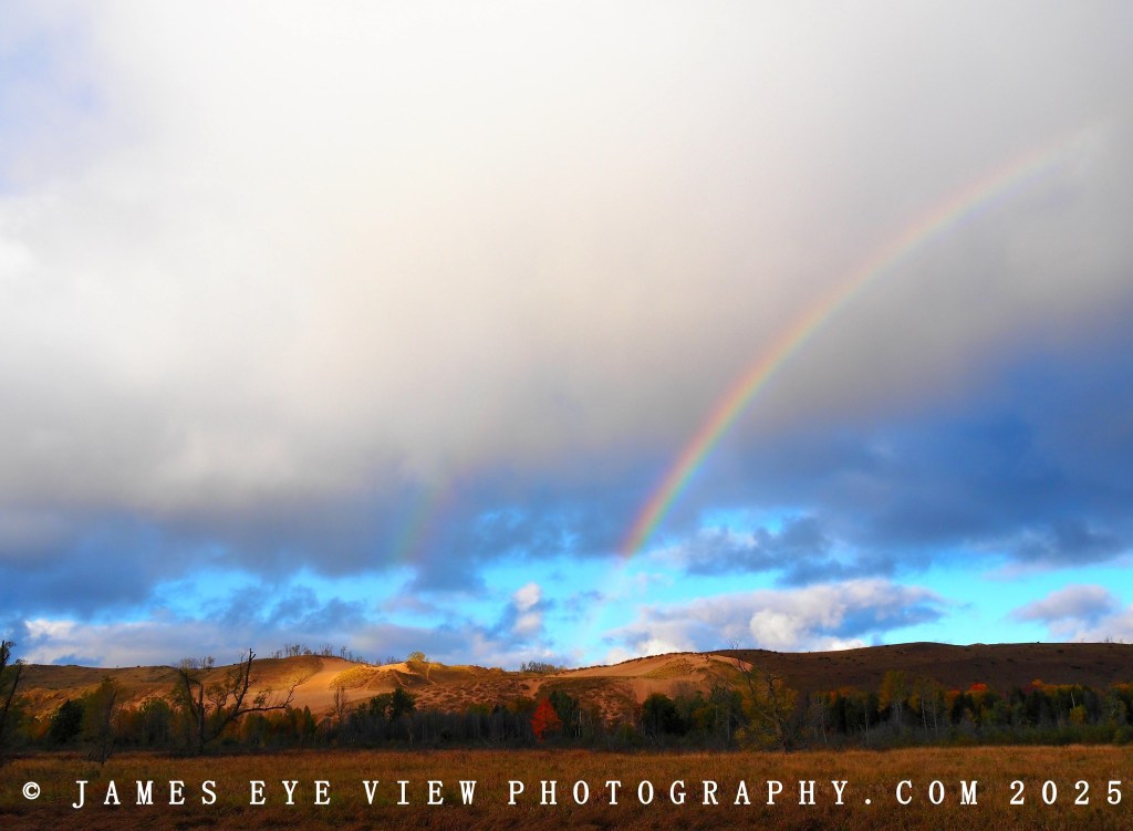
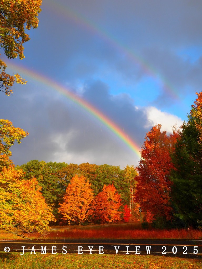
To have rainbows, we need rain and sun at the same time. What weather pattern is classic for rain and sun at the same time? The current lake-effect rain shower situation is perfect for rainbows. The rain showers are small, maybe only five miles wide. There is a lot of clear sky around the rain showers.
…So we know why we have had and currently have a lot of rainbows in Michigan in the past few days- the spotty lake-effect showers combined with sunshine. But why have there been numerous double rainbows? It has to do with the angle of the sun, combined with the daily weather pattern.
For a double rainbow, the sun has to be fairly low on the horizon, lower than 40 degrees above the horizon. It just so happens the lake-effect showers reach their peak intensity and coverage during the late afternoon heating of the day, when the sun is low on the horizon.
The good folks at EarthSky inform us that today (September 12, 2025) is International Cloud Appreciation Day. The Cloud Appreciation Society shares that it’s a day when people all around the world look up to appreciate the beauty of the clouds and contribute a photo of their sky to the Memory Cloud Atlas. The Atlas is an enduring and unifying record of people coming together from different locations and cultures in appreciation of our shared world and the most dynamic, evocative, and poetic nature of clouds.
I took this photo in August in Detroit’s Midtown neighborhood looking east over Woodward & Barlum Apartments, about 2 blocks from the Detroit Institute of Arts. If you would like to support me, please feel welcome to do so through Patreon or just sharing this blog with your friends & family!