Quiet water of the Presque Isle River

Presque-Isle-in-the-Porkies

Quiet water of the Presque Isle River. Porcupine Wilderness State Park, photo by Linda Carter

The Porcupine Mountain Wilderness State Park is the area of Michigan where I haven’t yet visited that I’m most fascinated with. One of the cool things for me about putting Michigan in Pictures together is learning new things about places, and Linda’s photo showed me something new about the Park! She writes:

The Presque Isle River (French explorers named it for the little island at the mouth of the river) is the largest and most dangerous flow through the Porcupine Mountains. The 3 waterfalls near its mouth are some of the most scenic in the Upper Peninsula of Michigan. The river forks at the end as it flows to Lake Superior. This picture is the right side, which is quiet and peaceful.

View her photo bigger and see more (including some of those waterfalls) in her Porkies slideshow.

The Anvil and the Pine

Cliffs from below

Cliffs from below, photo by David Clark

David writes that “The Anvil” is a high point where a white pine somehow makes a living growing out of a crack in the rock. On his blog, Cliffs and Ruins he writes:

This is one of my favorite places along the Cliff range: The Lookout. Apparently different people have different lookouts, but this is what I think of as the Cliff Lookout.

It’s a bit of a hike (no, you don’t have to go straight up the side of the cliffs… but you can if you want), but the view is 100% worth it. You can even see the silhouettes of the Huron Mountains in the distance. The most amazing thing, to me, is that tree — you can see it here. It’s a big old pine growing straight up out of the rock, over the edge of the cliffs.

There’s nothing quite like the solitude at the top of the lookout. When I snowshoed out to the lookout, there weren’t any tracks at all on the trail to the lookout — nor on the trail to the trail! It was one of those feelings which I love when I’m hiking up here — that I’m the first person in years to set foot here and see these sights. It might not be true, but this is still one of my favorite places to go whenever I really need some time alone.

View his photo background bigtacular and see more in his Winter slideshow. You can purchase David’s pics right here.

More winter wallpaper on Michigan in Pictures.

Baker’s Falls … and the Michigan in Pictures Twitter

bakers-falls-wakefield-mi

Bakers Falls, Wakefield, MI, photo by Josh Ringsmuth

Yesterday Michigan in Pictures joined Twitter @michpics. In addition to tweeting out the daily photo, I’m planning to dig out gems from the huge archive of pics & posts here, and also to share some of the many photos that I can never get around to featuring in the one-a-day format of Michigan in Pictures. I hope that you’ll follow me and tweet pictures at me there as well.

In honor of the occasion, I thought it would be good to share the first picture tweeted at me, even though it means back-to-back waterfalls. It’s of Baker’s Falls in the western U.P. aka Gabbro Falls about which GoWaterfalling says (in part):

Gabbro Falls is on the Black River and is as impressive, if not more impressive, than its more celebrated neighbors downstream along the Black River Scenic Byway. This is a largely wild waterfall with no fences or barriers of any kind. It consists of three separate drops. When the water is high there is a fourth drop that is the height of the other three combined. The main drop falls into a narrow crevice between two large rock formations.

Gabbro Falls is relatively easy to find but there is some confusing information out there. The waterfall is also known as Baker’s Falls, and it is often mistakenly called Garbo Falls (gabbro is a type of rock).

Read more & get directions at GoWaterfalling.com. Michigan in Pictures has more of those Black River waterfalls, and if you’re curious about gabbro, Wikipedia has your answers.

View the photo on Josh’s Twitter and follow him at @DaRealOtisJosh.

Tale of the tape at Laughing Whitefish Falls

Laughing Whitefish Falls

Laughing Whitefish Falls, photo by James Marvin Phelps

GoWaterfalling’s page on the Laughing Whitefish Falls says (in part):

Laughing Whitefish Falls is in the Laughing Whitefish State Park. This is one of the most impressive of Michigan’s waterfalls. I believe it is the highest waterfall in Michigan that is readily visitable.

The falls can be found off of M-94, about 30 miles from Munising or Marquette, and just outside of Chatham…

The waterfall is named for the river. The river is so named because the mouth of the river resembled a laughing fish when viewed by the Ojibwe from Lake Superior.

Get detailed directions at GoWaterfalling.com. They add that later in the year the water flow can get thin enough to be hardly visible!

To answer the question of the height, I found a very cool list of Michigan waterfalls by height at the World Waterfall Database. At 100 feet tall, Laughing Whitefish Falls check in fourth behind:

  • Spray Falls – 140′ (towering and incredible – view by Pictured Rocks boat tour or long hike)
  • Jasper Falls (125′, midway between Miners Beach & Sand Point along the Pictured Rocks National Lakeshore shoreline – they say it’s basically a trickle most of the time)
  • Houghton Falls (110′, private property/no trespassing! You can click that link for a Michigan in Pictures photo from someone who got permission from the landowner to visit)

View James’ photo on Flickr and see more in his massive Michigan Waterfalls slideshow including a few nice shots of Spray Falls and some waterfall videos!

PS: Just realized that this photo was from way back in 2005! Amazing that I’ve been doing Michigan in Pictures for so long, and that people like James have been supporting me with their photography for so long!

More Michigan waterfalls on Michigan in Pictures.

Fall color on Grand Sable Lake

Fall Colors On Grand Sable Lake

Fall Colors On Grand Sable Lake, photo by Gary McCormick

Gary took this back in September at Grand Sable Lake in the Pictured Rocks National Lakeshore.

Get it background bigtacular and see more in his Grand Marais, MI slideshow.

More Fall wallpaper & more Pictured Rocks on Michigan in Pictures.

Tis the season … to Surf Michigan

Marquette MI Surf 04-12-2013

Marquette MI Surf 04-12-2013, photo by Shawn Malone/Lake Superior Photo

The Great Lakes Echo has a great WKAR Current State feature produced by April Van Buren that I encourage you to check out to get a real feel for Michigan surfing. It’s titled Can’t get to California? Surf the Great Lakes and features Bob Beaton, president of the Great Lakes Surfing Association and Joe Matulis, owner of East Lansing-based paddleboard and surfboard company Matuli.

The story of surfing the 25 foot waves at Grand Haven the night the Fitz went down is reason alone to check it out, and this 15 minute feature takes you from the birth of Michigan surfing in the 70s when they tore the masts off of sailboats and made their own boards, to the recent past when they … well … still made their own boards while learning to surf to be more employable as ocean lifeguards, and all the way up to the present day with heated wetsuits that let you surf two hours in the dead of winter without a break. Except for the winter waves because this is Michigan, so of course the best waves are found in winter!

If you’re talking about cold weather surfing, it doesn’t get much colder than Lake Superior in April! Check out Shawn’s photo bigger and get many more from this April surfing session on Lake Superior in Marquette in her Marquette MI Surf 04-12-2013 album on Facebook. Shawn also has a gallery of some long period Superior winter waves at lakesuperiorphoto.com that was featured in Surfer’s Journal.

Lots more surfing on Michigan in Pictures.

Chasing Fall

Aubrieta at Cloud Peak

Aubrieta Hope at Cloud Peak, photo by Michigan Nut Photography

Aubrieta Hope shared this feature from the Pure Michigan blog about six photographers chasing UP fall color that includes three Michigan in Pictures regulars – Neil Weaver, Craig Sterkin & John McCormick. It begins:

Once upon a time, six shooters ventured north to the Tripod Forest, a fabled land of brilliant fall color in Michigan’s Upper Peninsula. All were packing: most brought Nikon’s, but two carried Canons. They loaded up minivans, SUV’s and 4×4′s, bringing filters and flashlights, bug spray, raingear, ice scrapers, and backpacks. About half of them planned to find a campsite someplace and the others made hotel reservations. Some had never met, but were destined to. A few of them hoped to cross paths up there somewhere.

It was late September and their only plan was to find and follow the color. Frost was in the forecast. The time was now. The 2014 Michigan Fall Foliage Convention had begun!

Click for more including photos of these folks in action!

View Aubrieta’s photo bigger at the Pure Michigan Blog and see her photography at michiganscenery.com. You can also check out the other photographers at Neil Weaver Photography, John McCormick’s Michigan Nut PhotographyCraig Sterken Photography, Phil Stagg’s MI Falls and Kenneth Keifer Photography.

Armistice Day Blizzards, yesterday & today

Super Storm on Superior

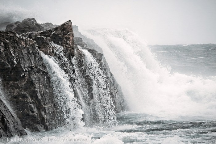
Super Storm on Superior, photo by Cory Genovese

74 years ago today on November 11, 1940, Michigan got blasted by one of the most severe November storms on record, the Armistice Day Blizzard. The Michigan Historical Marker in Ludington regarding the Armistice Day Blizzard says:

On November 11, 1940, a severe storm swept the Great Lakes area. As it crossed Lake Michigan, ships and seamen fought to reach safety away from its blinding winds and towering seas. Between Big and Little Points Sable the freighters William B. Davock and Anna C. Minch foundered with the loss of all hands. The crew of the Novadoc, driven aground south of Pentwater, battled icy winds and water for two days before being rescued by local fishermen. At Ludington the car-ferry City of Flint 32 was driven ashore, her holds flooded to prevent further damage. Elsewhere lives were lost and ships damaged in one of Lake Michigan’s greatest storms.

Also see the entry on the Armistice Day Blizzard at carferries.com. Wikipedia’s entry for the Armistice Day Blizzard adds that 66 people lost their lives on Lake Michigan on three freighters, the SS Anna C. Minch, the SS Novadoc, and the SS William B. Davock, as well as two smaller boats that sank and (at least) another 4 perished on land. There was one positive outcome though:

Prior to this event, all of the weather forecasts for the region originated in Chicago. After the failure to provide an accurate forecast for this blizzard, forecasting responsibilities were expanded to include 24-hour coverage and more forecasting offices were created, yielding more accurate local forecasts.

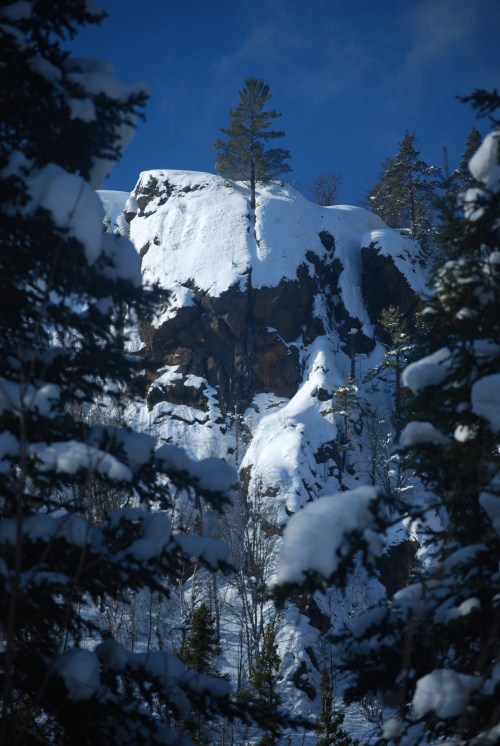
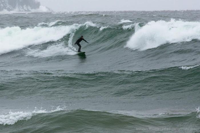
While it’s nothing like what happened in 1940, the Upper Peninsula is currently under a winter storm warning and looking at 8-16″ of snow today as an early season blizzard barrels through.

Cory took this shot on Lake Superior during the most severe late fall storm in recent times, Superstorm Sandy. View it bigger and see a lot more in his U.P. Winter ’12 & ’13 Gallery on his PhotoYoop page at Facebook.

More wild Michigan weather on Michigan in Pictures!

Cougar Cam Confirmation

Cougar Cam

Confirmed Cougar, photo by the Hiawatha Sportsman’s Club

It was just a few years ago that the Michigan DNR vehemently denied the presence of cougars in Michigan, but things have definitely changed. Regarding this photo taken November 1st by an automatic trail cam in the Hiawatha Sportsman’s Club (located near Engadine in the southern Upper Peninsula), the Club writes:

This photo was confirmed by the DNR on November 3rd. The location is the area of S-trail / A-trail, east towards the perimeter of HSC property.

Click to view it big as a cougar and see more photos at the HSC Facebook page including some more trail cam shots and few shared by Denise Conroy of a cougar on someone’s porch near Cedarville!

Follow the whole Michigan Cougar Controversy on Michigan in Pictures.

You can see it all from Mission Hill

mission hill overlook, chippewa county, michigan by twurdemann

mission hill overlook, chippewa county, michigan, photo by twurdemann

Regarding his photo from the Superior shore a couple weeks ago, twurdemann writes:

Autumn view from the Mission Hill Overlook / Mission Hill Cemetery, Brimley, Michigan- -32 km / 20 miles west of Sault Ste. Marie, Michigan. The overlook rises more the 50m / 165 feet above nearby Spectacle Lake. In the distance, Point Iroquois, St. Marys River / Whitefish Bay / Lake Superior, Gros Cap Crib Lightstation in the middle of the river (Ontario, Canada), Gros Cap Bluffs, Prince Township wind farm turbines (my link), and in the far distance the Batchewana Highlands (upper left)- -over 50 km / 30 miles away.

View this bigger and see more in his Autumn slideshow.