Fall…ing: Michigan is Still Michigan Edition

Fall-ing Northern Marquette County

Fall…ing, photo by Thom Skelding

Yep. This photo pretty much sums up the weekend!! In Michigan gets bragging rights to first heavy snow east of Rockies, mLive meteorologist Mark Torregrossa writes:

Michigan now has bragging rights to the first heavy snow of the winter, east of the Rockies. Overnight Friday, October 16, 2015, and this morning, lake effect snow has been falling in part of the Upper Peninsula and a large area of northwest Lower Michigan.

The Kalkaska area, east of Traverse City, has officially reported 5.7 inches of new snow.

The northwest Lower Michigan snow belt has received areas of two to five inches of the winter wonder.

Click through for more, including some photos.

View Thom’s photo background bigtacular and see more in his slideshow.

More fall wallpaper and more winter wallpaper

Autumnal Splendor at Lake of the Clouds

Autumnal Splendor

Autumnal Splendor, photo by Eric Hackney

True confession: I was asked to share less from northern Michigan and the Upper Peninsula. True answer: It’s really hard to turn my back on incredible visions like this! I will try and do better tomorrow. Promise. 

Also – new design for the blog. Not finished, but at least the pics are bigger. Thoughts & comments are appreciated.

Lake of the Clouds is one of the main attractions in the Porcupine Mountains State Park. Be sure to check out this interactive map & photo presentation from the Park that includes a 360-degree panorama from the spot atop Cuyahoga Peak where this photo was taken!

View Eric’s photo bigger and see more in his Landmarks & Landscapes slideshow.

PS: There’s more photos from Eric on Michigan in Pictures


Birds Eye View of the Huron Mountains

Birds Eye View of the Huron Mountains

Birds Eye View of the Huron Mountains, photo by Kristian Saile

Summit Post’s page on the Huron Mountains says:

The Huron Mountains encompass THE most wild and rugged territory in Michigan. It is a region of low, yet surprisingly rugged mountains, swamps, lakes, and high plateaus. It is because this is such a large and diverse region that I decided to devote a page to the entire range in addition to the two prominent peaks already on this site (Arvon & Hogback). The majority of peaks in this area are unnamed and for the most part inaccessible. I have spent many years living near them, spent countless hours and days exploring them and feel like I’ve barely scratched the surface. The region has become increasingly popular with climbers in the past few years for its numerous granite cliffs. You’ll need a local to find them though:)

The Huron Mountains are the largest range of mountains in Michigan yet they are not listed on any map. The boundaries of the range are vague but generally include the area north of US-41 between Marquette and L’anse. This is approx. a 1000 sq. mi. chunk of real estate without a single paved road.

The Hurons can be divided up into three ranges. The Arvon Range includes the highest peaks, Mount Arvon (1980′) and Curwood (1979′), in the state of Michigan. The Arvon Range runs generally north-south in eastern Baraga County. The most rugged section, The Huron Range, runs northwest-southeast to the west of Big Bay in northern Marquette County. The highest peak in this region is Ives Hill at approx. 1400 feet. This part of the mountains has the most rugged relief, the highest waterfalls, and the prettiest lakes. Unfortunately a good chunk of it privately owned by the uber-exclusive Huron Mountain Club and is off-limits to the general public. The third region is the most accessible, the Marquette Iron Range. This region runs from Lake Superior at Marquette west to the Lake Michigamme area. Hogback Mountain (1200′), listed separately, is part of this range but numerous unnamed peaks to the west rise to over 1700 feet.

Read on for more and also check out the post author’s Michigan hikes – a lot of cool ones!

My friend Kristian took this in early October of 2011 while flying with his buddy Jon over the Huron Mountains. Click to view it bigger (if you can’t see it on facebook, try this link).

Another friend, Dick Huey of upwaterfront.com, researched the location for me – click the pic below to see it bigger.

The-Huron-Mts.-in-the-Huron-Mt.-Club

More aerial photos on Michigan in Pictures.

Mission Hill, Spectacle Lake & Fall Color 2015

Mission Hill View Upper Peninsula Michigan

Mission Hill 3, photo by Susan H

Here’s a look-in on the current state of fall color in the northeastern Upper Peninsula. DWHIKE has this to say about the Mission Hill trail, which also affords views of Spectacle Lake & Monocle Lake:

Monocle Lake sits just inland from Lake Superior about a half hours’ drive west of Sault Ste. Marie. Along its south shore is a nice National Forest campground which serves as the trailhead for the days adventure. The Monocle Lake Trail heads east from the swimming area at the south end of the lake for little more than a quarter mile where it splits north and south in to the North Country Trail and the Mission Hill Trail respectively…

Directions to Trailhead: -Take Highway 221 north from M-28 west of Sault Ste. Marie. -Follow Hwy 221 for 2.5 miles, through Brimley, to Lakeshore Drive. -Turn left on Lakeshore Drive, follow it 5 miles to Tower Road on the left. -Follow Tower Road (which changes to dirt as you climb the hill) 1.5 miles to overlook and trailhead on the right.

Click above for a map where you can need both lakes and get more about the Monocle Lake Trail from the DNR.

Susan took this photo on Sunday. View it big as the sky and see more in her UP slideshow.

Lots more Fall wallpaper on Michigan in Pictures!

Under An Autumn Sunbeam: Fall Color Explained

Fall Color 2015 in Michigan

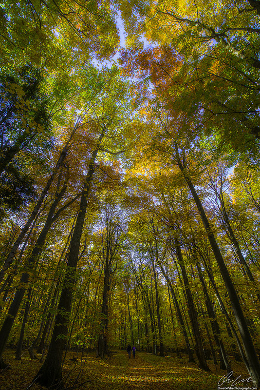
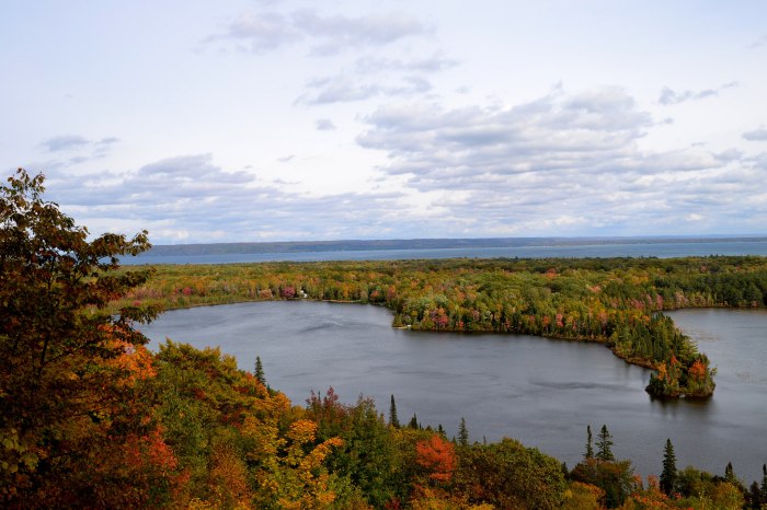
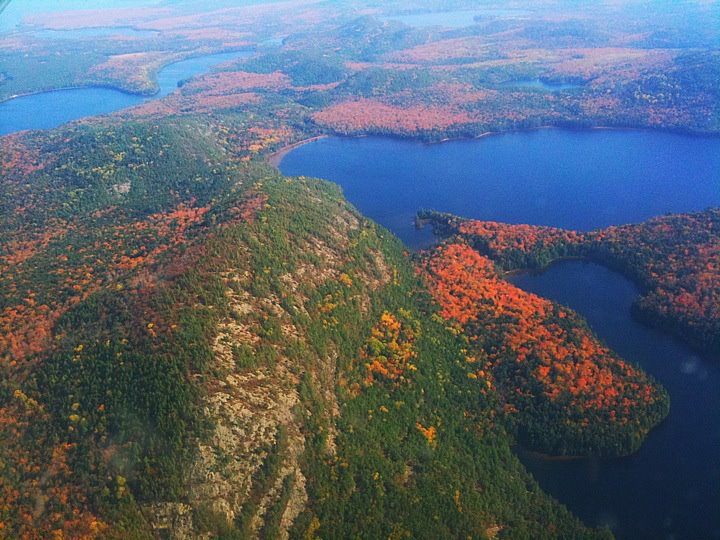
Under An Autumn Sunbeam, photo by Owen Weber

As we wait for the fall color season in Michigan to kick off, here’s a look back to last October and my annual rework of one of the most popular posts on Michigan in Pictures, the Science of Fall Color. If you already know the words you can sing along – have a great weekend folks!

The Science of Color in Autumn Leaves from the United States National Arboretum says (in part):

Many think that cool weather or frost cause the leaves to change color. While temperature may dictate the color and its intensity, it is only one of many environmental factors that play a part in painting deciduous woodlands in glorious fall colors.

…The process that starts the cascade of events that result in fall color is actually a growth process. In late summer or early autumn, the days begin to get shorter, and nights are longer. Like most plants, deciduous trees and shrubs are rather sensitive to length of the dark period each day. When nights reach a threshold value and are long enough, the cells near the juncture of the leaf and the stem divide rapidly, but they do not expand. This abscission layer is a corky layer of cells that slowly begins to block transport of materials such as carbohydrates from the leaf to the branch. It also blocks the flow of minerals from the roots into the leaves. Because the starting time of the whole process is dependent on night length, fall colors appear at about the same time each year in a given location, whether temperatures are cooler or warmer than normal.

During the growing season, chlorophyll is replaced constantly in the leaves. Chlorophyll breaks down with exposure to light in the same way that colored paper fades in sunlight. The leaves must manufacture new chlorophyll to replace chlorophyll that is lost in this way. In autumn, when the connection between the leaf and the rest of the plant begins to be blocked off, the production of chlorophyll slows and then stops. In a relatively short time period, the chlorophyll disappears completely.

This is when autumn colors are revealed. Chlorophyll normally masks the yellow pigments known as xanthophylls and the orange pigments called carotenoids — both then become visible when the green chlorophyll is gone. These colors are present in the leaf throughout the growing season. Red and purple pigments come from anthocyanins. In the fall anthocyanins are manufactured from the sugars that are trapped in the leaf. In most plants anthocyanins are typically not present during the growing season.

As autumn progresses, the cells in the abscission layer become more dry and corky. The connections between cells become weakened, and the leaves break off with time. Many trees and shrubs lose their leaves when they are still very colorful. Some plants retain a great deal of their foliage through much of the winter, but the leaves do not retain their color for long. Like chlorophyll, the other pigments eventually break down in light or when they are frozen. The only pigments that remain are tannins, which are brown.

Temperature, sunlight, and soil moisture greatly influence the quality of the fall foliage display. Abundant sunlight and low temperatures after the time the abscission layer forms cause the chlorophyll to be destroyed more rapidly. Cool temperatures, particularly at night, combined with abundant sunlight, promote the formation of more anthocyanins. Freezing conditions destroy the machinery responsible for manufacturing anthocyanins, so early frost means an early end to colorful foliage. Drought stress during the growing season can sometimes trigger the early formation of the abscission layer, and leaves may drop before they have a chance to develop fall coloration. A growing season with ample moisture that is followed by a rather dry, cool, sunny autumn that is marked by warm days and cool but frostless nights provides the best weather conditions for development of the brightest fall colors. Lack of wind and rain in the autumn prolongs the display; wind or heavy rain may cause the leaves to be lost before they develop their full color potential.

OK, sorry to share a novel with you. Might have to change the name of the blog to “Michigan in a Whole Bunch of Words with a Picture.”

Owen took this last October in Glen Arbor. View it bigger and see more in his Michigan slideshow.

PS: I have to think that it doesn’t look the same there this year due to the crazy storm they are still recovering from.

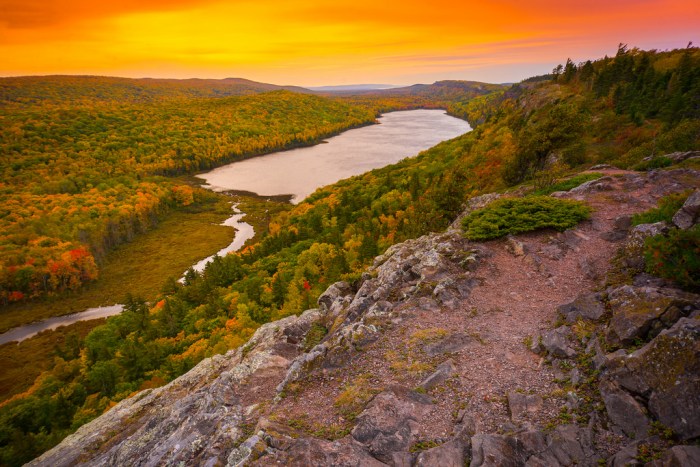
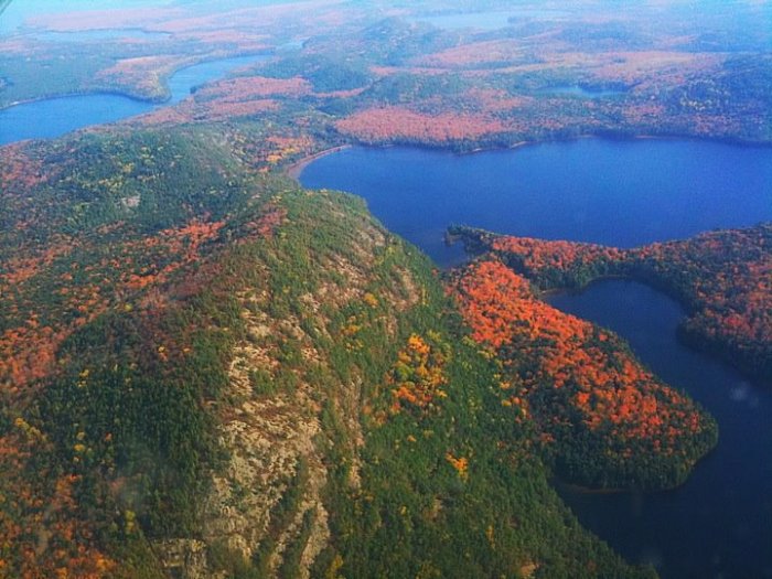
Tons more fall photos on Michigan in Pictures.

Dipping into October … and October’s Full Moon

Dipping into October

Dipping into October, photo by Aaron Springer

Keith’s Moon Names page says that the October full moon was known as the Hunter’s Moon by Colonial Americans, the Harvest Moon by the Cherokee and ancient Celts and the Blood Moon in Medieval England.

The Farmer’s Almanac says that October’s moon is full on the 27th at 8:05 AM and adds:

Many moons ago, Native Americans named this bright moon for obvious reasons. The leaves are falling from trees, the deer are fattened, and it’s time to begin storing up meat for the long winter ahead. Because the fields were traditionally reaped in late September or early October, hunters could easily see fox and other animals that come out to glean from the fallen grains. Probably because of the threat of winter looming close, the Hunter’s Moon is generally accorded with special honor, historically serving as an important feast day in both Western Europe and among many Native American tribes.

View Aaron’s photo bigger and see more in his slideshow.

Lots more moon lore on Michigan in Pictures!

Bond Falls in Autumn

Bond Falls in Autumn

Bond Falls in Autumn, photo by Tom Mortenson

Here’s the latest cover photo for Michigan in Pictures, one of many in the Michigan Cover Photos group on Flickr!

It’s from early October of 2013, and while it looks like our color season could be pretty darned good, it’s probably a little late this year. Via the Freep, it looks like the recent run of “Indian summer” is pushing color back:

The Upper Peninsula, which usually has plenty of fall color by this time in September, is still lolling around in green, reports Pure Michigan and the Foliage Network, which monitor fall color in the state.The very western Upper Peninsula as of Thursday was showing between 12% to 30% color, but the rest of the state had none.

Things seem to be about two weeks or more behind schedule.

Still, “cooler weather has taken hold and should help to get things going,” reports Market Rzonca, who runs The Foliage Network.

Pure Michigan’s fall color blog (Michigan.org/fall) predicted that peak fall color in the U.P., including Mackinac Island, is not expected to hit for about three weeks. Same with Alpena, Charlevoix and Ludington. Farther south, the show will come even later.

View Tom’s photo background bigtacular and check out more of Tom’s Michigan waterfall photos.

There’s more fall wallpaper, more about fall color, and more on Bond Falls on Michigan in Pictures.


Summer to Fall

Looking Out at Pictured Rocks

Looking Out, photo by Peter Tinetti

What a perfect photo from the Pictured Rocks National Lakeshore for the last day of summer as we prepare to make the leap into autumn tomorrow.

View this photo background bigtacular and see more in Peter’s slideshow.

There’s more Pictured Rocks and more Fall wallpaper on Michigan in Pictures!

Legend of the Crooked Tree

The Crooked Tree Petoskey

The Crooked Tree, photo by Robert Carter

Robert writes: Huge and ancient . . . this locally famous ‘Crooked Tree’ sits beside one of the roads near my home. “Crooked Tree”: “Crooked Tree Arts Center”, “Crooked Tree Breadworks”, “Crooked Tree Golf Club”, “Crooked Tree Septic Service”, “Crooked Tree This and Crooked Tree That”. This may not be the actual tree from which they take their names . . . but it is the most crooked tree I’ve come across in my travels, and it jumps out at everyone as they drive past.

Robert is correct that this isn’t the original. The Crooked Tree; Indian legends and a short history of the Little Traverse Bay region is available online and tells the story of the original Crooked Tree:

A tall, crooked pine tree overhanging a high bluff, served to designate what was probably the most important Indian village in the north, prior to the advent of the white man. “Wau-go-naw-ki-sa” the Crooked Tree could be seen for many miles by the occupants of approaching canoes. After rounding the northwestern extremity of what is now Emmet county, in the state of Michigan, on their way south, it was a familiar sight, and one that never failed to bring exultations of joy from the brave and daring Ottawas.

Just where the Crooked Tree stood we have been unable to ascertain; but tradition says it was in the vicinity of Middle Village of the present day. According to the legend it was bent by Na-na-bo-jo. Formerly it was straight, but as the great hunter and chieftain was climbing the hill one day at this point, with his canoe over his head, the end of the boat caught on the tree and gave him a bad fall. In anger he struck the tree a blow with his fist and bent it over. Where he hit the trunk a large swelling came out, and henceforward every knot or growth protruding from a tree was called “Na-na-bo-jo’s Fist.”

Read on for some cool stories from the area including some about the tree-punching Na-na-bo-jo!

View Robert’s photo bigger and see more in his My Petoskey slideshow.

Tahquamenon Falls Thursday

Tahquamenon Falls Thursday

Tahquamenon Falls, photo by Charles Bohnam

The Tahquamenon Falls State Park page says:

Tahquamenon Falls State Park encompasses close to 50,000 acres stretching over 13 miles. Most of this is undeveloped woodland without roads, buildings or power lines. The centerpiece of the park, and the very reason for its existence, is the Tahquamenon River with its waterfalls. The Upper Falls is one the largest waterfalls east of the Mississippi. It has a drop of nearly 50 feet and is more than 200 feet across. A maximum flow of more than 50,000 gallons of water per second has been recorded cascading over these falls. Four miles downstream is the Lower Falls, a series of five smaller falls cascading around an island. Although not as dramatic as the Upper Falls, they are equally magnificent. The falls can be viewed from the river bank or from the island, which can be reached by rowboat rented from a park concession. The island walk affords a view of the falls in the south channel.

This is the land of Longfellow’s Hiawatha – “by the rushing Tahquamenaw” Hiawatha built his canoe. Long before the white man set eyes on the river, the abundance of fish in its waters and animals along its shores attracted the Ojibwa Indians, who camped, farmed, fished and trapped along its banks. In the late 1800’s came the lumber barons and the river carried their logs by the millions to the mills. Lumberjacks, who harvested the tall timber, were among the first permanent white settlers in the area.

Rising from springs north of McMillan, the Tahquamenon River drains the watershed of an area of more than 790 square miles. From its source, it meanders 94 miles before emptying into Whitefish Bay. The amber color of the water is caused by tannins leached from the Cedar, Spruce and Hemlock in the swamps drained by the river. The extremely soft water churned by the action of the falls causes the large amounts of foam, which has been the trademark of the Tahquamenon since the days of the voyager.

Click through for maps, photos & more.

View Charles’s photo background bigtacular (really – do it!) and click more of his waterfall photos.

Lots more Tahquamenon Falls on Michigan in Pictures and (just found it) waterfall wallpaper. :)