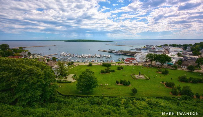
Beautiful Mackinac Island by Mark Swanson
“Mackinac is a place largely visited by people from all parts of our country, and I take it from many foreign lands. A National Park is established on the island and I think the military post should be made not only comfortable but attractive.”
-Quartermaster General Montgomery Meigs
It’s a birthday of sorts for Mackinac State Historic Parks which is a treasure trove of our colonial history. The page from Mackinac Parks on Fort Mackinac and the Mackinac National Park explains the birth of the park and how one forward thinking officer may very well have created the model for historical preservation in the park that holds so much of Michigan and the nation’s cultural history:
After Congress created Yellowstone in 1872, Senator Thomas Ferry introduced legislation to create a second park on Mackinac Island. In addition to the island’s attractive history and natural features, the U.S. government already owned much of the island as part of the Fort Mackinac military reservation and the soldiers stationed at Fort Mackinac could act as caretakers. As a result, the park would cost almost nothing, which Ferry knew appealed to the tight-fisted Congressmen of the 1870s. After two years of campaigning, President Ulysses Grant created the Mackinac National Park, the second park in the country, on March 3, 1875.
The park made Mackinac Island even more attractive to Midwestern visitors, and brought changes to Fort Mackinac, where the commanding officer became the park superintendent and a second company of soldiers joined the garrison. The Army finally performed some long-overdue repairs at the fort … Quartermaster General Montgomery Meigs believed that “the fort itself is to the public one of the greatest curiosities within the lands of the park,” and required the fort’s commanding officer, Major Alfred Hough, to repair the post’s aging blockhouses. Although the blockhouses served no military purpose, Meigs knew that they were “among the few relics of the older time which exist in this country,” and believed that “there would be a cry from tourists” if they were destroyed. Fort Mackinac thus became as much a part of the national park as the island’s natural curiosities.
…On September 16, 1895, the last soldiers formally transferred Fort Mackinac and the Mackinac National Park to the state. Although the national park ceased to exist with this transfer, the state immediately created the Mackinac Island State Park, which continues to welcome thousands of Mackinac Island visitors every year.
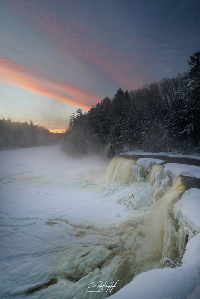
Mark took this photo back in the summer of 2017 from the cannon deck at Fort Mackinac on the Island. See more in his Mackinac, Michigan gallery on Flickr.
Lots more from Mackinac on Michigan in Pictures!

Share Michigan in Pictures:

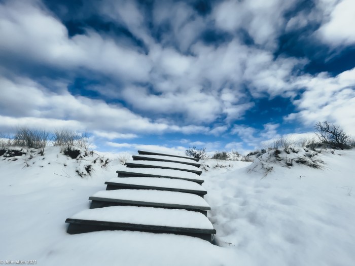
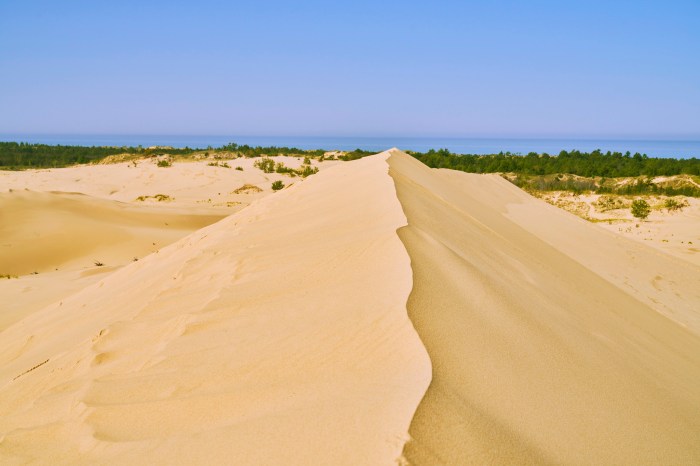
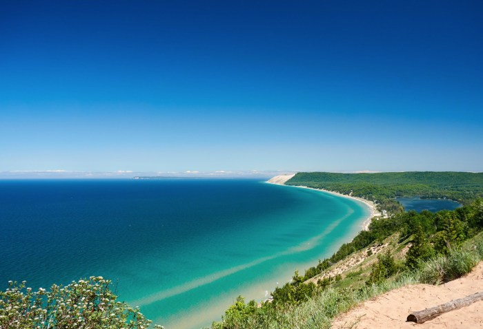
 Beginning in 1919 a small portion of what is now the national lakeshore was set aside as a state park. The idea of a national park in northwestern Michigan did not surface until the National Park Service’s Great Lakes Shoreline Survey visited the area in 1958. Between 1959 and 1970 there was a continuous and controversial effort in Congress to create a park unit around the Sleeping Bear Dune. The legislative leader of the Sleeping Bear park proposal was United States Senator Philip A. Hart. The senator’s persistence and patience in the end led to the creation of Sleeping Bear Dunes National Lakeshore on October 21, 1970.