Warren Dunes State Park has three miles of shoreline and six miles of hiking trails on nearly 2000 acres. It is open year-round, and the centerpiece is the dune formation that rises 260 feet above the lake and offers spectacular views. It’s also our busiest state park!
On December 30, 2005 I posted the first photo to Michigan in Pictures. 11 years later, it’s still going so I guess I must be doing something right. Thanks to all you photographers and fans for being a part of Michigan in Pictures!!
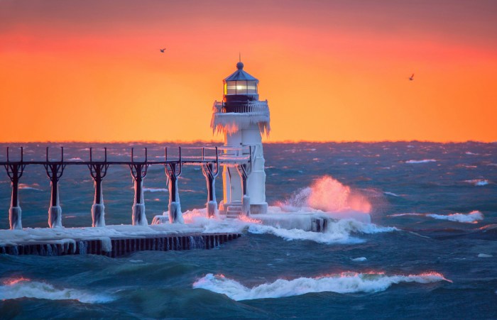
I figured Lake Michigan popping its cork would be better than champagne.
As I work on the year in review of the year’s top photos on Michigan in Pictures, I thought it would be cool to share regular contributor John McCormick’s favorite 2016 photos on his Michigan Nut Photography site. A couple made Michigan in Pictures this year and the choice of which one to feature was hard so check them all out!
Baby, it’s cold outside. I hope you enjoy the July sunset from South Haven which seems more than half a world away from the teens and single digits that are out there this morning.
As Michigan deals with the first winter storm of the season, it’s a good time to brush up on how Michigan’s lake effect snow machine works with a nice video (below) from mLive chief meteorologist Mark Torregrossa who writes:
The areas hit by lake effect are called snowbelts. Some parts of the snowbelts typically get much more snow than other parts. This is because some locations get lake effect from multiple wind directions. Good examples are in the heart of the northwest Lower Peninsula snowbelt. Mancelona and Gaylord get heavy lake effect with northwest, west and slightly southwest winds. Also, the Keweenaw Peninsula, sticking out into Lake Superior, can get lake effect snow from west winds to north winds to northeast winds. That’s why they often shovel over 200 inches of snow in Houghton, MI.
The opposite is true for Grand Rapids and to some extent, Traverse City. Grand Rapids needs a west to southwest wind for heavy lake effect. West winds are common in winter, but don’t tend to last for more than 12 hours. That’s why Grand Rapids often gets only 12 hours of heavy lake effect and a few inches of snow. The wind then veers to the northwest and areas around Holland and Allegan get buried. Downtown Traverse City has a hard time getting heavy lake effect also. Traverse City needs a north-northwest wind to straight north wind for the heaviest lake effect to move into downtown. That wind flow does happen, but it only lasts 24-48 hours a few times each winter.
Thanks to another Mark, Mark Miller, for today’s photo of the Ice Beast of the Frozen Tundra aka Major. View the photo bigger and see more in his “Major” slideshow.