Wikipedia’s entry for Lake Huron says that Lac Huron was named by early French explorers after the Huron people inhabiting the region. Lake Huron is the second largest of the Great Lakes and the third largest fresh water lake on earth with a surface area of 23,010 sq mi, a volume of 850 cubic miles and a shoreline length of 3,827 mi.
The Great Lakes Information Network page on Lake Huron pegs it as the 5th largest lake in the world and adds:
It has the longest shoreline of the Great Lakes, counting the shorelines of its 30,000 islands.
It contains Manitoulin Island, largest freshwater island in the world.
Georgian Bay and Saginaw Bay are the two largest bays on the Great Lakes.
Huron was the first of the Great Lakes to be discovered by European explorers. Since its French discoverers knew nothing as yet of the other lakes, they called it La Mer Douce, the sweet or fresh-water sea. A Sanson map in 1656 refers to the lake as Karegnondi, simply meaning “lake” in the Petan Indian language.
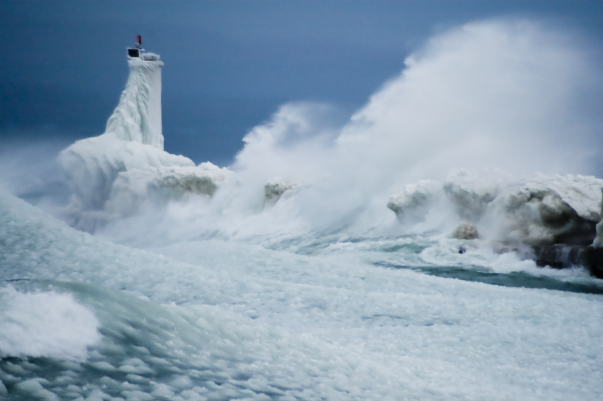
“No lake master can recall in all his experience a storm of such unprecedented violence with such rapid changes in the direction of the wind and its gusts of such fearful speed! Storms ordinarily of that velocity do not last over four or five hours, but this storm raged for sixteen hours continuously at an average velocity of sixty miles per hour, with frequent spurts of seventy and over.
Obviously, with a wind of such long duration, the seas that were made were such that the lakes are not ordinarily acquainted with. The testimony of masters is that the waves were at least 35 feet high and followed each other in quick succession, three waves ordinarily coming one right after the other.
~Report from the Lake Carriers Association in the wake of the Great Lakes “White Hurricane”
97 years ago the Great Lakes region reeled under the deadliest storm in its history. Known as the “Big Blow” and the “Freshwater Fury”, was a blizzard with hurricane-force winds that devastated the Great Lakes Basin in the Midwestern United States and the Canadian province of Ontario from November 7 through November 10, 1913. Read on for more!
Dear wife and Children. We were left up here in Lake Michigan by McKinnon, captain James H. Martin tug, at anchor. He went away and never said goodbye or anything to us. Lost one man yesterday. We have been out in storm forty hours. Goodbye dear ones, I might see you in Heaven. Pray for me. / Chris K. / P.S. I felt so bad I had another man write for me. Goodbye forever.
~A message found in a bottle 11 days after Plymouth disappeared, dictated by Chris Keenan, federal marshal in charge of the barge.
Wikipedia says that the Great Lakes Storm of 1913, also known as the “Freshwater Fury“or the “White Hurricane”, was a blizzard with hurricane-force winds that ravaged the Great Lakes November 7-10, 1913. With the sinking of 19 ships, the stranding of another 19 and a death toll of at least 250, it remains the deadliest and most destructive natural disaster in Great Lakes history.
Major shipwrecks occurred on all but Lake Ontario, with most happening on southern and western Lake Huron. Lake masters recounted that waves reached at least 35 feet (11 m) in height. Being shorter in length than waves ordinarily formed by gales, they occurred in rapid succession, with three waves frequently striking in succession. Masters also stated that the wind often blew in directions opposite to the waves below. This was the result of the storm’s cyclonic motion*, a phenomenon rarely seen on the Great Lakes.
In the late afternoon of November 10, an unknown vessel was spotted floating upside-down in about 60 feet (18 m) of water on the eastern coast of Michigan, within sight of Huronia Beach and the mouth of the St. Clair River. Determining the identity of this “mystery ship” became of regional interest, resulting in daily front-page newspaper articles. The ship eventually sank, and it was not until early Saturday morning, November 15, that it was finally identified as the Charles S. Price. The front page of that day’s Port Huron Times-Herald extra edition read, “BOAT IS PRICE” DIVER IS BAKER “SECRET KNOWN”. Milton Smith, the assistant engineer who decided at the last moment not to join his crew on premonition of disaster, aided in identifying any bodies that were found.
“In terms of the whole food web, I don’t think there’s any question that zebra and quagga mussels have had the largest impact on the biological communities of the Great Lakes”
~Tom Nalepa, Great Lakes Environmental Research Laboratory
Today’s villain in our Michigan Invasive Species series are Zebra Mussels & Quagga Mussels. That feature on Absolute Michigan goes in depth about who they are and what they do so I won’t go on and on here except to say that as someone who walks the beaches of Lake Michigan often, there’s few things that make me sadder or madder than these little bastards. They’ve trashed the food chain, spawned all manner of nasty plants & algae and they slice up your feet.
Todd writes:
This stretch of beach on South Manitou Island was once filled with sugary white sand. Today, the beach is covered in razor sharp zebra mussel shells. I knelt to take then photo, and when I stood, my knee was bleeding in 3 places.
“They just eat so much,” says David Ullrich, executive director of the Great Lakes and St. Lawrence Cities Initiative. “They’re like the locusts of the river.”
That’s what makes them so dangerous to the lakes. Asian carp aren’t direct predators, but they eat plankton, which knocks out the bottom layers of the food chain. If they were to successfully establish themselves in the Great Lakes and start breeding, they could utterly disrupt the existing ecosystem, potentially starving out the trout and other native fish that make the Great Lakes a tourism hot spot.
Estimates put the Great Lakes sport and commercial fishery at $2.5 to $7 billion. While the loss of this would be a terrible shame, the thought that one day you wouldn’t see photos like this of a parent and child enjoying Michigan’s amazing fishery seems worse to me.
Rob feels this is one of the best photos he’s ever taken. Check it out bigger and in his slideshow.
And if you can, make sure you write your representatives to tell them how important it is to stop the Asian carp in Chicago!
All week we’re going to be featuring invasive species – who they are, what they’re doing to our lakes & land and how folks are working to stop them. See the articles as we post them on Absolute MichiganMichigan in Pictures and !
I actually already blogged this photo to Pandora’s Locks: How Invasive Species got into the Great Lakes on Absolute Michigan. The book is a must-read for anyone who wants to learn how the way the shipping industry operates guarantees that invasive species will spread.
You will note that John has TWO invaders here, the zebra mussel and the Asian ladybird beetle. Check this out bigger in John’s slideshow!
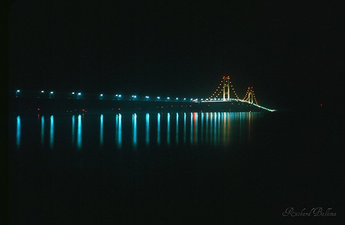
Every year, thousands of people come to the Mackinac Bridge on the morning of Labor Day for the annual Mackinac Bridge Walk. They’ll do it again at the 53rd annual walk on Monday, September 6, 2010 from 7-11 AM.
To enter, all you need to do is add 1-3 photos of any Michigan lake, river, waterfall, pond or wetland to the Michigan Water Group on Flickr by July 23, 2010.
Here’s the Michigan Water slideshow – what an amazing gift we have been given in Michigan! Here’s hoping we can protect it.
In this week’s Traverse City Area Chamber of Commerce e-News, Laura Oblinger wrote :
In 1957, the Mackinac Bridge connected the state to new economic and social opportunities. More than a half-century later, high-speed Internet service (broadband) can have a similar impact by connecting all regional businesses to the global marketplace. Statewide broadband deployment is projected to result in a $400 billion increase in the state’s gross state product over 10 years.
If tourists can remain connected to their work, it could mean an additional $52 million to the Traverse City area economy due to stays being extended by just two days.