Grand Island East Channel Light

Picture Rock Light House

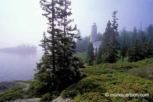
Picture Rock Light House, photo by wlmgram.

The Grand Island East Channel Light entry at Terry Pepper’s Seeing the Light begins:

Grand Island stands at the entrance to Munising Bay, with its south shore long serving as a natural harbor of refuge to vessels seeking shelter from the fury of Superior’s late season storms. So critical was the area considered by mariners that one of the big lakes’ first lighthouses was built on the north tip of Grand Island in 1856, to both warn coasting captains of the northern point of the island and to indicate the safe harbor located to the south. While the lighthouse served both purposes well, it did little to provide assistance to captains making their way through the harbor passages one the east and west sides of the island, through which entry was difficult under conditions of good visibility, and next to impossible under the cover of darkness.

To this end on February 27, 1860, Senator Chandler presented a petition signed by masters, pilots and owners of vessels sailing through the area “praying the erection of two light-houses upon the entrance to Grand Island bay and harbor.”

In addition to being one of the first lights on Lake Superior, it was also one of the first to be decommissioned. Click through to Terry’s site to read on and to see more pictures. He notes that you pass this light if you take the Pictured Rocks Boat Cruise. You can also see a Map to Grand Island light at Lighthouse Friends.

Be sure to check this out bigger and also see Wendy’s slideshow for a few more lighthouse photos.

Detroit Aerial Photography: Above Belle Isle

Detroit

Detroit, photo by paulhitz.

This photo is part of Paul’s Detroit Aerial Photography set (slideshow).

Be sure to check it out bigger.

Rain on My Sunset at Isle Royale

Rain on My Sunset

Rain on My Sunset, photo by yooper1949.

Take a trip to Isle Royale National Park with yooper1949 (slideshow) and be sure to check this beauty out bigger.

Isle Royale National Park is one of our state’s true treasures. You can see more photos from this beautiful Michigan island in the Isle Royale National park group. Two cool ways to explore the pics is through this group slideshow and the Isle Royale group Flickriver.

Hope you all have a happy weekend wherever you may be.

The Islands of Isle Royale

Little Dean Is.

Little Dean Is., photo by yooper1949

Wikipedia lists islands in Isle Royale National Park (but not this one):

  • Amygdaloid Island – has a ranger station
  • Barnum Island
  • Beaver Island – has a campground
  • Belle Isle – a small island just off the north shore of Isle Royale at the head of Belle Harbor. It is the site of a primitive campground and is visited every second day during the peak season by the island-circling ferry.
  • Caribou Island – has a campground
  • Grace Island – has a campground
  • Johns Island
  • Long Island
  • Menagerie Island – has a lighthouse
  • Mott Island – summer park headquarters
  • Passage Island – has a lighthouse and short trail
  • Raspberry Island – has a nature trail
  • Rock of Ages – has a lighthouse
  • Ryan Island – the largest island in the largest lake on the largest island in the largest freshwater lake in the world
  • Tookers Island – has a campground
  • Washington Island
  • Wright Island

Learn more from Isle Royale National Park (U.S. National Park Service) and check this out bigger (along with many more) in Carl’s spectacular Isle Royale Natonal Park slideshow.

Rock Harbor Lighthouse, in lifting fog – Isle Royale National Park

Rock Harbor Lighthouse, in lifting fog - Isle Royale National Park

Rock Harbor Lighthouse, in lifting fog – Isle Royale National Park, photo by Mark S. Carlson

Mark writes:

This was one of my favorite photographs made during my last visit to the island in spring 2006. I’ve been to the wilderness isle many times and every time is special. It’s ruggedly beautiful, inspirational and one of the most exciting places in Michigan to make photographs if you appreciate pure nature.

You can see more from the island in Mark’s Isle Royale gallery, and more of Michigan in his other galleries and in his book Michigan, Simply Beautiful. Along with fellow photographer Mark also operates Great Lakes Photo Tours, providing personalized and in-depth instruction in nature photography in some of Michigan and the region’s most beautiful locations.

The entry for Rock Harbor Lighthouse at Terry Pepper’s Seeing the Light tells the history of this remote lighthouse and includes a number of historical photos. With the boom of mining on Isle Royale and the new lock at the Soo, a light at Rock Harbor was approved by Congress (for the outrageous sum of $5000). The light was completed in 1856 and:

The station’s rubble stone tower stood 16 feet 11 inches in diameter at the foundation, with its 49 foot 11 inch high walls tapering gently to a diameter of 14 feet 1 inch below the circular gallery. A set of spiral pine stairs supported by a central pine post wound within the tower from the first floor to a trap door in the gallery floor to provide access to the lamp. The lantern itself was fabricated of cast iron, and featured a domed copper roof. Centered within the lantern, a fixed white Fourth Order Fresnel lens sat at a focal plane of 70 feet above lake level, and cast its light 15 miles across the lake The attached rubble stone dwelling, stood 29 feet square and 20 feet 9 ½ inches high at the apex of the cedar shingled roof.

View from the top of Sugarloaf Mountain … and a flight to Marquette

View from the top of Sugarloaf Mountain

View from the top of Sugarloaf Mountain, photo by kcox5342.

I believe that I have the best job in the world (or at least the part of it that includes Michigan in Pictures). Not only do I get to discover cool pictures like this view of Lake Superior from Sugarloaf Mountain near Marquette and cool sets of photos like the photographer’s Upper Peninsula of Michigan (slideshow).

I also get to stumble into the dawn of the next internet with things like kcox5342’s photo of Marquette’s lower harbor that uses a nifty script called flickrfly and Google Earth to fly to the location of photos.

If you have Google Earth installed, click the photo link above to fly to Marquette’s lower harbor!

You can also check out the location of Sugarloaf Mountain on the Absolute Michigan Map of Michigan.

Lilacs and the Mackinac Island Lilac Festival

lilacs 2008 05-10 03

lilacs 2008 05-10 03, photo by Ray-48.

Wikipedia says that Syringa (Lilac) is a genus of about 20–25 species of deciduous shrubs or small trees in the olive family (Oleaceae), native to Europe and Asia.

Although lilacs in Michigan typically bloom in mid to late May in most locations, it’s not until June that Mackinac Island holds their annual Mackinac Island Lilac Festival:

Celebrating Mackinac’s lilac collection began in 1949 after a conversation with Evangilene “Ling” Horn, Nurse Stella King and Mackinac Island Carriage Tours veterinarian Dr. Bill Chambers. The idea was to bring people to the Island to enjoy a great horse drawn parade amidst the lovely lilacs that fragrance the Island in June. What began as a one day event called the Mackinac Island Lilac Day has blossomed into a ten day festival.

2008 is the 59th annual Lilac Festival and it takes place June 6-15. You can go to mackinacislandlilacfestival.org to learn much more about the festivities which include parades, coronation of the Lilac Queen and lots of lilac walks and talks, concerts and even a dog and pony show (I thought that was just a figure of speech).

Huron Island Light Station from the Michigan Lighthouse Collection

Huron Island Light Station

Huron Island Light Station c. 1965, Archives of Michigan

The Archives of Michigan has a number of digital collections including the Michigan Lighthouse Collection. With almost 600 photos, the Lighthouse Collection is a great resource for lovers of lighthouses and historical photos.

The entry on the Huron Island Light Station in Terry Pepper’s Seeing the Light begins:

When the Soo Locks opened in 1855, maritime traffic boomed around the Keweenaw, with immigrant miners and supplies arriving at the growing number of harbors, and huge loads of copper shipped to feed the incessantly hungry furnaces of the industrial cities of on the southern lakes.

With this increasing vessel traffic it became quickly apparent that the Huron Island chain represented a significant hazard to vessels making their way along the coast. Marking the turning point for vessels coasting in either direction between the lights of Marquette and Portage River, the islands were surrounded by dangerous shoals, were frequently enshrouded in pea-soup fogs, and had been the site of numerous shipwrecks over the years.

You can see more Huron Island Light Station photos from the Archive of Michigan’s Lighthouse Collection, get information about the Huron Island Light from the National Park Service lighthouse inventory, check out a few  photos and a map from Lighthouse Friends and also get a more recent view of the Huron Island Lighthouse feature from Michigan in Pictures.

The Detroit Belle Isle Grand Prix

Raw00340

Raw00340, photo by ktpupp.

Sometimes I make a note to post about something at a later date, lose the note and then when the later date rolls around, realize that I’ve become a party to one of my pet peeves: telling folks about something when it’s too late to make any plans for it. That’s what happened with my plan to post something about the 2007 Detroit Grand Prix. Ah well, such is life…

The Detroit Belle Isle Grand Prix official site says that the Detroit Belle Isle Grand Prix returns after a 6 year absence and features the cars of the American Le Mans Series (Detroit Sports Car Challenge on Saturday at 3:15) and the IndyCar Series (Detroit Indy Grand Prix on Sunday at 3:30 on ABC). Net proceeds raised by the Grand Prix will fund measures to preserve and improve Belle Isle, and the Detroit Belle Isle Grand Prix has earmarked $100,000 in cash for the improvement and preservation of Belle Isle (Belle Isle park page).

Here’s a map of the course, which is also available in the Detroit News interactive tour of the course. Over at Jalopnik they’ll be covering the race all weekend (check the Detroit Grand Prix tag) and they have a video of the pace car navigating the course (there’s also some historical footage from past Detroit Grand Prix in the menu at the end of the video).

Wikipedia’s Detroit Indy Grand Prix entry has a bit about the history of the race and there’s some more in the US Grand Prix history pages.

The photo above is part of Kate’s Detroit Belle Isle Grand Prix 2007 set (slideshow). She has a photo from the qualifying of pole-sitter Ryan Briscoe of hometown Penske Motorsports.

There’s some more pics available from yesterday including this massive set of
Detroit Grand Prix 2007 photos
and I’m guessing that the detroitgrandprix tag might be the best place to find pics as the event unfolds.

There’s also this cool set of Formula One pics that includes a lot from the old Detroit Grand Prix.

Michigan History magazine needs your photos!

Untitled, photo by jacalynsnana.

Christine Schwerin is a photo editor looking for a good venue to find specific images from Michigan photographers on a regular basis to be used in Michigan History magazine. She’s hoping to find photographers interested in joining an email list to receive a monthly list of images they’re looking for. If you are, send her an email!

Christine says that the first photo they’re looking for is a nice scenic picture – river, meadow, whatever, so long as it is in the Huron National Forest. Do you have one? Let her know!

A quick review of the Huron National Forest (part of the Huron-Manistee National Forests) tells me that we’ll have to return for an extended visit another day.

The above photo is of one of the world’s premier trout streams, the Au Sable River – a large portion of which winds through the Huron National Forest.