Along the Graveyard Coast

Keel at Au Sable

Keel at Au Sable, photo by swaneesimpalass.

The Pictured Rocks National Lakeshore says that the shipwrecks of Lake Superior’s “Graveyard Coast” represent many eras of shipping. They are relatively well preserved because they have been spared from the human pressures of population and industry.

Some of them have lost their names, while others like the Mary Jarecki or the Annie M Peterson retain some of their stories:

The Annie M. Peterson was a 2-masted wooden schooner-barge built in 1874. She sank in a storm on November 19, 1914 off the mouth of Two-Hearted River on Michigan’s Upper Peninsula, when she was lost from her towline, and broke up offshore in heavy seas.

Winter storms in 2003 revealed her ice-encased remains, embedded in the Lake Superior shoreline, about 6 miles east of Grand Marais. Last I heard, she had disappeared again.

Click over to Bruce Moore’s site for the a map to the wreck and stay tuned to Absolute Michigan keyword shipwreck (there’s already a ton of stuff there!) and Michigan in Pictures all November for tales of the wrecks and information about museums, preserves and web sites to learn more about the unfortunate side of Michigan’s rich maritime history.

River of Mystery – exploring the St. Joseph River

St. Joseph River Valley

St. Joseph River Valley, photo by mojophiltre.

Mojophiltre took this photo of the St. Joseph River, just above the Buchanan Hydro-Electric Dam. He has a view of the water going over the Buchanan Dam that you’ll want to check out too.

As usual, Wikipedia has an entry on the St. Joseph River – I like to include these so that people who are passionate and knowledgeable can add to the phenomenal resource that Wikipedia offers. The St. Joseph River Watershed site (which has some cool maps of the watershed but some rather annoying Java) says:

The St. Joseph River Watershed is located in the southwest portion of the Lower Peninsula of Michigan and northwestern portion of Indiana. It spans the Michigan-Indiana border and empties into Lake Michigan at St. Joseph, Michigan. The watershed drains 4,685 square miles from 15 counties (Berrien, Branch, Calhoun, Cass, Hillsdale, Kalamazoo, St. Joseph and Van Buren in Michigan and De Kalb, Elkhart, Kosciusko, Lagrange, Noble, St. Joseph and Steuben in Indiana). The watershed includes 3,742 river miles…

The Friends of the St. Joseph River has a nifty historical photo of the Buchanan Dam and a great article about the history of the names of the St. Joseph River by Bob Owens & Scott Null. The river was important to native peoples – all the way from the enigmatic Hopewell Mound Builders who made their home all along the Saint Joseph River valley to the Fox & Sauk who moved in as mercenaries for the English. This very interesting page lists various names for the river and I think it’s fascinating how one river can provide such a wealth of insight into Michigan’s history:

  • The Miami called it Sauk-Wauk-Sil-Buck (which The Google thinks means “River of Mystery”).
  • The Iroquois, who apparently conducted a nasty genocidal campaign on the Algonquian in the region, called the river The Illinois – maybe because the first Algonquian tribe they met were the Illinois.
  • In spring of 1672, Explorer Rene-Robert Cavalier De La Salle (searching for the best route between Quebec and the mouth of the Mississippi) ran into the Miami (who by this time were in the pay of the Iroquois against their Algonquin brethren), so naturally he christened it The River of the Miamis.
  • Jesuit Missionary Claude Allouez (who earlier had named Lake Michigan “Lake Saint Joseph” after first sighting it on Catholic Feast Day of Saint Joseph) founded a mission at the rail junction at Bertrand. It’s noteworthy that when LaSalle returned later, he still called it the River of the Miami.
  • North and east, the French built Fort St. Joseph near Niles in 1691. At that time the Potowatomi (who called the river Sohg-Wah-Se-Pe – also Mystery River) were friendly with the French.
  • Around 1700, the Fox & Sauk tribes, who were allied with the English and named the river O-Sang-E-Wong-Se-Pe (Mystery River again), began to tangle with the Potowatomi and French.

The authors advocate for naming the river the Sagwa. I don’t know about that, but I do know that time seems to mysteriously disappear when I run into cool Michigan history like this!

More from the Michigan Fall Wallpaper series

Grayling legend David Shoppenagon

Chief David Shoppenagon with wife & child

Shoppenagon, photo courtesy the Archives of Michigan

November is Native American Heritage Month and last year, the Archives of Michigan featured one of Michigan’s most famous Native Americans, David Shoppenagon.

Shoppenagon’s birth date is unknown. He died in 1911 and was generally believed to be about 103 at the time! He was a Chippewa from the Saginaw River Valley who settled in Grayling sometime in the 1870’s. Locals believed him to be a chief. However, the Grayling Centennial history (The First Hundred Years: An Introduction to the History of the Grayling Area, edited and published by the Grayling Centennial Commission, 1972), notes that Shoppenagon himself may have never claimed such a title.

“Old Shop,” as he was affectionately known, built a home at the mouth of the Au Sable River’s east branch. He gained wide renown as an expert trapper, hunter and fisherman. Whites often hired him as a guide, and his services were greatly in demand.

The Grayling Centennial history characterizes Shoppenagon as a man who knew the value of promotion. It’s noted that he frequently dressed in Native American regalia to impress his clients. The Grayling history also states that Rasmus Hanson, a local lumber baron, had an arrangement with Shoppenagon and used his image to sell his products. During his long life, Shoppenagon contributed greatly to Grayling area commerce and to general awareness of the Northern Lower Peninsula’s abundant natural resources.

You can read the rest of Shoppenagon and get some links to resources for Michigan Native American history (including the Clarke Library at Central Michigan University) at the Archives and also check out the Michigan Historical Marker at the Shoppenagon home site in Grayling from Waymarking.

Spartan Stadium at Michigan State University

MSU Aerial Photo by clayton_busbey

MSU Aerial Photo, photo by clayton_busbey

Be sure to take a look at other photos Clayton took on this day – they include aerial views of Lansing & Mackinac Island.

I’ve certainly given the University of Michigan and the Big House ample time here on Michigan in Pictures. Looking back, I see that the football stadium at my alma mater, Michigan State University, has received rather less attention. What can I say – my grandmother was a dyed-in-blue Wolverine fan. As usual, you can get lots of the basic information from Wikipedia’s entry for Spartan Stadium in East Lansing which begins:

In the early 1920s school officials decided to construct a new stadium to replace Old College Field. The resulting stadium was ready in the fall of 1923 with a capacity of 14,000. Over the years the stadium grew. In 1935 the seating capacity increased to 26,000 and the facility was dedicated as Macklin Field. John Macklin, football coach from 1911-15, put Michigan State football on the map with a 29-5 record over five seasons with victories over big name programs such as Michigan, Notre Dame, Ohio State, Penn State and Wisconsin. After admittance into the Big Ten in 1948, Michigan State increased stadium capacity to 51,000 and the field was renamed Macklin Stadium. With Spartan football attracting national attention under Clarence “Biggie” Munn and Hugh “Duffy” Daugherty, 9,000 seats were added in 1956. The following season upper decks were added to the east and west sides boosting the capacity to 76,000. That same season Michigan State dropped the name Macklin Stadium in favor of Spartan Stadium.

In August of 2005 a press box and luxury seating were added – here are photos and renderings of the addition to Spartan Stadium and the page on Spartan Stadium at Ballpark.com (has a cool view of the stadium on game day).

For more photos, head over to Flickr where Patrick Power (love the Spartan Stadium Sundown!) and Alex (excellent Spartan Stadium Panorama) each have a ton of photos of the stadium. Also look in of the Michigan State University Fans pool on Flickr and get some shots of on the field action from the Spartans Football photo gallery at MSU.

The Haunting of Seul Choix Point Lighthouse

Seul Choix Point Lighthouse; Schoolcraft County

Seul Choix Point Lighthouse; Schoolcraft County, photo courtesy Archives of Michigan

Dave Wobster has an excellent article on Seul Choix at boatnerd.com that begins:

Hundreds of years ago, moving the across this region was a different story. Native Americans and French explorers were traveling in canoes and later small ‘Mackinac’ boats. It was readily apparent that along the 75 mile stretch, from the Straits of Mackinac to today’s Manistique, there was only one place to seek refuge from the storms that often sweep up Lake Michigan. Realizing that the bay near the present day Port Inland was their only choice, the French named the place Seul Choix, the French name for ‘Only Choice’. The French pronunciation is “Sel-Shwa”, while locally the name is spoken as “Sis-Shwa”.

He goes on to document the history, touching upon a ghost story that is fleshed out in The Keeper of Seul Choix Point by Ken Rudine:

Joseph Willie Townsend was the keeper there from 1902 to 1910 when he died in that upstairs bedroom. His body was drained and prepared for his wake which was held in the basement. He lay in state in the parlor until his relatives could assemble from other locations. He was buried nearby in a cedar coffin. Joseph was a cigar smoker in life, but his wife refused to let him smoke in the house. Now cigar smoke is often smelled in the house, as if Townsend now enjoys what his wife forbade.

The article tells other tales about the haunting, and you can get more information about this lighthouse (including an aerial view that shows the setting) at the Seul Choix Point Light web site. Beware! The site is “haunted” as well – by a song you cannot shut off … mu-hu-hahaha! There are a couple of children’s books based on these stories (well, probably minus the embalming part) called The Captain & Harry by Jan Langley.

You can also see more historical photos of Seul Choix Point Lighthouse at the Archives of Michigan and view modern-day photos of Seul Choix Light on Flickr (slideshow). Since I’m not sure that anything I linked to has good directions to the lighthouse (which is located near the ghost town of Fayette about 10 miles east of Manistique), here’s the Seul Choix page from Exploring the North.

There’s Nothing Like a CMU Sunset

Theres Nothing Like a CMU Sunset

Theres Nothing Like a CMU Sunset, photo by brandonjb.

This photo from a Central Michigan Chippewas football game is part of Brandon’s The Life and Times At CMU set.

Central Michigan University is located in Mt. Pleasant and their CMU History page says:

Central opened its doors in 1892 as the Central Michigan Normal School and Business Institute. At that time, few of the state’s teachers received any formal training in teaching. School founders made teacher training their mission in founding the state’s second normal school.

Thirty-one students attended classes in second-floor rooms over an office on the corner of Main and Michigan streets in downtown Mount Pleasant. Most students at the time were eighth-grade graduates, attending the “Normal” for a few weeks or months prior to beginning their careers as teachers. Within the first two years, land was acquired and a $10,000 Normal School Building was constructed where Warriner Hall now stands.

In their virtual photo & video tours they have a photo of Kelly/Shorts Stadium and you can at a ton of information on the CMU Chippewas at cmuchippewas.com.

Fall Color Tours: Lansing – Grand Ledge – Hastings – Battle Creek – Eaton Rapids

maplepath by Aunt Owwee

maplepath, photo by Aunt Owwee

Our next fall color tour from Travel Michigan, Lansing – Grand Ledge – Hastings – Battle Creek – Eaton Rapids, starts where the above photo was taken: at the Fenner Nature Center in Lansing (once known as the Fenner Arboretum). The park is named after biologist Carl G. Fenner and has 130 acres with 4 miles of trails winding through maple groves, pine forests, swamp forests, old fields and 3 different ponds. This weekend (Oct 20 & 21) they’re having an Apple Butter Festival. Aunt Owwee (Shirl) has a cool four seasons view from here and lot more great shots of autumn in Michigan.

If you’ve got the nature center bug, you can stop at the Woldumar Nature Center, located along the Grand River not far southwest of Lansing. From there, head out M-43 to Grand Ledge. Fitzgerald Park aka “The Ledges” are absolutely gorgeous in the fall, as evidenced by this photo from Rein Nomm of Fall at the Ledges that appeared last year on Michigan in Pictures. Not convinced? Search fall at Grand Ledge on Flickr. Last weekend, the city of Grand Ledge held their annual Color Cruise, but there’s still plenty of color to be found.

Thornapple River by hansendmThen it’s on to Hastings and Historic Charlton Park, a re-creation of a 19th century town. The structures are open only Memorial Day to Labor Day but you can certainly enjoy strolling along the river. For a little more exercise, jump on the non-motorized vehicle only Paul Henry – Thornapple Trail (see photos of the trail on Flickr). When complete, the trail will be a 42-mile route from Grand Rapids to Vermontville. The photo to the right of the Thornapple River was taken by hansendm.

The it’s on to Gull Lake and the W.K. Kellogg Bird Sanctuary. The sanctuary is one of the North America’s pioneer wildlife conservation centers and offers a chance to see birds in the wild, bird displays and birds of prey enclosures featuring rare and common raptors including a bald eagle, red-tailed hawks and eastern screech owl.

Travel Michigan suggests a possible detour to the Fort Custer Recreation Area, located between Battle Creek and Kalamazoo. It features three lakes, the Kalamazoo River and an excellent trail system that includes 16 miles of mountain bike trails. The 3000+ acre area was farmland that was acquired by the federal government to establish Camp Custer, an induction and military training center for the US Army during WWII.

If it’s raining or all this outdoor stuff doesn’t sound fun, consider stopping at the Gilmore Car Museum in Hickory Corners which features almost 200 vehicles spanning over 100 years of automotive heritage from a 1899 Locomobile to the muscle cars of the 60s and 70s.

Kalamazoo river from the Nature Center bridge by cathieContinuing south, we come to the city of Battle Creek where recommended stops include the Sojourner Truth Monument (check out this set of photos of the Monument), Binder Park Zoo, the Leila Arboretum and Children’s Garden and the Battle Creek Linear Park. The park is a walkable, bikeable and billed as “the world’s largest classroom,” featuring signs that tell about plant, animal, cultural and historical points-of-interest along the park.

If you’re hungry as you head out on Old 27, consider Cornwell’s Turkey House aka Turkeyville USA. A bit further south is the town of Marshall. In addition to being a shopping mecca, Marshall’s downtown is designated as a National Historic Landmark District and features a wealth of historic attractions including the American Museum of Magic.

The photo to the right is of the Kalamazoo river from the Nature Center bridge by cathie and it’s just one of the places you can stop as you ease on down the road back to Lansing through the towns of Albion, Springport & Eaton Rapids. They recommend a stop at The English Inn of Eaton Rapids for dinner. Having eaten there before, I can only say “got room for another?”

Just so it’s clear, these fall color tour entries are produced by Absolute Michigan & Michigan in Pictures using the great information compiled in Travel Michigan’s Fall Color Tours as a starting point. We’re trying to add to what they’ve put together – not rip them off! As always, if you have links to information or photos that we missed, comments or reports, post them in the comments below!

Don’t miss our Michigan Fall Wallpaper series and see more of Travel Michigan’s Fall Color Tours.

Yesterday & today at Round Island Lighthouse

Since yesterday was technically not Michigan in Pictures, here are two photos for today!

Round Island Lighthouse, c 1920

Round Island Lighthouse c. 1920, courtesy Archives of Michigan

round-island-lighthouse-mackinac

Light House, photo by frostman721

You can see more historical photos of Round Island Lighthouse in the Archives of Michigan’s Lighthouse Collection. Terry Pepper’s Seeing the Light has a great history of the Round Island Lighthouse that begins:

The area around the Straits of Mackinac is riddled with islands and reefs, which made vessel traffic at the transition from Lakes Huron, Michigan and Superior particularly difficult. While the construction of the Old Mackinac Point Light in 1892 eased the situation, the Lighthouse Board requested funds from Congress to augment the Mackinac Light with a second light in the Straits to be located on a shoal off Round Island.

Congress responded to the request with an appropriation of $15,000 for the construction of such a light in 1894. The construction contract was awarded to the local contractor Frank Rounds. The construction was completed, and the light first exhibited on May 15.

Terry has a number of views of the light, including the one above which he dates around 1900 (which might make more sense in light of the schooner pictured). There’s also a shot of the Round Island light nearly destroyed following a violent 1972 storm. For many of Michigan’s lighthouses, such an event was a death knell, but Mackinac Islanders rallied and work continues through the Boy Scouts and the Great Lakes Lighthouse Keepers Association. You’ll probably also want to see check out Wikipedia’s entry on Round Island (info about the uninhabited island and a cool aerial view of the light!), the Mackinac Visitors Bureau photos of the light, this page with interior and exterior photos of Round Island Lighthouse and this view of restoration work and Round Island (he also has a cool shot of the lighthouse in the fog).

Speaking of lighthouses, if you’re in the Alpena area this weekend (Oct 11-14), be sure to check out the annual Great Lakes Lighthouse Festival.

Fall Color Tours: Mackinaw City – Charlevoix – Petoskey

outside east jordan, mi. by redmudball

outside east jordan, mi., photo by redmudball

The above photo is of the St. John Nepomucene Catholic Church of East Jordan (link) and is part of Casey’s Fall in East Jordan set.

While the autumn color is still in full bloom in the Upper Peninsula, we better head south across the Mighty Mac and spend some time on color touring Michigan’s Lower Peninsula. Our first tour of Mackinaw City – Charlevoix – Petoskey (as designed by Travel Michigan) begins just on the other side of the Mackinac Bridge in Mackinaw City. They encourage you to stop in at the Old Mackinac Point Lighthouse, a beautifully restored 1892 structure that serves as a museum and is part of Mackinac State Historic Parks. You might pop for the MSHP day pass and check out Colonial Michilimackinac and/or Mackinac Island, but we better not get sidetracked.

Harbor Springs in fall by Latitude45Travel Michigan suggests getting off I-75 (a suggestion with which we heartily concur) and heading south down US-31. Just a few miles down, take Gill Rd. west to Just a Plain Farm, which features a full farm market & bakery plus all kinds of activities including hay rides, pumpkin picking and corn mazes. Then it’s back to 31 to Levering Rd. where you’ll want a map to navigate to Petoskey State Park, featuring 300+ acres on Little Traverse Bay, sandy beaches and one of the many dunes named Old Baldy on Lake Michigan. If you like views like the one to the right of Harbor Springs by Latitude45, continue on because this area is full of them! Martin has great photos of fall color from all over the Petoskey area as well!

You’ll want to keep that map handy (or turn to Google maps) as you head through the city of Petoskey (and maybe stop for lunch or a coffee at Roast & Toast). You may also want to wind through historic and tree-lined Bay View and check out the scenery & fishing on the Bear River. Up the Bear River is Walloon Lake (it’s a town and a lake). You can’t say Walloon Lake without also saying “Ernest Hemingway”, so here’s the Hemingway Resource Center’s page on the family cottage Windimere on the shore of Walloon Lake. The cottage is privately owned, but there’s a wealth of detail about the history of the area.

Assuming you avoid the temptation to brood moodily at Hemingway’s favorite barstool, it’s on to Charlevoix. On any of several ways, you can pass through a large number of small towns which are well detailed by the Petoskey – Harbor Springs – Boyne Country Visitors Bureau. There’s a lot of beautiful scenery here and even the back roads have back roads.

Like Petoskey, Charlevoix is full of all manner of shops and stores. If you’re in the mood for a more extended color trip, consider the ferry to Beaver Island. It’s known as America’s Emerald Isle, but in the fall, there’s all kinds of color to be enjoyed. Near Charlevoix there are two state parks, Young State Park on Lake Charlevoix and Fisherman’s Island State Park on Lake Michigan.

Assuming you head back north, take M-32 out of Petoskey to Harbor Springs. North of Harbor Springs on M-119 is the “Tunnel of Trees” a gorgeous stretch of narrow road along the shore that is lined with maple and other trees.

 Unique Door of Leggs Inn restaurant, Cross Village, Michigan by artbabeeThe Legs Inn in Cross Village is a textbook example of the “It’s my darn place and I’ll do whatever the heck I want with it” style of architecture for which northern Michigan is justly celebrated. The picture to the right of the door by artbabee is just the barest sample – she has more in her Charlevoix, Cross Village, and Walloon Lake, Michigan set! Their Polish food is also justly celebrated – here’s what they have to say about the whole thing:

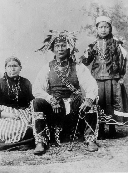
Located in historic Cross Village, Michigan, Legs Inn is a “monument to nature.” Built on a high bluff overlooking Lake Michigan, it is unique and mysterious as seen in its architecture and decor. The fantasy-like atmosphere of this medieval looking stone, timber and driftwood landmark was created by one man, Polish immigrant, Stanley Smolak. He fell in love with Northern Michigan and its people, many of them Ottawa and Chippewa Indians and decided to settle in Cross Village in 1921.

Authentic Polish cuisine is our specialty, but delicious American dishes, including local fresh Whitefish, are also served. The Smolak family and staff are dedicated to making your visit to Legs Inn an unforgettable experience, which will have you returning often with family and friends throughout the years.

In a perfect world, you might arrive at Wilderness State Parkin time for sunset over Lake Michigan. In an even more perfect world, you’d be at the top of a multi-year waiting list for a cabin at the park!

Just so it’s clear, these fall color tour entries are produced by Absolute Michigan & Michigan in Pictures using the great information compiled in Travel Michigan’s Fall Color Tours as a starting point. We’re trying to add to what they’ve put together – not rip them off! As always, if you have links to information or photos that we missed, comments or reports, post them in the comments below!

Don’t miss our Michigan Fall Wallpaper series and see more of Travel Michigan’s Fall Color Tours.

Picking Apples, W. Golden Orchard 1894 … or thereabouts

Picking Apples, W. Golden Orchard 1894 courtesy Archives of Michigan

The Image of the Month for October 2007 (link defunct) from the Archives of Michigan begin:

This photo depicts apple pickers in the Old Mission Peninsula. It was taken in the early 1890’s. (The caption on the front of the photo gives the year as “1894.” However, identifying information on the back gives the year as “1891.” The exact date, then, is uncertain.)

Michigan’s “fruit belt” strides the shore of Lake Michigan. The Lake itself plays a key role. It functions as a moderating body, preventing temperatures from getting too cold in the fall and too hot in the summer. It also provides the frequent rainfall that fruit farmers require. This climate combines with rich soil and regional topography to provide ideal fruit-growing conditions.

Michigan’s fruit industry started to boom about the time of the Civil War. By then, Chicago’s growing population had provided a ready market. Transportation improvements (notably the expansion of railroads) provided greater access to this and other population centers.

If you’d like to learn more about apples in the present day, check out the first ever Absolute Michigan Word of the Week: Apples!

Support Michigan in Pictures with Patreon