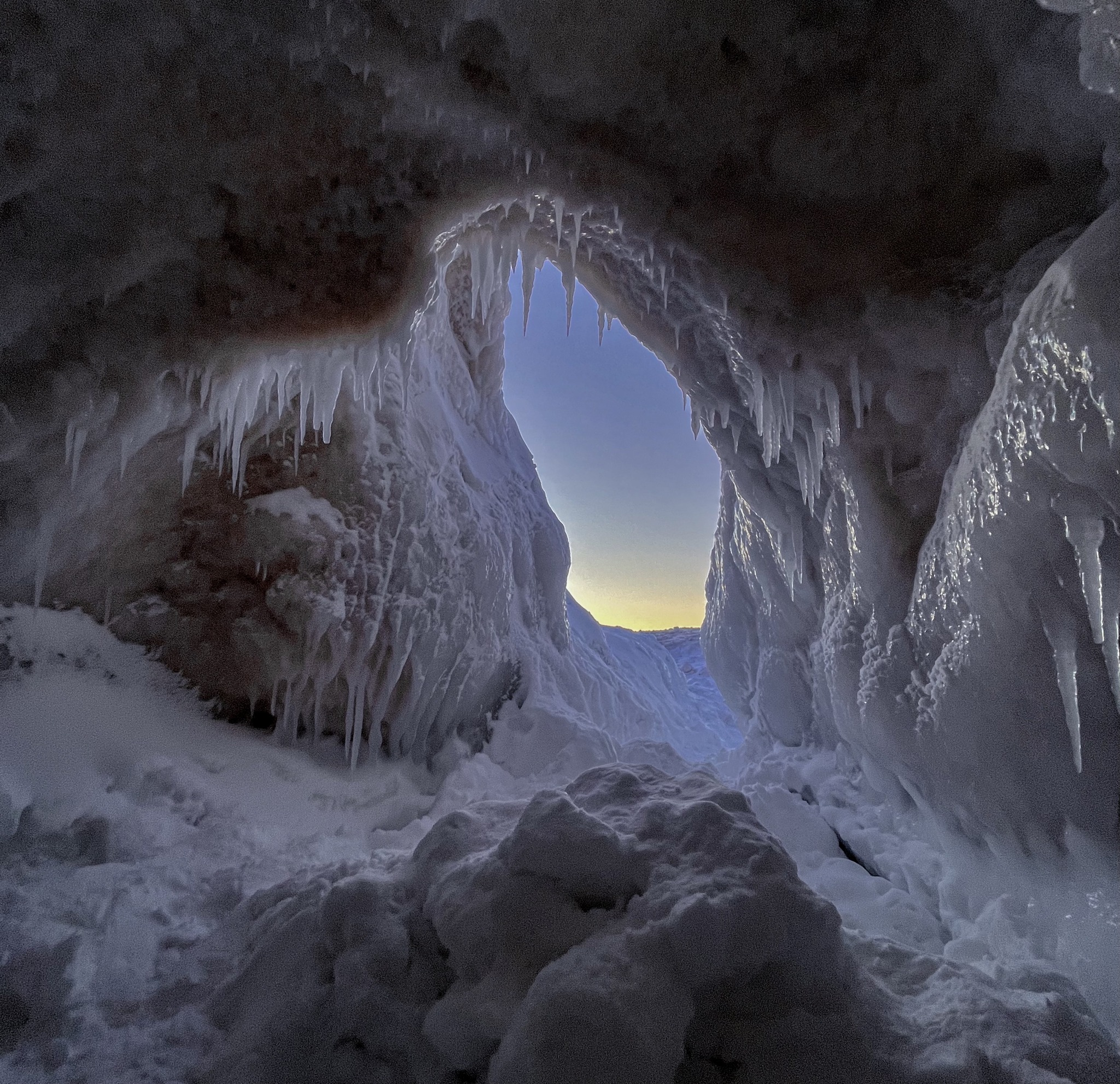
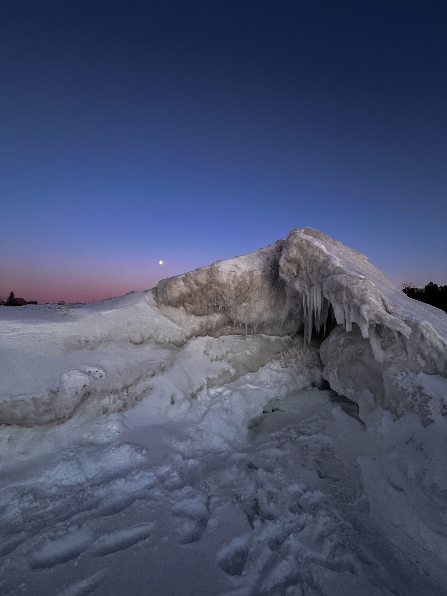
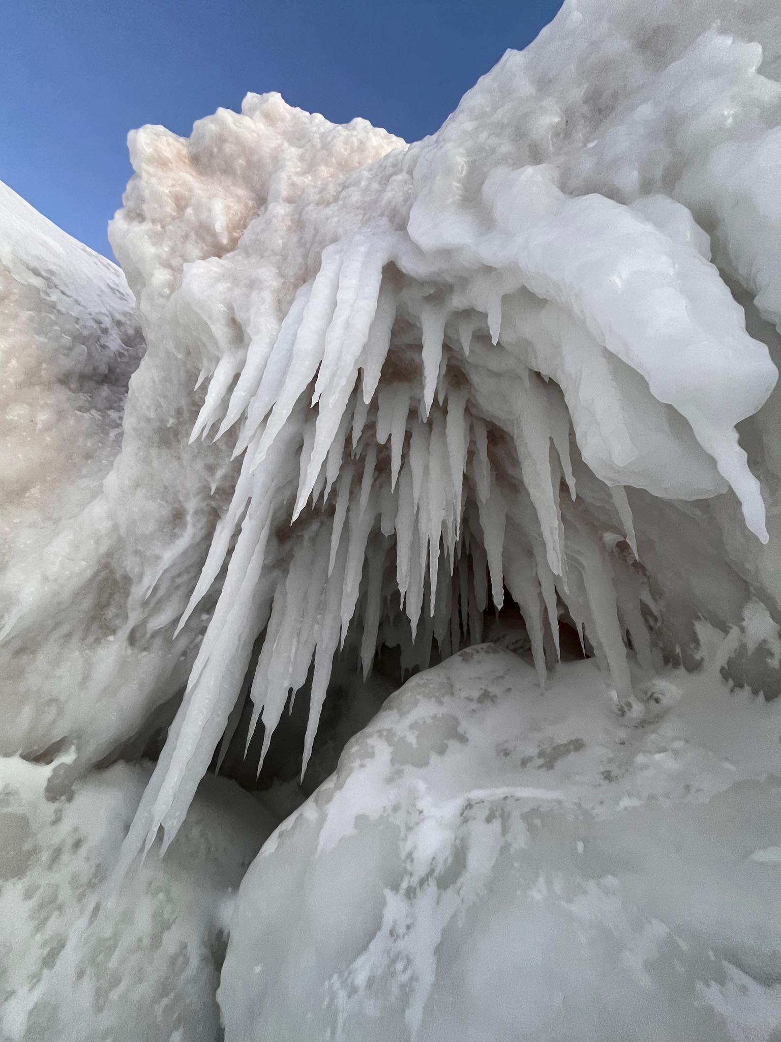
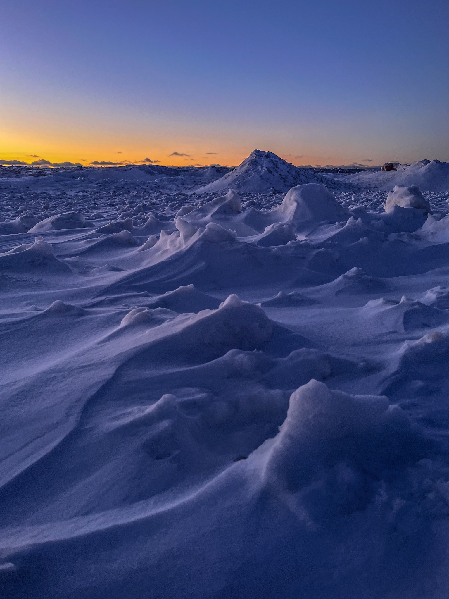
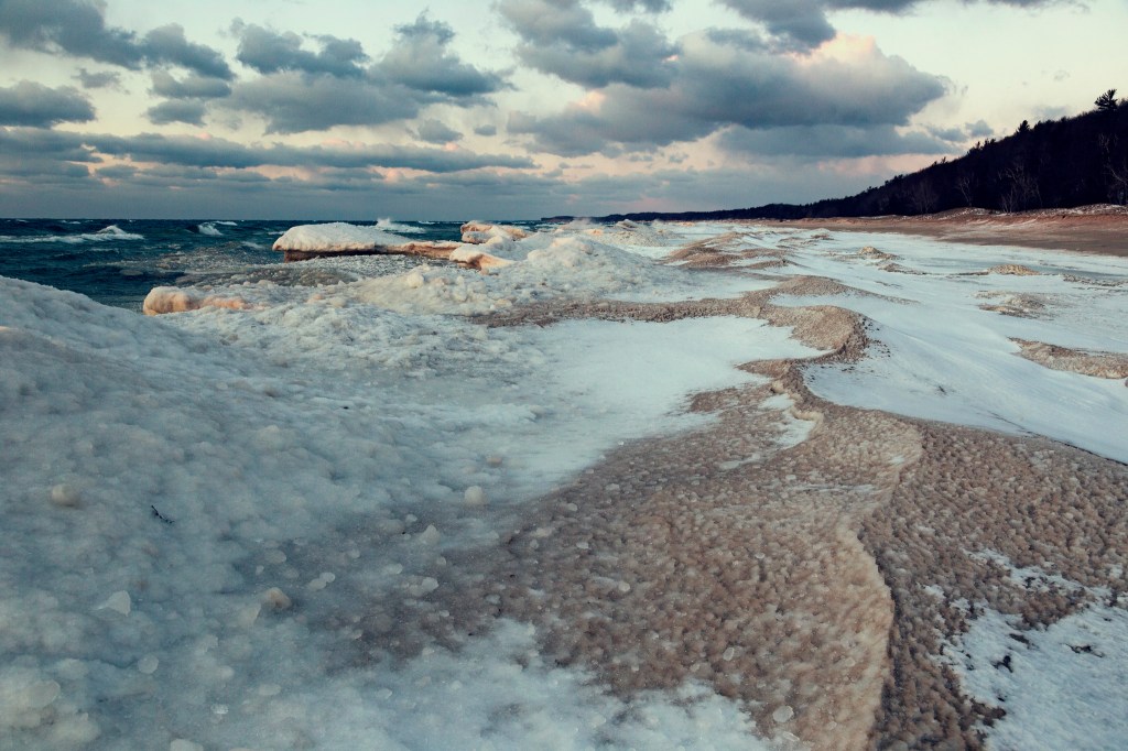
Robin shared these otherworldly shots of the ice caves on Empire Beach in the Sleeping Bear Dunes National Lakeshore earlier this week. Click the pics to see them bigger & follow her on Instagram for more!
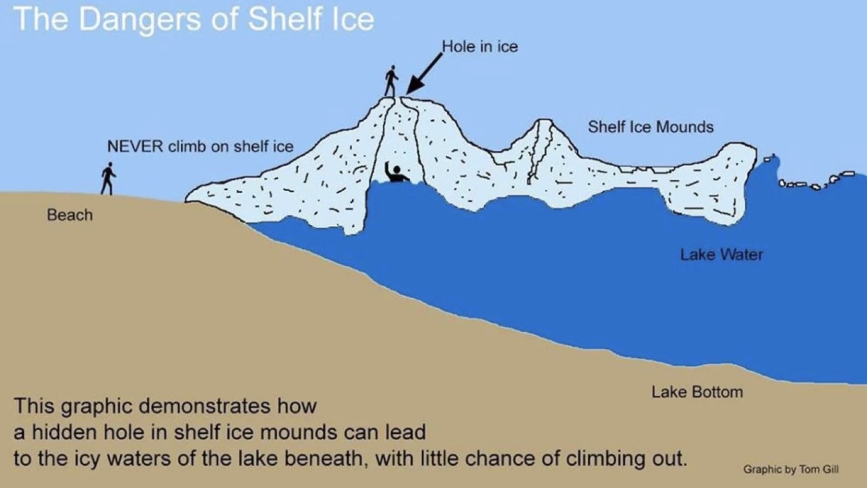
As with any time we share photos of ice caves, we need to caution you that you can 100% lose your life exploring ice caves. Be smart.
It can be dangerous because you might think you’re walking on solid ground, when actually you’re out over the water. Due to the layered nature of shelf ice, even if you’re out over four feet of water, if you were to fall through a thin spot in the ice, you could find yourself trapped in an ice cavern and even though you may not be fully submerged in the water, you’re unable to get out because the walls of the cavern are ice and impossible to climb.
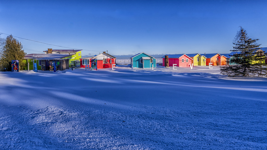
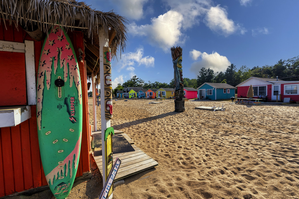
Here are two pics from Charles of the joyfully painted Mai Tiki Resort on Lake Huron in Oscoda demonstrating that you can find a little spot of summer in Michigan even on the coldest day. See his latest on Flickr & stay warm!
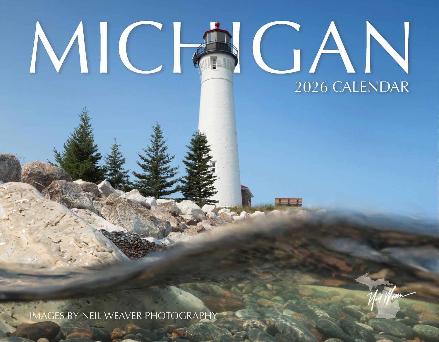
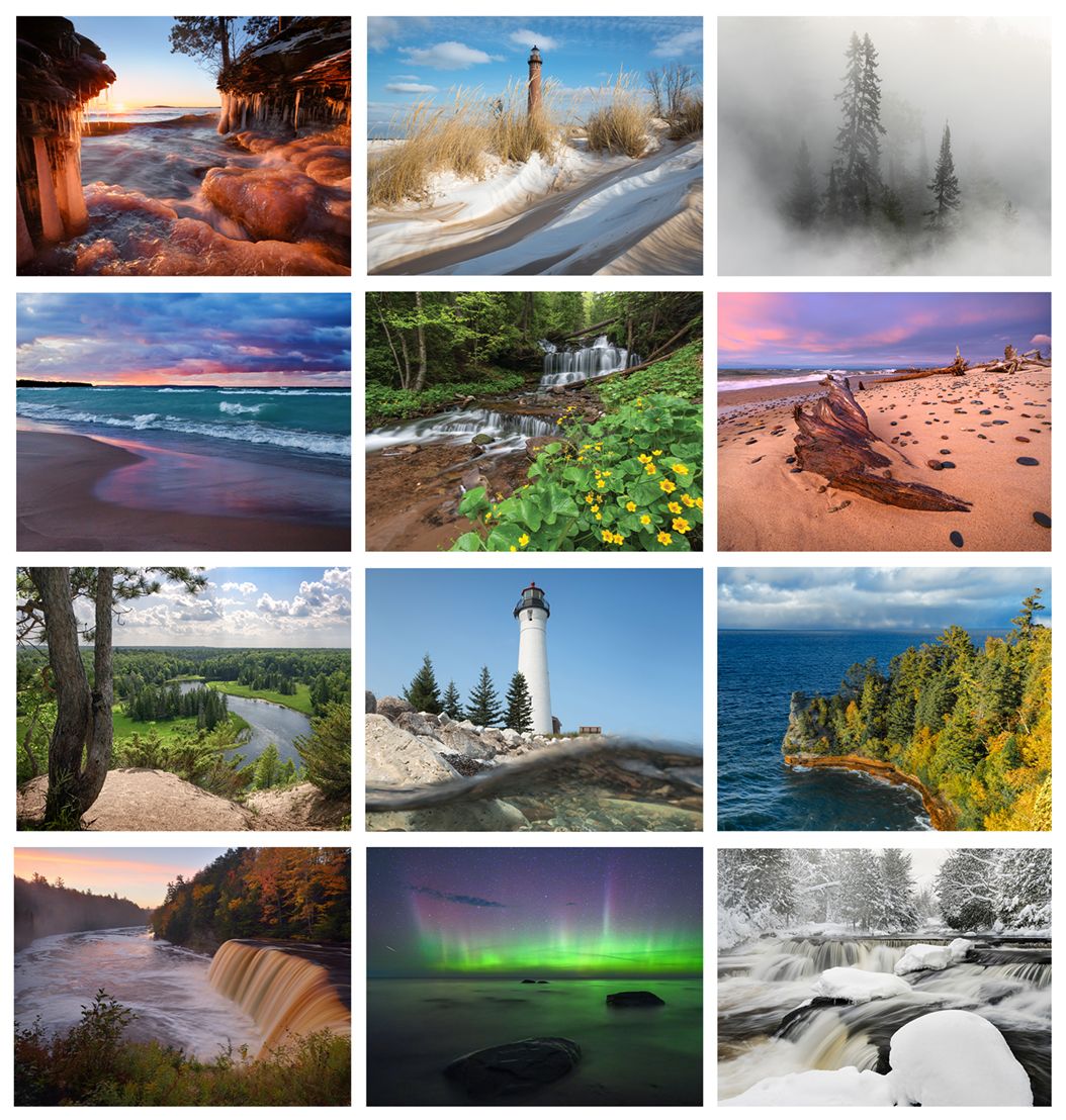
I am thinking that a good way to help support the photographers who make Michigan in Pictures so cool is to feature their calendars & photos as potential holiday gifts. In a way, you are also supporting the protection of the beautiful places featured in these calendars by sharing that beauty with the people you love!
Neil has been a favorite photographer for a long time now for his excellent work as well as for his photography workshops like the upcoming Munising Winter Workshop that make great gifts as well! He says that you can get his 2026 Michigan Calendar while they last & is also offering 25% off all prints orders through this week with the code: HOLIDAY25 at NeilWeaverPhoto.com.
Back in the day, Linda Godfrey would regularly share stories with me from her classic book Weird Michigan and her other works. Linda has regrettably passed on and her Weird Michigan website is lost, but here’s a seasonally appropriate tale of shipwrecks & lost love from my archives…
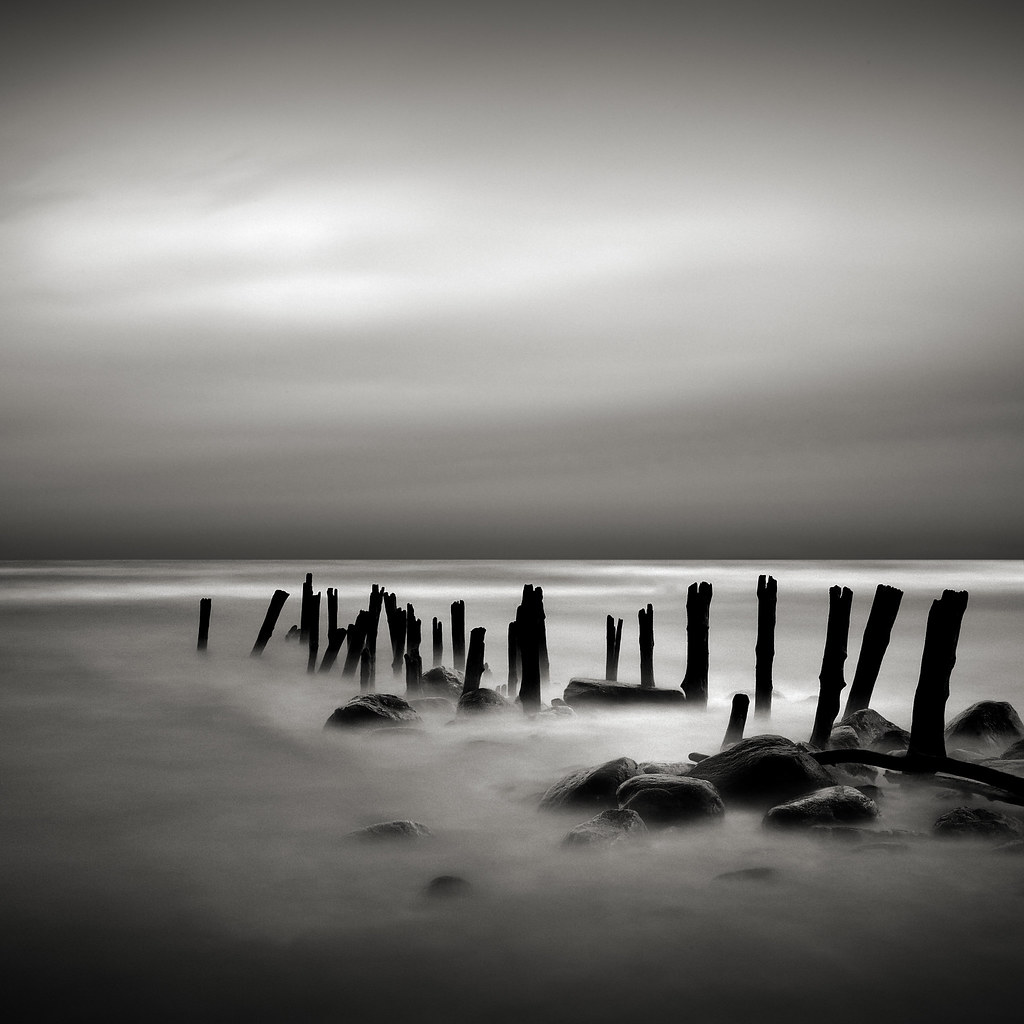
In the mid-1800s, the Lake Huron port and lumber town of Forester was a far cry from the sleepy, near ghost town it is today. The remains of huge pilings just off the scanty beach now stand as crumbling reminders of the great pier that once bustled with Great Lakes ships and sailors.
One of those sailors unwittingly started the legend that would be Forester’s main claim to fame after the lumber ran out and the ships stopped coming.On shore leave one day, the unnamed young man took up with a local girl named Minnie Quay, whose folks, James and Mary Ann Quay, owned the town tavern.
The Quays forbid Minnie to see her beloved, but the order proved tragically unnecessary after his ship became one of many that succumbed to Great Lakes gales. Minnie made one more visit to the forbidden pier after learning that news, and on April 26, 1876, at the age of 16, she threw herself into the water in hope of joining him in the afterlife. She lies in a waterfront cemetery now, next to the bodies of her father, mother and brother.
Legend says that she still wanders the beaches, moaning for her lost sailor, and that some have seen her standing waist deep in the water, beckoning others to join her. The former Quay home and bar still stands, giving Minnie’s ghost even more reason to linger.
“And the iron boats go as the mariners all know, with the gales of November remembered” – Gordon Lightfoot
Every Michigander knows that the winds of November are to be respected and even feared on the Great Lakes. The State of Michigan says that an estimated 6,000 vessels were lost on the Great Lakes with about a quarter of these canoes, sailing ships, ferries, steamers, and modern ore boats like the mighty SS Edmnd Fitzgerald still remain on Michigan’s 38,000 square miles of the Great Lakes bottomlands.
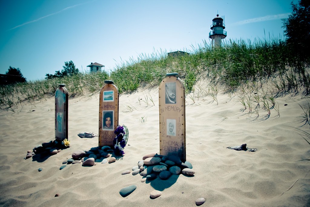
Yolanda took this photo a memorial at Whitefish Point Lighthouse to few of those lost aboard the S. S. Edmund Fitzgerald. More in her excellent Somewhere in Michigan gallery.
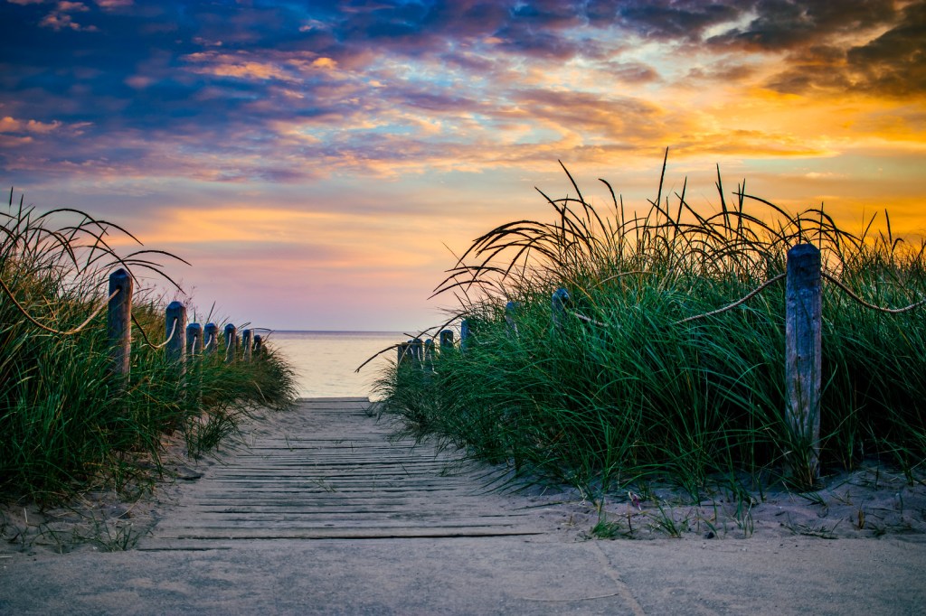
Today is the 55th birthday of the Sleeping Bear Dunes National Lakeshore. Normally, I would lead with a photo of the Dunes, but the creation of the National Lakeshore on October 21, 1970 preserved a whole lot more!!
Here is the tale of the tape on Michigan’s magnificent national lakeshore as of August 1, 2024!
Annual Visits – 1,589,248
Employees – 46 permanent, 83 seasonal
Volunteer Hours – 58,389 from 1,659 volunteers
Natural and Cultural Resources
Area – 71,318 acres
Lake Michigan Shoreline – 65 miles (35 miles on the mainland)
Inland Lakes – 26
Miles of rivers and streams – 12
Terrestrial plant species – 908
Bird species – 246
Federally threatened or endangered species – 6
Historic structures on List of Classified Structures – 369
Sites on National Register of Historic Places – 8
Cultural Landscapes – 9 (4,500 acres)
Prehistoric archeological sites – 150
Historic boats – 21
Lighthouse – 1
Historic artifacts – 70,158
Archived documents – 21,325
Infrastructure
Buildings – 370
Employee housing units – 38
Campgrounds – 9 (357 sites)
Picnic Areas – 5
Visitor Centers – 3
Outdoor ampitheaters – 2
Miles of roads – 23
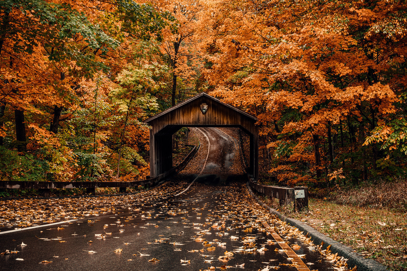
Covered bridge – 1 (Pierce Stocking Drive)
Miles of trails – 105
Lake access ramps – 9
Signs and wayside exhibits – 3572
Major photovoltaic power systems – 3
Motor vehicles in fleet – 54
Large boats – 8
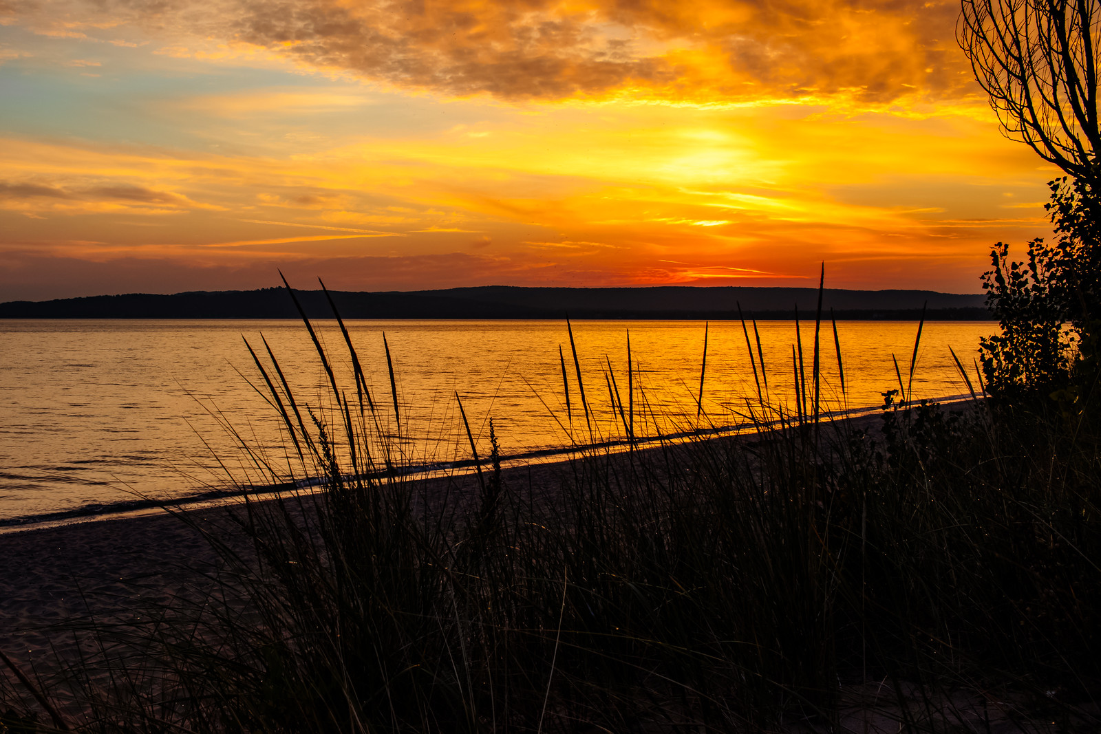
James took these in the Sleeping Bear Dunes National Lakeshore back in fall of 2023. See lots more great shots in his Top 100 gallery on Flickr!
…“When we get 15 foot waves on Lake Michigan, I’m thinking, ‘Oh, my God. How much damage are they doing?’” says David Bunte, the supervisor for Chikaming Township, near the southern tip of Lake Michigan.
Water levels fluctuate naturally in the Great Lakes but intensifying climate change accelerates those changes. What used to be normal on a 20 year cycle is now happening in five or 10 years, says Mike Shriberg, an environmental policy researcher at the University of Michigan.
“We’re seeing record highs and then record lows much closer together,” says Shriberg, whose work focuses on Great Lakes water policy. “The Great Lakes has already experienced more water level change in the last decade than the saltwater coasts are expected to experience in the next 100 years.”
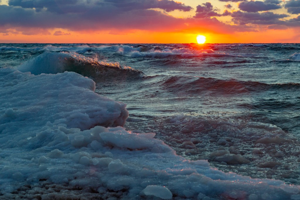
Ice normally acts as a buffer for the shoreline, absorbing the blows of powerful waves in winter storms, but as temperatures warm, diminished ice coverage in the Great Lakes is speeding up coastal erosion.
Read on for much more. If you’re not yet aware of Michigan Sea Grant , I encourage you to learn more about this cooperative program of the University of Michigan, Michigan State University, and the National Oceanic and Atmospheric Administration that funds research, education, and outreach projects designed to foster science-based decisions about the use and conservation of Great Lakes resources.
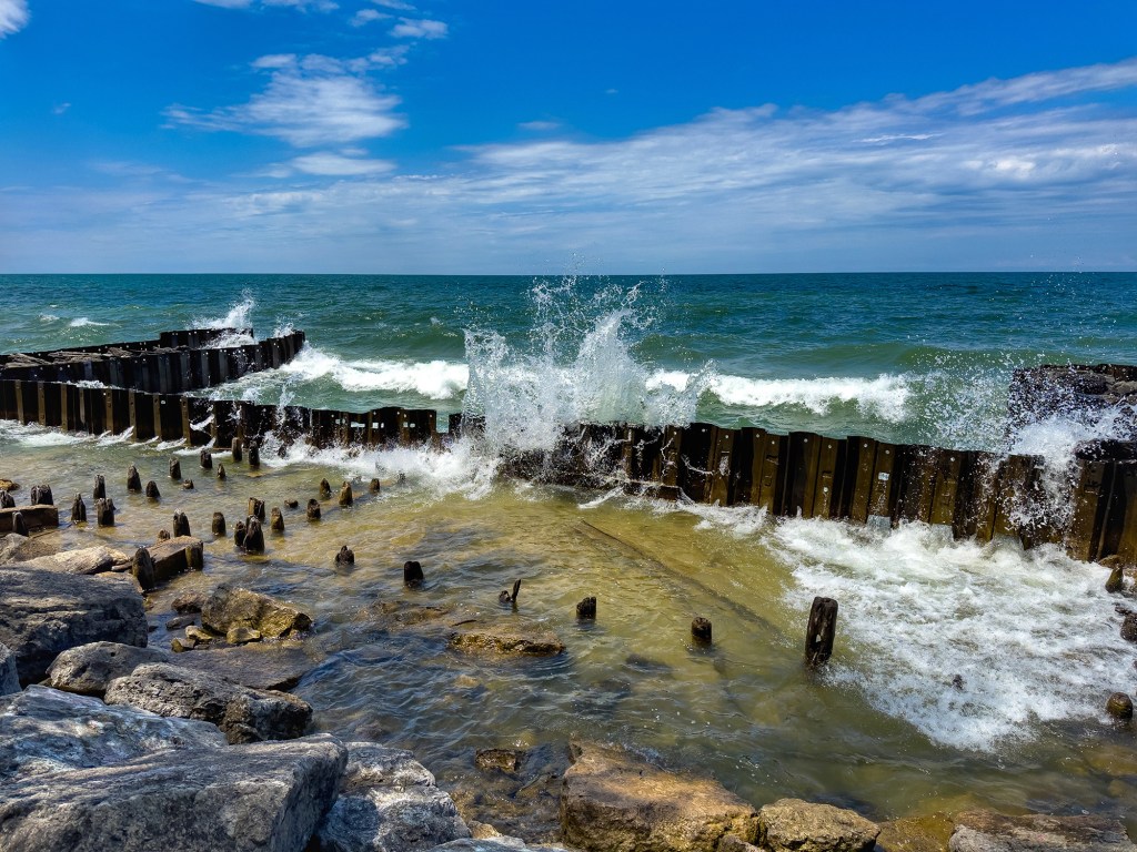
Mark took this photo at the beach in St. Joseph. Here’s a few more of Mark’s recent shots from the St Joseph’s Lake Michigan shoreline – note the crazy high water! See the latest in his 2025 gallery on Flickr!
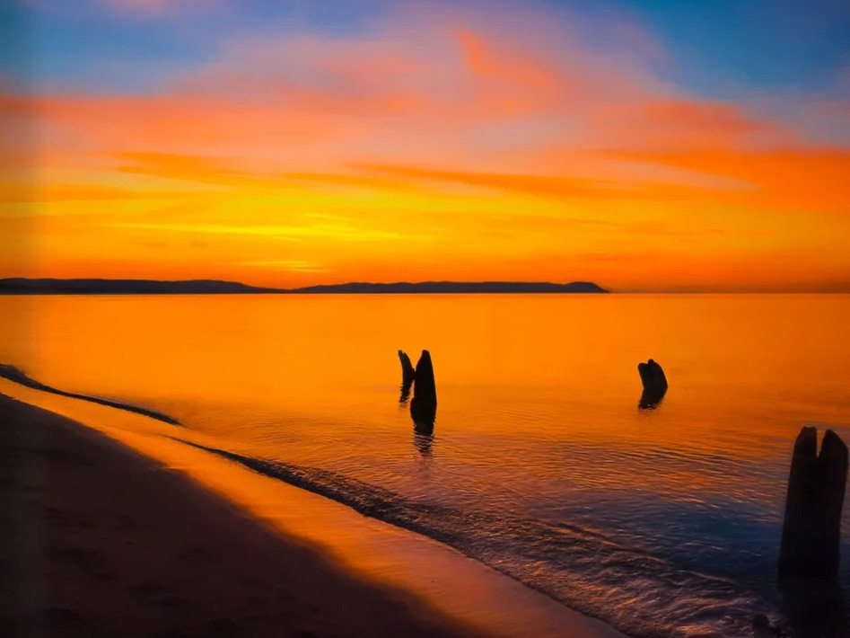
The sun’s brush paints the day’s end with strokes of flowing orange and opalescent coral. Sleeping Bear Dunes, guardian of the coast, stand silhouetted against the celestial masterpiece. As the sun descends, the waters of North Bar Lake become a mirror, reflecting the heavens in all their fiery glory. A ribbon of liquid cuts through the sand, mirroring the sky’s vibrant hues. The wet sand, kissed by the setting sun, flows with ethereal light, a testament to the sun’s final performance. The air, still and hushed, is filled with the gentle lapping of waves against the shore, a soothing melody that accompanies the visual symphony.
Mark Lindsay from The Soul of Sleeping Bear
Leelanau.com shares that photographer Mark Lindsay (whose work you may have seen on Michigan in Pictures) has released his first book, The Soul of Sleeping Bear. It’s a beautiful, coffee table book that blends Mark’s gorgeous photography of the Sleeping Bear with writings on what these vistas can spark in your heart.
9 years ago I started a Michigan in Pictures Patreon page to allow folks to throw me a few bucks in support of michpics. A big thank you to all who have done so – it means a lot to know you care.
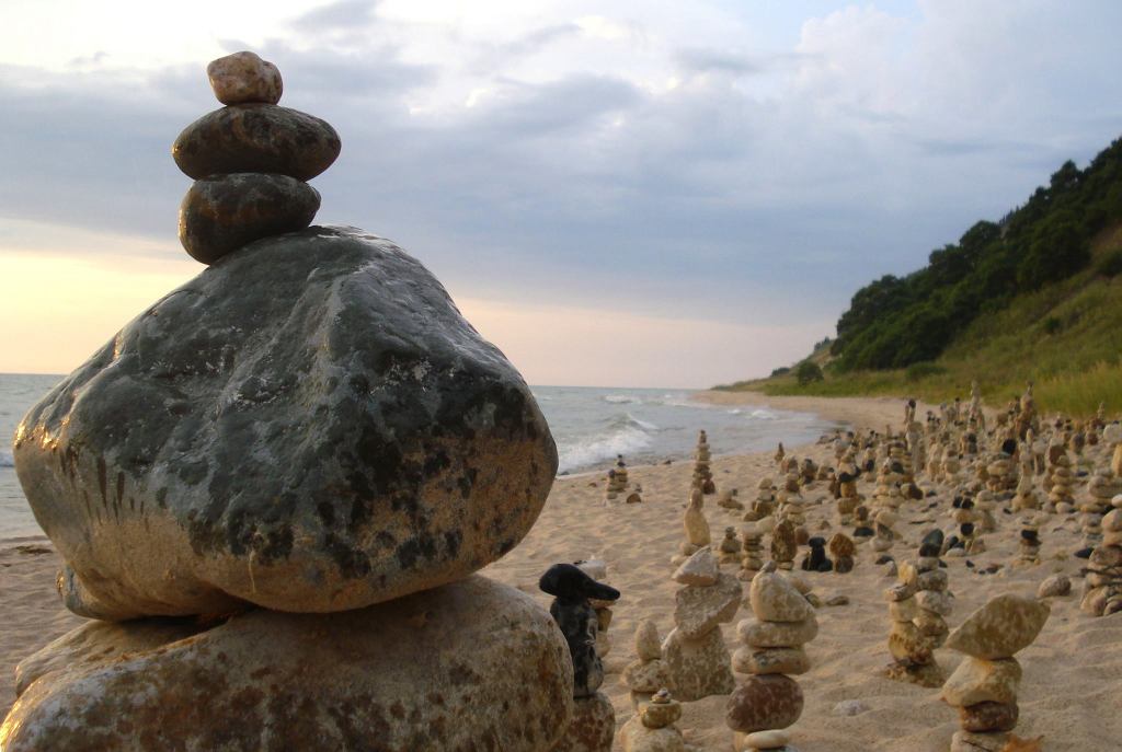
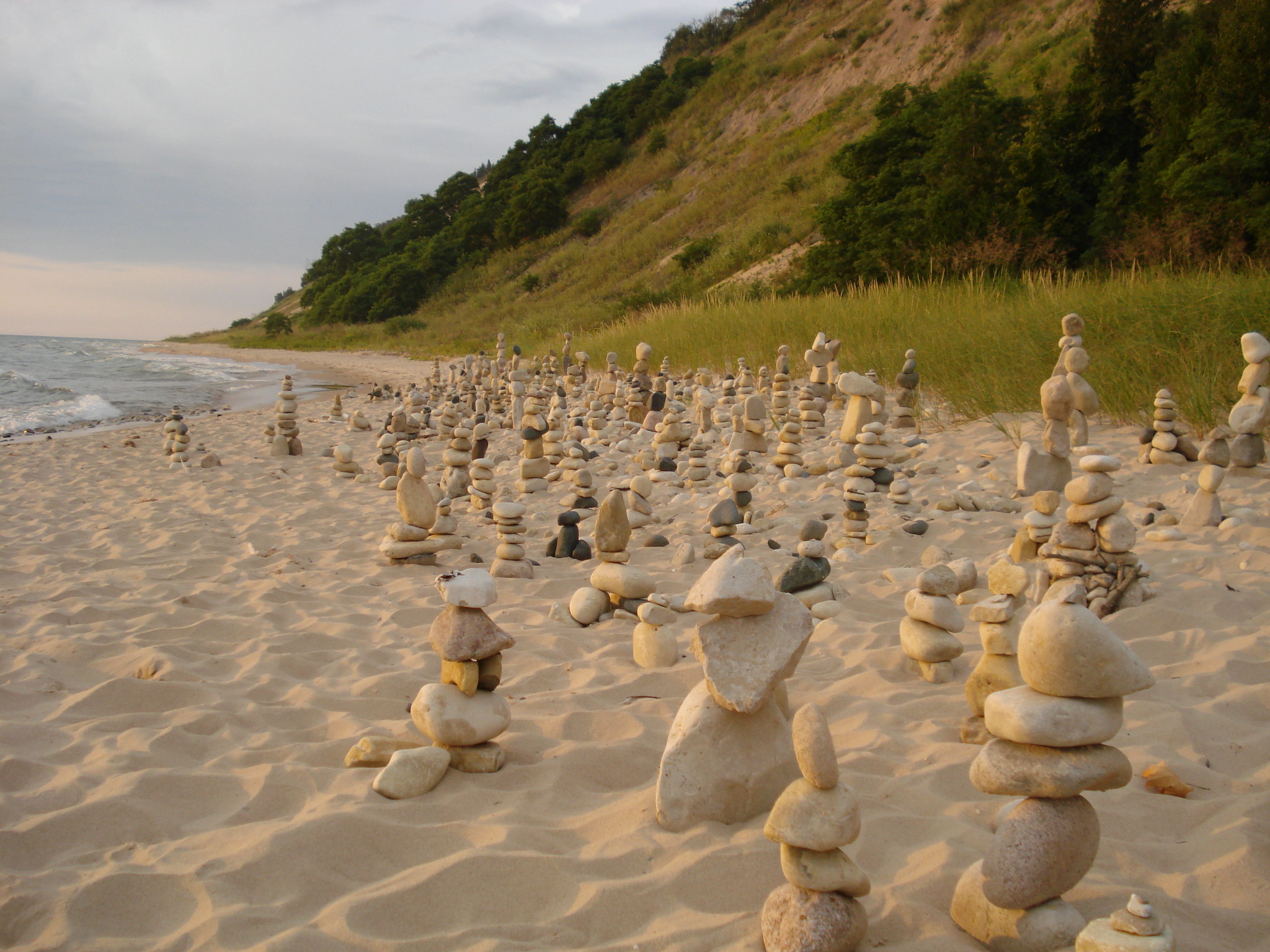
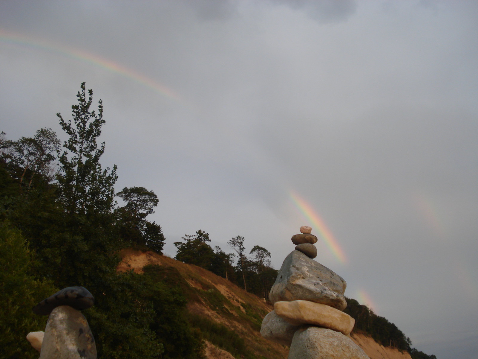
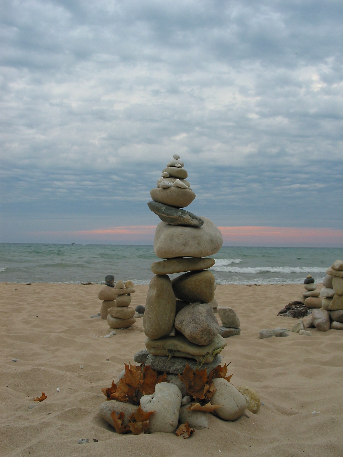
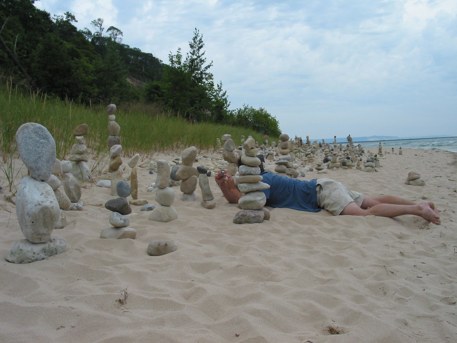
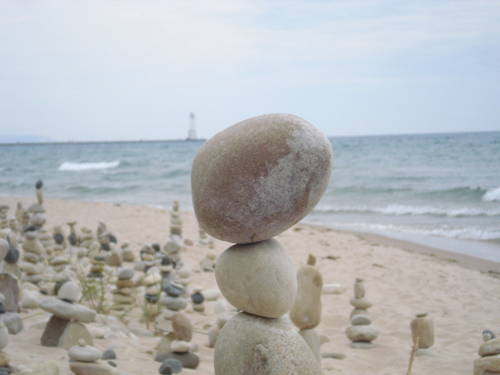
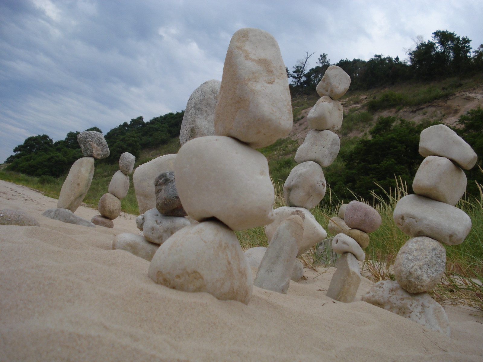
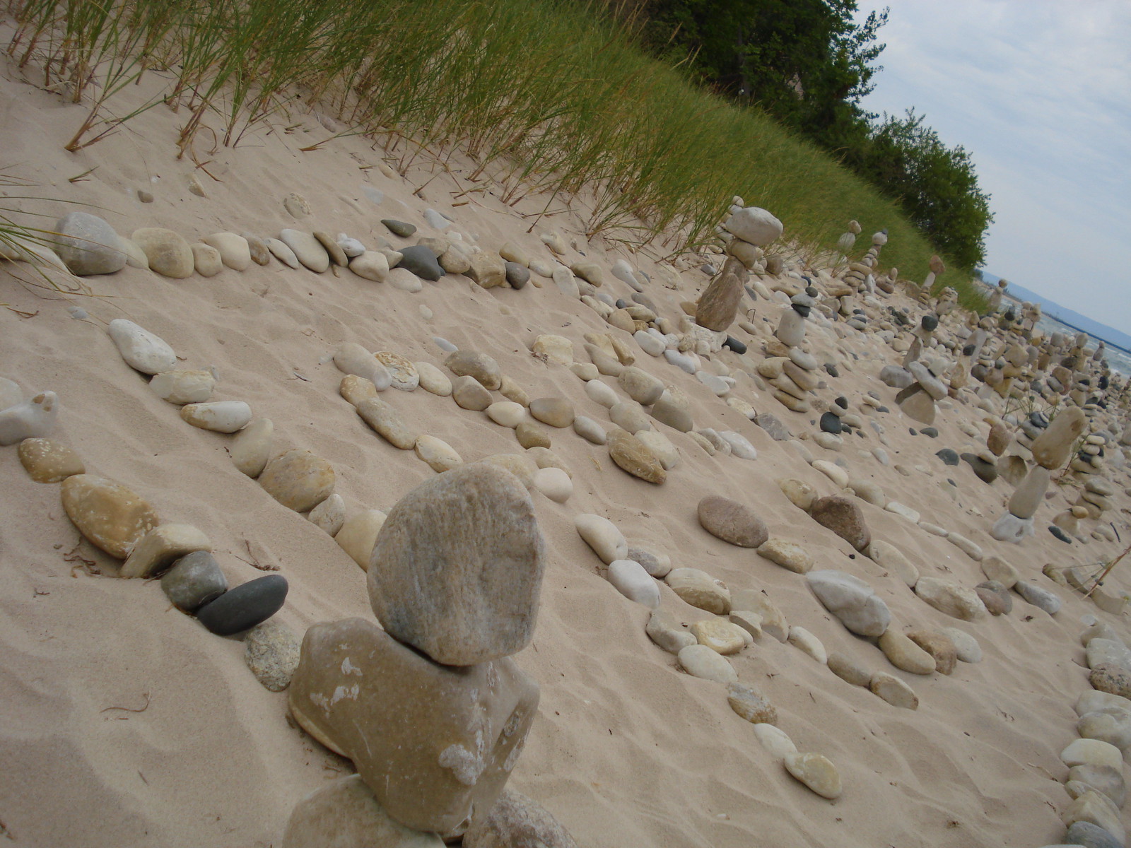
My best friend Ken who has since passed on & I took these photos way back in August of 2007 after an honestly incredible rock stacking event on the Lake Michigan shoreline just north of the village of Frankfort. I still have no idea who did this, but I know that I will never forget it!! I hope you enjoy these photos & the video and also that you’re able to make or discover magic in your corner of the Great Lakes State.
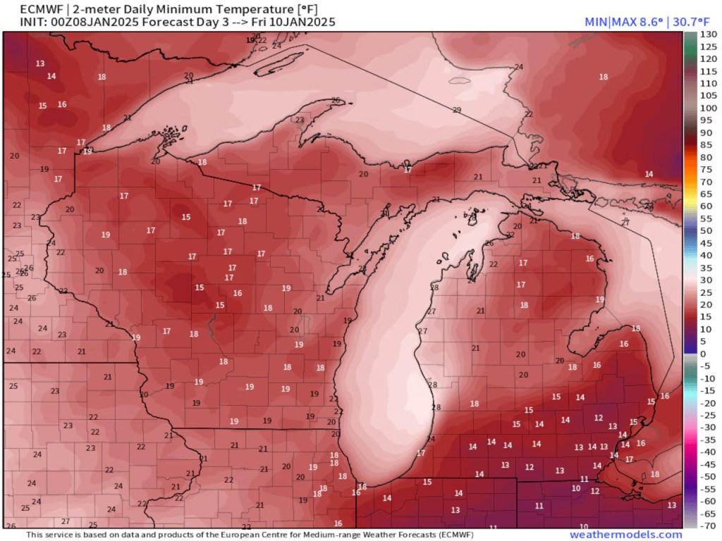
Several times a year I can point out to you weather we see nowhere else in America. One of those times is when we get Arctic air crossing the 40-degree water of Lake Michigan.
Look at the low temperature forecast for tomorrow morning, Jan. 9. You could call a friend in northeast Lower Michigan, and they will tell you it’s very cold and near zero degrees. Look at the “warmer” air that blows off of 40-degree Lake Michigan. We will have spots around Kalamazoo, South Haven and Benton Harbor that only drop to 20 degrees. Southeast Lower Michigan can be colder than the northwest shoreline of Lake Michigan at this time of year. Thursday morning’s map clearly shows that strange temperature pattern. We also see the warmer air under the clouds and lake effect snow stretching southeast off Lake Michigan.