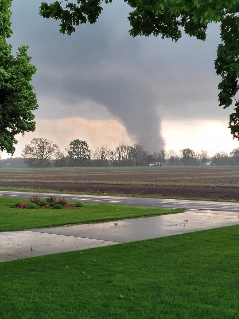
William shares that the F2 tornado that hit Kalamazoo/Portage on May 7th flattened these trees in the Gourdneck State Game Area in Portage. The tornado has already cost the city of Portage over $5 million, and they’ve allocated another $2 million.
The storms rolled through around 6 p.m. and 7 p.m., causing thousands to lose power. Some of the heaviest damage was concentrated around Westnedge Avenue, Centre Avenue and Oakland Drive, according to Portage city officials.
The FedEx building at 6701 Portage Road sustained a direct hit from one of the reported tornadoes. The roof of the building caved in, leaving the interior exposed. After the storm passed, 50 employees were trapped inside as crews worked to remove dangerous wires so rescue efforts could commence. First responders eventually helped them all out of the building, Tuesday night.
Another spot with major damage was Pavilion Estates Mobile Home Park, 6830 East N Ave. in Pavilion Township, just east of Portage. About 17 of the homes were totally demolished and 173 had some degree of damage, according to the Kalamazoo County Sheriff’s Office.
“The noise sounded like two freight trains going over a trestle right over your head; it was an ugly roar. My wife said the noise when the house went was like a giant pencil sharpener working.” -Tornado Survivor Robert Blue
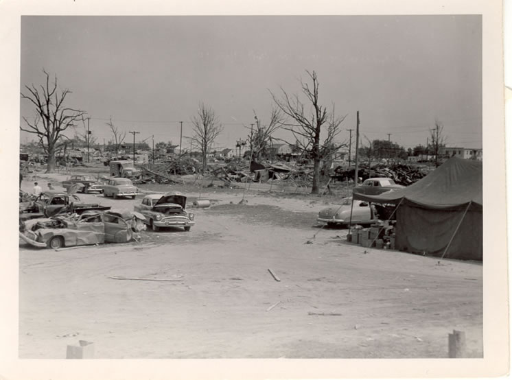
This was the last tornado to kill over 100 people in a single tornado event anywhere in the United States. On June 8th, 1953, 116 people lost their lives in the Flint-Beecher community, and 844 people suffered injuries. The Flint-Beecher Tornado was just one of eight tornadoes that occurred that horrible evening across the eastern portion of the Lower Peninsula. Those other seven tornadoes resulted in an additional 9 deaths, 52 injures, and damage stretching from Alpena to Erie.
The Flint-Beecher tornado was rated as an F5, the highest rating on the Fujita scale of damage. Winds were likely in excess of 200 mph as the 800 yard wide tornado moved on its 27 mile path through Genesee and Lapeer counties. Approximately 340 homes were destroyed, 107 homes had “major damage”, and 153 homes had “minor damage”. In addition farms, businesses and other buildings were destroyed and had damage. These totaled another 50 buildings destroyed and 16 with damage. The damage was estimated around $19 million (about $125 million adjusted for inflation).
So great a number were killed by the monstrous tornado that the National Guard Armory building, along with other shelters, was turned into a temporary morgue. The scene of bodies pouring into the Armory (as an intermittent light rain poured outside) was incredibly bleak and horrifying, especially for the families and friends of the victims. At least 100 people waited outside into the rainy night before they could move inside to try and identify the bodies.
The Wizard of Oz rolled off the presses May 17, 1900. It’s one of my all-time favorite books. What you may not know is that L. Frank Baum, author of the beloved series, purchased a large, multi-story Victorian summer home on the southern end of the Macatawa peninsula on Lake Michigan.
“The Wonderful Wizard of Oz” supposedly was written in Chicago, but some of the forest scenes look just like the pathways that run through the dunes, the younger Baum said.
He assumes Macatawa was where part of the book had been worked on or written, as Baum might have found inspiration from the castle in Castle Park for the yellow brick road, some say, or even based some of the characters in the book on personalities he encountered in the small lakeshore community.
“Especially in the Oz stories, a lot of characters and situations that we may not recognize … he drew lots of inspiration from Macatawa for the book.”
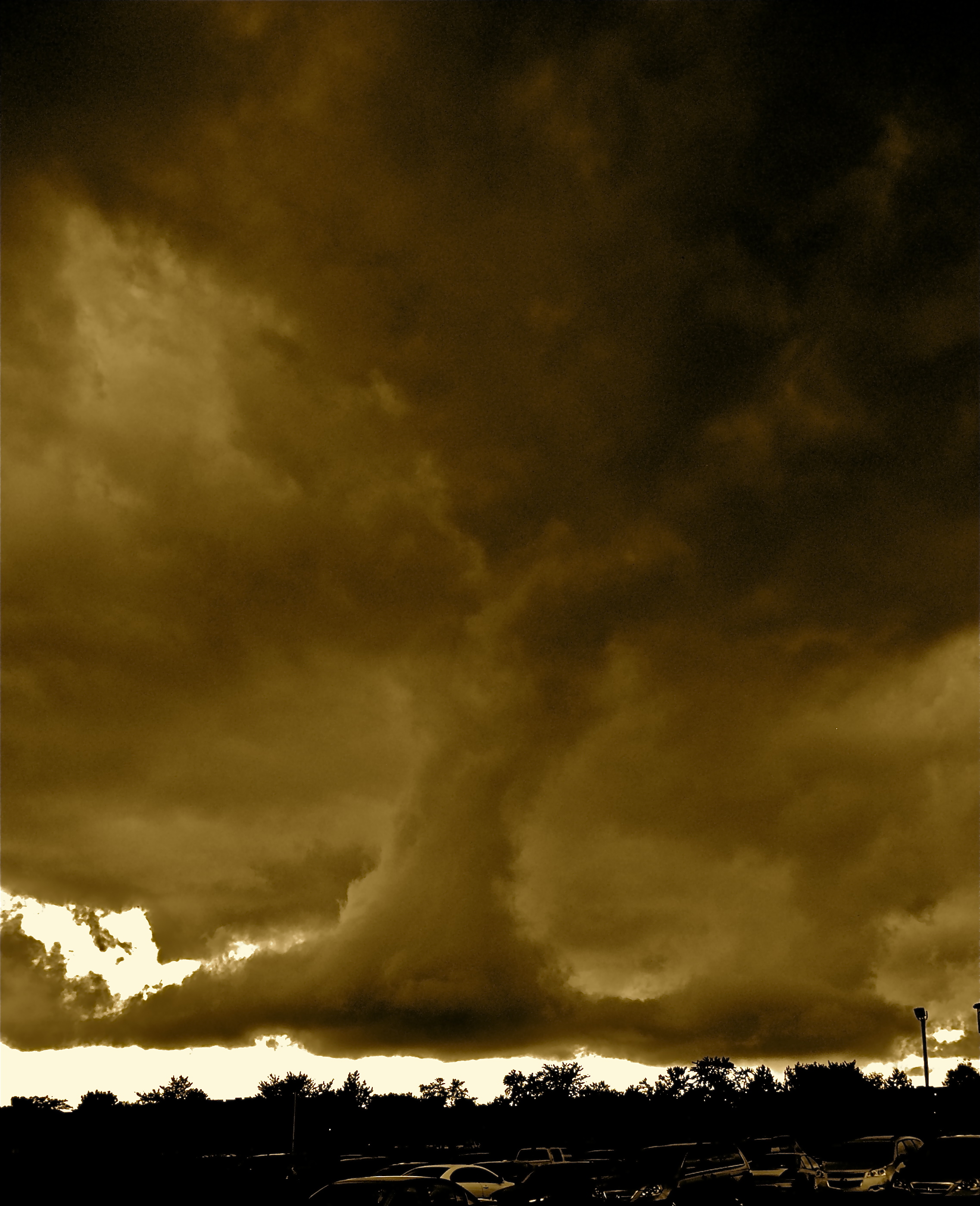
This freakie cloud formation started at the end of our wedding photo shoot. There were clouds swirling all over us but luckily no tornados formed. I added some sepia for a little Wizard Of Oz effect.
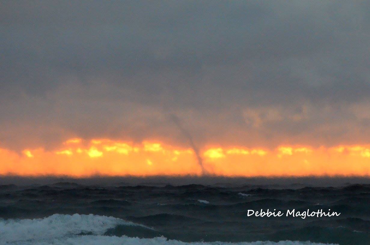
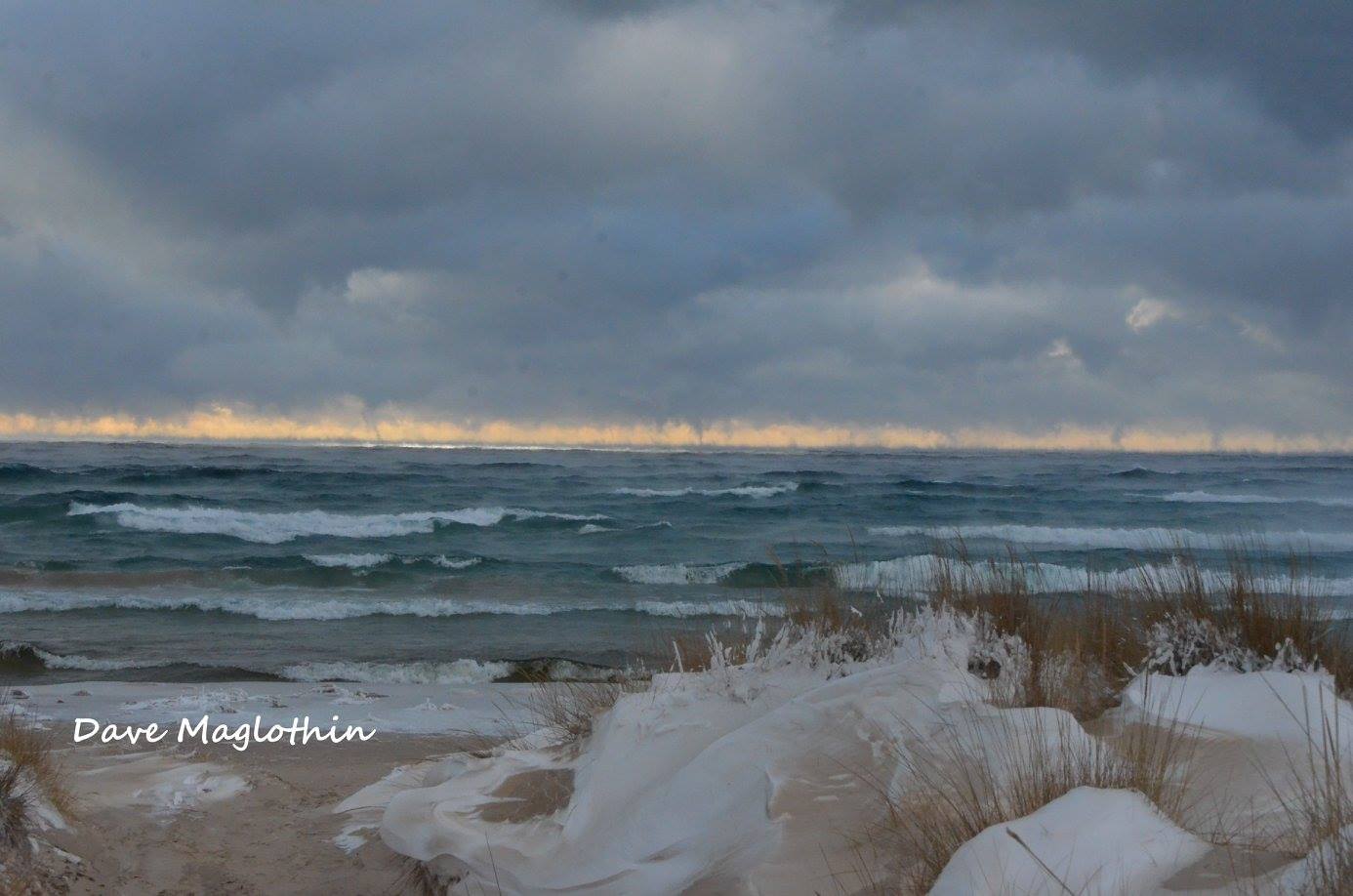
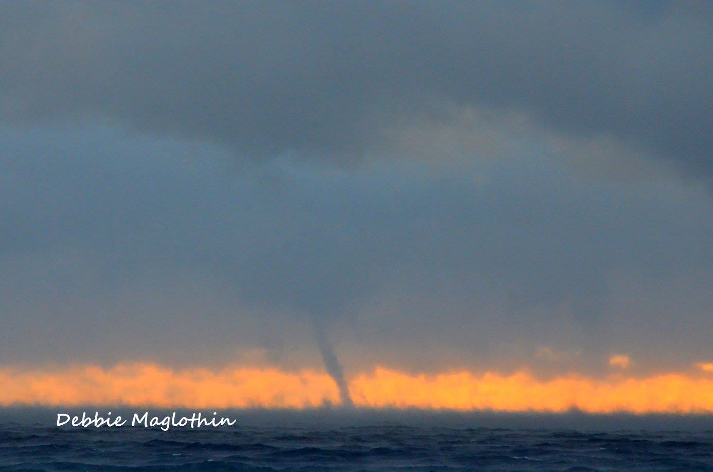
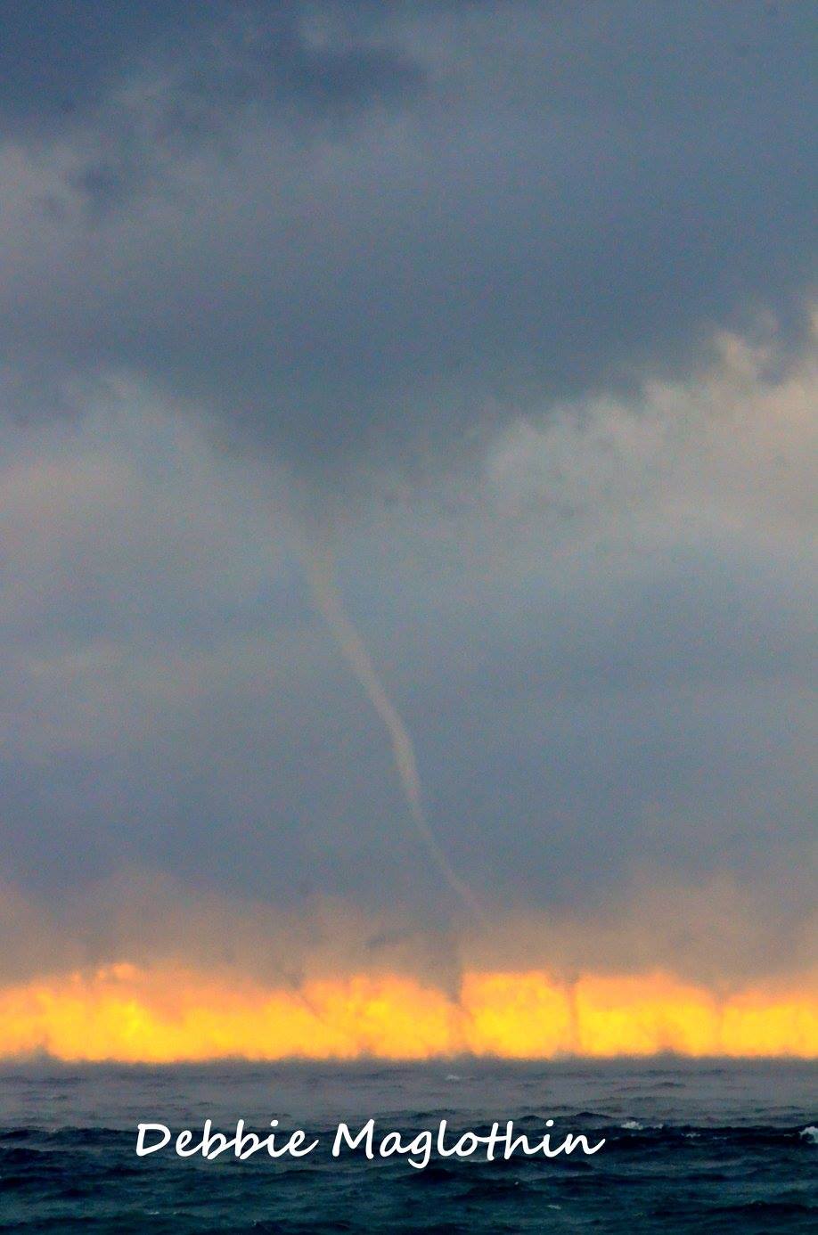
If you live along the Great Lakes, chances are you’ve seen a waterspout from time to time. While waterspouts are typically formed when cold air moves over warm water in late summer or early fall, occasionally the reverse can happen.
Debbie Maglothin took several photos of cold air waterspouts over Lake Michigan off the Ludington State Park beach. WZZM 13 meteorologist Alana Nehring explains how they form:
A drastic temperature difference between the air an water is required. In the most recent event, water temperatures were near 32 degrees while air temperatures were closer to 10 degrees.
A steady breeze needs to be present to jump-start the process of evaporation.
In most cases, this is also how lake-effect snow is produced but in some unique situations, a slight twisting motion will occur in the steam above the water. If it is maintained long enough, eventually weak funnels will develop.
Click the pics to view them bigger and follow Debbie on Facebook at Cha Bella Photography.
A strong low pressure system tracking from the southern Plains into the Upper Great Lakes brought record December warmth to Southeast Michigan on Wednesday, December 23rd. Stronger winds associated with this system interacted with the unseasonably warm air to produce the first December tornado in Michigan history during the evening. This tornado occurred in Wayne County, just north-northeast of Canton. The tornado was rated EF-1 with peak winds of 90 mph. The tornado touched down at 643 pm EST, tracking 2 miles before lifting at 646 pm EST.
This brief tornado developed along a fast moving line of showers that shifted across Southeast Michigan during the evening (5 to 8 pm). A Significant Weather Statement (SPS) was issued at 620 pm, highlighting the potential for wind gusts up to 50 mph. The brief duration and weak intensity of this tornado made the issuance of a tornado warning nearly impossible, typical of brief spin-ups that are embedded along a fast moving line. In many cases, such as this one, the tornado touchdown occurs largely between radar scans, leaving little opportunity for advanced warning.
This is the first December tornado in Michigan history and only the third during the winter season. The other two tornadoes occurred on Jan 18, 1996 in Kalamazoo County and Feb 28, 1974 in Wayne County.
You can get a report on the tornado with images of the very minor damage from WDIV TV-4/Click on Detroit.
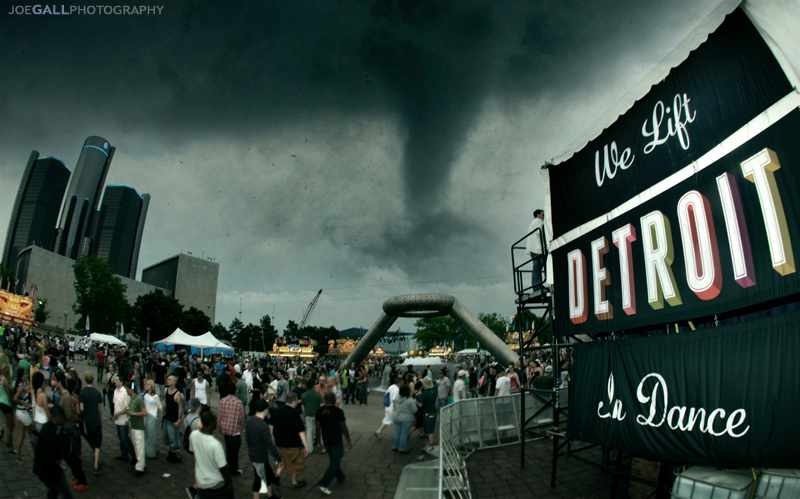
Joe photoshopped this picture back in 2011, so please don’t tell me it’s not real because I know that. View it on Flickr and see more in his Movement 2011 slideshow.
Monday will begin with sun but storms will develop to the west and advance quickly into West Michigan by late afternoon/early evening time frame. Models are suggesting the atmosphere will be unstable with abundant moisture by Monday afternoon, meaning storms will have a favorable environment to grow.
The NOAA Storm Prediction Center has most of Lower Michigan in the ‘enhanced risk’ area (orange) on Monday meaning several thunderstorms could reach severe levels. To read more about the convective outlook Monday, click here.
Threats from this round of thunderstorms include damaging wind, hail, lightning, isolated tornadoes, and brief heavy downpours. Thunderstorms reach severe criteria when winds are at least 58 mph, hail is one inch in diameter, or a tornado is produced.