Trouble in a corner of paradise

porcupine-mountain-state-park

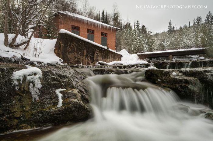
Porcupine Mountain State Park, photo by Jim Sorbie

I’m sure that some people will see this as a “political” post, but it’s very much in line with Michigan in Pictures’ 11 year focus on the promotion AND protection of Michigan’s natural beauty. In other words, I will never stop speaking up when I believe decisions are being made that jeopardize this state that I love. Mineral mining, particularly the sulfide mineral mining that is sweeping the UP, is among the most polluting activities, and in my opinion, is totally out of bounds within a state park. If you are interested in opposition to this and in learning about acid mine drainage and its impact on groundwater, streams, rivers and lakes, including Lake Superior, I encourage you to visit the Mining Action Group.

On Monday, the Michigan DNR released this troubling story about exploratory drilling at Porcupine Mountains State Park:

The Michigan Department of Natural Resources has issued a use permit to Orvana Resources U.S. Corp. – a subsidiary of Highland Copper – to conduct exploratory drilling on a 1-mile-square piece of property situated along the westernmost edge of Porcupine Mountains Wilderness State Park in Gogebic County.

The exploratory drilling began Sunday and is scheduled to continue into early March, depending on weather conditions.

“This drilling project will affect a very small portion of DNR-managed land,” said John Pepin, DNR deputy public information officer. “The vast majority of the park, including the Presque Isle River, will remain unaffected by this exploration activity.”

If the exploration results indicate the potential for copper in suitable quality and minable quantities, Highland Copper would conduct a feasibility study, designed to mine the deposit entirely by underground methods, allowing the company to gain access to the copper ore body from land it owns outside the park.

You can view Jim’s photo from October of 2013 background bigilicious and see more in his Autumn in Michigan slideshow.

Confluence of Montreal River and Lake Superior

confluence-of-montreal-river-and-lake-superior

Confluence of Montreal River and Lake Superior, photo by Kirt E. Carter

Waterfalls of the Keweenaw has a nice feature on the Montreal River and Montreal Falls that says in part:

Located right at the mouth of the Montreal River as it tumbles into Lake Superior, Montreal Falls is a rugged, beautiful cascade over blocky volcanic rocks. The views over the lake are incredible: to the west you can see Bare Bluff and Mt Bohemia rising along the lake shore, to the southwest the distant side of Bete Gris Bay, and to the south (on a clear day) the Huron Mountains ripple up above the lake. The drop sits at the last easily accessible southern spot on the tip of the Keweenaw, with Fish Cove, Keystone Bay, and Keweenaw Point a tough drive/hike beyond.

Some flat ground for camping sits on the shore of the waterfall, complete with a few fire rings and a convenient beach for kayakers, and during summer weekends a few tents can be found near the falls. A narrow trail leads up along the river towards Upper Montreal Falls, more traveled by fishermen than anyone else, and an even fainter path can be found leading further east to Fish Cove.

Read on more maps & more!

View Kirt’s photo bigger, see more in his slideshow, and see more work on his website.

Below Au Train Falls

below-au-trail-falls

Below Au Train Falls, photo by Neil Weaver Photography

The Au Train Falls information page from Chatham, MI says (in part):

The AuTrain Falls are part of the AuTrain River. A major reason why the falls were created is because of the large power dam located about a mile south of the falls site, in close proximity to highway M-94. The Forest Lake Dam, run by the Upper Peninsula Power Company, is the main source of water for the falls. When water levels are high on the AuTrain Basin, an increased flow of water is released via the dam and down the river. The AuTrain River actually flows from South to North. When more water is released via the dam, the more volume of water that flows through the falls.

…A short distance from the bridge, where the view is the most spectacular, is where an old brick building is located. As you approach the building, you will hear a humming noise and as you approach, the humming noise gets louder and louder. As you peak inside the building, you will notice these large lime-green mechanical devices. These are power generators. These generators create enough power to supply 600 homes in the area. The water to supply the generators also comes AuTrain Basin, but travels through large metal piping running from the Forest Lake Dam to the generator site. Once the water runs through the generator, it is released in the back of the building and back into the river. It is a unique facility, and one that is still an important part of the area.

Read on for more.

View Neil’s photo bigger, follow him on Facebook, and be sure to check out the Michigan Waterfalls gallery on his website!

Barge on the Detroit River

barge-on-the-river

Barge on the River, photo by charles hildebrandt

View Charles’ photo background bigtacular and see more in his Detroit slideshow.

Yesterday on the Platte River

fall-color-on-the-platte-river

Platte River, photo by Aaron Springer

Today’s photo shows that fall color is still hanging on … as does the latest cover for the Michigan in Pictures Facebook that I took not far away yesterday. Definitely still color out there to be had!!

View Aaron’s photo of this gorgeous maple at a bend on the river bigger and see more in his slideshow.

Misty Bond Falls

misty-bond-falls-by-yanbing-shi

Misty Bond Falls, photo by Yanbing Shi

Gorgeous photo from Bond Falls in the western Upper Peninsula taken back in October of 2014. GoWaterfalling’s page on Bond Falls says (in part):

This is the best single waterfall in the Western U.P, and the second best waterfall in Michigan. If you are in the Western U.P., possibly on your way to or from the Porcupines or Copper Harbor, this is a definitely worth a stop.

…The main drop is 40 feet high and 100+ feet wide. Above the main falls are a series of cascades and rapids that must drop a total of 20 feet. The water level is controlled by a dam, and a steady flow over the falls is maintained for scenic reasons. Of course during the spring melt the flow is much higher.

View Yanbing Shi’s photo bigger and see more from Michigan and elsewhere in his Landscape slideshow.

More Michigan waterfalls and more fog & mist on Michigan in Pictures.

Friday Fall Color Update from the High Rollways


high-roll-away-buckley-michigan

High Roll Away, photo by Charles Bonham

“Of all the places I’ve worked here in Michigan, this is my favorite place to collect my senses, do a little meditating and get rid of my problems. It’s like a soothing balm.”
-Ray Westbrook, retired DNR on the High Roll-Away

Charles took this yesterday at the Buckley High Roll-Away overlooking the Manistee River, and it shows how autumn color continues to lag a bit behind in northern lower Michigan. mLive posted some satellite pics of fall color from NASA’s Aqua satellite earlier this week that give you a look at how things are shaping up. If you’re thinking about a jaunt, Pure Michigan’s fall color tours provide some pre-planned ideas all over the state. To get current fall color, I usually find it best to pick your location and call their chamber or visitor’s bureau. The bigger ones in Traverse City, Petoskey, Marquette, Grand Rapids, and elsewhere will often have a good idea about a large range.

MyNorth’s Jeff Smith has a great story on Buckley’s Big View that says in part:

Like any notable landmark without an official name, this one goes by several aliases—Horseshoe Bend Overlook, Lookout Point or the Highbanks Overlook—not to mention spelling variations. Depends who you ask.

Stand atop the Roll-Away and the scenery is for certain. From the lookout it’s 200 feet down, and before you the valley curls up like a vast bowl, taking in a viewscape of almost 130 square miles of dense pine and hardwood forest. The bowl’s rim, a ridge, runs roughly from Manton in the east, around to Meauwataka and Harrietta in the south (you’ll see the distant radio towers), and on the west to Mesick.

Here, more than a century ago, the expanse of treetops inspired awe among those who saw wealth in the more than 1.2 billion board feet of lumber in the upper Manistee River basin. Surveying the area in 1869 for the Manistee River Improvement Company, A.S. Wordsworth wrote, “This river is the great highway that penetrates the vast pine region of Manistee. … It is without doubt the best logging stream in the world, and all along its circuitous path, reaching far away, it seems to bear mute testimony to the wonderful wisdom of the Creator.”

Read on for lots more and here’s the map on Waymarking!

You can get Charles’ photo background bigtacular and see more in his slideshow.

Lots more fall color and fall wallpaper on Michigan in Pictures!


Rainbow Falls and the Waterfalls of the Black River

Rainbow Falls Ottawa National Forest

Rainbow Falls, Ottawa National Forest, photo by John McCormick

GoWaterfalling’s page on the Waterfalls of the Black River Scenic Byway explains that this section of the river is Michigan’s waterfall alley:

The Black River Scenic Byway is located in the western corner of Michigan’s Upper Peninsula. Dedicated in 1992 as a National Forest Scenic Byway, it starts just north of Bessemer Michigan and ends at the Black River Harbor in the Ottawa National Forest, following the Black River on its way towards Lake Superior.

Along the way it passes five main waterfalls, as well as some minor ones. The five main waterfalls are all located on the last three miles of the river before it reaches Lake Superior.

The waterfalls are Great Conglomerate Falls (profiled last week), Potawatomi, Gorge, Sandstone, and Rainbow Falls which is:

the last of the main falls on the Black River before it enters Lake Superior…The waterfall has carved out a large pothole. Most of the river falls into the pothole, but some of the water, depending on how high the river is, goes around or jumps clear over this hole.

Head over to GoWaterfalling for more pics, directions, and info about the falls in the area.

Check out John’s photo bigger, see more in his Michigan Waterfalls slideshow, and definitely follow John’s Michigan Nut Photography on Facebook for lots more like this shot of nearby Gabbro Falls, also on the Black River!

Many more Michigan waterfalls on Michigan in Pictures!

Waterfall Wednesday: Great Conglomerate Falls on the Black River

Great Conglomerate Falls

Great Conglomerate Falls, photo by Gray McCormick

GoWaterfalling’s entry on Great Conglomerate Falls says (in part):

The first of the five main waterfalls on the Black River. This waterfall is named for the large piece of conglomerate rock that divides the two segments. It is hard to see all of this waterfall at once, but that is no reason not to visit.

Great Conglomerate Falls is the first of the five main waterfalls on the Black River Scenic Byway. Here the river slides down 20 feet around a large chunk of conglomerate rock, hence the name of the falls. It is hard to get a picture of the full waterfall from the observation area. The two segments of the waterfall are pictured separately below plus a composited image of the entire falls.

Read on for directions and info about other nearby falls!

View Gary’s photo background big and see more in his Black River slideshow.

More Michigan waterfalls on Michigan in Pictures!

Hammock with a view at P.J. Hoffmaster State Park

View from my hammock Hoffmaster State Park

View from my hammock, photo by Bailiwick Studios

The photographer says that the outlet of Little Black Creek was the view from his hammock at Hoffmaster State Park near Muskegon. Not too shabby!

The Gillette Nature Center’s page on P.J. Hoffmaster State Park says (in part):

P.J. Hoffmaster State Park was established in the 1960s in honor of Percy James Hoffmaster, the longest acting Director of Conservation and the first chief of state parks in Michigan. The park encompasses 1200 acres, including 3 miles of Lake Michigan shoreline, and represents one of the finest examples of high relief, parabolic dunes and forested backdunes on the Great Lakes. The undisturbed quality of the habitat makes the park a refuge for 460 species of plants, nearly 90 species of birds and a rich array of mammals, reptiles, amphibians and insects. Hoffmaster is home to several listed species of plants, reptiles and birds.

The park’s pristine sandy beach is often described in magazines and travel guides as one of the wildest and most scenic beaches in Michigan.

…The park’s ten miles of trails and diversity of birds provides a birding experience unparalleled in the region, especially in the spring at the peak of migration. The park’s 293 site campground provides the opportunity for an overnight stay, and the surrounding landscape abounds with outdoor adventure for overnight or day visitors alike.

View the photo background bigtacular and see more in Bailwick Studios’ slideshow.

More summer wallpaper on Michigan in Pictures.