Michigan in Pictures Top 5 for 2015

It’s that time of year when I look back and try to remember what happened, a task that is made a lot easier by the nifty analytics provided by the good folks at WordPress.com (and the questionable folks at Facebook).

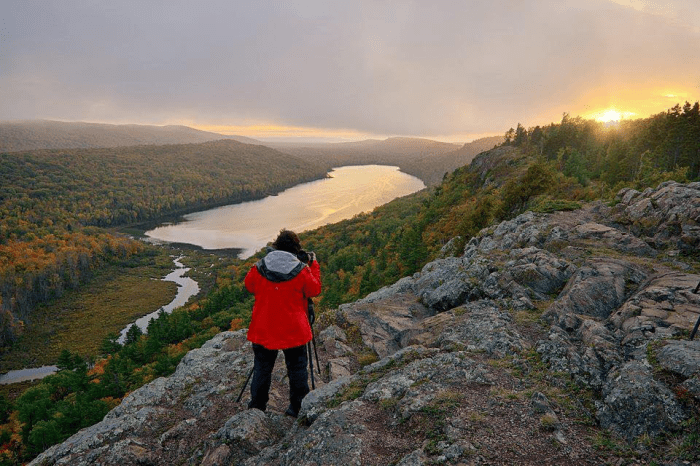
One thing that happened was the re-design of Michigan in Pictures to feature bigger photos, something that pretty much everyone seems to appreciate.

Honorable Mention is the consistently popular post Know Your Michigan Turtles. It was originally published in 2013 and continued to be the most consistently visited post on Michigan in Pictures in 2015. This year I featured the Spiny Soft-shell Turtle on World Tortoise Day and was even re-tweeted by American Tortoise Rescue, the amazing organization behind the day and worldwide turtle preservation. As a turtle fan, I find this awesome.

#5

Pere Marquette 1255

December 7th ~ How Pere Marquette 1225 inspired the Polar Express by Bob Gudas

Subtitle the story of how this iconic engine provided inspiration for the iconic children’s book by Michigan Author Chris Van Allsburg “Why it’s important to preserve our history.”

#4

SS Edmund Fitzgerald Underway

November 10th ~  The Wreck of the Edmund Fitzgerald via Wikimedia Commons

If there’s a Michigan folk song that everyone knows, it’s Gordon Lightfoot’s Wreck of the Edmund Fitzgerald. Read about how he wrote it, watch the best darn video on the internet featuring this song, and marvel at the fact I can’t tell the difference between Walter Cronkite and Harry Reasoner.

#3

Ice Caves Return

January 13th ~  Ice Caves Return to Lake Michigan by Heather Higham

Two years ago, Lake Michigan’s ice caves blew up, drawing tens of thousands of people to the shores of Lake Michigan, and when they formed this year, Heather was there!

#2

Old Mission Storm Cloud

August 3rd ~  Jellyfish Stormfront by Tom Parrent

The crazy storm of early August 2015 devastated areas of Northern Lower Michigan including leveling acres and acres of trees in the Sleeping Bear Dunes National Lakeshore and rendering the village of Glen Arbor inaccessible for days.

#1

Wreckage of the Rising Sun

April 20th ~  Coast Guard shares Manitou Passage shipwrecks from above by the U.S. Coast Guard Air Station Traverse City

The top post of the year is this aerial photo of the 1917 wreck of the Rising Sun by a Traverse City based Coast Guard aircrew. Several more photos available at the link.

Thanks everyone for being a part of Michigan in Pictures in 2015!

Behind every great photo…

Hogback Mountain Photographer

Hogback Mountain, photo by Chelsea Graham

Shots like these help me remember that behind every great photo, there’s someone who went through all the time and effort to get out there and take it.

Thanks so much to all of you photographers who share your work with me – there’s no way I could do what I do without all of your time, effort and love of Michigan.

View Chelsea’s photo background big and see more in her Michigan slideshow.

More fall wallpaper on Michigan in Pictures.

Chasing Fall

Aubrieta at Cloud Peak

Aubrieta Hope at Cloud Peak, photo by Michigan Nut Photography

Aubrieta Hope shared this feature from the Pure Michigan blog about six photographers chasing UP fall color that includes three Michigan in Pictures regulars – Neil Weaver, Craig Sterkin & John McCormick. It begins:

Once upon a time, six shooters ventured north to the Tripod Forest, a fabled land of brilliant fall color in Michigan’s Upper Peninsula. All were packing: most brought Nikon’s, but two carried Canons. They loaded up minivans, SUV’s and 4×4′s, bringing filters and flashlights, bug spray, raingear, ice scrapers, and backpacks. About half of them planned to find a campsite someplace and the others made hotel reservations. Some had never met, but were destined to. A few of them hoped to cross paths up there somewhere.

It was late September and their only plan was to find and follow the color. Frost was in the forecast. The time was now. The 2014 Michigan Fall Foliage Convention had begun!

Click for more including photos of these folks in action!

View Aubrieta’s photo bigger at the Pure Michigan Blog and see her photography at michiganscenery.com. You can also check out the other photographers at Neil Weaver Photography, John McCormick’s Michigan Nut PhotographyCraig Sterken Photography, Phil Stagg’s MI Falls and Kenneth Keifer Photography.

Into the cold clear night with Shawn Malone … and NASA

Shawns Comet

Comet Pan-Starrs over Headlands International Dark Sky Park, photo by Shawn Malone/Lake Superior Photo

Michigan in Pictures regular Shawn Malone of Lake Superior Photo is one of the best photographers of the Michigan night sky around, and on the evening of November 22nd , you have a chance to learn from her at a Night Sky Workshop. She writes:

The Upper Peninsula of Michigan is a wonderful place to discover the magic of night sky photography, due to the abundance of easily accessible dark sky locations. These night sky workshops are designed for those looking for a basic understanding of the equipment and technique necessary for capturing the night sky.

Photography workshops will take place at LakeSuperiorPhoto- gallery/studio on 211 S. Front, Marquette Mi. 49855. There will be an hour class at the studio where I will cover techniques for capturing night sky photos, from basic camera set up and settings, to a brief discussion of post processing to helpful websites and software to help you come away with great night sky photos.

During this workshop we will concentrate on the techniques necessary to capture low light and night sky photos. Hopefully the weather cooperates and we have a chance to photograph the stars or maybe even possibly the northern lights. No matter what weather conditon – we will conduct the workshop and you will come away with everything you need to know about capturing great night sky images.

She has 4 spaces left – click here to register!

You can purchase this photo of Comet Panstars at Lake Superior Photo. Be sure to follow her at Lake Superior Photo on Facebook and see more of Shawn’s photos on Michigan in Pictures.

Speaking of comets, NASA’s Rosetta Mission is going to go all Bruce Willis on a comet THIS MORNING! EarthSky reports:

The Philae (fee-LAY) lander is scheduled to touch down on Comet 67P/Churyumov-Gerasimenko on November 12, 2014 at 10:35 a.m. EST (15:35 UTC). We on Earth – 300 million miles (500 million km) away – won’t know the lander has set down successfully until a signal is received back at about 11:02 a.m. EST (16:02 UTC). Both NASA and ESA will provide live online coverage of this first-ever attempted landing on a comet.

Rosetta spacecraft will do the equivalent of transferring an object from one speeding bullet to another, when it tries to place its Philae lander on its comet. Read more about the mission’s dramatic attempt to land on a comet here.

After landing, Philae will obtain the first images ever taken from a comet’s surface. It also will drill into the surface to study the composition and witness close up how a comet changes as its exposure to the sun varies.

Philae can remain active on the surface for approximately two-and-a-half days. Its “mothership” – the Rosetta spacecraft – will remain in orbit around the comet through 2015. The orbiter will continue detailed studies of the comet as it approaches the sun for its July 2015 perihelion (closest point), and then moves away.

Click through for more and follow it live from NASA right here!

watercolor

watercolor by paulh192 (kingfisher)

watercolor, by paulh192

You really ought to view Paul’s photo of a kingfisher contemplating its next meal bigger. More in his slideshow.

Brought to you by the letter J … and the iPhone

Today's Photo is Brought to You by the Letter J (for Jetsetter)

Today’s Photo is Brought to You by the Letter J (for Jetsetter), photo by Matt Burrows

On January 9, 2007 Steve Jobs announced the iPhone. Within months, photography apps for Apple’s pocket computer with a crappy digital camera began showing up. Apps like Hipstamatic and Shake It made the phone’s resolution weakness tolerable and spawned a resurgent interest in the lomo ethic.

Here’s a nice article on apps to trick your iPhone out for a new year of photography.

Check Matt’s photo out big as Big Bird and see more in his iPhoneography slideshow.

Grace Dickinson & Leelanau County’s Female Photographers

WomenPhotographers-GraceDickinson-SteamerMissouri

Steamer “Missouri” docked in Leland in 1919, photo by unknown, hand colored by Dickinson Photography

This week’s Glen Arbor Sun has a terrific feature by my friend Kathleen Stocking on Six Leelanau County Women Photographers. She profiles Barbara Nowinski, Kathleen (Dodge) Buhler, Meggen Watt Peterson, Ashmir McCarthy, Marty Schilling and Grace Dickinson. Here’s Grace:

Grace Dickinson has a photo studio across the road from the place her grandparents first came to on the south shore of Little Glen Lake in the summer of 1912. Her grandparents traveled to the Leelanau Peninsula by steamer, from the Navy Pier in Chicago up Lake Michigan to Glen Haven. In 1942 her parents met and fell in love while her mother was a writer/editor at the Leelanau Enterprise and soon after became year-round residents. Grace’s father, Fred, a broker who worked from home, spent his free time photographing the dunes and the islands. One unusual photo shows a cloud the exact size of one of the Manitou Islands, above the island, a rare phenomenon caused by condensation when the temperature of the island is colder than that of the surrounding waters of Lake Michigan.

From an early age, Grace followed in her father’s footsteps, quite literally, accompanying him and sometimes photographing the same scenes. Grace left her studies at Northwestern Michigan College to go on a year-long sailing adventure in the Bahamas, and followed this with a two-decade-sojourn out in Montana where she married a rancher and finished college. Grace returned to the Leelanau Peninsula in the late 1980s and became a mapmaker for the Leelanau County Planning Commission. She began taking photos of the Leelanau Peninsula and opened her own studio out of which she sold her own and her father’s photos and maps. In the mid-1990s she revived the 1930s art of photographic hand-coloring, laboriously hand-tinting her father’s black and white photos of earlier years, photos which evoke the shadows and starkness of some of the photos of Diane Arbus, but as applied to nature, not people. In the medium of hand-coloring Grace discovered a way to keep her father’s legacy alive and express her own love of Leelanau. Her photo studio is on Glenmere (M-22) west of the bridge over the Glen Lake Narrows.

Head over to the Glen Arbor Sun for more! The photo above is labeled as having been taken in Glen Arbor in 1909, but former Leelanau Historical Museum Director Laura Quackenbush identified it as Leland’s dock. The photo was hand-colored by Grace from an old negative on glass found in the Leelanau Enterprise office during the time her parents (briefly) owned it.

If you’re interested in more work bu Grace and her father, head over to Dickinson Photography. I’ve also featured several photos from Fred Dickinson on Michigan in Pictures, and you can click that link to read a little about the coloring process.

Sleeping Bear Dunes Ghost Forest

Ghost Forest

Ghost Forest, photo by Neil Weaver Photography

Walk silently through the haunting landscape of the ghost forest of Sleeping Bear Point Trail
and wind spirits whisper to you and chatter among the skeletons of long dead cedars.
If you do not hear them you are not listening.
I am sure the Anishinaabek knew the song in their day on Sleeping Bear.
~Jonathan Schechter, Earth’s Almanac

Jonathan Schechter who runs the very cool blog Earth’s Almanac at the Oakland Press penned these lines about the Ghost Forest on the Sleeping Bear Dunes (thanks SleepingBearDunes.com for the link). Click through for a photographic account of his visit!

The Sleeping Bear Dunes National Lakeshore page on the Sleeping Bear Dunes Overlook explains how the ghost forest was created:

The Sleeping Bear Dune is estimated to be about two thousand years old and has a fascinating history. It is classified as a perched dune because it is perched on top of a plateau, high above the lake. When the dune was forming, it was not at the edge of the bluff, but somewhat inland.Wind carried sand from the upper portion of the Lake Michigan bluff inland and deposited it to form the Sleeping Bear Dune.

Notice the skeletons of dead trees within the eroded bowl of the dune. This called a ghost forest and tells a story of alternating stability and change. After an initial phase of active sand accumulation, a period of stability followed when trees began to grow on the dune. Later, more sand moved in and buried the trees. Two layers of buried soil within the dune indicate that there was a second period of stability and tree growth, followed by another period of sand build-up and then the final growth of the trees and shrubs that now cover the sheltered portions of the dunes.

For a long time, the sleeping Bear Dune stood at about 234 feet high with a dense plant cover. However, trough most of the twentieth century, erosion has prevailed.

By 1961, the dune was only 132 feet high, and by 1980, it was down to 103 feet. The process is a continuing one. The major cause of the dune’s erosion was wave action wearing away the base of the plateau on which the dune rests. As the west side of the dune loses its support, it cascades down the hill. The wind, too, is a major agent of erosion, removing sand and destroying the dune’s plant cover. What does the future hold? It seems that the present trend will continue and it is only a matter of time until the Bear disappears completely.

See Neil’s photo bigger and see more in his Sleeping Bear Dunes slideshow. You can see a bunch more shots from Sleeping Bear for viewing & purchase on his website!

More dunes on Michigan in Pictures.

North Country Dreamland

North-Country-Dreamland-at-Miners-Castle-by-Shawn-Malone


North Country Dreamland at Miners Castle, photo by Shawn Malone / lakesuperiorphoto.com

Last night I got an alert of a moderately strong solar flare with the possibility of generating northern lights. When I went looking to see if anyone had photographed them, I discovered that Michigan in Pictures regular Shawn Malone has just released a truly stunning video featuring a series of time-lapses of the night skies of northern Michigan! She writes:

Rare pairings caught on camera include ribbons of aurora above a full moon fogbow on the horizon of Lake Superior, the aurora and an isolated singular lightning storm cloud over Lake Superior, and the aurora and Milky Way in several scenes including Copper Harbor, Marquette, Isle Royale, Pictured Rocks, and Eagle Harbor Lighthouse.

…All scenes are within 200 miles or so of my home in Marquette, Mi. and I feel very blessed to live where I do and to share the beauty that I see ‘in my own backyard’ with you. I hope it inspires others to take time to find the beauty that is everywhere around us and also to raise an awareness about the importance of preserving our night wondrous starlit skies.

You can read about it and see it on Absolute Michigan or head over to Vimeo to watch it.

The shot above is one of 33 different scenes in the video and shows Miners Castle in the Pictured Rocks National Lakeshore. See it bigger in the video and see a lot more on the Lake Superior Photo Facebook.

Much more from Shawn on Michigan in Pictures.

Locally Known as “the Bowl”

Locally Known as "the Bowl"

Locally Known as “the Bowl”, photo by karstenphoto

EDIT: Wow I really messed this one up, sleepily citing an article that gave the dune’s age in the millions of years. Thanks to Tom Burrows for the catch. Let’s see if this information on coastal dunes from the DNR makes more sense:

Michigan’s glacial history provides an explanation for the formation of dunes. The Great Lakes dune complex is relatively young, in terms of geological time. As recently as 16,000 years ago, Michigan was covered with glacial ice thousands of feet thick. This glacial ice contained a mix of boulders, cobbles, sand, and clay. During glacial melting, this deposit was left and is known as glacial drift.

This glacial drift is the source of sand in most of Michigan’s dunes. The sands were either eroded from glacial drift along the coast by wave activity or eroded from inland deposits and carried by rivers and streams. Only the hardest, smallest, and least soluble sand grains were moved. Waves and currents eventually moved these tiny rocks inland, creating beaches along the Great Lakes shoreline.

…Blowouts are saddle shaped or U shaped (parabolic) depressions in a stabilized sand dune, caused by the local destabilization of the dune sands. Blowouts, which originate on the summit or windward face of a dune, are often rapidly formed by the wind, creating narrow channels and exposing plant roots. Blowouts can create interruptions in the shape of parallel dunes that may result in deeply carved indentions called parabolic dunes. It is the combination of interwoven parallel dune ridges and U shaped depressions, including parabolic dunes, that characterizes the classic dunes from Indiana, northward to Ludington, in Michigan.

Awesome Michigan wrote a little about The Bowl at Holland saying:

The Bowl is an gigantic sand bowl, resembling a sort of concave desert. Along with the other dunes and Lake Michigan itself, The Bowl was carved out of the earth by glaciers millions of years ago and was likely a small lake before drying up. Standing at the center of The Bowl and being surrounded on all sides by enormous walls of sand is quite breathtaking. The landscape is truly like no other. This awesome sight alone makes a trip to Laketown a summer necessity and a great, relaxing place to bring friends and family.

You can also check in there on Foursquare. Here’s another shot from the bowl from all the way back in 2007. Amazing to me how long Michigan in Pictures has endured – thank you all for staying with me!

Check Stephen’s photo out big as the Bowl and see this and many more in his FILM! slideshow.

More dunes on Michigan in Pictures.