Mackinac Wake

Mackinac Bridge from ferry

Mackinac Wake, photo by Bill Johnson

Bill took this photo in May of 1987 and writes:

We had been out to the island and were returning via ferry when the captain announced a slight detour in our route. There was some kind of a special group aboard and as a treat, our boat went under the Mighty Mac, something they hardly ever do. It was pretty neat. The five mile long bridge is no longer the longest suspension bridge in the world, but to me it’s still the prettiest. I’ve personally seen several other suspension bridges, including the Golden Gate, and I’ll pick the Mac every time.

View his photo background big and see more in his Michigan slideshow.

Lots more of the Mighty Mackinac Bridge on Michigan in Pictures!

Way above the Mighty Mac

Mackinac Bridge from Above

The Mackinac Bridge, photo by FotoLense

Well while we’re up in the air (see yesterday) why not stay there?

View this photo background bigtacular and see more including some more aerials from the area in FotoLense’s Mackinac Island July 2013 slideshow.

There’s some great facts about the Mackinac Bridge if you click the photo and a ton more on the Mighty Mac from Michigan in Pictures!

Above the Fog at the Mackinac Bridge

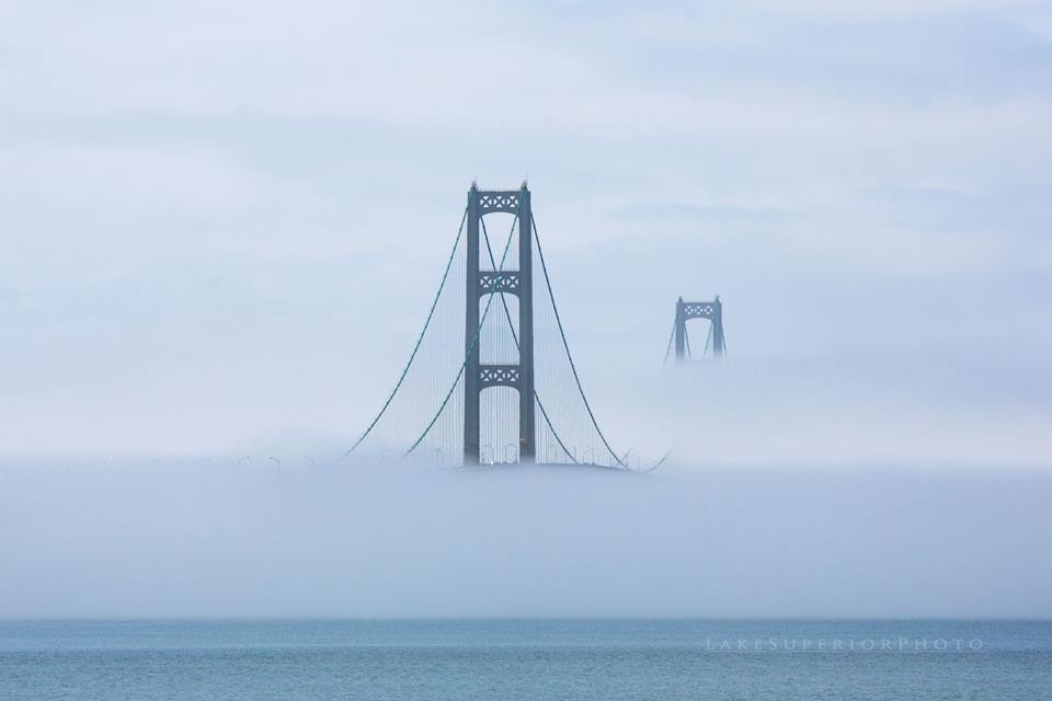
Mighty Mac in Fog

Mighty Mac in the Fog, photo by Lake Superior Photo

Shawn writes that she crossed a very mysterious looking Mackinac Bridge on Sunday – no shortage of fog lately!

View the photo bigger on Facebook and see more & purchase prints in Lake Superior Photo’s Mackinac Bridge Gallery.

More fog & mist on Michigan in Pictures.

Clouds of Michigan: Mackinac Bridge Edition

Mackinac Bridge, Michigan by Zack Schindler

Mackinac Bridge, Michigan by Zack Schindler

Zack says that he shot this in B&W with the red filter turned on in the X-E1.

View it big as the sky and see more in his My Other Stuff slideshow.

More black & white photography on Michigan in Pictures.

Way up high and round and round with Pure Michigan

Atop the Mackinac Bridge, photo courtesy Google Trekker

Pure Michigan announced a cool new way to experience some of Michigan’s scenic treasures:

Through a partnership between Pure Michigan and Google, many of Michigan’s iconic destinations are now accessible to people all around the world through Street View in Google Maps. Google’s Street View Trekker is a backpack system with a camera on top that is worn by an operator who walks through pedestrian walkways or trails on foot – or in the case of some Michigan locations by kayak. The imagery is captured automatically and stitched together to create the 360 degree panorama seen on Google Maps.

More than 44,000 panoramic photos were taken by members and volunteers on the Pure Michigan team and the Department of Natural Resources who borrowed the Trekker and traveled for four weeks, capturing breathtaking scenes around Michigan, including this stunning view from the top of Mackinac Bridge.

Click through for a video introducing the partnership and a bunch of panoramic scenes from the State Capital to Mackinac Island to the Sleeping Bear Dunes to Tahquamenon Falls. Be sure to check out the behind the scenes for this pano as well!

MDOT Pic of the Day: Office with a View

Mackinac Bridge Walking Down the Cables

Office with a View, photo by MDOT Pic of the Day

Discovered the Michigan Department of Transportation’s MDOT Pic of the Day Instagram yesterday. The other day they posted this photo of an unidentified Mackinac Bridge employee out for a stroll:

One thing about working on the #MackinacBridge, your office has a good view. :)

Indeed!

View the photo bigger and follow them on Instagram.

PS: From the Full Circle Department, a couple of days ago Michigan in Pictures regular Rudy Malmquist shared a link to some photos of the Coast Guard Cutter HollyHock breaking the ice under the bridge!! Click that link to see page through them on Facebook.

More of the Mighty Mac on Michigan in Pictures.


Bridge to the North

Mackinac Bridge

Mackinac Bridge, photo by Dan Moran

If you want to call this the world’s most beautiful bridge, you’ll get no argument from me.

View Dan’s photo background bigtacular and settle into his slideshow for a couple more amazing shots from Michigan. Then – because everyone needs a vacation every so often – keep watching for some jaw-dropping pics from Alaska. Seriously: wow, wow, WOW.

There’s lots more winter wallpaper and lots more of the Mackinac Bridge on Michigan in Pictures.

The Mackinac Bridge Walk: a Michigan Labor Day Tradition

Yikes! I accidentally re-blogged a photo by Dave so I switched it out for the one below…

OPEN ARMS

OPEN ARMS, photo Dave Trapp

The annual Mackinac Bridge Walk has been held every year on Labor Day since the Bridge opened in 1957, which means the Bridge Walk is celebrating its 57th anniversary. Just 68 people took that first 5 mile walk across the Mighty Mac, but since the Governor began leading the walk, it averages 40,000 to 65,000 attendees.

Follow along for photos and updates at the Mackinac Bridge Facebook page and also jump on the Mackinac Bridge Cam for a live view!

View Dave’s photo bigger and see more shots from his walk in 2010 in his slideshow.

Lots more about the Mackinac Bridge on Michigan in Pictures!

#TBT: Frozen Straits

Mackinac Bridge

Mackinac Bridge, photo by Mark Miller

OK, we’re not throwing back too far for this Thursday, but I wanted to share a really cool view that Mark took this February of the Mackinac Bridge and the Straits of Mackinac locked in the grip of the Polar Vortex.

View his photo bigger and see more great views of Michigan from above in his Aerials slideshow. You can also see one of his aerial photos of the Straits from last August on Michigan in Pictures.

There’s more aerials and more Mackinac Bridge on Michigan in Pictures!

The Making of the Mackinac Bridge

Bridge_HDR2.jpg

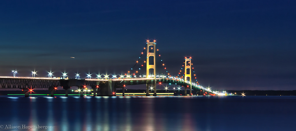
Bridge HDR 2, photo by Allison Hopersberger

A calm night on the Straits of Mackinac, and Michigan’s signature bridge was looking fine!

I’ve posted a ton about the Mighty Mackinac Bridge here on Michigan in Pictures, but had never seen this excellent summary of how it came to be courtesy the Michigan Dept. of Transportation’s page on I-75 and the Straits of Mackinac:

The five-mile stretch of water separating Michigan’s two peninsulas, the result of glacial action some twelve thousand years ago, has long served as a major barrier to the movement of people and goods. The three railroads that reached the Straits of Mackinac in the early 1880s, the Michigan Central and the Grand Rapids & Indiana Railway from the south, and the Detroit, Mackinac and Marquette from the north, jointly established the Mackinac Transportation Company in 1881 to operate a railroad car ferry service across the straits. The railroads and their shipping lines developed Mackinac Island into a major vacation destination in the 1880s.

Improved highways along the eastern shores of Michigan’s lower peninsula brought increased automobile traffic to the straits region starting in the 1910s. The state of Michigan initiated an automobile ferry service between St. Ignace and Mackinaw City in 1923 and eventually operated eight ferry boats. In peak travel periods, particularly during deer season, five mile backups and delays of four hours or longer became common at the state docks at Mackinaw City and St. Ignace.

With increased public pressure to break this bottleneck, the Michigan legislature established a Mackinac Straits Bridge Authority in 1934, with the power to issue bonds for bridge construction. The bridge authority supported a proposal first developed in 1921 by Charles Evan Fowler, the bridge engineer who had previously promoted a Detroit-Windsor bridge. Fowler’s plans called for an island-hopping route from the city of Cheboygan to Bois Blanc, Round, and Mackinac islands, thence to St. Ignace, along a twenty-four-mile route. The Public Works Administration flatly rejected a request for loans and grants to implement this project.

A plan was then drawn up for a direct crossing from Mackinaw City to St. Ignace, but they were again denied funds. In 1940, a plan was submitted for a suspension bridge with a main span of 4600 feet. This design was a larger version of the ill-fated Tacoma Narrows Bridge in Washington State, a structure destroyed by high winds on November 7, 1940. Although the disaster delayed any further action, the activities of 1938-1940 nevertheless produced some important results. The bridge authority conducted a series of soundings and borings across the straits and built a causeway extending out 4200 feet from the St. Ignace shore. The Second World War ended any additional work, and the Legislature abolished the bridge authority in 1947.

William Stewart Woodfill, president of the Grand Hotel on Mackinac Island, almost singlehandedly resuscitated the dream of a bridge across the Straits of Mackinac. Woodfill formed the statewide Mackinac Bridge Citizens Committee in 1949 to lobby for a new bridge authority, which the legislature created in 1950. A panel of three prominent engineers conducted a feasibility study and made recommendations to the bridge authority on the location, structure, and design of the bridge.

The State Highway Department, which had just placed a $4.5 million ferryboat, Vacationland, into service at the straits in January 1952, remained hostile to the bridge plan. In April 1952, the Michigan legislature authorized the bridge authority to issue bonds for the project, choose an engineer, and proceed with construction. The authority selected David B. Steinman as the chief engineer in January 1953 and tried unsuccessfully to sell the bridge bonds in April 1953, but by the end of the year, the authority had sold the $99.8 million in revenue bonds needed to begin construction.

View Allison’s photo bigger and see LOTS more in her Mackinac Island slideshow!