Ice is Nice: Tracking Ice Cover on the Great Lakes

shoreline-ice-on-lake-michigan

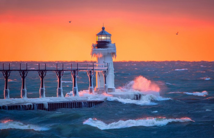
Shoreline Ice, photo by Mark Swanson

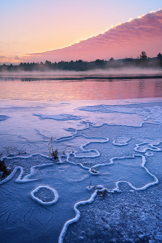
Ice on Michigan’s Great Lakes has become something of a phenomenon in the last few years, attracting photographers and thousands more to see the ephemeral beauty created by wind, water, and freezing temperatures. But ice has other important purposes, as NOAA’s Great Lakes Environmental Research Laboratory page on Great Lakes Ice Cover explains:

Ice formation on the Great Lakes is a clear signal of winter. Looking back in time, the lakes were formed over several thousands of years as mile-thick layers of glacial ice advanced and retreated, scouring and sculpting the basin. The shape and drainage patterns of the basin were in a constant state of flux resulting from the ebb and flow of glacial meltwater coupled with the rebound of the underlying land as the massive ice sheets retreated.

Heavy ice cover can reduce the amount of evaporation from the Great Lakes in the winter, thus contributing to higher water levels.

In bays and other nearshore areas, ice forms a stable platform for winter recreational activity such as ice fishing. This stable ice also protects wetlands and the shoreline from erosion.

  • 94.7% ice coverage in 1979 is the maximum on record (data began in 1973)
  • 9.5% ice coverage in 2002 is the lowest on record
  • 11.5% ice coverage in 1998, a strong El Niño year
  • The extreme ice cover in 2014 (92.5%) and 2015 (88.8%) were the first consecutive high ice cover years since the late 1970s.

NOAA pegs the current ice cover at 9.9% and you can also watch an animation of the last 60 days of ice formation. You can check out satellite images of the Great Lakes for current ice cover and also this cool animation of Great Lakes ice cover from 1973 – 2016.

Mark took this photo a little over a week ago at Lincoln Township Park near Stevensville. With the warmer weather, there’s probably less. View his photo bigger and see more in his Michigan Winter slideshow.

Confluence of Montreal River and Lake Superior

confluence-of-montreal-river-and-lake-superior

Confluence of Montreal River and Lake Superior, photo by Kirt E. Carter

Waterfalls of the Keweenaw has a nice feature on the Montreal River and Montreal Falls that says in part:

Located right at the mouth of the Montreal River as it tumbles into Lake Superior, Montreal Falls is a rugged, beautiful cascade over blocky volcanic rocks. The views over the lake are incredible: to the west you can see Bare Bluff and Mt Bohemia rising along the lake shore, to the southwest the distant side of Bete Gris Bay, and to the south (on a clear day) the Huron Mountains ripple up above the lake. The drop sits at the last easily accessible southern spot on the tip of the Keweenaw, with Fish Cove, Keystone Bay, and Keweenaw Point a tough drive/hike beyond.

Some flat ground for camping sits on the shore of the waterfall, complete with a few fire rings and a convenient beach for kayakers, and during summer weekends a few tents can be found near the falls. A narrow trail leads up along the river towards Upper Montreal Falls, more traveled by fishermen than anyone else, and an even fainter path can be found leading further east to Fish Cove.

Read on more maps & more!

View Kirt’s photo bigger, see more in his slideshow, and see more work on his website.

Golden Light at the Lighthouse

golden-light-at-the-lighthouse-by-photojacko-jackie-novak

Golden Light at the Lighthouse, photo by PhotoJacko – Jackie Novak

View Jackie’s photo bigger, see more in her Winter slideshow, and be sure to follow Jackie Novak Photography on Facebook.

PS: You can do a little Throwback Thursday to January 12, 2015 and the Polar Vortex at the St. Joseph Lighthouse.

Frozen Map of Dawn

frozen-map-of-dawn

Frozen Map of Dawn, photo by Heather Higham

Heather writes: Ice formations trace a map in an inland lake’s surface as a mountain of pink clouds engulfs the sky.

View her photo bigger, see more in her slideshow, and view & purchase photos at Snap Happy Gal Photography.

Suspended

suspended

Suspended, photo by paulh192

Paul captured this very cool ice formation along the shoreline of Lake Michigan last week. View it photo bigger and see more in his slideshow.

USS Edson at the Saginaw Valley Naval Ship Museum

uss-edson-frozen-in-the-saginaw-river

USS Edson frozen in the Saginaw river, photo by Tom Clark

The USS Edson is located at the Saginaw Valley Naval Ship Museum in Bay City. The say (in part):

The keel for the Forrest Sherman class destroyer USS EDSON (DD-946) was laid at Bath Iron Works in Bath, Maine, on 3 December 1956. EDSON is one of the relatively few ships of the U.S. Navy named for a United States Marine, in this case Major General Merritt Austin Edson.

Edson was launched on 4 January 1958 by General Edson’s widow, Ethel Robbins Edson, who broke the traditional bottle of champagne over the ship’s bow. EDSON’S final fitting out and sea trials occupied the next ten months, and on 7 November 1958, EDSON was commissioned under the command of CDR Thomas J. Moriarty, USN. She then sailed in early 1959 to the Caribbean and through the Panama Canal to reach her original homeport of Long Beach, California, on 2 March 1959.

For the next two decades, EDSON served as a valuable member of the U.S. Pacific Fleet, earning a reputation as a Top Gun ship and the nickname, “The Destroyer.” Her ship’s crest included a skull copied from the shoulder patch worn by then Colonel Edson’s First Marine Raider Battalion.

Note that the Museum itself is closed for the winter until March!

View Tom’s photo bigger and see more in his Ships & Boats slideshow.

More ships & boats on Michigan in Pictures!


11th Anniversary of Michigan in Pictures!

water-spray-by-sandy-hansen-photography

Water Spray, photo by Sandy Hansen Photography

On December 30, 2005 I posted the first photo to Michigan in Pictures. 11 years later, it’s still going so I guess I must be doing something right. Thanks to all you photographers and fans for being a part of Michigan in Pictures!!

I figured Lake Michigan popping its cork would be better than champagne.

View Sandy’s photo bigger and see more in her Northern Michigan slideshow.

Icy Straits

icy-sraits-by-michigan-nut-phototography

Icy Straits, photo by Michigan Nut Photography

As I work on the year in review of the year’s top photos on Michigan in Pictures, I thought it would be cool to share regular contributor John McCormick’s favorite 2016 photos on his Michigan Nut Photography site. A couple made Michigan in Pictures this year and the choice of which one to feature was hard so check them all out!

View John’s photo bigger and purchase it as well and be sure to follow him on Facebook as well!

White Walkers

white-walkers-by-aaron-springer

White Walkers, photo by Aaron Springer

I think we can all agree that Winter is not merely coming, it’s here.

View Aaron’s photo bigger and see more in his slideshow.

Michigan’s Lake Effect Snow and the Ice Beast of the Frozen Tundra

ice-beast-of-the-frozen-tundra

Ice Beast of the Frozen Tundra, photo by Mark Miller

As Michigan deals with the first winter storm of the season, it’s a good time to brush up on how Michigan’s lake effect snow machine works with a nice video (below) from mLive chief meteorologist Mark Torregrossa who writes:

The areas hit by lake effect are called snowbelts. Some parts of the snowbelts typically get much more snow than other parts. This is because some locations get lake effect from multiple wind directions. Good examples are in the heart of the northwest Lower Peninsula snowbelt. Mancelona and Gaylord get heavy lake effect with northwest, west and slightly southwest winds. Also, the Keweenaw Peninsula, sticking out into Lake Superior, can get lake effect snow from west winds to north winds to northeast winds. That’s why they often shovel over 200 inches of snow in Houghton, MI.

The opposite is true for Grand Rapids and to some extent, Traverse City. Grand Rapids needs a west to southwest wind for heavy lake effect. West winds are common in winter, but don’t tend to last for more than 12 hours. That’s why Grand Rapids often gets only 12 hours of heavy lake effect and a few inches of snow. The wind then veers to the northwest and areas around Holland and Allegan get buried. Downtown Traverse City has a hard time getting heavy lake effect also. Traverse City needs a north-northwest wind to straight north wind for the heaviest lake effect to move into downtown. That wind flow does happen, but it only lasts 24-48 hours a few times each winter.

Thanks to another Mark, Mark Miller, for today’s photo of the Ice Beast of the Frozen Tundra aka Major. View the photo bigger and see more in his “Major” slideshow.

Here’s Mark Torregrossa’s video: