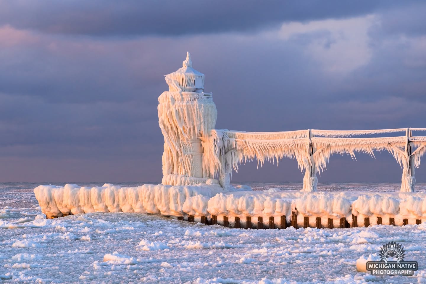
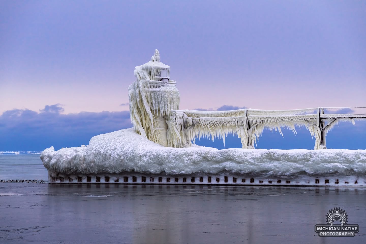
These photos of the St. Joseph North Pier Outer Lighthouse on Lake Michigan taken just four days apart provide a dramatic example of how fast cold weather & high winds can build ice! For sure follow Michigan Native Photography on Facebook for their latest & more great Michigan photos.
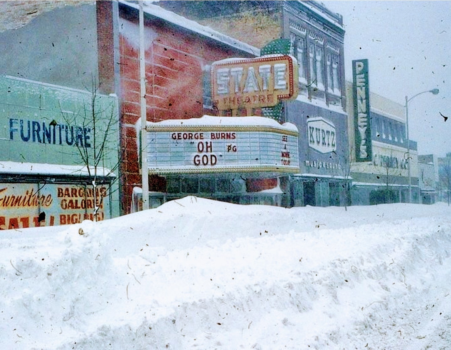
“The most extensive and very nearly the most severe blizzard in Michigan history raged throughout Thursday January 26, 1978 and into part of Friday January 27. About 20 people died as a direct or indirect result of the storm, most due to heart attacks or traffic accidents. At least one person died of exposure in a stranded automobile. Many were hospitalized for exposure, mostly from homes that lost power and heat. About 100,000 cars were abandoned on Michigan highways, most of them in the southeast part of the state.” -National Weather Service Ann Arbor Meteorologist in Charge, C.R. Snider on January 30th, 1978
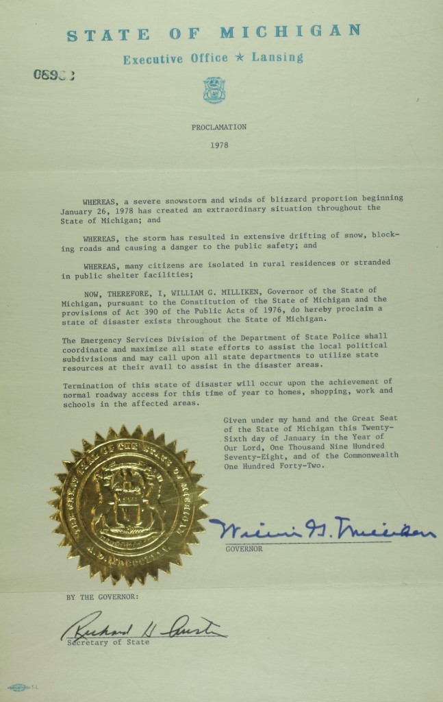
48 years ago one of the most powerful blizzards in Michigan history brought the state to a standstill. In her feature on historical Michigan snow days in the now defunct Seeking Michigan, Jessica Miller of the Archives of Michigan related:
On January 26-27, 1978, snowstorms with fifty-to-seventy-mile per hour winds pummeled much of Michigan. Snowfall totals ranged from eighteen inches in Lansing to an incredible fifty-one inches in Traverse City. More than 100,000 cars were abandoned on roads and highways, and travel was impossible for days. Governor William G. Milliken declared a state of emergency on January 26 (See the image below.) and activated the National Guard to assist with the cleanup. The governor also requested financial assistance from the federal government and estimated damage totals to be more than $25 million, not including lost productivity from workers who were unable to get to their jobs.
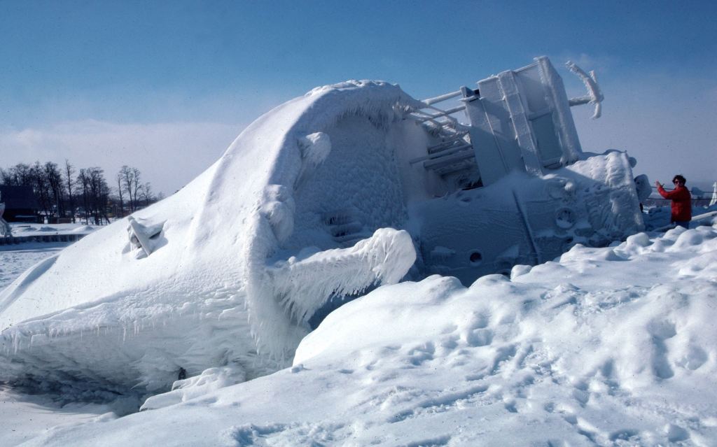
Regarding the photo, John wrote: Marty Lagina stands on the frozen pier at the Great Lakes Maritime Academy on January 29, 1978, viewing the capsized training vessel Allegheny, which capsized from ice buildup during the Blizzard of ’78. This image was on assignment for TIME magazine, who had seen my b&w image on the UPI wire and wanted a color image. Marty and I were lucky – the sky cleared and the wind stopped for about 20 minutes, then the storm began again. I wondered at the time who TIME knew to make that happen…
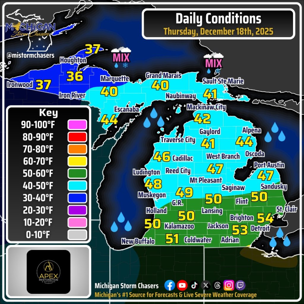
The only places not under an Extreme Cold Warning are the Southeast corner of the state – from Saginaw and The Thumb down to Flint, Ann Arbor and Detroit, as well as the Lansing and Jackson area along the southern rim of Michigan. Those southern and eastern spots are under a Cold Weather Advisory, as the cold is not expected to be quite as severe there.
The Extreme Cold Warning now covers the Upper Peninsula – where wind chills could plummet to -45 degrees over the next couple of days – and all of Northern Michigan and West Michigan. This extreme warning covers Grand Rapids, Holland, Muskegon, Traverse City, Gaylord and the Tip of the Mitt, too.
That’s a big yikes from me! Brian took this when we were deep in the polar vortex of January of 2019 from the South Pier in Grand Haven. See his latest on Flickr and STAY WARM!
PS: If you want to tune into the current scene in Grand Haven, check out the Grand Haven South Pier Cam!
Aubrieta shared this incredible shot of a sunset over Lake Superior in the Pictured Rocks National Lakeshore. Follow Michigan scenery on Facebook for her latest and view & purchase her work on her website.
Not gonna lie, I’m not feeling good about the “plan” for Venezuela. Also, while I actually have a degree in the geopolitics of the Caribbean basin, I don’t plan to argue the logic of starting a conflict with a Chinese ally because of “drugs” but then switching to “oil & regime change” before the fires are even out. Is Maduro a good guy? Unquestionably not. Is invading a nation of 30 million people for vague & shifting reasons a good idea? Also no.
Point Betsie Lighthouse on Lake Michigan just north of Frankfort is one of the most photographed lighthouses in Michigan, but it’s definitely an “ice cleats mandatory” location this time of year! If this view looks good to you, consider supporting the renovation of this iconic lighthouse on with a stay in the Keepers Quarters.
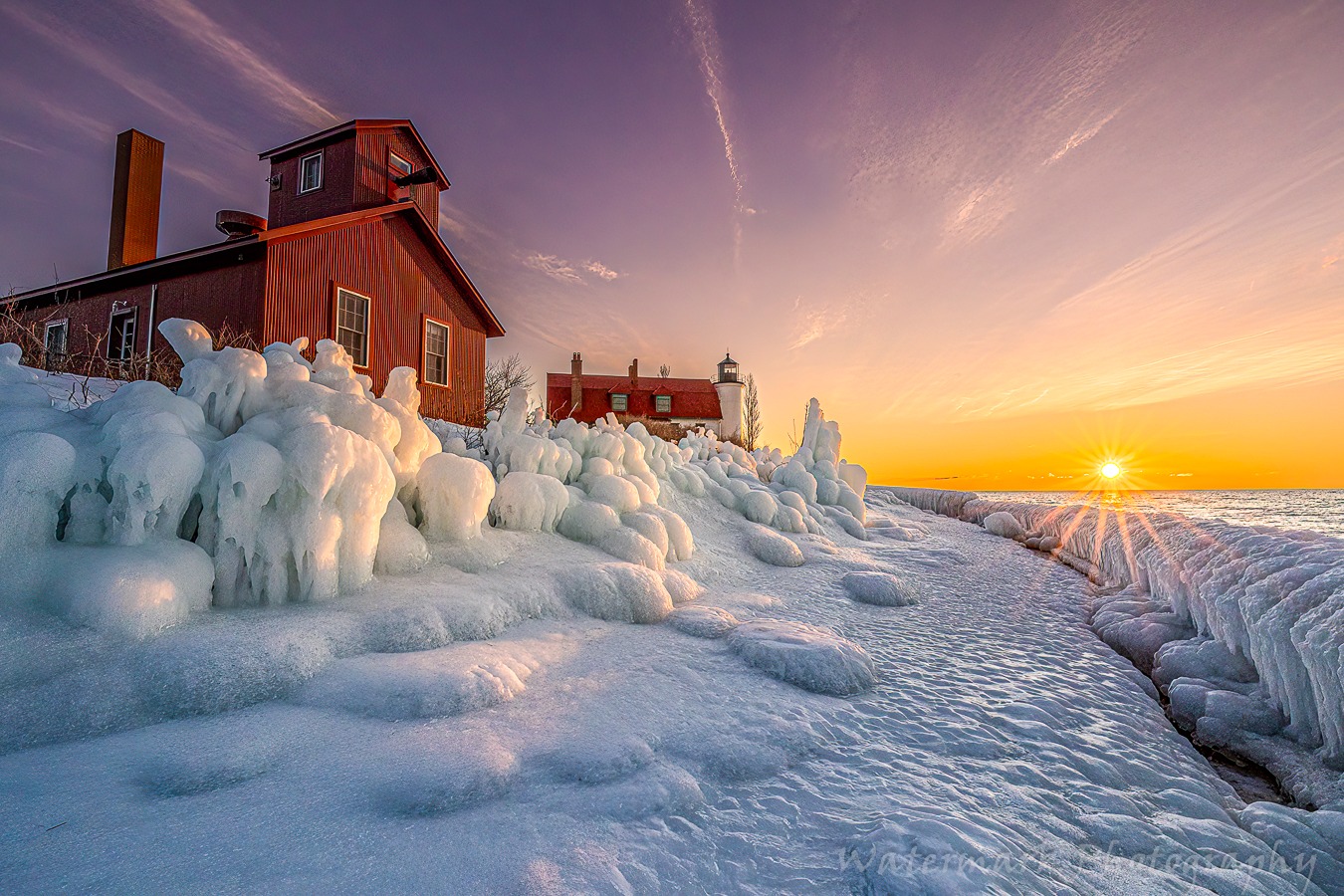
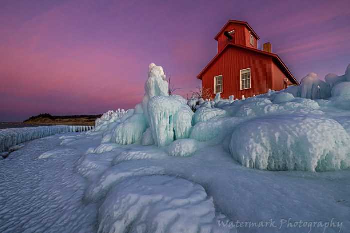
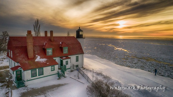
Jeff shares that Wednesday evening was his first time in a while seeing clear skies and sunset, and the ice sculptures made by the wind and breaking waves did not disappoint! There’s a couple more pics below. See (and purchase) this photo & others in the Winter Wonderland gallery on his website, and for sure follow Watermark Photography on Facebook for his latest.
The folks at Michigan Storm Chasers share a detailed statewide Michigan weather forecast every morning that you should definitely incorporate into your daily feed. On Facebook they share that although we will see temps above freezing for most of the state, even topping 50 degrees in southern Michigan, temps will drop later in the day, potentially precipitously in what is known as a “flash freeze”. A flash freeze happens when rain has fallen, completely stopped, and then shortly afterward air temperatures drop from the 40s or 50s down into the 20s or colder. Ryan explains is all in their excellent video.
Michael shared this photo 13 years & one day ago on December 17, 2012, remarking that it was strange to see rain in December in the UP. Here are a couple more he shared to our Absolute Michigan group on Flickr, and you can see more in his The UP Eh! gallery.
Today is one of those days when I see the photo first and go looking for the post because honestly WOW! So here are some updates:
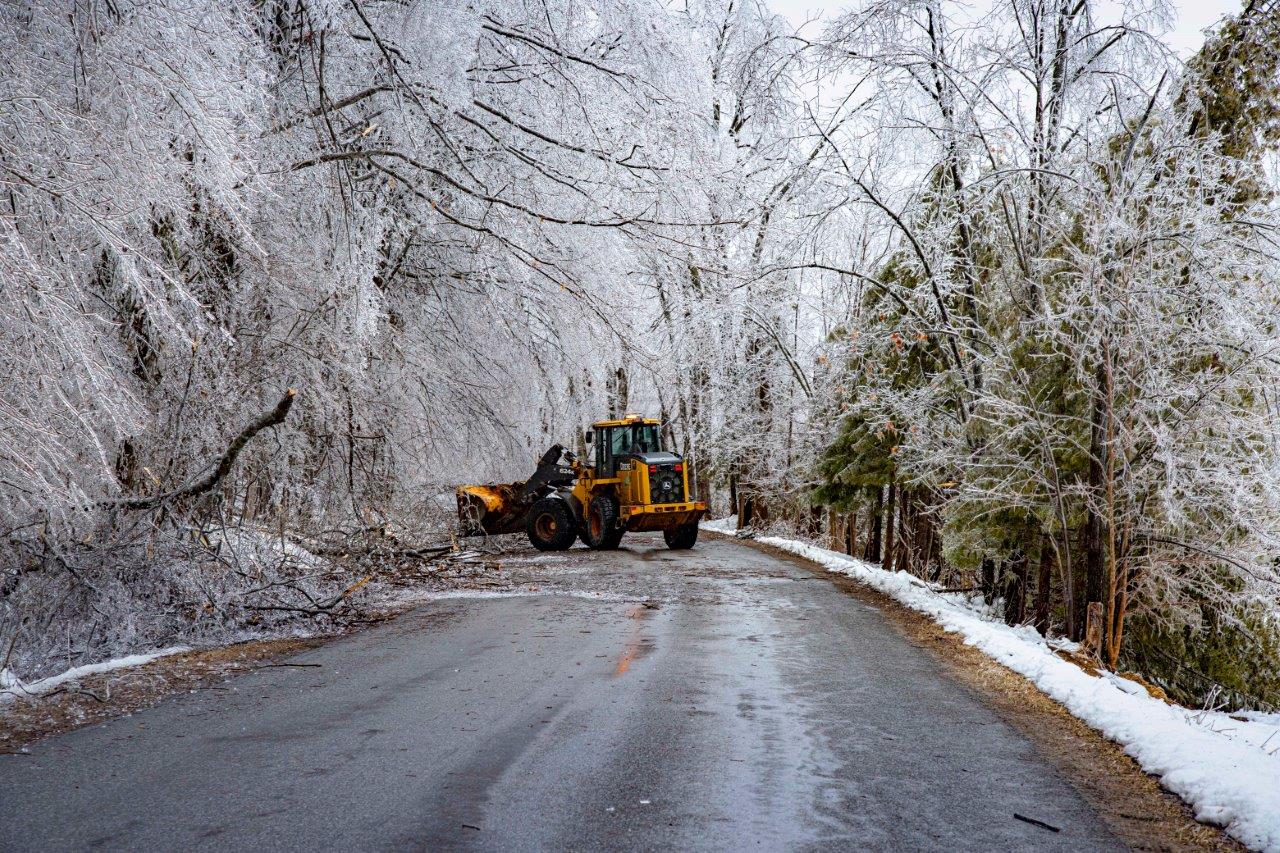
Last week Gov Whitmer met with President Trump & officially requested a Presidential Emergency Declaration for 12 counties and the Little Traverse Bands of Odawa. The request has nothing to do with FEMA actions or the ongoing process to pursue a Presidential Major Disaster Declaration, which is required to access longer-term recovery programs.
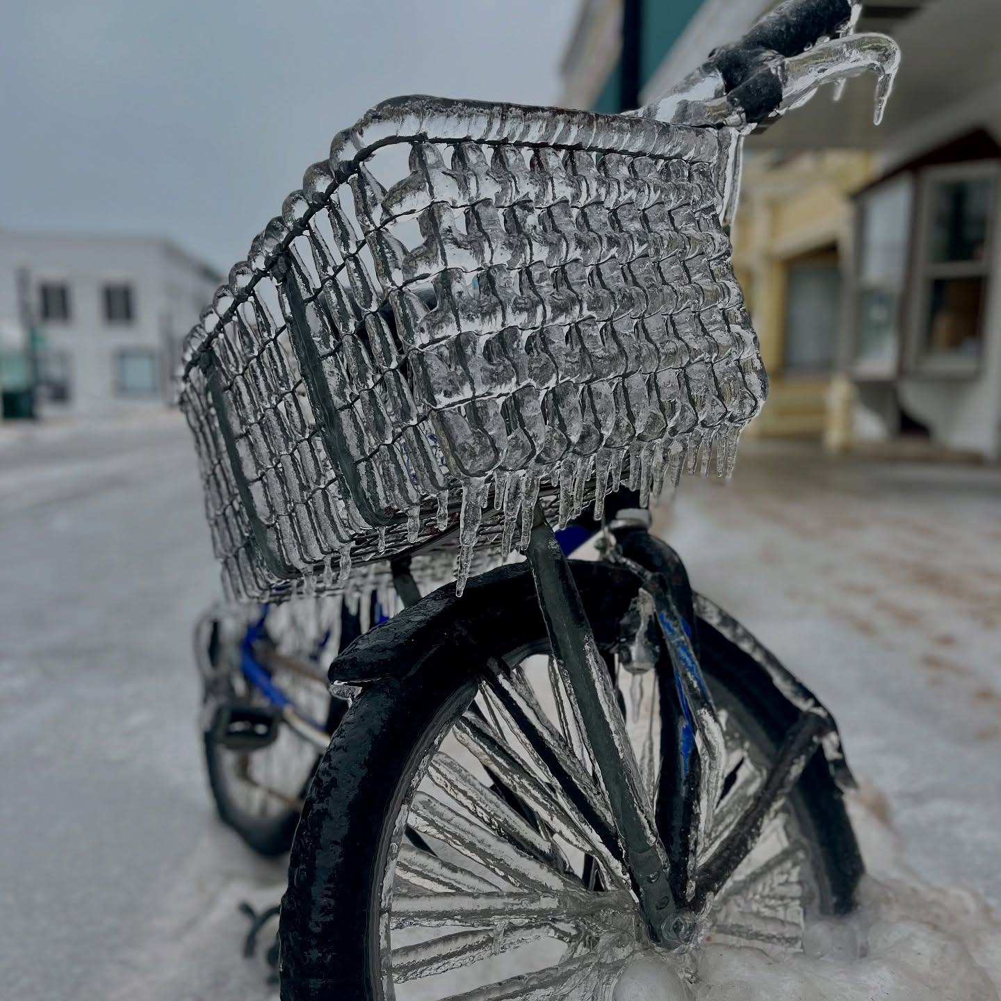
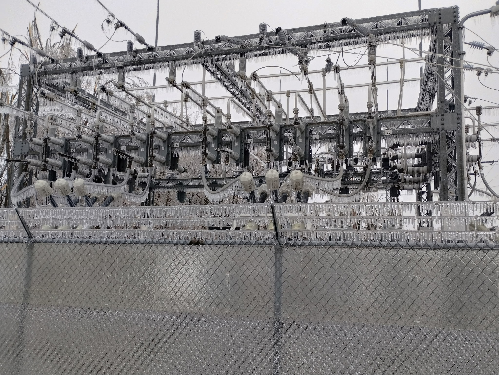
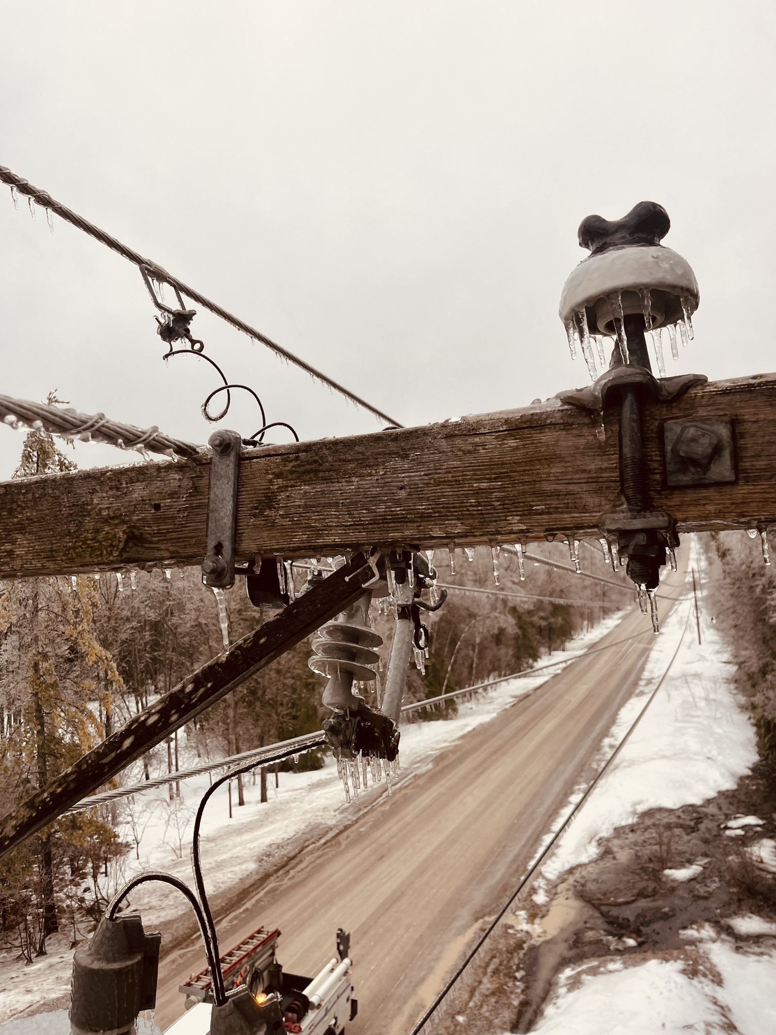
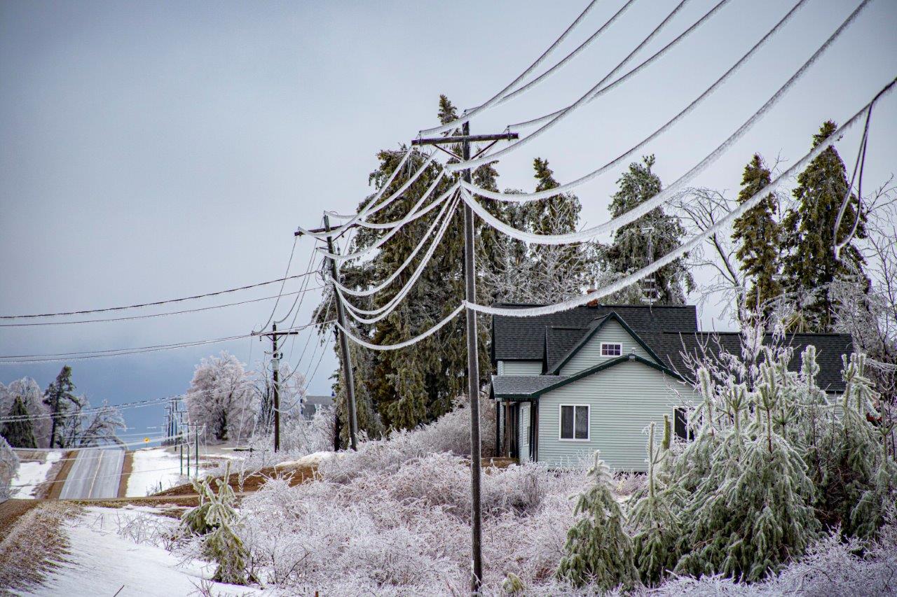
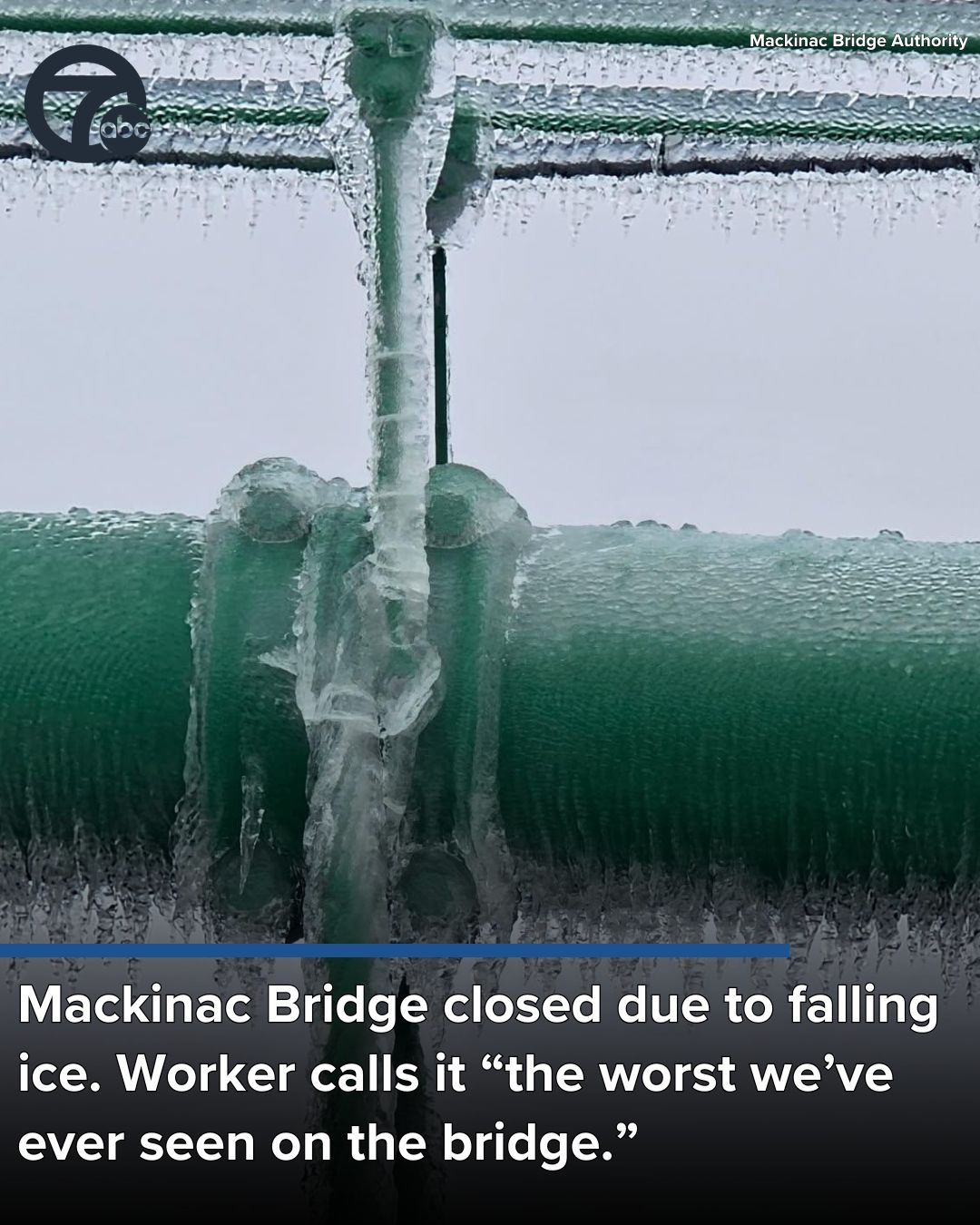
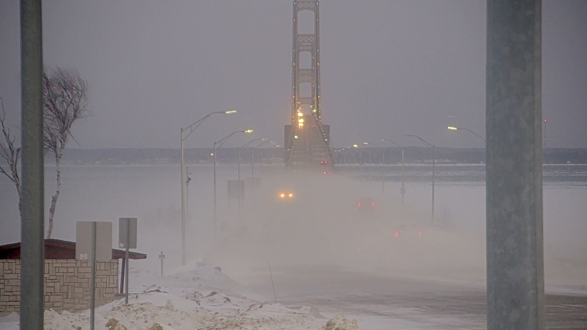
From Friday night through Sunday morning, Northern Lower Michigan was hit with a massive ice storm that left tens of thousands without power, closed the Mackinac Bridge with “the worst ice we’ve every seen on the Bridge”, and led Gov Whitmer to declare a state of emergency in Otsego, Oscoda, Montmorency, Presque Isle, Emmet, Charlevoix, Cheboygan, Crawford, Mackinac and Alpena counties. Great Lakes Energy shared the status as of yesterday morning
Since the storm began, power has been restored to over 56,000 members.
Just over 45,000 Great Lakes Energy (GLE) members remain without power this morning across 15 of our 26 counties.
Unfortunately, a new storm system hit our southern territory late yesterday, causing additional damage and compounding restoration challenges.
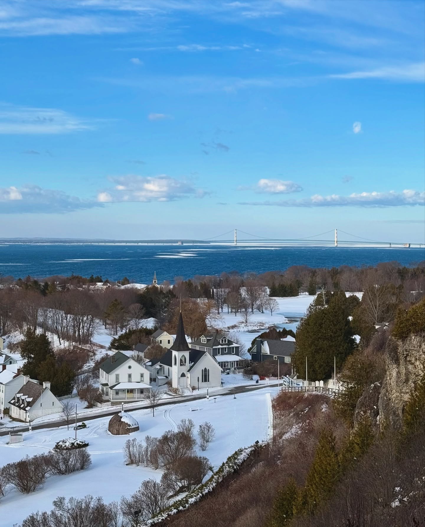
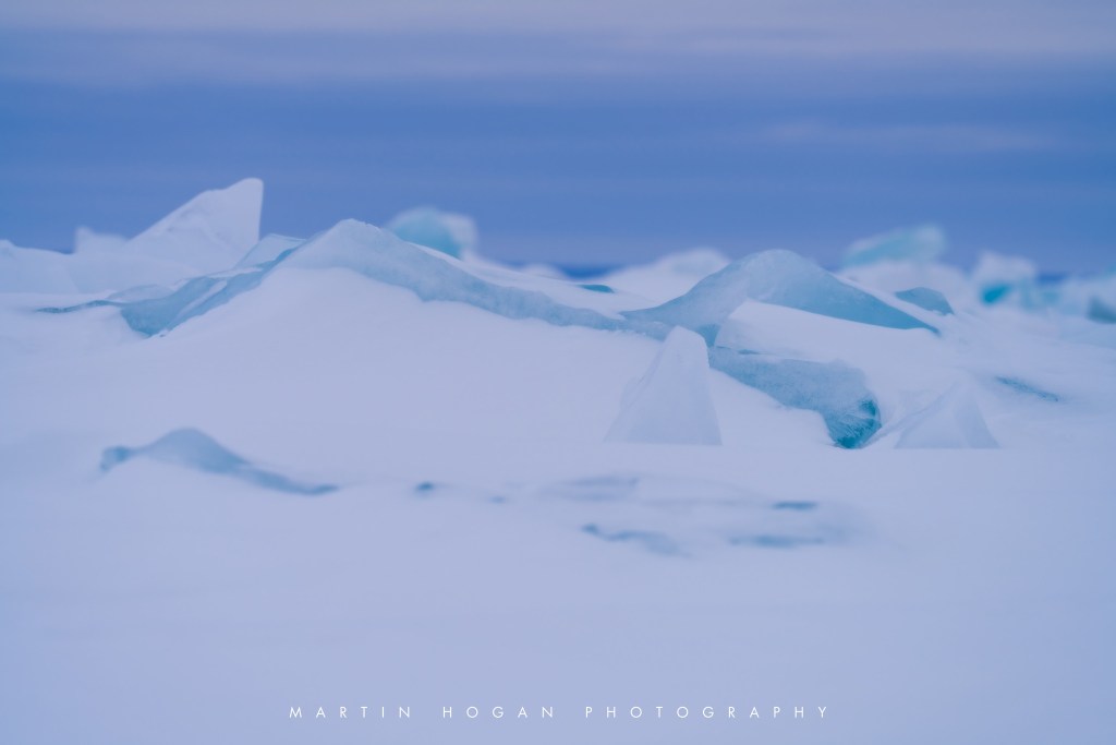
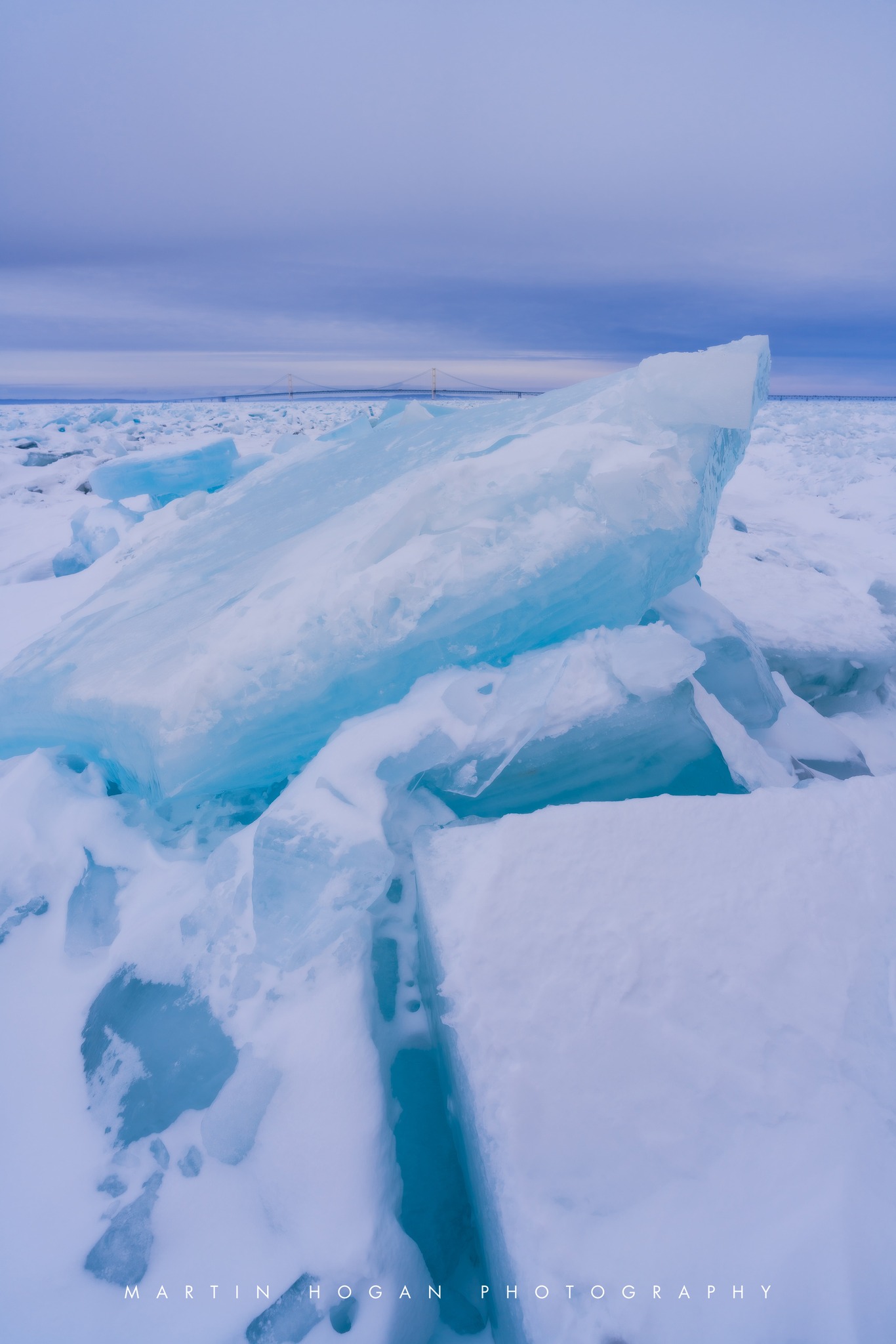
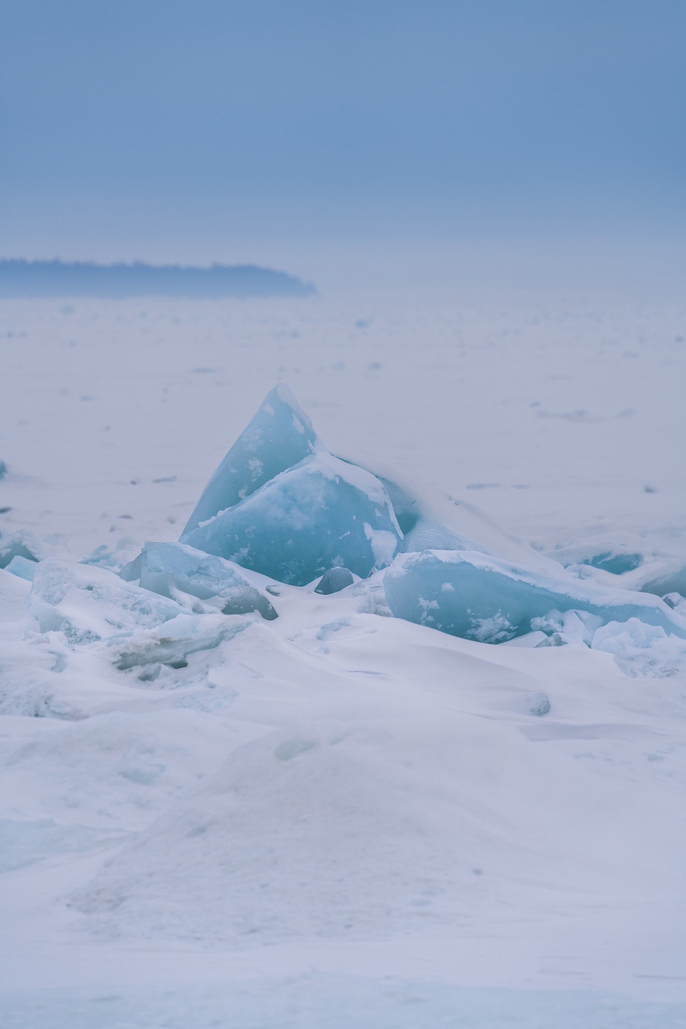
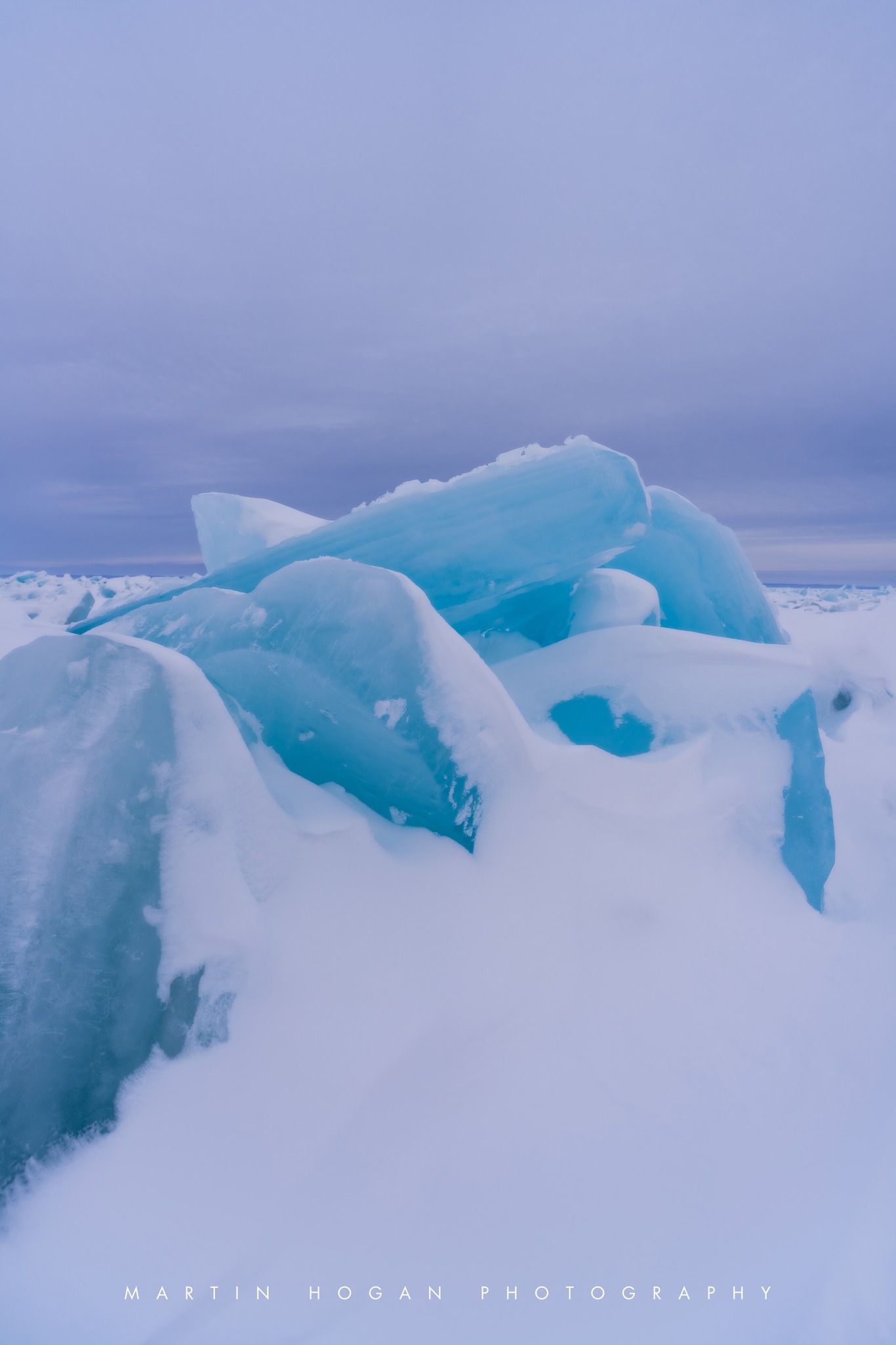
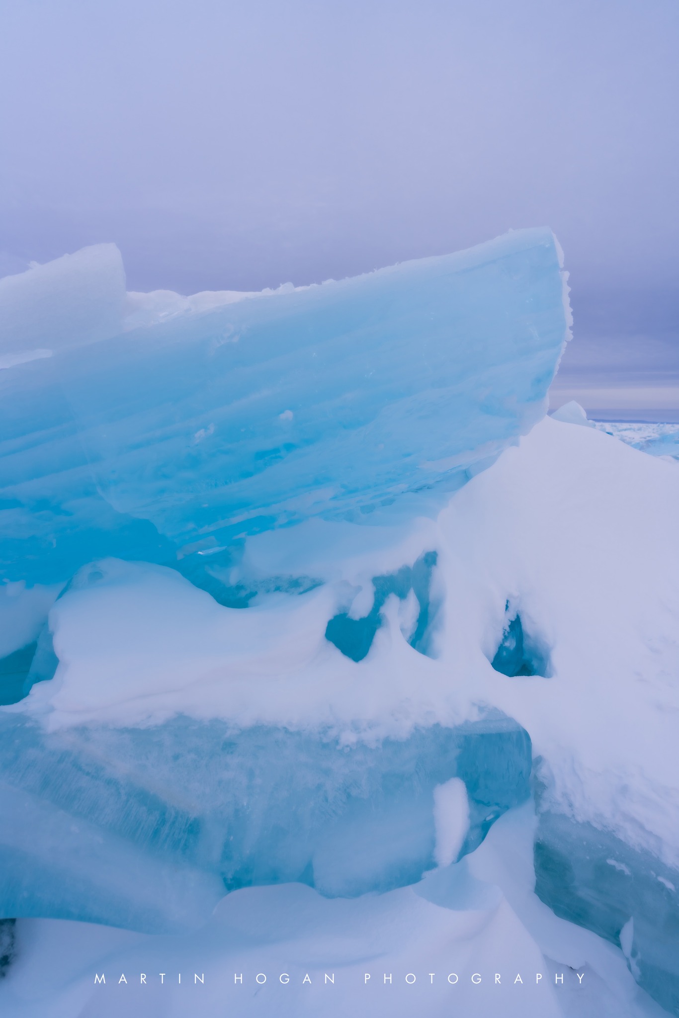
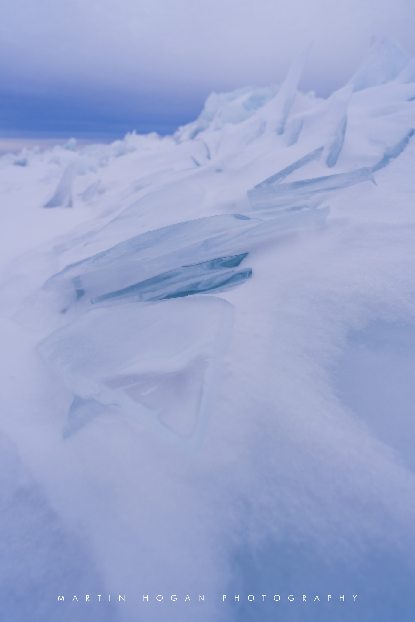
Although winter “officially” ended yesterday, the snowy pictures I’m seeing from around Michigan this morning make me feel OK sharing these pics Marty got of blue ice on the Straits of Mackinac last weekend. Click to follow Marty on Facebook & for sure check out some of his past photos on Michigan in Pictures!
As with water, this color is caused by the absorption of both red and yellow light (leaving light at the blue end of the visible light spectrum) … In simplest of terms, think of the ice or snow layer as a filter. If it is only a centimeter thick, all the light makes it through; if it is a meter thick, mostly blue light makes it through. This is similar to the way coffee often appears light when poured, but much darker when it is in a cup.