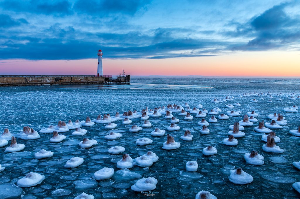
Frigid Sunrise at Wawatam Light by Robert F Carter
Pure Michigan shares that Wawatam Lighthouse started life in 1998 as a Michigan Welcome Center travel icon at Monroe, Michigan. In 2004, the Monroe Welcome Center was being revamped and the lighthouse was put up for relocation. The City of St. Ignace was the lucky recipient and the structure was trucked north in five pieces. It stayed on the Chief Wawatam Dock for a time, awaiting the construction of its new platform … The Wawatam Lighthouse beacon was first lit on August 20, 2006. Visible for more than 13 miles out over Lake Huron, it is now an official aid-to-navigation. The 250 millimeter Fresnel lens casts its light in a 152 degree arc.
Robert writes “Four of us from my camera club decided to visit Michigan’s U.P. in search of the Snowy Owl. We left early and before we got up to the hunting grounds, we stopped by St. Ignace to see the sunrise. This area of Lake Huron was not frozen over yet even though it was about -5 degrees this morning. One did not stay outside the car very long with the blowing breeze.”
See more in Robert’s Lighthouses gallery on Flickr & see lots more lighthouses on Michigan in Pictures.