The Blizzard of ’78 by John Russell
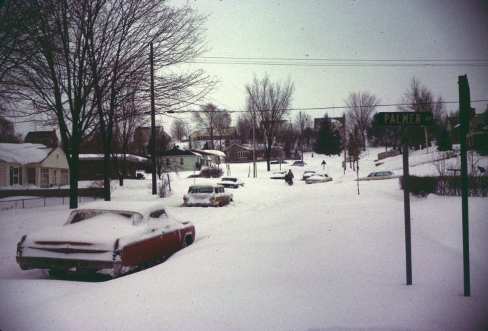
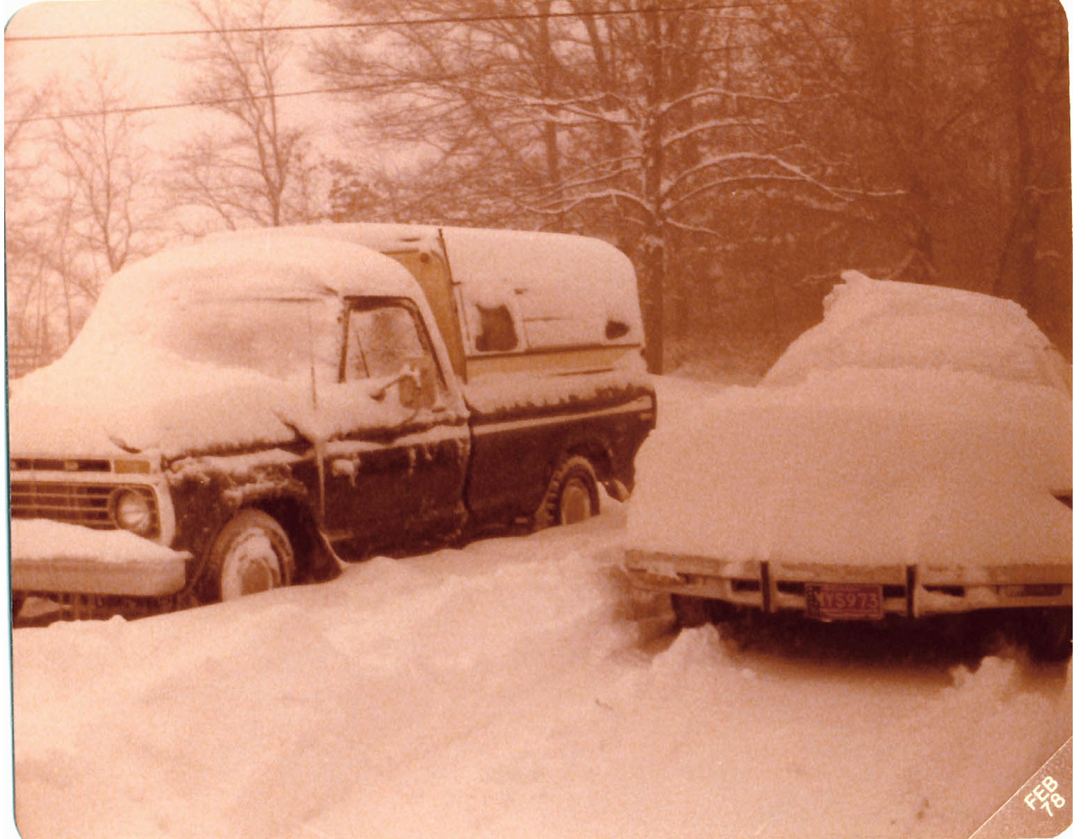
“The most extensive and very nearly the most severe blizzard in Michigan history raged throughout Thursday January 26, 1978 and into part of Friday January 27. About 20 people died as a direct or indirect result of the storm, most due to heart attacks or traffic accidents. At least one person died of exposure in a stranded automobile. Many were hospitalized for exposure, mostly from homes that lost power and heat. About 100,000 cars were abandoned on Michigan highways, most of them in the southeast part of the state.” -National Weather Service Ann Arbor Meteorologist in Charge, C.R. Snider on January 30th, 1978
48 years ago one of the most powerful blizzards in Michigan history brought the state to a standstill. In her feature on historical Michigan snow days in the now defunct Seeking Michigan, Jessica Miller of the Archives of Michigan related:
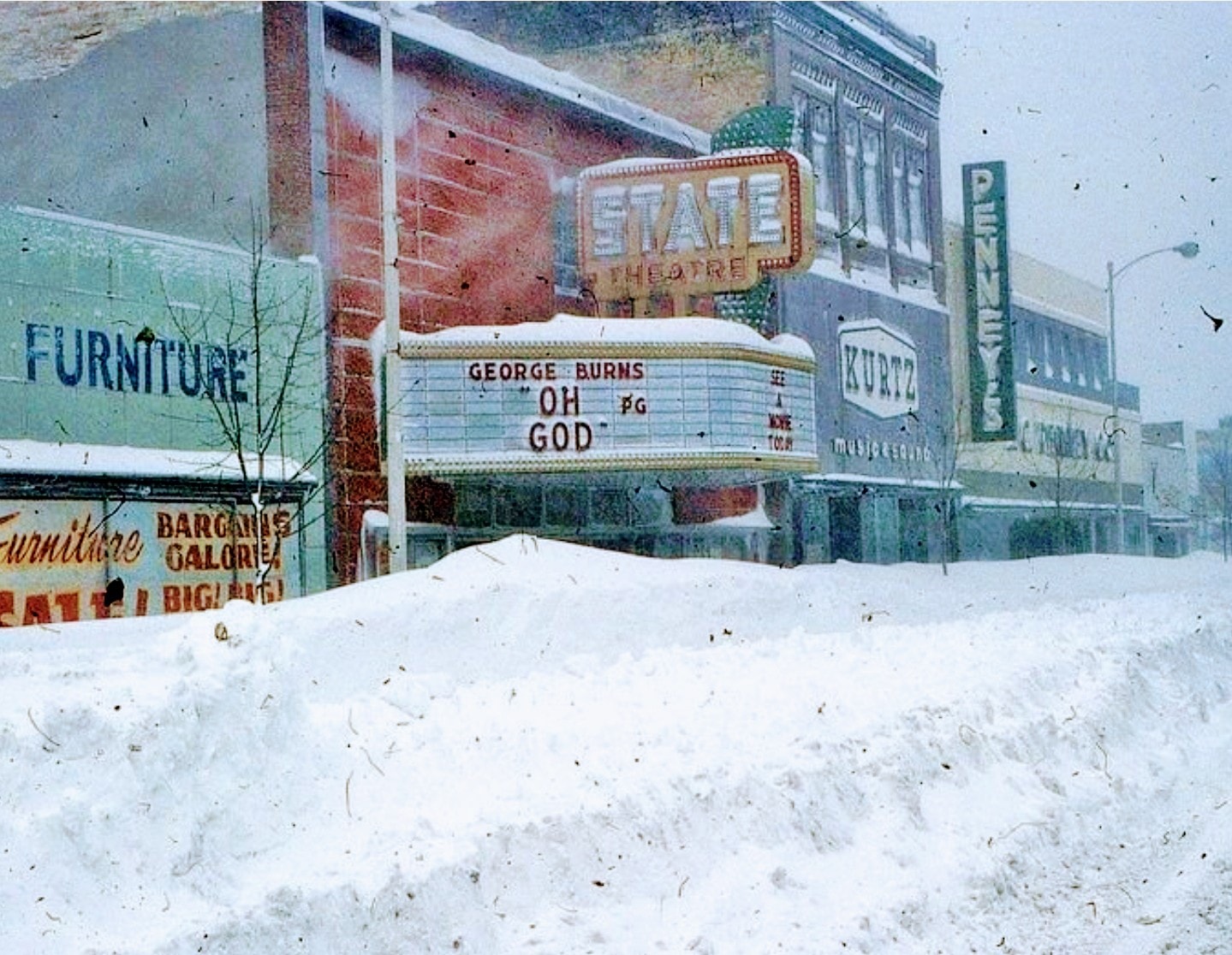
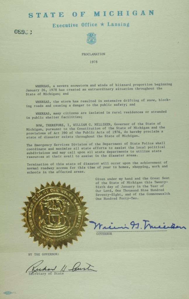
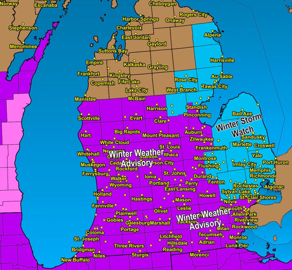
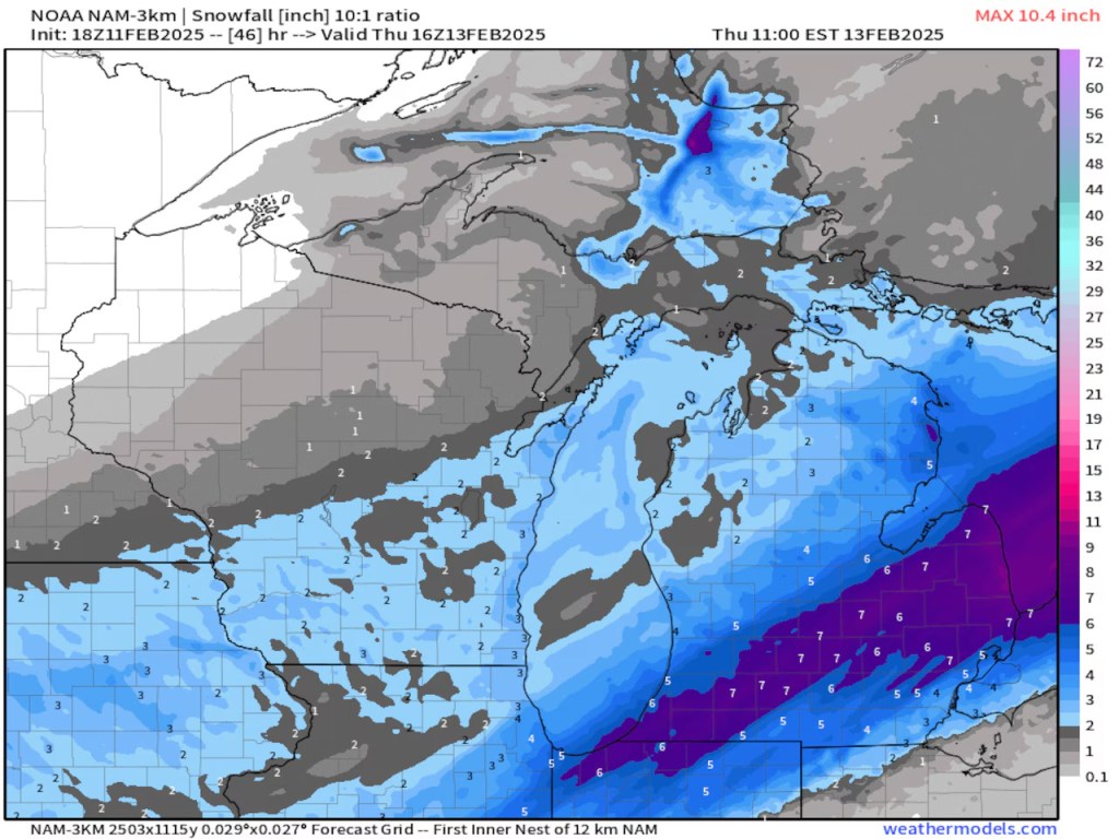
On January 26-27, 1978, snowstorms with fifty-to-seventy-mile per hour winds pummeled much of Michigan. Snowfall totals ranged from eighteen inches in Lansing to an incredible fifty-one inches in Traverse City. More than 100,000 cars were abandoned on roads and highways, and travel was impossible for days. Governor William G. Milliken declared a state of emergency on January 26 (See the image below.) and activated the National Guard to assist with the cleanup. The governor also requested financial assistance from the federal government and estimated damage totals to be more than $25 million, not including lost productivity from workers who were unable to get to their jobs.
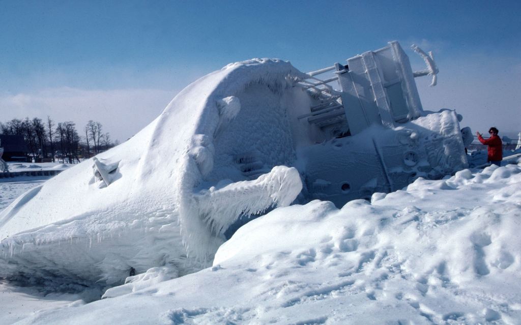
Regarding the photo, John wrote: Marty Lagina stands on the frozen pier at the Great Lakes Maritime Academy on January 29, 1978, viewing the capsized training vessel Allegheny, which capsized from ice buildup during the Blizzard of ’78. This image was on assignment for TIME magazine, who had seen my b&w image on the UPI wire and wanted a color image. Marty and I were lucky – the sky cleared and the wind stopped for about 20 minutes, then the storm began again. I wondered at the time who TIME knew to make that happen…
See the latest from John on his TC Photo Facebook page & stay warm folks!!