Time for the 2017 Michigan Ice Festival!

dairyland-ice-climbing

dairyland, photo by Wilkinson Visual

Wilkinson Visual writes that this photo shows David Hixenbaugh scrapping up dairyland on a blustery day out on the lakeshore. Great climbing, very unique features formed by the wind making for an exciting top out!

The annual Michigan Ice Fest runs today through Sunday (Feb 15-19, 2017) in Munising. It’s an annual celebration of the sport of ice climbing that brings together some of the world’s best climbers and experts for climbing exhibitions, seminars, guided climbs, get togethers and much more! Click the link above for all the details.

View the photo bigger on the Wilkinson Visuals Facebook and visit their website for all kinds of photos including this cool Michigan Ice Climbing Gallery.

Here’s climbing video from the Pictured Rocks National Lakeshore by David (@alpine_elevation on Instagram):

Breakwall Sunrise in Grand Marais

grand-marais-breakwall-sunrise

Break Wall Sunrise, photo by Gary McCormick

View Gary’s photo from February of 2012 background bigilicious, see more in his big old Grand Marais MI slideshow, and follow him for the latest at Footsore Photography on Facebook.

More from Grand Marais and more winter wallpaper on Michigan in Pictures!

Hard Luck Lights: Grand Island East Channel Lighthouse

grand-island-east-channel-lighthouse

Grand Island Lighthouse, photo by Steve Nowakowski

Terry Pepper’s Seeing the Light shares the story of one of Michigan’s hard-luck lighthouses, the Grand Island East Channel LightWork began in 1867 with the the clearing of a sandy peninsula on the southeast shore of the island:

As a result of the chosen site being both on low ground and close to the water’s edge, a considerable amount of cribbing was installed along the shore line to help stave-off erosion and undermining of the station’s foundation. Plans for the station building called-out a typical “schoolhouse” style combination dwelling and tower similar to that used frequently throughout the lakes. However, in order to minimize cost the building was to be of timber frame construction with wood siding, as opposed to the more common brick or stone materials used in such structures elsewhere. Painted white to increase its value as a daymark, the 1 ½ story dwelling incorporated a forty-five foot tower its southern end, and was outfitted with an oil-fired steamer lens with a focal plane of 49 feet.

…The combination of a wooden structure in such an exposed location, and its location on the low sandy area close to the water’s edge created an ongoing maintenance nightmare for the district engineers, with the station listed as one at which considerable repairs were taken every year for the following thirty years.

…Without any care throughout the years, the structure deteriorated rapidly. Without regular scraping and repainting, the once bright white structure had turned a dismal driftwood gray, and the cribs installed a hundred years previously had disintegrated completely, with the waters of Munising Bay lapping directly at the stones of the structure’s foundation.

Read on for much more including efforts that stabilized this structure and the lighthouses that replaced it after decommissioning in 1908.

View Steve’s photo background big and see more in his 2016 Grand Island East Channel Lighthouse slideshow.

More Michigan lighthouses on Michigan in Pictures!

Confluence of Montreal River and Lake Superior

confluence-of-montreal-river-and-lake-superior

Confluence of Montreal River and Lake Superior, photo by Kirt E. Carter

Waterfalls of the Keweenaw has a nice feature on the Montreal River and Montreal Falls that says in part:

Located right at the mouth of the Montreal River as it tumbles into Lake Superior, Montreal Falls is a rugged, beautiful cascade over blocky volcanic rocks. The views over the lake are incredible: to the west you can see Bare Bluff and Mt Bohemia rising along the lake shore, to the southwest the distant side of Bete Gris Bay, and to the south (on a clear day) the Huron Mountains ripple up above the lake. The drop sits at the last easily accessible southern spot on the tip of the Keweenaw, with Fish Cove, Keystone Bay, and Keweenaw Point a tough drive/hike beyond.

Some flat ground for camping sits on the shore of the waterfall, complete with a few fire rings and a convenient beach for kayakers, and during summer weekends a few tents can be found near the falls. A narrow trail leads up along the river towards Upper Montreal Falls, more traveled by fishermen than anyone else, and an even fainter path can be found leading further east to Fish Cove.

Read on more maps & more!

View Kirt’s photo bigger, see more in his slideshow, and see more work on his website.

Below Au Train Falls

below-au-trail-falls

Below Au Train Falls, photo by Neil Weaver Photography

The Au Train Falls information page from Chatham, MI says (in part):

The AuTrain Falls are part of the AuTrain River. A major reason why the falls were created is because of the large power dam located about a mile south of the falls site, in close proximity to highway M-94. The Forest Lake Dam, run by the Upper Peninsula Power Company, is the main source of water for the falls. When water levels are high on the AuTrain Basin, an increased flow of water is released via the dam and down the river. The AuTrain River actually flows from South to North. When more water is released via the dam, the more volume of water that flows through the falls.

…A short distance from the bridge, where the view is the most spectacular, is where an old brick building is located. As you approach the building, you will hear a humming noise and as you approach, the humming noise gets louder and louder. As you peak inside the building, you will notice these large lime-green mechanical devices. These are power generators. These generators create enough power to supply 600 homes in the area. The water to supply the generators also comes AuTrain Basin, but travels through large metal piping running from the Forest Lake Dam to the generator site. Once the water runs through the generator, it is released in the back of the building and back into the river. It is a unique facility, and one that is still an important part of the area.

Read on for more.

View Neil’s photo bigger, follow him on Facebook, and be sure to check out the Michigan Waterfalls gallery on his website!

Still Standing … on the Superior Shore

still-standing-along-lake-superior

Still Standing, photo by Bobby Palosaari

Back in June, Bobby wrote, “Weathered and worn, these trees are enjoying a gorgeous summer evening along the shores of Lake Superior.

I’m assuming they’re still there, but I’m guessing it’s a bit less idyllic. View Bobby’s photo taken on the Keweenaw background bigtacular and see more in his slideshow.

Not ready to let summer go? There’s lots more summer wallpaper on Michigan in Pictures!

Lower Silver Falls

lower-silver-falls

Lower Silver Falls, photo by Tom Mortenson

GoWaterfalling’s page on Lower Silver Falls says:

Lower Silver Falls is located in Michigan’s Baraga county on the Silver River. The Silver River has many drops, and they are lumped together into the Lower, Middle and Upper Falls. The Lower Falls are not particularly impressive but they are very easy to visit.

The falls consists of two chutes where the river is constricted to a narrow channel. The second is the larger of the two, and the river drops about 15 feet in a thirty foot stretch while taking a turn.

Head over to GoWaterfalling to read about their big brother upstream, the Upper Silver River Falls!

View Tom’s photo from early October background big and see more in his Upper Michigan slideshow.

Lions in the Sky: The 2016 Leonid Meteor Shower

aurora-fireball-by-ross-ellet

Aurora Fireball, photo by Ross Ellet

Space.com’s page on How to Watch the Leonids says in part:

The Leonid meteor shower happens every year in November, when Earth’s orbit crosses the orbit of Comet Tempel-Tuttle. The comet makes its way around the sun every 33.3 years, leaving a trail of dust rubble in its wake. When Earth’s orbit crosses this trail of debris, pieces of the comet fall toward the planet’s surface. Drag, or air resistance, in Earth’s atmosphere cause the comet’s crumbs to heat up and ignite into burning balls of fire called meteors.

…The Leonid meteor shower peaks on the night of Thursday, Nov. 17, and early the following morning. Skywatchers might be able to see some meteors as early as Sunday, Nov. 13. However, with a full supermoon slated to rise Monday, Nov. 14, moonlight will likely outshine most meteors, rendering them difficult to see.

But don’t feel bummed if you don’t spot any of the early meteors. The Leonids will continue to graze the night sky until Nov. 21. At this point, the waning moon will be at its third quarter, meaning only half of the moon’s face will illuminate the sky. With less of the moon’s natural light obstructing the view, skywatchers who were unable to see the meteor shower at first will still have a chance to catch the last Leonid meteors.

Ross took this photo in late September of 2014 and writes:

The sky was cloudy most of the night, but at 3:30am there wasn’t a cloud in the sky. We made our way to the lakeshore and sure enough the northern lights were dim on the northern horizon. At one point you could hear the howl of a distant wolf pack while the northern lights were out. Then moments later a slow move fireball flashed across the sky. It lasted a couple seconds and the brightness pulsed as it moved through the atmosphere. After that the aurora faded, but several more meteors (some very bright) streaked above us.

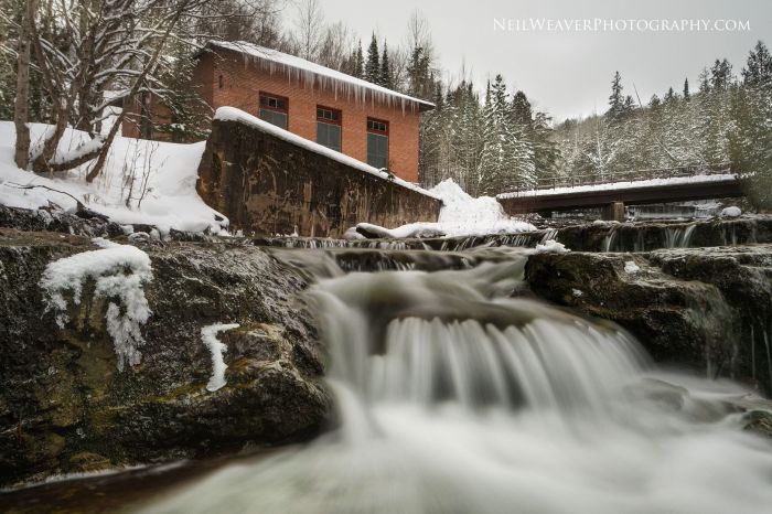
View it background bigtacular and see more in his Porcupine Mtns slideshow, and definitely check out his website, Ross Ellet’s Weather & Photography for more!!

PS: Some of the best northern lights on the year happen in November so be sure to keep an eye on the skies!

The Road Goes On

the-road-goes-on

The Road Goes On, photo by Ann Fisher

Not. Giving. Up. On. Fall.

View Ann’s photo background big and see more in her 2016 U.P. slideshow.

Lots more fall wallpaper on Michigan in Pictures.

Get your (Michigan) ghost town on!

through-the-never-central-mine-powder-house

through the never, photo by Marty Hogan

mLive’s Emily Bingham has a feature on 11 eerie & intriguing ghost towns in Michigan that is definitely worth checking out. The slide for the Upper Peninsula ghost town of Central says:

This abandoned village on the U.P.’s Keweenaw Peninsula was a company town of nearly 1,300 residents, many of them German and Cornish immigrants who’d come to work in the copper mines. The town had a post office, three-story school, and one of the first telephone services in Copper Country. The mine closed in 1898, only four decades after it had opened, and residents quickly left to find work elsewhere. All that remains are thirteen houses and a Methodist church, maintained by the Keweenaw Historical Society; every year on the last Sunday of July, locals and descendants of the Central Mine villagers attend a special service at the church to honor those who lived there.

If you’re looking to get more ghost town goodness, look no further than Marty Hogan! His photo albums get up close and personal some of Michigan’s coolest forgotten communities. View this photo background bigilicious and see more in his Central slideshow.