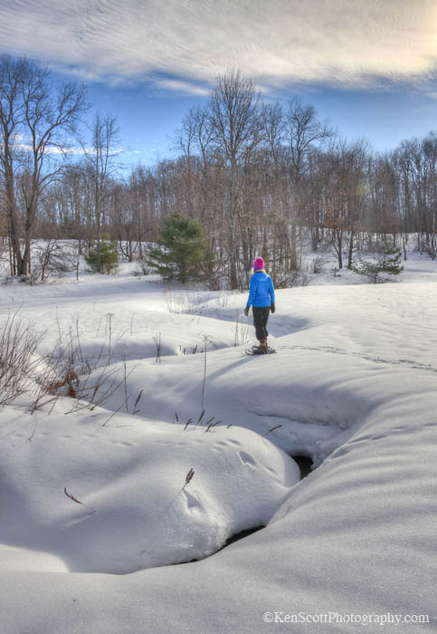
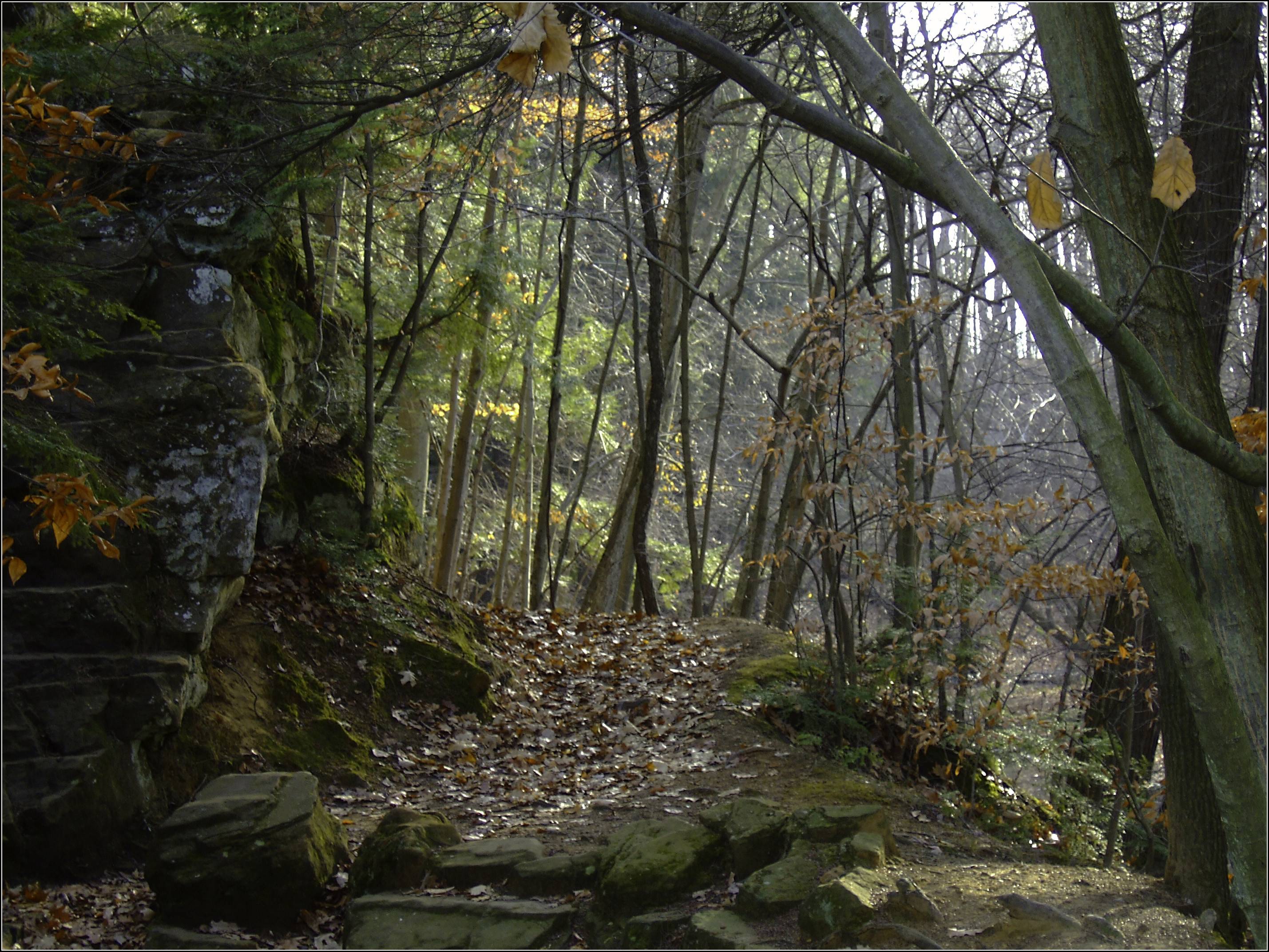
Longtime readers know that “Back Into the Woods Day” is one of the invented Michigan holidays we celebrate on Michigan in Pictures. It’s an annual December 1st holiday that celebrates the end of firearm deer hunting season & the return of (mostly) gun free hiking trails.
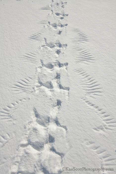
Today’s photo is from Leelanau photographer Ken Scott, and I’d like to be sure to highlight his 2026 “Best of the Back Pages” Calendar that features some of his great photos from the back page of the weekly Leelanau Enterprise. See a few more below including these amazing snowy owl tracks and many in Ken’s massive snow gallery on Flickr.
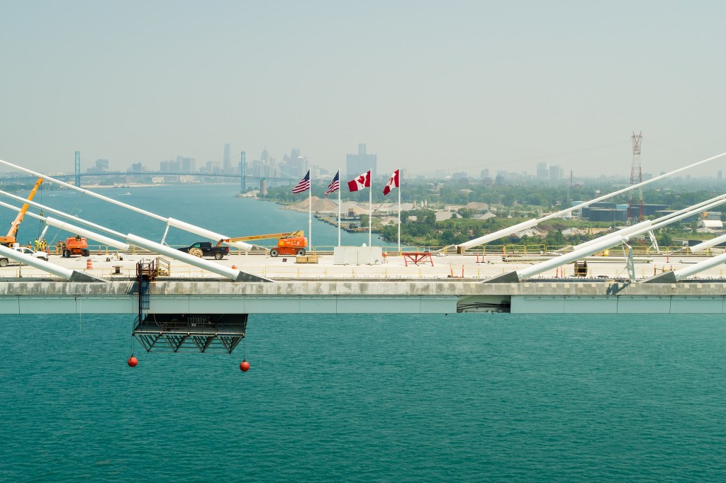
Last week the Gordie Howe International Bridge shared that the Canadian and US flags have found their permanent home at center of the bridge deck, adding “Soon you’ll be able to see the flags for yourself from the multi-use path as you walk or bike across the bridge.” Bike to Canada you say?? Beauty!!
The Gordie Howe Bridge multi-use path will be one lane and will accommodate two-way pedestrian and cyclist traffic. It will be 1.5 miles in length and 11.8 feet wide. The multi-use path will be toll-free & connect to local road and trail networks. In Windsor, there will be connections to the Broadway Street Multi-Path and the Trans Canada Trail. In Detroit, there will be linkages to the Great Lakes Way which provides water & land routes from Lake Erie to Lake Huron and Iron Belle Trail that runs all the way to the far western corner of the Upper Peninsula!
Lots more from Gordie the Bridge! And you can bet I’ll be getting you the info about riding the Bridge just as soon as I have it! More bikes & biking on Michigan in Pictures including (very soon) the scoop on this Iron Belle Bike Trail!
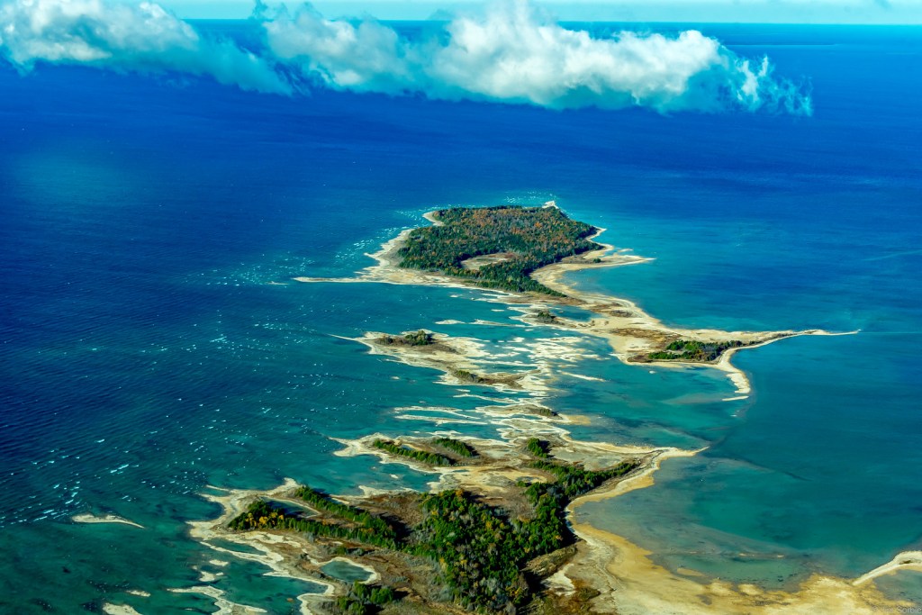
Waugoshance Point is easy to spot on a map, just look for the large peninsula jutting out from the northwestern corner of the lower peninsula: that’s it. If only for that reason it was an attractive place to want to take a hike. An added bonus was the fact that it marks the western end of the Mackinac Straits amidst three remote lighthouses and is completely devoid of trails. I simply couldn’t come up with a reason NOT to go.
Waugoshance Point is truly spectacular in the summer when the rock beaches are home to a myriad of waterfowl and a dizzying array of lake shore wildflowers. I just couldn’t wait though. The snow was gone and I needed to get out. The trail head, if there was a trail, is located at the end of Waugoshance Point Road which gives access to the back-country cabins of Wilderness State Park. From there I’d trust my topo-map to guide me along the shore out to the point. Though there are no hills or cliffs to speak of the area turned out to be quite diverse and beautiful, as you’ll see…
Here’s a great aerial photo by Jim – see more in his From the Air gallery on Flickr which also includes another view of the Point from August of 2022.
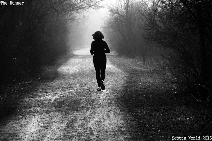
If you’re like me & love to hike, the two weeks of deer season put a little damper on your outdoor fun. Years ago, I proposed December 1st be designated a holiday so a very happy “Back into the Woods Day” to you all!
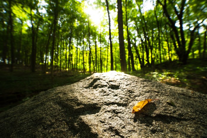
Joel took this photo at Fitzgerald Park in Grand Ledge back in 2012, and since you can see more in his Into the Woods gallery, it’s clear he deserves a lot of the holiday naming credit!
Bill writes “On this, the altar to the last day of summer: the sacrificial leaf that will bring on fall,” so if anyone is sad summer’s over, Bill’s the man to talk to. ;)
Of course if you’re excited for apples, autumn’s colors & of course, pumpkin spice, mad props to Bill! Check out more in Bill’s Kalamazoo River Valley Trail album & enjoy the season!
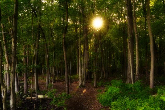
Bill writes that this path through the woods at Bishop’s Bog near Portage was always one of the summer sun’s favorites. See more great pics on his Facebook & in the Michigan in Pictures Group!
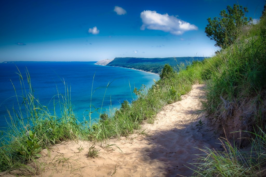
Mark took this beautiful photo a couple of summers ago on the Treat Farm Trail in the Sleeping Bear Dunes National Lakeshore. Guessing it looks much the same today, but you should check it out just to be sure! 😉
Head over to Mark’s Flickr for more & here’s the Park’s writeup on the trail:
The trail that leads from the corner of Norconk Road into the woods is about ½ mile long through the maple-beech forest and will take you to the Treat Farm. As you reach the top of the hill, the canopy of trees opens up to a view of the farmstead. A portion of the original barn has been rebuilt on the original foundation.
Visitors are drawn to this intriguing farmstead for several reasons. The trail leading up the slight incline from Norconk Road holds an allure of its own… it seems to beckon passers-by. It piques the curiosity by conjuring visions of what might be at its terminus. It is also one of the most beautiful areas for spring wildflowers in all of Michigan!
We’re going to let David Clark of one of my favorite blogs, Cliffs and Ruins, take over today’s post. He writes:
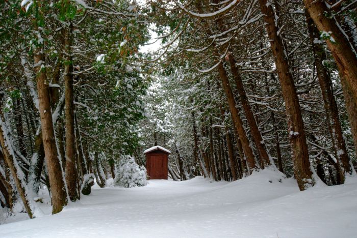
The most scenic walk to an outhouse award goes to Sturgeon Bay Cabin at Wilderness State Park, where this line of wind-blown cedars escorts you to the potty.
I took this photo on the 2nd day of my snowshoe adventure at Wilderness State Park in December 2016, after a heavy snowfall the night before. I enjoyed 3 days of spectacularly good snowshoeing and utter solitude. Read more at my blog: Winter Cabin Camping at Wilderness State Park.
I really encourage you to check out David’s post for photos and a great account of his visit to Wilderness State Park which is located on the northwest shore of the lower peninsula, to the west of the Mackinac Bridge. This is an adventure I really hope to take!!
December 1st is one of my personal holidays, Back into the Woods Day, which of course is the day after deer hunting season ends when it’s once again safe to wander Michigan’s woods & trails.