White Christmas dreams will come true in Michigan!

I'm Dreaming Of A White Christmas!

I’m Dreaming Of A White Christmas!, photo by Spring Noel

mLive meteorologist Mark Torregrossa makes the question of whether we’ll have a white Christmas or not pretty simple, saying: “If you will be in Michigan this Christmas, your dream of a white Christmas will come true – wherever you are.” Read on for his detailed forecast.

Alert readers will note the first back-to-back owling in Michigan in Pictures history. What can I say? This shot of a barred owl is simply perfect!!

View Spring’s photo bigger and see more in her Birds of Prey slideshow.

More birds on Michigan in Pictures.

Snowfall, with Color

Snowfall With Color

Snowfall With Color, photo by Mark Oliver Photos

Mark took this in the Proud Lake Recreational Area near Milford last December. Check it out bigger and see more in his great Michigan slideshow.

More parks on Michigan in Pictures!

Early takeoff for the 2014 Michigan Ski Season

Mulligans Hollow

Mulligans Hollow, photo by Kevin Ryan

Michigan’s ski resorts have enjoyed the best launch to the ski season in recent memory. The reason for this is simple: steady cold temperatures and lots of lots of “white gold.” mLive’s Weekend Snowmobile and Ski Report leads with a graphic showing 4-40 inches of snow on the ground across Michigan:

In the Upper Peninsula, the Lake Superior shoreline has over 10 inches of snow cover. The Keweenaw Peninsula mostly has over 20 inches of snow. The deepest snow cover in the Great Lakes is just east of Lake Superior in Canada. Satellite reports have the snow cover over 40 inches already. That area has seen heavy lake effect due to very cold air and a persistent west wind.

…Gaylord has had 17 inches more snow than normal, and most other cities are near normal to slightly above normal on seasonal snowfall. Traverse City, Sault Saint Marie, and Petoskey have already shoveled over 20 inches of snow. This time last year northern Michigan was well below normal on snowfall.

Read on for more including a graphic of snowfall this year, last year and average totals – Gaylord is almost 1/3 of the way to last year’s total!

Check background big and see more in Kevin’s skiing slideshow.

PS: In case you’re wondering, Mulligan’s Hollow where this photo was taken is located in Grand Haven and is 100% open already. If you follow that link you can see their webcam.

More skiing photos on Michigan in Pictures.

Earth Wind … and Snow

Earth Wind and Snow

Earth Wind and Snow, photo by Beth

One of the lesser known bands of the 70s…

View Beth’s photo from the beach at Holland background bigtacular and see more in her Winter slideshow.

More winter wallpaper on Michigan in Pictures!

The Beauty of My Nemesis: Snowflake Edition

The Beauty of My Nemesis

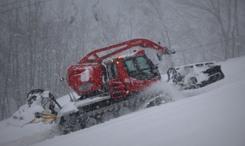
The Beauty of My Nemesis, photo by pkHyperFocal

Waaaay back when I started out on the capital “I” Internet with an online publication called the Northern Michigan Journal. For over five years I edited NMJ, producing around 4 issues a year that featured some interesting work from a wide range of writers & artists.

Two of these were my friends Jerry Dennis and Glenn Wolff, a writer/artist duo who collaborated on several books.  Their first was called It’s Raining Frogs & Fishes: Four Seasons of Natural Phenomena and Oddities of the Sky, a fascinating romp through the oddities and beauties of the natural world through Jerry’s captivating prose and Glenn’s engaging drawings. You can click that link to learn more about the book from Jerry’s website. Trust me, it’s the perfect gift for the nature lover or scientist in your life!

Glenn & Jerry shared a chapter from the book with me that I published to the inaugural issue of NMJ. Here’s the beginning of Nature Baroque: Snowflakes & Crystals:

There is more to the birth of a snowflake than Aristotle’s assertion that “when a cloud freezes there is snow.” Snow is not merely frozen rain. Rain occasionally freezes, falling to the ground as sleet or freezing rain, but snow originates independent of atmospheric drops of water. Individual ice crystals for high in the atmosphere when water vapor freezes around dust or other particulates. Without particles to serve as condensation nuclei, water vapor can be cooled to -40 degrees Fahrenheit before freezing occurs. A supercooled cloud of this sort seeded with a few particles often escalates into a snowstorm. The individual crystals collect additional molecules of water vapor one at a time, building on one another symmetrically in a rapidly growing, widening circle. Temperature, wind, humidity, and even barometric pressure will determine the growth and ultimate form of the crystal. Large and elaborate crystals for at higher temperatures and humidity while, while the small, basic crystals such as those common in polar regions form when temperature and humidity are very low. As the crystals fall they bump against each other, breaking off pieces of ice that in turn serve as nuclei for new crystals. As they pass through warmer layers of air they adhere to one another, congregating into snowflakes that may contain a thousand or more crystals.

Snowflakes, then, are aggregates of snow crystals. When the temperature is near or slightly above freezing, snowflakes become wet, adhere to other flakes, and grow to two or three inches in diameter. On very rare occasions, they can grow larger yet. According to a report in a 1915 issue of Monthly Weather Review, a snowfall on January 28, 1887 dropped flakes “larger than milk pans,” measuring fifteen inches in diameter by eight inches thick across several square miles near Fort Keogh, Montana.

Only when the temperature remains consistently below freezing will complete, individual crystals fall to the ground. If the temperature of the cloud they form in and the air they descend through is warmer than 27 degrees Fahrenheit, the crystals tend to be flat and hexagonal. Between 27 and 23 degrees, they tend to be needle-shaped. Between 23 and 18 they are likely to be hollow and columnar, with prismatic sides. At temperatures below 18 they can be columnar, hexagonal, or fernlike. Virtually all have six sides. That hexagonal tendency is something of a mystery, although some scientists suggest it is produced by electrical charges in the crystals, while others say it is basic to the molecular structure of water molecules. The atoms in a molecule of H20 are arranged, in physicist Hans C. von Baeyer’s graphic description, “with two little hydrogens stuck onto a big oxygen like ears on a Mickey Mouse’s head.” Scientists like von Baeyer believe that the angle at which the hydrogen molecules protrude from the oxygen atom–about 120 degrees–causes snow crystals to grow to a six-pointed symmetry that repeats the molecular structure of water.

Read on for much more including whether or not two snow crystals are alike, heavy snowfalls and snow words & myths.

View this photo background bigtacular and see more in pk’s really, really cool Chromatic Progression slideshow.

More snow, sciencewinter wallpaper on Michigan in Pictures!

Ice Volcanoes in Michigan

Shore Ice

Shore Ice, photo by timmerschester

The Weather Notebook has this to say about Ice Volcanoes:

Ice volcanoes can form during winter on the Great Lakes. They are not lava-spewing mountains of ice, but water-spouting ice cones.

As winter ice begins to build along the shores of large lakes such as Lake Superior, it is jostled, broken, and shifted by the winds and wave motions on the waters. When winds blow onshore, they can build an ice shelf, a jumble of ice chunks that anchors on the shore but extends some distance back into the water. Amongst the numerous ice blocks comprising a shelf, many open tunnels lead back to the lake waters.

To build a good ice volcano cone, the surface air temperature must be several degrees below freezing and lake waves should be several feet high and breaking onshore. As the waves strike the edge of the ice shelf, pulses of wave energy flow beneath the ice. Upon reaching the open end of a tunnel, the wave forces water to erupt out through the ice. If the hole has been covered with snow, the eruption may spray snow outward like a volcanic gas cloud.

As the ejected water falls back onto the ice, it quickly freezes and begins the formation of an ice cone, a process very similar to the building of a lava cone surrounding a geologic volcanic vent. A study of ice volcanoes on Lake Superior’s southern shore by students from Michigan Tech measured ice cones ranging from three to 25 feet in height.

Like rock volcanoes, ice volcano vents can heal over and become dormant during periods of low wave action. They lie in wait for a strong wave surge to awaken them back to explosive activity.

Also see the Ice Volcanoes page from Michigan Tech and a video of an ice volcano from Great Lakes Echo.

Kathy took this photo on November 29th on Lake Huron in Caseville – pretty early for ice this big! Check it out background bigtacular and see more in her Winter slideshow.

More icy goodness on Michigan in Pictures.

lighthouse snowman

lighthouse snowman

lighthouse snowman, photo by kiwirat

Frosty’s got nothing on the St. Joseph Lighthouse.

View Dave’s photo bigger or in his St. Joseph, MI slideshow.

Early Start for the 2013 Michigan Ski Season!

1126130-winchcat-crystal-mountain

New Cat on Buck, photo by Crystal Mountain Resort

While the blizzardy blowing going on this morning in northern Michigan and the U.P. isn’t the best for “over the rivering”, it is ensuring that Many of Michigan’s ski resorts get to enjoy their earliest opening date in tears with plenty of white gold!

If you’re looking to check out Michigan’s ski scene, head over to goskimichigan.com from the Michigan Snowsports Industries Association. They have updates from Michigan ski resorts on snow conditions & planned opening dates. Their Discover Michigan Skiing program will give you a beginner lesson, ski or snowboard rental equipment and a beginner-area ski lift pass or cross-country trail pass at 23 Michigan ski facilities! It’s available through January 31 and costs just $20 for cross-country skiing, $30 for downhill skiing and $40 for snowboarding. While you’re there, check Cold Is Cool – a promotion that gives every Michigan 4th Grader FREE skiing at participating Michigan resorts.

This photo from yesterday (Nov 26, 2013) shows Crystal Mountain’s new PistenBully Winch Cat roaring up the ski hill “Buck” – they open for skiing and riding Thanksgiving Day! Stay up to date with their ski & snow report.

More Michigan skiing on Michigan in Pictures!

Lake Effect Snow Season in Michigan

Lake Effect 4794-09

Lake Effect 4794-09, photo by StacyN – MichiganMoments

Many in Michigan are waking up to frigid temps, high wind and snow – the perfect conditions for lake effect snow. Meteorologist Robert J. Ruhf has an excellent article on Lake-Effect Precipitation in Michigan that explains lake effect snow and rain are common in Michigan, especially in late fall and early winter as cold polar air moves across the warmer Great Lakes. 

The unfrozen waters are relatively warm when compared with the temperature of the wintertime air mass. Therefore, the temperature of the air that comes into contact with the water increases. The warmed air expands and become less dense, which causes it to rise. This is an “unstable” situation. As the air rises, the temperature decreases until it reaches the dew point, which is the temperature at which the air becomes saturated.. Ice crystals or water droplets will then begin to collect until the force of gravity pulls them down. The result is “lake-effect” precipitation. When the cP air mass is very cold, as is often the case between December and February, the precipitation falls as snow. During late autumn, however, the polar air mass may be warm enough for the precipitation to fall in the form of rain.

“Lake-effect” precipitation can cause substantial intensification of snowfall amounts in very narrow bands, often referred to as “snow belts,” along the leeward (downwind) shores of the Great Lakes. The prevailing wind direction in the Great Lakes region is westerly; therefore, most “lake-effect” precipitation events occur to the east of the lakes.

…An interesting feature of “lake-effect” is that the heaviest bands of snow do not usually occur along the immediate shoreline, but tend to fall several miles inland. Snowfall accumulations are enhanced inland because the air experiences more uplift when it is forced over hills and higher terrain. 

Read on to learn lots more about lake effect snow in Michigan including four narrow bands  – Keweenaw Peninsula, Leelanau Peninsula, the Thumb and the southwest Lower Peninsula – where geographic features and the shape of the shoreline contribute to more intense snowfall. Hang on to your hats – winter is here!

Stacy took this photo of Lake Michigan from the North Muskegon shoreline in January of 2009. See it bigger and see more in her awesome Michigan BLUE Winter 2012 slideshow.

Need a winter background?

Farmers’ Almanac calls for cold & snowy winter 2013-2014

Snowfall: Scenic Drive

Snowfall: Scenic Drive, photo by marylea

In Farmers’ Almanac prediction: valid winter forecast or ‘darts at a dartboard’?, the Great Lakes Echo explores the accuracy of the venerable Farmers’ Almanac, writing:

…this year, like many before, bloggers, newspapers and local TV stations alike are abuzz with the Almanac’s prediction for winter 2014 – particularly a notably bitter, cold, precipitous winter for the Midwest and most of the Great Lakes region.

“This winter is shaping up to be a rough one,” the almanac reports.

So how much weight does this prediction hold?

“The value of the Farmers’ Almanac in terms of weather forecasting is no better than a comic book,” says Detroit-based meteorologist Paul Gross. “If we knew the forecast a year in advance, we’d be utilizing that knowledge by now.”

The Almanac, which famously keeps its weather predicting methods rather hush-hush, claims to be 80 percent accurate – although the lack of concrete evidence proving that claim draws some skepticism.

The Almanac also makes a questionable remark about the relationship between global warming and a winter with heavy snow.

“Brrrrr!” says the excerpt. “It looks like global warming will soon be taking a vacation to make room for Old Man Winter.”

Heavy snow in winter means quite the opposite in regards to global warming, says Gross. “What people don’t understand is that global warming means that more ocean water is evaporated into the atmosphere,” he said. “And that water vapor in the atmosphere is what becomes available to storms to create precipitation.”

Global warming isn’t “taking a vacation” to make way for the heavy precipitation, Gross said. Rather, a warming climate cause increased precipitation. “It’s shocking, but four of Detroit’s top 10 snowiest winters in history have occurred since 2002,” he said.

They add that the Almanac’s prediction does appear to be somewhat in line with predictions like the National Oceanic and Atmospheric Adminstration’s. Read on for more at the Echo.

Check Marylea’s photo out bigger and see more in her Winter 2011-2012 slideshow.

More weather on Michigan in Pictures.