Feeling Free at Pierce Stocking

feeling-free

Feeling Free, photo by Matt Kazmierski

Few places in Michigan have the expansive view of the Lake Michigan overlook on Pierce Stocking Scenic Drive in the Sleeping Bear Dunes National Lakeshore. It’s 450′ feet down to the water, so remember that freedom comes at a price!

View Matt’s photo bigger and see more in his slideshow.

Hard Luck Lights: Grand Island East Channel Lighthouse

grand-island-east-channel-lighthouse

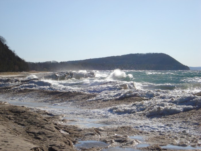
Grand Island Lighthouse, photo by Steve Nowakowski

Terry Pepper’s Seeing the Light shares the story of one of Michigan’s hard-luck lighthouses, the Grand Island East Channel LightWork began in 1867 with the the clearing of a sandy peninsula on the southeast shore of the island:

As a result of the chosen site being both on low ground and close to the water’s edge, a considerable amount of cribbing was installed along the shore line to help stave-off erosion and undermining of the station’s foundation. Plans for the station building called-out a typical “schoolhouse” style combination dwelling and tower similar to that used frequently throughout the lakes. However, in order to minimize cost the building was to be of timber frame construction with wood siding, as opposed to the more common brick or stone materials used in such structures elsewhere. Painted white to increase its value as a daymark, the 1 ½ story dwelling incorporated a forty-five foot tower its southern end, and was outfitted with an oil-fired steamer lens with a focal plane of 49 feet.

…The combination of a wooden structure in such an exposed location, and its location on the low sandy area close to the water’s edge created an ongoing maintenance nightmare for the district engineers, with the station listed as one at which considerable repairs were taken every year for the following thirty years.

…Without any care throughout the years, the structure deteriorated rapidly. Without regular scraping and repainting, the once bright white structure had turned a dismal driftwood gray, and the cribs installed a hundred years previously had disintegrated completely, with the waters of Munising Bay lapping directly at the stones of the structure’s foundation.

Read on for much more including efforts that stabilized this structure and the lighthouses that replaced it after decommissioning in 1908.

View Steve’s photo background big and see more in his 2016 Grand Island East Channel Lighthouse slideshow.

More Michigan lighthouses on Michigan in Pictures!

Threepeat: 2016 once again our warmest year

meltdown

Methdown, photo by Andrew McFarlane

“2016 is remarkably the third record year in a row in this series We don’t expect record years every year, but the ongoing long-term warming trend is clear.”
– NASA Goddard Institute for Space Studies Director Gavin Schmidt

NASA reported last week that 2016 was the warmest year on record: You can read about it below, but I would like to offer two thoughts to the people who are getting angry about me ruining their daily photo with “politics”:

This is not politics. This is provable science backed up with excellent data.

While NASA (and I) believe in anthropocentric climate change (climate change driven by human activity) disbelief in that model DOESN’T MEAN IT’S NOT HAPPENING.

Earth’s 2016 surface temperatures were the warmest since modern recordkeeping began in 1880, according to independent analyses by NASA and the National Oceanic and Atmospheric Administration (NOAA). Globally-averaged temperatures in 2016 were 1.78 degrees Fahrenheit (0.99 degrees Celsius) warmer than the mid-20th century mean. This makes 2016 the third year in a row to set a new record for global average surface temperatures.

The 2016 temperatures continue a long-term warming trend, according to analyses by scientists at NASA’s Goddard Institute for Space Studies (GISS) in New York. NOAA scientists concur with the finding that 2016 was the warmest year on record based on separate, independent analyses of the data.

Read on for more at NASA.

You can view my photo from a thaw in early February 2009 background big and see more in my Frozen Shore slideshow.

Cracking Ice

cracking-ice

Cracking Ice, photo by Jerry James Photography

Jerry writes: As I stood on the Ice waiting for the sun to set ( we was 1 1/2 hours early ) I could here all the ice around me cracking. talk about being paranoid, I wasn’t out to deep but it was still pretty cold and I wasn’t dressed to get wet. but everything ended good though, I stayed dry.

Always a good idea to be careful and know what’s below you when the temperatures rise.

View his photo from Muskegon bigger, see more in his slideshow, and follow Jerry James Photography on Facebook.

Ice is Nice: Tracking Ice Cover on the Great Lakes

shoreline-ice-on-lake-michigan

Shoreline Ice, photo by Mark Swanson

Ice on Michigan’s Great Lakes has become something of a phenomenon in the last few years, attracting photographers and thousands more to see the ephemeral beauty created by wind, water, and freezing temperatures. But ice has other important purposes, as NOAA’s Great Lakes Environmental Research Laboratory page on Great Lakes Ice Cover explains:

Ice formation on the Great Lakes is a clear signal of winter. Looking back in time, the lakes were formed over several thousands of years as mile-thick layers of glacial ice advanced and retreated, scouring and sculpting the basin. The shape and drainage patterns of the basin were in a constant state of flux resulting from the ebb and flow of glacial meltwater coupled with the rebound of the underlying land as the massive ice sheets retreated.

Heavy ice cover can reduce the amount of evaporation from the Great Lakes in the winter, thus contributing to higher water levels.

In bays and other nearshore areas, ice forms a stable platform for winter recreational activity such as ice fishing. This stable ice also protects wetlands and the shoreline from erosion.

  • 94.7% ice coverage in 1979 is the maximum on record (data began in 1973)
  • 9.5% ice coverage in 2002 is the lowest on record
  • 11.5% ice coverage in 1998, a strong El Niño year
  • The extreme ice cover in 2014 (92.5%) and 2015 (88.8%) were the first consecutive high ice cover years since the late 1970s.

NOAA pegs the current ice cover at 9.9% and you can also watch an animation of the last 60 days of ice formation. You can check out satellite images of the Great Lakes for current ice cover and also this cool animation of Great Lakes ice cover from 1973 – 2016.

Mark took this photo a little over a week ago at Lincoln Township Park near Stevensville. With the warmer weather, there’s probably less. View his photo bigger and see more in his Michigan Winter slideshow.

Confluence of Montreal River and Lake Superior

confluence-of-montreal-river-and-lake-superior

Confluence of Montreal River and Lake Superior, photo by Kirt E. Carter

Waterfalls of the Keweenaw has a nice feature on the Montreal River and Montreal Falls that says in part:

Located right at the mouth of the Montreal River as it tumbles into Lake Superior, Montreal Falls is a rugged, beautiful cascade over blocky volcanic rocks. The views over the lake are incredible: to the west you can see Bare Bluff and Mt Bohemia rising along the lake shore, to the southwest the distant side of Bete Gris Bay, and to the south (on a clear day) the Huron Mountains ripple up above the lake. The drop sits at the last easily accessible southern spot on the tip of the Keweenaw, with Fish Cove, Keystone Bay, and Keweenaw Point a tough drive/hike beyond.

Some flat ground for camping sits on the shore of the waterfall, complete with a few fire rings and a convenient beach for kayakers, and during summer weekends a few tents can be found near the falls. A narrow trail leads up along the river towards Upper Montreal Falls, more traveled by fishermen than anyone else, and an even fainter path can be found leading further east to Fish Cove.

Read on more maps & more!

View Kirt’s photo bigger, see more in his slideshow, and see more work on his website.

Golden Light at the Lighthouse

golden-light-at-the-lighthouse-by-photojacko-jackie-novak

Golden Light at the Lighthouse, photo by PhotoJacko – Jackie Novak

View Jackie’s photo bigger, see more in her Winter slideshow, and be sure to follow Jackie Novak Photography on Facebook.

PS: You can do a little Throwback Thursday to January 12, 2015 and the Polar Vortex at the St. Joseph Lighthouse.

Suspended

suspended

Suspended, photo by paulh192

Paul captured this very cool ice formation along the shoreline of Lake Michigan last week. View it photo bigger and see more in his slideshow.

USS Edson at the Saginaw Valley Naval Ship Museum

uss-edson-frozen-in-the-saginaw-river

USS Edson frozen in the Saginaw river, photo by Tom Clark

The USS Edson is located at the Saginaw Valley Naval Ship Museum in Bay City. The say (in part):

The keel for the Forrest Sherman class destroyer USS EDSON (DD-946) was laid at Bath Iron Works in Bath, Maine, on 3 December 1956. EDSON is one of the relatively few ships of the U.S. Navy named for a United States Marine, in this case Major General Merritt Austin Edson.

Edson was launched on 4 January 1958 by General Edson’s widow, Ethel Robbins Edson, who broke the traditional bottle of champagne over the ship’s bow. EDSON’S final fitting out and sea trials occupied the next ten months, and on 7 November 1958, EDSON was commissioned under the command of CDR Thomas J. Moriarty, USN. She then sailed in early 1959 to the Caribbean and through the Panama Canal to reach her original homeport of Long Beach, California, on 2 March 1959.

For the next two decades, EDSON served as a valuable member of the U.S. Pacific Fleet, earning a reputation as a Top Gun ship and the nickname, “The Destroyer.” Her ship’s crest included a skull copied from the shoulder patch worn by then Colonel Edson’s First Marine Raider Battalion.

Note that the Museum itself is closed for the winter until March!

View Tom’s photo bigger and see more in his Ships & Boats slideshow.

More ships & boats on Michigan in Pictures!


Warren Dunes in black & white

warren-dunes

Warren Dunes, photo by Mark Swanson

Warren Dunes State Park has three miles of shoreline and six miles of hiking trails on nearly 2000 acres. It is open year-round, and the centerpiece is the dune formation that rises 260 feet above the lake and offers spectacular views. It’s also our busiest state park!

View Mark’s photo bigger and see more in his Michigan – Black & White slideshow.

More about Edward K Warren & Warren Dunes on Michigan in Pictures.