Welcome to May in Michigan

may light break through

may light break through, photo by beaconsoul

This morning the perfectly titled photo was posted to our Absolute Michigan pool on Flickr, and while it’s actually from August, it definitely captures the light and promise of warmth that May brings.

Over on Absolute Michigan we’ve posted our May Event Calendar for Michigan that is packed full of all kinds of fun across Michigan celebrating new life and the beginning of summer in the Great Lakes State.

Check this photo out bigger and in beaconsoul’s morning slideshow.

Northern Lights squared at Point Iroquois Lighthouse

Iriquois Point Light and th Northern Lights

Iroquois Point Light and the Northern Lights, photo by yooper1949

It’s hard to let the Northern Lights go when they come for a visit as they did earlier this week, so here’s one more shot! You can read all about Point Iroquois Light from Terry Pepper’s Seeing the Light.

The Iroquois tribe made their home far away in New York. Point Iroquois is located at the east end of Lake Superior, where the lake narrows into the St. Mary’s River. If you’re wondering like I was how this point came to bear their name, the brochure for Point Iroquois has the answer:

The area around Sault Ste. Marie (“The Soo”), including Whitefish Bay, has been called the “Heartland” of the Chippewa Indians. This tribe is also called Ojibwa, and sometimes refer to themselves as “Anishinabeg,” which is their word for “original people.” The Iroquois lived about 400 miles away, mostly in what is now western New York. In the 1600’s these nations were at war, at least in part because of European influence and fur trade competition. The Iroquois often sent expeditions far from their homeland and attempted to control the trade routes leading east from the Great Lakes.

Accounts of an important battle at Point Iroquois in 1662 have been passed down for over 300 years. They tell how an Iroquois war party camped near the point where the lighthouse now stands, and how the Chippewa secretly watched their movements and mounted a surprise attack near dawn. The Iroquois were defeated decisively, and apparently never again ventured this far west.

Here’s information on visiting Point Iroquois Lighthouse and you can also see it on Google Maps.

Carl seems to have a knack for shooting the Northern Lights at the lighthouses of Northern Michigan. Check it out background bigtacular and see a ton more in his Lighthouse slideshow.

Much more northern lights and lighthouses on Michigan in Pictures!

Michigan’s State Tree: White Pine (Pinus strobus)

13/52

13/52, photo by Wenström

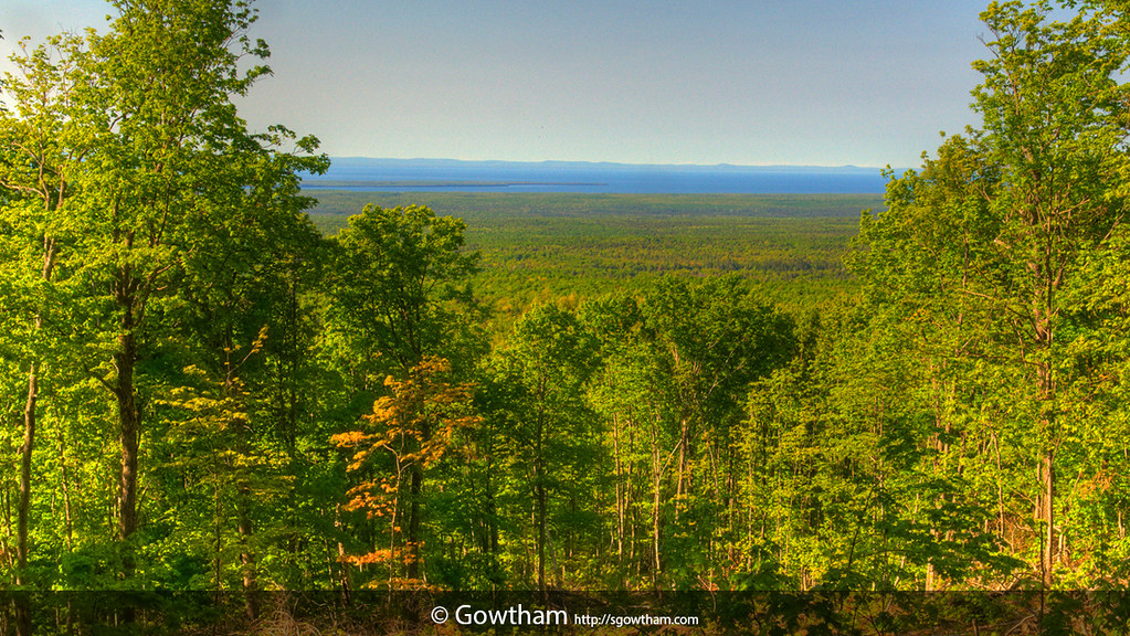
This week is Arbor Week, a week dedicated to celebrating and planting trees. One tree for Michiganders to celebrate is the eastern White Pine (Pinus strobus), which was adopted as our official State Tree by Act 7 on March 4, 1955. Here’s an edited summary of what I’ve learned about white pines.

The eastern white pine, is also known as “soft pine.” It was called the Tree of Peace by the Iroquois and in Ojibway, Zhingwaak. Mature white pines can easily live 200+ years of age, with some Michigan trees that have approached 500 years in age. The eastern white pine has the distinction of being the tallest tree in eastern North America, and pre-colonial stands were reported over 200′ in height.

It was said that when settlers arrived, a squirrel could travel in the forest canopy from one side of the state to the other. With this amazing resource, Michigan led the nation in lumber production in the 1880s and 1890s, and by the early 1900s, over 100 million of Michigan pine trees worth more than all the gold mined in California had been felled in the Lower Peninsula. Most of that value was in white pine, an when the forest was depleted, timber companies moved to the UP.

Small white pines are popular as Christmas trees due to their ability to hold needles, while large white pines were prized as ship masts and known as mast pines by the British navy. These trees were marked with a broad arrow by agents of the crown, a very controversial action that was one of the factors leading to the Revolutionary War. The original masts on the USS Constitution (aka Old Ironsides) were single trees before they realized that laminated trees were better about to withstand cannon fire.

More about the White Pine in Michigan

Scott writes that this mighty 200+ year old White Pine was spared the lumberjack’s axe, but he’s glad to have this remnant of the forest that once covered Upper Michigan standing sentinel in the forest surrounding his cabin. Check it out bigger and in his Fisheye slideshow. More of Scott’s work on his Facebook.

More of Michigan’s tallest things on Michigan in Pictures.

April Northern Lights over Michigan

Reflection

Reflection, photo by Xavist on the colorful way

Quite a number of photographers in our Absolute Michigan pool caught photos of the aurora borealis. More including a great video over on Absolute Michigan.

See Xavist’s photo background bigtacular, catch another that is currently the cover of our Absolute Michigan Facebook or enjoy some great photos from the U.P. in his slideshow.

Much (much) more northern lights information & photos on Michigan in Pictures.

At the Corner: 100 Years at Tiger Stadium

at the corner

at the corner, photo by 1ManWithACamera

“It was the most famous address in Michigan. Not the number, but everyone knows the location. The corner of Michigan and Trumbull was a connection for everyone all over Michigan to the city of Detroit”
~Charley Marcuse, former hot dog vendor at Tiger Stadium

The above is a quotation from a heartbreaking feature on the 100th anniversary of Tiger Stadium that we are linking to today from 100 years at Tiger Stadium on Absolute Michigan. It’s chock full of great links, photos and a video narrated by Jeff Daniels and featuring Tiger greats Al Kaline, George Kell and Ernie Harwell.

The feature was especially heartbreaking for me as I was as guilty as most of the rest of the media that let this historic milestone pass unmarked. Don’t get me wrong – I think Comerica Park is a fantastic place to play baseball and a fitting home for the Tigers. To me, the shame lies in the manner in which one of the finest ballparks in all of baseball was cast aside by a city that seemed more interested in squeezing one last dime from the stadium at Michigan & Trumbull than celebrating and honoring her rich legacy.

Check this out bigger and in Larry’s great Detroit Tigers and their ballparks slideshow.

Much more on Tiger Stadium and the Detroit Tigers at Michigan in Pictures.

Henry’s Wavy Wall

Henry's WavyWall 2

Henry’s WavyWall 2, photo by swatzo

Check it out bigger and in Steve’s Panasonic LX-5 slideshow.

Earth Day, are you doing it?

Come On Everybody Is Doing It

Come On Everybody Is Doing It, photo by B0nes

Sunday (April 22) is the 42nd Earth Day. You can read about Earth Day’s Michigan roots and much more on Michigan in Pictures. Here’s a few more links:

Erik took this on Earth Day in 2010. Check it out bigger and in his Spring slideshow.

Mt Arvon: Michigan’s Highest Point

Mt Arvon - Michigan's Highest Point by Gowtham

Mt Arvon – Michigan’s Highest Point by Gowtham

Yesterday we featured Mark Chamerberlin’s photo of Michigan’s tallest building (the Renaissance Center) in our Daily Michigan email along with some more of Michigan’s tallest things. Seemed like a good theme to continue…

You can view Gowtham’s photo bigger and in his Michigan slideshow. About Mount Arvon, which is part of the ancient Huron Mountains, he writes:

Mt. Arvon is Michigan’s highest point standing at 1,979.238 ft above sea level. It is located in the rugged backwoods of Michigan’s Upper Peninsula, about 25 [driving] miles from L’Anse. Getting to Mt. Arvon is no easy feat if one doesn’t know her/his way around. Due to logging operations, the roads in the area change frequently. In the winter, the roads become impassable due to the heavy snow the area receives. During the rainy season, the roads become muddy and are often unfit for passenger cars. As if that weren’t sufficient, the peak is not prominent as it is located in a heavily wooded area.

He adds that the blue waters in the distance are Lake Superior and:

…the edge of tiny strip of land [Copper Country State Forest] marks Point Abbaye. The piece of land lining up with horizon is the Keweenaw Peninsula. For many years, Mt. Curwood, located a few miles south of Mt. Arvon, was recognized as the highest point in Michigan. However, in 1982, the U.S. Department of Interior’s Geological Survey team gathered new measurements and found Mt. Curwood to be slightly lower in elevation than Mt. Arvon measuring in at 1,978.24 ft above sea level.

Slightly is an understatement – Wikipedia’s Mount Arvon entry explains that the surveyors found Arvon to be a whopping ONE FOOT taller than Curwood.

Check out both peaks on Google Maps and get a little more info in Summit Post’s entry for Mt. Arvon.

Sun Pillar, Light Pillar, Solar Pillars

Sunset - Sun Pillar by Kevin Povenz

Sunset – Sun Pillar, photo by Kevin Povenz

Today’s post I suspect will be in the “You learn something new every day” category for most readers. Here’s an explanation of this phenomenon pieced together from Pillars at Atmospheric Optics and Wikipedia’s Light Pillar entry (more photos at both links and the one below).

A sun pillar (or light pillar or solar pillar) is a visual phenomenon created by the reflection of light from ice crystals with nearly horizontal parallel planar surfaces. The hexagonal plate-like ice crystals fall with a horizontal orientation, gently rocking from side to side as they fall.

The light source can be the Sun (usually low to the horizon), moon or manmade sources like streetlights. Niagara Falls is a common place to see them as the mist from the Niagara Falls causes the phenomenon to appear frequently during the winter months, when ice crystals interact with upward facing spotlights to create prominent light pillars.

Check this out bigger or in Kevin’s Sunrise/Sunset slideshow.

Support Michigan in Pictures with Patreon

Trash the Dress, Michigan

Trash the Dress

Trash the Dress, photo by Steven White Photographic Art

Wikipedia says that Trash the Dress is:

…also known as fearless bridal or rock the frock, is a style of wedding photography that contrasts elegant clothing with an environment in which it is out of place. It is generally shot in the style of fashion and glamour photography. “Trash the dress” is the art of destruction or deconstruction of a brides wedding dress to create a new “artwork” that the bride would be proud to display on their wall. This new “masterpiece” is formed in the creative destruction of the dress. This will normally be portrayed in a sequence of images or simply a single image…

It may be done as an additional shoot after the wedding, almost as a declaration that the wedding is done and the dress will not be used again. It is seen as an alternative to storing the dress away.

It’s also being used for prom dresses now. Check this out background bigtacular and in Steven’s Portraits slideshow and at stevenwhitephotographicart.com.

There’s a Trash the Dress group on Flickr and also check out the Trash the Dress Michigan slideshow on Flickr.