Eagle River Falls, actually

DSC_3761_edited-1.jpg

DSC_3761_edited-1.jpg, photo by Bearcats Photography

Only the second day of Waterfall Week on Michigan in Pictures and already I have egg on my face … maybe all those waterfalls can wash it off. An alert commenter noted that this waterfall is not Jacobs Falls but actually nearby Eagle River Falls. GoWaterfalling fortunately has the 411 on these falls that are about 4 miles from Jacobs Falls.

Eagle River Falls is in Eagle River, on MI-26. This is a roadside falls. There is a small park and a pedestrian bridge from where you can get a nice view of the falls. There is an old dam at the top of the falls. The falls used to power the Lake Superior Safety Fuse Factory. In the spring the falls is much wider and sometimes flows over the dam…

The pedestrian bridge used to be the main bridge, and is of historical interest. It is an early steel bridge. Personally, I thought the modern bridge it was replaced with was much more interesting.

Click through for more and also information about other nearby waterfalls. If you’re curious about the Lake Superior Safety Fuse Factory, click that link from some photos & recollections about this Eagle River business at pasty.com.

Speaking of nearby waterfalls, I found another cool site this morning. Waterfalls of the Keweenaw Area by Jacob Emerick features a nice map of waterfalls in the area as well as a list of waterfalls. He has several albums of photos on the Eagle River Falls page – check it out!

Check this out big as a waterfall and see more in Mike’s Upper Peninsula, mi slideshow.

More waterfalls on Michigan in Pictures.

Mosquito Falls and Waterfall Week on Michigan in Pictures

Mosquito river - Pictured Rocks National Lakeshore

Mosquito river – Pictured Rocks National Lakeshore, photo by Michigan Nut

I’ve decided to declare it Waterfall Week on Michigan in Pictures, due in part to today’s photo from John McCormick.

We’ll lean heavily on the fantastic GoWaterfalling.com, far and away the best guide to waterfalls in the Great Lakes region. They say that Michigan has nearly 200 named waterfalls, with all but one located in the Upper Peninsula (more about that tomorrow). They note that many (such as today’s) are pretty small and might better be described as rapids.

Their page on Mosquito Falls says:

This is the smallest and least impressive of the named waterfalls in Pictured Rocks. If time is limited, skip this one in order to see Chapel Falls. However this waterfall is a nice feature of the Chapel Loop Hike which will take you past both Chapel and Mosquito Falls.

Mosquito Falls is a small waterfall consisting of two main drops about 100 meters apart with a stretch of rapids in between them. The lower drop is about 10 feet high, and the upper one is about 5 feet high. This is the smallest of the named Pictured Rocks waterfalls but it is a very lovely hike, especially in spring when the flowers are out.

They’re definitely right about what is for my money the best hiking trail in Michigan – trail map right here. Read on for directions and more and also see the Waterfalls page from the Pictured Rocks National Lakeshore.

See John’s photo bigger and see more in his Michigan Waterfalls slideshow.

be always an explorer

be always an explorer

be always an explorer, photo by .brianday

A good motto for the weekend … or a lifetime.

Check this out on black and see this and many more shots in Brian’s long exposure slideshow.

More black & white photography (including several by Brian) on Michigan in Pictures.

Red Sunflower

Red Sunflower

Red Sunflower, photo by d charvat

I wish I’d planted a field of these.

Check it out bigger and in d charvat’s Summer slideshow.

More flowers on Michigan in Pictures.

Hot Air Balloon Ride over Grand Traverse Bay

Hot Air Balloon Ride-19

Hot Air Balloon Ride-19, photo by alioops1956

Here’s a great set of photos from a misty hot air balloon ride over Grand Traverse Bay. Check it out background bigtacular and in Alison’s Hot Air Balloon Ride slideshow.

I’m pretty sure this is a balloon from Grand Traverse Balloon.

Morgan Falls near Marquette

9358 Morgan Falls

Morgan Falls, photo by my marquette

GoWaterfalling, the premier site for Michigan & Midwest waterfalls has this to say about Morgan Falls:

Morgan Creek tumbles 20 feet into the Carp River, creating this small wild waterfall. This is one of the more accessible of the Marquette waterfalls. The more impressive, but much harder to visit Carp River Falls are half a mile away.

Morgan Falls is located about two miles south of the city of Marquette. Of the many waterfalls in Marquette county this is one of the easier to visit, especially if you have four wheel drive. The waterfall is located at the confluence of Morgan Creek and the Carp River. The creek cascades down 20 feet to join up with the Carp.

…There is some disagreement about the name of this falls. According to some Morgan Falls is actually a cascade further upstream, and this is just an unnamed waterfall. This is the more distinctive and photogenic of the two features.

Get directions, nearby falls & more pics from GoWaterfalling!

Check this out bigger and see more in Ashley’s Nature slideshow.

Many more Michigan waterfalls or more from Marquette can be found on Michigan in Pictures!

The Gray Treefrog doesn’t care if you’re confused

Gray Tree Frog

You Can’t See Me, photo by MacDonald_Photo (Formerly Sl33stak)

Michigan has two species of Gray Treefrog – the Eastern (Hyla versicolor) and Cope’s (H. chrysoscelis) that are hard to distinguish, sometimes even sharing the same ponds. Check out the Hyla versicolor page at the UM Animal Diversity Web for a bit about that. Their color spans a range of gray, green or brown according to environment or activity. See a collection of photos showing their wide range of color at the UM Animal Diversity Web.

They can be found in woods, swamps and your own backyard. Their ability to climb vertically & horizontally is due to their specially adapted toe pads, and you’ll sometimes find them on your screen windows at night. You’ll hear their short musical trill on warm spring & summer nights.

Jamie writes that he walked 20′ into the woods off a heavily used path and ran into this little guy – small as his thumb and sitting on a milkweed. Check this out background bigtacular and see more in his Fauna slideshow.

More Michigan frogs on Michigan in Pictures. Or, for something different, here’s what we have for green!

Unchaining a River: Restoring the Boardman River

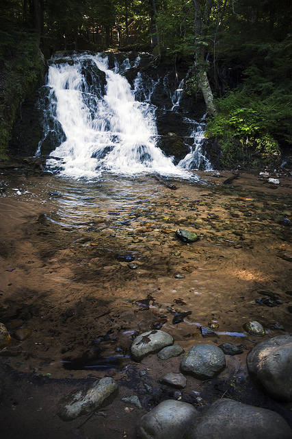
Poetry of Nature, photo by Mark Lindsey

“We’re healing one of Mother Earth’s arteries. I think she’s been hurting for a long time.”
~Hank Bailey, Grand Traverse Band Natural Resources Official

The Boardman River watershed encompasses 291 square miles and flows 179 miles from its origin in Kalkaska County to West Grand Traverse Bay in Traverse City. Last Wednesday, the process of removing three no longer used hydro-electric dams from the Boardman began at Brown Bridge Dam. The removal of the three Boardman River dams (Brown Bridge, Sabin & Boarman) will be the largest dam removal project in Michigan’s history, and the largest wetlands restoration in the Great Lakes Basin. It will allow the Boardman to return to a more natural state as a free-flowing, cold-water river. You can read all about the dam removal on the Boardman River website which explains:

The Boardman River was formed after the last retreat of glaciers covering Northern Michigan approximately 10,000 years ago. The proto-Boardman River was a tributary of the Manistee River and flowed south to Lake Michigan. The course of the river changed as early headwaters streams cut through glacial deposits and joined with the proto-Boardman River. This allowed the Boardman River to flow north and empty into Grand Traverse Bay. Glacial deposits, in particular the Kalkaska series soil, are responsible for the high quality of the Boardman River.

…Americans living in the area knew the River by another name. They valued the river as an important transportation route as well as a source of sustenance. Early European settlers called the river the “Ottawa” after the local band of Native Americans. Things changed when Captain Harry Boardman came to the area around 1848, established a sawmill, and acquired timber rights for the area. Captain Boardman stored logs for his sawmill in a natural lake on the Ottawa River, which became known as “Boardman’s Lake.” In time, the entire river became known as the “Boardman River.” In 1852 Captain Boardman sold his timber rights to the real timber barons of time, Perry Hanna & Tracy Lay. The Boardman River played a vital role in the economic growth of the region as it was cleared of debris in order to drive logs downriver to the mills. This process fueled a growing city but was devastating to the river’s aquatic habitat, contributing to the extirpation of Michigan Grayling in the river. After the logging era, several dams were constructed to provide power for the growing needs of Traverse City. These hydroelectric dams originally supplied a large percentage of the city’s electrical needs, but this declined over time. Before being decommissioned in 2005, these dams only provided 3.4% of the power used by Traverse City Light & Power customers each year.

Of approximately 179 miles of stream in the Boardman River Watershed, 36 are designated as “Blue Ribbon” trout habitat. These areas, located upstream of the Beitner Road crossing are premier fish habitat and important to anglers. Boardman River anglers have an important economic impact on the region. The entire watershed is also used for activities such as canoeing, tubing, kayaking, hiking, hunting, and bird watching. These uses make it a destination for an estimated 2 million Recreational User Days annually.

This project seems to me to be an excellent example of “government done right” – an adequately funded effort that leverages a wide range of scientific experts to protect property owners while restoring a natural resource to its natural state. There’s also a Boardman River Prosperity Plan that will seek to turn a solid environmental decision into a sound economic one was well.

Also see this feature on IPR News Radio and a cool video about the dam removals produced for The Grand Vision Natural Resource Network by Miles Chisholm of the Grand Traverse Band of Ottawa and Chippewa Indians. The video includes some great old photos of activity on the river.

Mark took this photo in October 2010 when the colors were callin’ – see it on black and see more in his Explored slideshow.

Have you gotten your dose of Vitamin N today?

Green Point in Fog

Green Point in Fog, photo by *ojoyous1*

I was paging through a copy of the AARP Bulletin (not mine … yet) and came across an interesting little article about the benefits of spending time in nature by Richard Louv. Louv wrote the book Last Child in the Woods, which introduced the concept of “nature-deficit disorder”. He writes:

A growing body of research links more time in nature — or in home, work or hospital environments enhanced through nature-based design — with reduction of stress and depression, faster healing time and less need for pain medication.

Health care professionals are taking note. In 2010, a pilot program in Portland, Ore., began pairing physicians with park professionals, who helped children and families get their green exercise or, as I call it, their dose of “vitamin N.”

Other benefits of vitamin N include enhanced use of the senses and higher work productivity. In 2008, University of Michigan researchers demonstrated that, after just an hour interacting with nature, memory performance and attention spans improved by 20 percent. In April, researchers at the University of Kansas reported a 50 percent boost in creativity for people who were steeped in nature for a few days.

Michigan is blessed with an amazing amount of opportunities to slip into nature for ten minutes or ten days so what’s stopping you?? Check out books and more at Richard Louv’s website.

Joy took this photo at the Green Point Nature Reserve near Elberta. Check it out bigger and in her Up North slideshow.

More nature on Michigan in Pictures!

Farmland Sundown

Farmland Sundown

Farmland Sundown, photo by karstenphoto

Near Montague. Check this out background bigilicious or in Steven’s sunset slideshow.

More sunset wallpaper on Michigan in Pictures.