Hot Stove League

Comerica Park Winter - Detroit, MI

Comerica Park Winter – Detroit, MI, photo by memories_by_mike

The Freep has an interesting article with Detroit Tiger GM Dave Dombrowski discussing the teams offseason strategy.

View Mike’s photo background bigtacular and see more in his Detroit slideshow.

More Tigers on Michigan in Pictures.

Pictured Blue: Miner’s Castle in the Pictured Rocks National Lakeshore

Pictured Blue

Pictured Blue, photo by Kiiraaan

View this jaw-dropping photo of Miner’s Castle bigger and see more in Kiran’s Landscape slideshow.

The Pictured Rocks National Lakeshore’s Geology Field Notes page has this barely comprehensible stuff to say about Miner’s Castle:

The Miners Castle Member is a soft, crumbly, quartz sandstone (with abundant garnet content) about 140 feet thick; its complete section is exposed in the Pictured Rocks Cliffs between Sand Point and Miners Castle. Sediments of this member are generally poorly sorted.

Capping the easily eroded Miners Castle Member of the Munising Formation in the western half of Pictured Rocks, is the resistant Early Ordovician (480-500 million years old) Au Train formation. The Au Train Formation is a light brown to white dolomitic sandstone that forms the resistant cap to the underlying softer sandstones. The numerous falls in Pictured Rocks National Lakeshore are the result of this caprock.

Read on for much more about the geology of Pictured Rocks. Erosion is indeed a factor with one of the most visible instances being April 13, 2006, when one of the pillars of Miner’s Castle collapsed.

You can see more of Pictured Rocks from Absolute Michigan and at the Pictured Rocks National Lakeshore web site.

Snow Days like the Olden Days

Otsego Gaylord Mi Winter Drifts in the 1940s RPPC

Otsego Gaylord Mi Winter Drifts in the 1940s, photo by UpNorth Memories – Donald (Don) Harrison

Winter 2014 has been a real throwback with many school districts already past the maximum number of snow days and no sign that winter is slowing down. Seeking Michigan has a feature on two large snowstorms in recent memory—the blizzard of January 1967 and the one in 1978 about which they say:

On January 26-27, 1978, snowstorms with fifty-to-seventy-mile per hour winds pummeled much of Michigan. Snowfall totals ranged from eighteen inches in Lansing to an incredible fifty-one inches in Traverse City. More than 100,000 cars were abandoned on roads and highways, and travel was impossible for days. Governor William G. Milliken declared a state of emergency on January 26 (See the image below.) and activated the National Guard to assist with the cleanup. The governor also requested financial assistance from the federal government and estimated damage totals to be more than $25 million, not including lost productivity from workers who were unable to get to their jobs.

Seeking Michigan is the website of the Archives of Michigan. If you’re interested in the wild & wooly side of Michigan, the Michigan Historical Museum has a special exhibit “Lake Effects: Exploring Michigan Weather” where you can learn about winters past and share stories of your winter memories. They ask that you share a favorite winter photograph on the Michigan Historical Center’s Flickr page by e-mailing it to icy27ran@photos.flickr.com with the photo title in the subject line.

View the photo background big and see more snow photos from Don & UpNorth Memories.

Winter wallpaper? We have it if winter hasn’t beaten you yet!

The Tridge in Midland

The "Tridge" - Midland, Mi

The “Tridge” – Midland, Mi, phto by Bluejacket

Wikipedia explains that the The Tridge is a three-way wooden footbridge spanning the junction of the Chippewa and Tittabawassee Rivers near downtown Midland that opened in 1981. It consists of one 31′ tall central pillar supporting three 180′ long by 8′ wide spokes. This apparently globally unique structure was built by Gerace Construction of Midland who add:

The walkways are eight feet, three inches wide, and the triangular observation area in the center measures 35 feet per side. The wooden decking and beams filled six train cars. Although the majority of the Tridge is wood, there are 20 tons of steel in the structure in the form of bolts and connectors. A cofferdam – an enclosed circular cell formed from steel sheet piling – was driven into the river bed and then pumped dry to keep water out while the central concrete pier was built. A causeway – essentially a road in the middle of the river – was built from concrete rubble to allow a crane to approach the center construction area.

The Kuriositas has a nice aerial view of the Tridge too!

Check the photo out bigger and see more in Bluejacket’s The “Tridge” in Midland, Michigan slideshow.

More bridges and more Midland on Michigan in Pictures!

Early One February Morning at Little Girl’s Point

Early One February Morning (2)

Early One February Morning (2), photo by siskokid

Jim caught a gorgeous sunrise last February on the shore of Lake Superior at Little Girl’s Point. The article Legendary Little Girl’s Point from the Ironwood Daily Globe says it is located about 21 miles north of Ironwood and was used by the Chippewas for fishing, hunting and a camping place during trips to the Porcupine Mountains. As to the name:

According to Burnham, Mary Amoose (Little Bee), an unusually intelligent Chippewa woman of Bad River, told Burnham the story of the lost girl of Little Girl’s Point as she had often heard it told by her grandmother more than a half century ago.

She told Burham how a party of hunters returning from a trip to the Crouching Porcupine rounding the point of land now known as Little Girl’s Point, thought they saw the form of a girl among the trees. She was clad in green. The hunters, thinking that it was some girl that had become lost, beached their canoes, but on climbing the steep shore, only caught one or two glimpses of the green girl, who glided further back among the stately pines, and vanished.

Burham said he was interested in this story for it gave the name to Little Girl’s Point, and it was told to him by this Chippewa woman, much as it had been told to Henry R. Schoolcraft, the historian, and discoverer of the source of the Mississippi River. Burnham said the story was told to Schoolcraft by his half-breed wife, Julia (Jane) Johnson, granddaughter of the great chief Waubojeeg, who lived on the mainland near where Bayfield now stands.

I can’t tell if the “unusually intelligent” is sexist or racist, but there is a lot of interesting historical information to be found if you read on. The article is housed on the Gogebic Range City Directories which looks to be a treasure trove of historical information about the region that includes Michigan’s northwestern corner and Wisconsin’s northeastern.

Check it out bigger and see more in Jim’s Little Girl’s Point slideshow.

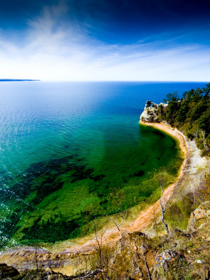
There’s more history (and more ice) on Michigan in Pictures.

A Lighthouse a day keeps the winter away

Frankfort Lighthouse by 22 north

Dawn at Frankfort North Breakwater Light, photo by 22 North Photography

22 North Photography has declared February as Lighthouse Month, sharing 28 Michigan lighthouses in 28 days. Day 1 is the Frankfort North Breakwater Light which marks the entrance to Betsie Lake and the Betsie River in Frankfort.

View the photo bigger on Facebook, keep up on their Facebook page and also see the 22 North Photography website.

Many more lighthouses on Michigan in Pictures.

In between the dark and the light on Empire Bluffs

Sun Spill, Empire Beach

Sun Spill, Empire Beach, photo by jess_clifton

Recently Michigan in Pictures regular Jess Clifton and her family made a wintertime excursion to Empire in the heart of the Sleeping Bear Dunes National Lakeshore. She writes (in part):

At Empire, the beach was already sprinkled with about 10-15 other folks and the scene was surreal. Kids were crawling in and out of caves carved into the thick, massive ice formations built up along the water’s edge. Clouds intermittently descended and receded, offering up dramatic skies that beckoned you out.

…Once I finally convinced myself the beach was “safe” to venture out onto after watching about 14 other people successfully make the trek, I was off cresting mini ice mountains at a snails pace until I could finally peer into the water.

It was there that I finally got a sense of just how still the water was. Pancake ice floated gently on the barely breathing lake. The revelation of something so calm in such a harsh environment was almost jarring. (In a really good way.)

Read on for more and lots of stunning photos in her Why Michigan? blog.

View Jess’s photo background bigtacular and see more in her Winter in Northern Michigan slideshow. She also has a comparison photo from last year.

Lots more winter wallpaper on Michigan in Pictures.

Black Slate Falls

Black Slate Falls, Baraga County, MI, April, 2010

Black Slate Falls, Baraga County, MI, April, 2010, photo by Norm Powell (napowell30d)

On Scenic USA, Ken Reese has some info about Black Slate Falls:

Gathering momentum on the slopes of Mount Arvon, Michigan’s highest peak, the Slate River drops northward into Lake Superior. At one time when slate was a predominant roofing material, Arvon Road led to the small town of Arvon and a slate quarry. Today the town has all but disappeared, and piles of waste slate mark the quarry site.

West of the Slate River, Arvon Road leads to this beautiful setting of Black Slate Falls. Here, tucked in the woods is a picturesque little falls as it drops over slate ledges. Quartzite and Black Slate falls are found at the end of Arvon Road. For those seeking more woodland waterfalls, this wild river leads down to Slate (the largest drop), Slide and Ecstasy falls, just three miles downriver. Hiker’s notes indicate it’s a lot easier to reach Slate Falls from Skanee Road, where Arvon Road gets its start.

GoWaterfalling adds that Black Slate Falls are one of several waterfalls on the Slate River.

View Norm’s photo bigger and see more of his waterfall photos on Flickr!

Many more waterfalls on Michigan in Pictures.

Lighthouse Punk

DSC07439P

Untitled, photo by Scott Glenn

Kids these days and their crazy hair.

Check Scott’s photo out bigger and see lots more in his Lighthouses slideshow. Also check out a previous photo by Scott on Michigan in Pictures.

Shoreline Wonders

Winter ... shoreline wonders!

Winter … shoreline wonders!, photo by Ken Scott

As you may have realized from his last photo, Ken enjoys winter quite a lot – a useful trait for a photographer! He says that he crawled in here to get out of the arctic blast yesterday when he was exploring the ice by the Grand Traverse Lighthouse at the tip of the Leelanau Peninsula. If you want to get a sense of what it’s like right now, he also shot a fantastic video!

View his photo bigger, see more in his Winter slideshow and if you’d like to chat with Ken about the photo, check it out on his Facebook page.

PS: I thought this photo was a nice counterpoint to Shawn Malone’s last pic.