Picking Apples, W. Golden Orchard 1894 … or thereabouts

Picking Apples, W. Golden Orchard 1894 courtesy Archives of Michigan

The Image of the Month for October 2007 (link defunct) from the Archives of Michigan begin:

This photo depicts apple pickers in the Old Mission Peninsula. It was taken in the early 1890’s. (The caption on the front of the photo gives the year as “1894.” However, identifying information on the back gives the year as “1891.” The exact date, then, is uncertain.)

Michigan’s “fruit belt” strides the shore of Lake Michigan. The Lake itself plays a key role. It functions as a moderating body, preventing temperatures from getting too cold in the fall and too hot in the summer. It also provides the frequent rainfall that fruit farmers require. This climate combines with rich soil and regional topography to provide ideal fruit-growing conditions.

Michigan’s fruit industry started to boom about the time of the Civil War. By then, Chicago’s growing population had provided a ready market. Transportation improvements (notably the expansion of railroads) provided greater access to this and other population centers.

If you’d like to learn more about apples in the present day, check out the first ever Absolute Michigan Word of the Week: Apples!

Support Michigan in Pictures with Patreon

Fall Color Tours: Pictured Rocks & Munising – Newberry – Grand Marais

Miners Castle - October 2006, Lars Jensen

Miners Castle – October 2006, photo by Lars Jensen

Let’s jump over to the eastern side of the UP for the next color tour of Munising – Newberry – Grand Marais … and the Pictured Rocks.

The highlight of this tour is of course the stunning Pictured Rocks National Lakeshore., (be sure to check out Lars Jensen’s other Pictured Rocks galleries). Travel Michigan starts you heading east from the town of Munising (Munising.com has the best links, but you can also see the Munising Visitors Bureau). Horseshoe falls at night by Amy KilroyBe sure to check out Munising area waterfalls including Horseshoe Falls (photographed so well by Amy Kilroy – see her Pictured Rocks set for more!). Regarding Munising, Michigan.org says:

This harbor town of about 2,500 is the departure point for regularly scheduled, 2-1/2 hour, narrated Pictured Rocks Boat Cruises as well as chartered Skylane Air Tours that offer a birds-eye view of the scenery. Hikers can tackle all or a portion of the 43 mile Pictured Rocks segment of The North Country Trail (NCT), a national scenic hiking route from North Dakota to New York.

I’ve never done the Air Tour (check that link above and scroll down for the video!), but the boat cruise offers an amazing look at the Pictured Rocks that’s well worth the time and cost! The Pictured Rocks is my favorite place in Michigan, and I’ve covered it pretty well on Michigan in Pictures and on Absolute Michigan. The same is true of Tahquamenon Falls, so let’s say that Grand Marais is a cool little harbor town with its own brewery and a great little diner car diner and skip over to the Tahquamenon Logging Museum which features all kinds of logging era memorabilia and special events including Lumberjack Breakfasts and a Harvest Fest the 3rd weekend of October.

They don’t stop at the Great Lakes Shipwreck Museum at Whitefish Point (’cause that’s another tour), but you can definitely make the short detour to check this very cool museum out. Then it’s back south to Newberry (recent photos at visitnewberry.com) and then west to the Seney National Wildlife Refuge (Wikipedia entry) and the gorgeous Seney Stretch of M-28. Although this highway has been called “mind-numbingly monotonous” and “the state’s most boring route“, it’s actually pretty beautiful in the fall! (photo to the right is H-58 in Fall Color by James Phelps – part of his great Pictured Rocks set).

Here’s a link to a map of photos from the Munising / Pictured Rocks area in the Absolute Michigan pool!

Just so it’s clear, these fall color tour entries are produced by Absolute Michigan & Michigan in Pictures using the great information compiled in Travel Michigan’s Fall Color Tours as a starting point. We’re trying to add to what they’ve put together – not rip them off! As always, if you have links to information or photos that we missed, comments or reports, post them in the comments below!

Don’t miss our Michigan Fall Wallpaper series and see more of Travel Michigan’s Fall Color Tours.

Untitled. Unplugged. Unknown.

Untitled, photo by jenny murray.

Jenny says that this photo was taken using a yellow filter (an actual one, not Photoshop).

I say that I apologize on the behalf of Charter for the lateness of today’s post. My office is quite tidy after the 8 hour outage though!

No word on what the pilot says.

Ken Rockwell has some interesting things to say about the use of filters, yellow and otherwise. Here’s a little excerpt:

The more you learn about photography the more you’ll also learn that artificial filters and manipulation are required to make a natural looking image. Ansel Adams realized that human perception and the photographic processes are quite different. Therefore one needs to use a lot of filtration, manipulation and burning and dodging to compensate for the human eye and brain’s image processing to create an image on paper that looks natural. (You can read this in his books.) This is why most snapshots don’t look like the original scene. Artificial processes and image manipulation are needed to make a photograph look natural.

Armchair photographers like to play a stupid game that prohibits anything creative and requires they just play forensic photographers blindly Xeroxing nature without filters. I only judge people on the final image, not the process.

Something to consider for sure.

Michigan fall … and the Michigan Fall Wallpaper Series

Michigan fall.

Michigan fall., photo by upthedubs1.

The latest in our Michigan Fall Wallpaper series* is part of Patrick McGowan’s Michigan Autumn set (slideshow)

This is the part where I think of something to add to the photo, but all I can come up with is “This is from October 30, 2005, so don’t despair – there’s still time to enjoy that fall color!”

*I’m sure a lot of you didn’t even know Michigan in Pictures had a “Michigan Fall Wallpaper series“. It’s actually a relatively new thing and by “relatively new” I mean “I thought it up this morning”. I’ll add photos to the series that are available in the bigger sizes to grace your computer’s desktop. Most of the pictures are on Flickr and you may have to join Flickr and/or become a contact of the photographer to be able to view that size.

Last look at Tiger Stadium?

Tiger Stadium, Detroit MI, photo by jnhkrawczyk

Jill was one of 18 members of the Exposure.Detroit photo group that got a chance to tour the soon to be demolished Tiger Stadium last Friday.

They brought back an amazingly collection of images. Some, with trees growing in the aisles and demolished seats are almost painful, but from other angles it looked almost as if you could play tomorrow (if you cut the grass).

I could go on and on highlighting pictures, but it’s probably best if you check out the photos of Tiger Stadium from September 28, 2007 (slideshow). More about the Detroit Tigers and Tiger Stadium on Michigan in Pictures.

Envision Michigan

reflection off the grand by oldbrushes

reflection off the grand, photo by oldbrushes

One of my big goals with Michigan in Pictures is to share the beauty of our state, and I’ve been happy to discover so many other people like Kathy who feel the same love for Michigan and want to share it too.

It’s no secret, however, that our state’s economic and political environment is less than beautiful. An organization that I’ve been working with lately, The Center for Michigan, is striving to aid in in the transformation of Michigan’s business, economic, political and cultural climate. To that end (they write):

We’re launching the Envision Michigan Story Competition. Submit your best shots and you can win some of $30,000 in college scholarships, $5,000 in great Michigan vacation packages, or weekly shopping sprees to Meijer.

Entering is very easy. Just pick your best photo and explain it in a 350-word caption. For your best chance to win, make sure your caption explains what you love about our state, what you want to change about our state, your best vision for Michigan’s future.

You can also enter essays and videos – click for all the details on the Envision Michigan Competition and please share this around with everyone you know!

If you’re a Flickr user, you can also add your photos to their Michigan photos group.

North U

North U

North U, photo by numstead.

Nathan writes There was an incredible sunset in Ann Arbor this evening, the sky looked like it was on fire. I just happened to be out, walking back to my studio, with my camera.

This photo is part of his Ann Arbor set … which in turn belongs to his Cities collection.

Fall Color Tours: The Keweenaw Peninsula (Houghton, Eagle River, Copper Harbor)

Quincy Hill in Fall Colors 5 by KaylynStar

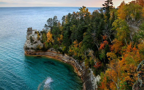
Quincy Hill in Fall Colors 5, photo by KaylynStar

Kaylyn has a number of colorful photos of Quincy Hill in the fall. As the northernmost point of Michigan, the Keweenaw Peninsula would probably have been the logical place to start color touring Michigan rather than where we did start (Western UP – Ironwood, Silver City, Wakefild, Porcupine Mountains).

In any case, the Keweenaw, way up north and surrounded by the icy waters of Lake Superior, is one of the first places in Michigan to be touched by autumn’s paintbrush. Michigan.org’s Color Tour of Houghton, Eagle River, Copper Harbor starts you in the city of Houghton at the Quincy Mine (photo: Quincy Mine & Hoist by Coder). Quincy Mine by CoderThe mine is open from May through late October and is part of the Keweenaw National Historical Park and offers guided tours of the old copper mine, the largest steam hoist ever built and a whole lot more mining history. There’s a museum on site and they also have a passenger cog rail tram that takes you to the top of Quincy Hill (where I assume you can get some great photos).

The tour heads north on M-41 to Phoenix where you can apparently tour the Church of the Assumption. The copper mining ghost towns of the Upper Peninsula page from Exploring the North has a brief bit on Phoenix:

Phoenix is located on highway 41 at the junction of M-26 to Eagle River. Once (about 1872) a thriving mining town of around 500 to 1000 people, but today there are only a few old buildings and the Phoenix Church remaining at the site of the old mine. St. Mary’s Church was built in 1858 to serve the Catholic residents of the mining community of Cliff, the scene of the area’s first major copper discovery in 1844. In 1899 the church was dismantled and reassembled in Phoenix, where it was renamed the Church of the Assumption. The Keweenaw County Historical Society has purchased and restored the property so the Phoenix Church appears much as it did over 100 years ago.

Eagle River Falls by Jim SorboeFrom there, it’s west to Eagle River, once an important port town for the copper industry and now a resort community. Attractions include the Eagle River Falls (photo: Eagle River Falls by Jim Sorbie) and the Eagle River Inn (they have some cool old photos on their site). Keep heading north and you’ll come to Jacob’s Falls and the Jampot, where the good monks of the Holy Transfiguration Skete make jams, jellies and pastries from all kinds of fruits including their famous thimbleberry jam. Stop car. Go in. Buy jam.

Eagle Harbor is next, and I can never mention Eagle Harbor without mentioning the first blog I ever saw, George’s Eagle Harbor Web. It’s also home to the Eagle Harbor Lighthouse and Museums (detailed info from Seeing the Light). Samuel of the Mountain by Kyle RokosNot far past here is Brockway Mountain Drive, the highest above sea-level drive between the Rockies and the Alleghenies. From the lookouts you can see glorious views of the town of Copper Harbor where you can see their photo gallery & webcam, Lake Fanny Hoe & Fort Wilkins State Park and the northern Keweenaw (photo: Samuel of the Mountain by Kyle Rokos). It’s probably time for a bite to eat too and them you can take a boat tour to the Copper Harbor Lighthouse if you’re feeling a little adventurous … or the ferry to Isle Royale if you’re feeling a lot adventurous!

It looks like the folks at Travel Michigan got a little tired at this point, tailing off with:

Continuing south of Copper Harbor is the authentic Delaware Mine, which yielded eight million pounds of the metal between 1847-1887. The scenic route continues through wonderful forests and through the city of Calumet, which was the cultural and commercial center of the Keweenaw Copper Range. Take time to visit the restored Calumet Theater and the red sandstone buildings of the downtown business district. This is the heart of the Keweenaw National Historic Park, which recognizes the importance of the mining history of this rugged and scenic region.

I’ve been in the Delaware Mine and I have to agree with UPTravel.com who say “If you have time to visit only one attraction in the Keweenaw, make it Delaware Mine, the area’s premier tourist attraction, where copper was mined from 1847 – 1887.” It’s very, very cool.

If you’re curious as to what the color looks like right now, I’d say “pretty darn good!” A final reminder, be careful when driving those back roads!

Just so it’s clear, these fall color tour entries are produced by Absolute Michigan & Michigan in Pictures using the great information compiled in Travel Michigan’s Fall Color Tours as a starting point. We’re trying to add to what they’ve put together – not rip them off! As always, if you have links to information or photos that we missed, comments or reports, post them in the comments below!

Don’t miss our Michigan Fall Wallpaper series and see more of Travel Michigan’s Fall Color Tours.

Flint Vehicle City Arch – The Making of Modern Michigan

Flint Vehicle City Arch

Flint Vehicle City Arch, photo by Arthur Crooks (Kettering University Library, Scharchburg Archive)

This photo of Saginaw Street (from Detroit Street looking south) shows the Vehicle City Arch that was erected in 1905 as part of the City’s 50th anniversary. It was taken in 1909 and is one of many photos from Michigan’s past in The Making of Modern Michigan, a collaborative project headed by the Michigan State University Libraries, in partnership with the Library of Michigan, the Michigan Library Consortium, and the 50+ libraries currently participating in the project. It includes local history materials from communities around the state – photographs, family papers, oral histories and genealogical materials on a wide range of subjects.

Many of the images (such as the one above) are part of collections. The Crooks collection includes lots more photos of Flint at the turn of the century like Buick: Made in Flint, The circus comes to town and a shot of the arches lit up at night. The Crooks collection reaches into the 1920s, and you have to check out Bootleg Raid in Flint.

As is often the case, I got curious about those arches. Fortunately, I didn’t have to go any further than Arches Restoration to Celebrate our Heritage (ARCH). Their history page explains:

The Flint arches were erected in 1899 to replace gas lanterns used to illuminate the business district at night. Built by Genesee Iron Works, five arches were placed at intersections along Saginaw Street. Each arch was built with 50 light bulbs to illuminate the City’s main street at night. Half were turned off at midnight. The arches supported decorations for every parade of importance held in the city and colorful lights replaced golden incandescence at holiday times. None of the original arches had the famous Flint Vehicle City crown at its apex.

When Flint celebrated its 50th anniversary in 1905 two additional arches were erected with the famous Flint Vehicle City graphic at the crown. These arches were placed at the south end of the city at the intersection of Fifth and Saginaw Streets and at the north end of the business district at the confluence of Saginaw and Detroit Streets (now M.L. King Boulevard).

Though many believe the arches celebrated Flint’s heritage as a center for automobile manufacturing, the original arches were a salute to Flint as the world’s largest volume manufacturer of horse drawn carriages.

They were successful in their campaign to restore the arches on Saginaw and you can see a photo by day and by night!

Fall Color Tours: The Western Upper Peninsula

Mom's Vista from Tiffibunny

Mom’s Vista, photo from Tiffibunny

This is one of a large number of great photos from all over the US posted by Tiffany Follett that were taken by her mom (see her set From My Mom for more!). It’s a view of Porcupine Mountains Wilderness State Park from M-107 that was taken in September 2003.

I thought this was a perfect photo to use to highlight Ironwood – Silver City – Wakefield, the first Michigan fall color driving tour from Michigan.org that I’m going to try and flesh out with photos from the Absolute Michigan group on Flickr and links to even more photos and information. View from Copper PeakI hope this isn’t seen as a rip-off – the tours they have developed are pretty cool and my hope is that this can be a complement to what Travel Michigan has put together. If you take the tour and/or have observations, photos or links to add, please do in the comments below!

This tour starts at the western end of Michigan’s stretch of US-2, in the town of Ironwood. Absolute Michigan’s page for Ironwood lists Copper Peak Ski Flying (MoodyGoat offers View from the Top – that’s over 1800′ up!) and the Western UP CVB as some notable sites. To those I’ll add the North Country National Scenic Trail, which enters Michigan at Ironwood and goes all the way to the Mackinac Bridge (explore the UP portion of the trail) and North Guide’s WesternUP.com (they are regularly posting fall color photos too).

They send you down U.S. 2 to Wakefield, one of many ore towns settled in the late 1800s, and then up County Road 519 to the Porcupine Mountains Wilderness State Park where you can catch staggering views like the one above (lots more from the Porkies on Michigan in Pictures). The photo below is Lake of the Clouds, Porcupine Mountains by J. Michael Ducey.

Lake of the Clouds, Porcupine Mountains by J. Michael DuceyNext it’s east to Silver City, about which Hunt’s Guide to the UP says:

Today Silver City is mostly a collection of tourist-oriented resorts and other businesses along M-107 near the entrance to Porcupine Mountains State Park. But for three years in the 1870s it was a silver mining boom town. At the fur-trading post that was the first settlement here, stories circulated about silver found by Indians back in the woods away from Lake Superior. Homesteader Austin Corser actually found the silver on the Little Iron River in the 1850s. He kept quiet about it until he proved his claim. In the 1870s he revealed the silver, sold his land, and left. Only one brick of silver, worth $723, was ever shipped from Silver City.

Then it’s south on M-64 to Bergland, located at the northern tip of the Upper Peninsula’s largest lake, Lake Gogebic. They suggest stretching your legs on the Gogebic Ridge Hiking Trail or Lake Gogebic State Park before heading back west to Ironwood.

You can check out more photos from this area on the Absolute Michigan group’s map on Flickr (and add your own!) and get your desktop in theme with the season with out Michigan Fall Wallpaper series!

More of Travel Michigan’s Fall Color Tours.