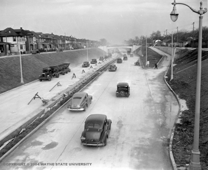
The Davison Urban Freeway by Wayne State University
The Daily Detroit is one of my favorite Michigan podcasts, and their story on The Davison, America’s First Urban Freeway in Detroit is pretty cool:
While freeways are pretty standard in American cities now, it wasn’t always that way. Instead of the ability to potentially go up to 70 miles an hour like on today’s highways, motorists had to use regular city streets to cross town. That was especially the case for motorists who wanted to cross Highland Park and enter Detroit.
Everyone piled onto Davison Avenue, the only large street that ran through Highland Park and connected to Detroit running roughly east to west. The avenue and freeway was named after an English immigrant from the 1840s that settled in the area, Jared Davison (it was then Hamtramck Township). His farm was approximately between Woodward and Oakland avenues along the south side of the street.
It wasn’t uncommon for drivers to spend 15 minutes sitting in traffic to reach Detroit. By 1940, thanks to Detroit’s growth and the growth of auto factories, Davison Avenue was approaching gridlock during rush hour by 1940.
…By November 1942, the five and a half mile long Davison Freeway was finished. It opened without a dedication ceremony, probably due to the desperate need the defense plants had for a functioning freeway. Despite its lack of dedication, the freeway became the first one of its kind – an urban freeway meant to connect one part of a metro area with another with as little interruption as possible.
…Ironically, the invention from Highland Park eventually played a key role in emptying the city out. In 1992, Chrysler moved their headquarters down the road – off of I-75 with a special off-ramp built for the development – to Auburn Hills, to follow the trend of suburban sprawl that the American highway system helped enable.
Read more at the Daily Detroit!

Share Michigan in Pictures: