It’s Election Day, Michigan, so get out and VOTE!

who’s YOUR candidate?, photo by erin MC hammer

Erin had just one thing to post on Flickr, ever. Not a bad choice.

Check it out bigger and get out there and pull some levers, push buttons, fill in the blanks or whatever it takes to get the job done.

If you need any help, head over to Absolute Michigan’s 2010 Michigan Election Resources!

Copper Harbor, Michigan

Copper Harbor

Copper Harbor, photo by Christopher’s eye.

The Copper Harbor history page from the official website of Copper Harbor says:

When Michigan became a state in 1837, 32-year-old Douglass Houghton was appointed as the first State Geologist. Houghton began a comprehensive geological exploration of the state to determine the extent of its mineral resources, visiting the Upper Peninsula in 1839 and 1840. This report to the Michigan legislature noted the probable extent of copper deposits in the Keweenaw Peninsula and stimulated new interest in Northern Michigan.

Publication of Houghton’s report of the mineral-rich Keweenaw Peninsula awakened the attention of eastern businessmen. The nation’s escalating need for brass (an alloy of copper and zinc) prompted further exploration of the area for exploitable copper resources….

Many of the earliest travelers to Keweenaw Point stayed only until their dreams of quick riches disappeared. But some stayed on to settle the area and a few of the current townfolk and shop owners are descendants of those first rugged settlers. Early Copper Harbor became the administrative center for a group of remote copper mining locations spread through the forst of Keweenaw Point. Later, the Harbor rang to the sound of axes and crosscut saws as the growing region required vast quantities of pine logs to support mine shafts and provide housing for a growing influx of immigrants. Today the Harbor still has the feeling of its frontier origins.

Here’s more about the history of copper mining at Copper Harbor and you can check out the official site for things to see and do around Copper Harbor in the present day.

Check this out bigger in Christopher’s slideshow and also have a look at the Copper Harbor slideshow from the Absolute Michigan pool on Flickr!

Happy Halloween!

Happy Halloween!

Happy Halloween!, photo by *Alysa*.

Happy Halloween from Michigan in Pictures and Absolute Michigan – we hope you all have a spooktacular holiday!

See this bigger in Anna’s slideshow.

spookys

spookys

spookys, photo by daveraoul.

Evil in Evart? For more Michigan creepiness, check out Halloween on Absolute Michigan!

Check this out bigger in Dave’s slideshow.

Michigan’s Otherside: Ghosts in the Cornfield

whats left..
whats left.. photo by PepOmint

Michigan’s Otherside has some great stories to put you in the Halloween frame of mind. Corn mazes are a popular attraction that many Michigan farmers put a lot of time into, but as Ghosts in the Cornfield warns, sometimes corn fields have their own haunts:

As a teenager I lived in a multilevel house right on M66 in Battle Creek close to the Pennfield schools. A couple of times I was walking along the rows of corn in the cornfield just behind my home when I had a paranormal experience. I was only about four or five rows back, walking parallel to the back of my house when I saw a farmer in blue jeans and a red flannel shirt walking towards me in the row closer to my house. I was too scared to look up to see his face. There was no sound from his footsteps or his arms hitting the dried leaves on the cornstalks. I had massive goose bumps! A couple of weeks later I was walking along the corn rows in about the same spot and this time I saw the farmer with a hound dog. Once again, I was too scared to look up. He was between me and the safety of my home. I kept my eyes down, held my breath and hoped he wouldn’t say or do anything to me. They passed silently and my heart rate slowed back down. My sisters and I loved to play in the cornfields.

Years later, one of my sisters admitted she had seen the farmer. He is probably still walking the fields every Fall as he had in life…

Read on at Michigan’s Otherside and check out some other spooky tales from Michigan, legends and haunted places!

You can see this photo bigger in PepOmint’s slideshow!

PS: Check out another classic Michigan ghost story on Absolute Michigan, the Ada Witch!

Michigan Windstorm of October 2010

NSPier10262010

NSPier10262010, photo by Twinz8.

Over the last 24 hours winds have roared through Michigan. While closed schools, downed trees and lost power are a problem for some, to some photographers & weather lovers (and of course surfers), the wild wind is a boon.

mLive has a report with some video from Grand Haven, a surfing hot spot (surfgrandhaven.com). More about Michigan surfing from Absolute Michigan.

Be sure to check this out bigger and check out more shots from the Grand Haven North Pier in Paul’s slideshow.

More Michigan weather from Michigan in Pictures!

Au Sable Lighthouse, Pictured Rocks National Lakeshore

Au Sable Lighthouse Pictured Rocks National Lakeshore
Au Sable Lighthouse, Pictured Rocks National Lakeshore, photo by yooper1949

The Au Sable Light Station is located in the Pictured Rocks National Lakeshore, and I think that it is the most peaceful setting of any lighthouse I’ve ever visited. Terry Pepper’s Seeing the Light page on Au Sable Point Lighthouse agrees, saying that the Lake Superior coastline between Whitefish Point and Grand Island attracts tons of tourists & stands as one of the most beautiful stretches of shoreline in all of the Midwest. However:

It is difficult to imagine that during the 1800’s this stretch of seemingly bucolic coastline was known to mariners as “The Shipwreck Coast,” with the hulks of innumerable vessels pushed onto the rocks by violent storms out of the north, or lost in the pea soup fogs which frequently enveloped the area.

While a Light at Whitefish Point had marked the eastern end of this stretch since 1849 and the western limit had been marked by the North Light on Grand Island since 1856, the 1860’s found mariners forced to blindly navigate the intervening 80 miles through some of the most treacherous waters in all of the Great Lakes. Bowing to increasing pressure from the maritime community, the Lighthouse Board finally took up the mariners call in its 1867 annual report, requesting a Congressional appropriation of $40,000 for the construction of a new coast light at a point between the Grand Island and Whitefish Point Lights.

It took five years for Congress to appropriate funds for the light. Pepper notes that in 1910 official government documents stopped referring to the station as “Big Sable,” and began listing it as “Au Sable,” likely to eliminate confusion with Big Sable Point on Lake Michigan. Definitely click through to Seeing the Light for much more about this lighthouse including old photos!

Check it out bigger in Carl’s slideshow and also check out his other lighthouse shots!

More Michigan lighthouses from Michigan in Pictures!

A little trip up north… and Thomas Story Kirkbride

2 Doors Down by Carolyn Gallo

Last weekend, I had the good fortune to lead a photo walk for a group of Michigan photographers at the place where I work, the The Village at Grand Traverse Commons in Traverse City. We were touring the as yet un-renovated parts of what was known as Building 50 when it was the Traverse City State Hospital. Also known as the Northern Michigan Asylum for the Insane and the Traverse City Regional Psychiatric Hospital, the building was a Kirkbride Institution, designed by Dr. Thomas Story Kirkbride.

Kirkbride was a Pennsylvania Quaker and founding member of the Association of Medical Superintendents of American Institutions for the Insane who developed a concept of treatment known as the Kirkbride Plan. This plan proposed a particular way of housing patients that included segregating by severity of mental illness and fresh air and natural light where possible:

It was believed crucial to place patients in a more natural environment away from the pollutants and hectic energy of urban centers. Abundant fresh air and natural light not only contributed to a healthy environment, but also served to promote a more cheerful atmosphere. Extensive grounds with cultivated parks and farmland were also beneficial to the success of an asylum. Landscaped parks served to both stimulate and calm patients’ minds with natural beauty (enhanced by rational order) while improving the overall aspect of the asylum. Farmland served to make the asylum more self-sufficient by providing readily available food and other farm products at a minimal cost to the state.

Patients were encouraged to help work the farms and keep the grounds, as well as participate in other chores. Such structured occupation was meant to provide a sense of purpose and responsibility which, it was believed, would help regulate the mind as well as improve physical fitness. Patients were also encouraged to take part in recreations, games, and entertainments which would also engage their minds, make their stay more pleasant, and perhaps help foster and maintain social skills.

There’s lots more from Kirkbride Buildings where the author has done some spectacular scholarship and created an excellent resource for these amazing structures. The Kirkbride System produced a photographic environment of uncommon richness that is evident in the slideshow from the group A little trip up north…, the Flick slideshow for the “atripupnorth2010” tag and in the streams of the photographers in the group. They also visited some wineries and other spots in the area.

As an added bonus, and unlike many of Michigan’s ruins, the Village at Grand Traverse Commons is actively being redeveloped. In fact, this week a crew began work to restore much of the North Wing where we toured!

See this photo bigger in Carolyn’s Photogs Up North slideshow.

Search Kirkbride on Michigan in Pictures for more about the history of this remarkable place.

Why is it called Indian Summer anyway?

indian summer

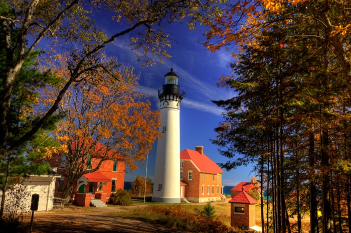
indian summer, photo by paulh192.

“The air is perfectly quiescent and all is stillness, as if Nature, after her exertions during the Summer, were now at rest.”
~John Bradbury, 1817

We’ve had a spectacular October, and that had me wondering about the term “Indian summer.” Wikipedia has some thoughts on Indian summer, but I thought the best work was done by William R. Deedler, Weather Historian for the National Weather Service Detroit/Pontiac in Just what is Indian summer and did Indians really have anything to do with it?. He writes:

It can be defined as “any spell of warm, quiet, hazy weather that may occur in October or even early November.” Basically, autumn is a transition season as the thunderstorms and severe weather of the summer give way to a tamer, calmer weather period before the turbulence of the winter commences.

The term “Indian Summer” is generally associated with a period of considerably above normal temperatures, accompanied by dry and hazy conditions ushered in on a south or southwesterly breeze. Several references make note of the fact that a true Indian Summer can not occur until there has been a killing frost/freeze.

The earliest known use of the term was in 1778 by Frenchman St. John de Crevecoeur who wrote:

Sometimes the rain is followed by an interval of calm and warmth which is called the Indian Summer, its characteristics are a tranquil atmosphere and general smokiness. Up to this epoch the approaches of winter are doubtful; it arrives about the middle of November, although snows and brief freezes often occur long before that date.”

But does it have anything to do with Native Americans? Some thoughts Deedler shares are that Native Americans chose that time of year as their hunting season, that natives made use of the dry, hazy weather to attack settlers before winter set in, and the prejudicial notion that immigrants equated Indian Summer to “fools” Summer, given the reliability of the weather. One curious idea is:

…not at all in the American Indian “camp” of theories, was put forward by an author by the name of H. E. Ware, who noted that ships at that time traversing the Indian Ocean loaded up their cargo the most during the “Indian Summer”, or fair weather season. Several ships actually had an “I.S.” on their hull at the load level thought safe during the Indian Summer.

In any case, this is a welcome phenomenon, and one of the best reasons I know to live in Michigan!

Check this out background big and in Paul’s slideshow.

More Michigan Fall Wallpaper from Michigan in Pictures.

Rock River Falls in the Rock River Canyon Wilderness Area

Rock River Falls

Rock River Falls, photo by gkretovic.

Regular readers of Michigan in Pictures know that  Go Waterfalling is the source for Michigan waterfall information. Their Rock River Falls entry says:

This wild waterfall is hidden in the Rock River Wilderness Area north of Chatham. Reaching it will require you to drive down some old logging roads and hike a mile or two along some ill defined trails, but if you are looking for a good waterfall adventure it is worth it.

Rock River Falls is in the Rock River Wilderness Area in the Hiawatha National Forest, which is just north of Chatham. This area is not well marked, but finding the falls is not too hard.

There’s detailed directions at the link above there and Greg also has this photo on his map. See it bigger along with a few other views in his slideshow

Many more Michigan waterfalls on Michigan in Pictures!