Freedom lies in being bold

Renaissance Center Fireworks

freedom festival | detroit, michigan, photo by Ryan Southen

“Freedom lies in being bold.”
~Robert Frost

Hope your Fourth of July is as big, bold & amazing as this great shot of the Detroit fireworks over the Renaissance Center from Lafayette Park.

View Ryan’s photo biggerpurchase it and others and definitely follow him on Facebook!

Today in Spoiler Alerts: July 3, 1776

MEG_0653

Untitled, photo by Marvin Graves

I hope everyone has a great Independence Day weekend … though I suspect the Redcoats won’t.

View Marvin’s photo bigger and see more in his really great Fort Michilimackinac 2009 slideshow.

PS: If you ever get a chance to visit Colonial Michilimackinac in Mackinaw City, I heartily recommend it. Definitely one of Michigan’s coolest museums!

PPS: Love the Bridge peeking up just to the right of the flagpole.


Kitch-iti-Kipi: Michigan’s Largest Spring at Palms Book State Park

Big Spring (Kitch-iti-Kipi) Palms Book State Park

Big Spring (Kitch-iti-Kipi) Palms Book State Park, photo by Michigan Nut Photography

How about a big “way to go!” to the State of Michigan for a complete revamp their previously not very good Michigan Parks & Trails site? The new site is miles better!! The Palms Book State Park page says:

Palms Book is a rewarding side trip for the vacationer touring the Upper Peninsula, for here can be seen one of Michigan’s alluring natural attractions — Kitch-iti-kipi, The Big Spring. Two hundred feet across, the 40-foot deep Kitch-iti-kipi is Michigan’s largest freshwater spring. Over 10,000 gallons a minute gush from fissures in the underlying limestone. The flow continues throughout the year at a constant 45 degree Fahrenheit. By means of a self-operated observation raft, visitors are guided to vantage points overlooking fascinating underwater features and fantasies. Ancient tree trunks, lime-encrusted branches and fat trout appear suspended in nothingness as they slip through crystal waters far below. Clouds of sand kept in constant motion by gushing waters create ever-changing shapes and forms, a challenge to the imagination of young and old alike.

The legend of Kitch-iti-kipi is said to be about a young chieftain whose girlfriend got the best of him. He told her he loved her far above the other dark-haired maidens dancing near his birch bark wigwam. Prove it, she insisted. As a test of his devotion, she declared that he must set sail in his canoe on the pool deep in the conifer swamp. He was to catch her from his canoe as she leaped from an overhanging bough. His canoe overturned in the icy waters and he drowned. It turns out that the maiden was back at the village laughing at his foolish quest. According to legend, the Spring was named Kitch-itikipi in memory of the young chieftain who went to his death in the icy waters in an attempt to satisfy the vain caprice of his ladylove.

Other legends tell of Chippewa parents who came to the pool seeking names for their newborn. They supposedly found names like Satu (darling), Kakushika (big eye), Natukoro (lovely flower) and We-shi (little fish) scribed in the sounds of the rippling water. They attributed healing powers to the waters.

A drop of honey on a piece of birch bark dipped into Kitch-iti-kipi and presented to a loved one was to make them true forever. Another legend concerned the tamarack growing on the banks of Kitch-iti-kipi. A small piece of the bark ground in a mortar and pestle and placed in an individual’s empty pockets would be replaced by glittering gold at exactly midnight. Whatever the legends, visitors to the spring loved them. Kitch-iti-kipi is said to have many meanings in the Chippewa language-The Great Water; The Blue Sky I See; The Roaring, Bubbling Spring. Others called it the Sound of Thunder and Drum Water, even though the quiet is eerie. Whatever its name and legend, Palms Book State Park continues to draw curious visitors.

Although it was a black hole all but hidden in a tangle of fallen trees, John I. Bellaire fell in love with the Big Spring in the early 1920s…

Read on for the story of how it came to be a state park along with maps, photos and park events.

View John’s photo background big, purchase this photo and definitely follow him at Michigan Nut Photography on Facebook.

More Michigan parks on Michigan in Pictures!

Waterfall Wednesday: Kukuck’s Falls

Kukuck's Falls

Kukuck’s Falls, photo by eahackne

Michigan has nearly 200 named waterfalls, and Michigan in Pictures has profiles of many of them. The Waterfall Record’s page on Kukuck’s Falls on the Slate River says:

The Slate River enters a deep gorge in a dramatic way with a sudden plunge down steep, layered rock. This drop, Kukuck’s Falls, is the uppermost named drop in a long and rugged path within the gorge. Slate River breaks evenly on the rock line and cascades down, jumping and foaming around, before landing in a small pool below. This waterfall is one of the only drops easily viewed from the east bank path thanks to a convenient bend, although the best vantage can be had riverside.

Park on either side of the bridge over Slate River, about 11 miles east of L’Anse, right on Skanee Road. Follow the river upstream past the lower falls (Slate River Falls, Ecstasy Falls, and Slide Falls) to reach Kukuck’s Falls. There is a path high up on east bank that lowers down to the waterfall, otherwise the more scenic route is right along (and sometimes inside) the river itself.

Click through for a map, more photos of these falls and descriptions of the others.

View Eric’s photo bigger, see more in his Slate River Canyon slideshow and be sure to check out Eric Hackney Photography on Facebook!

Sunrise at Iargo Springs

Iargo Springs Ausable River

Iargo Sunrise, photo by Tamara Rivette

It’s always cool to discover a new Michigan vista via Michigan in Pictures. Au Sable River Valley Online’s page on the River Road National Scenic Byway says:

Lying off of River Road National Scenic Byway, Iargo Springs provides a panoramic view of the Au Sable River. Used as a drinking water source since pre-settlement times, dams were constructed on the springs by early loggers before the turn of the century. The dams were useful in diverting water to the logging camps nearby. Most of Cooke Pond was dry land then.

Europeans have visited the springs for recreation since the 1920s. A trail to the springs was constructed by the Civilian Conservation Corps in 1934. Early photographs show the dam being repaired and reinforced by the CCC’s. The dams lasted until 1981 when a storm took them out. The site was renovated in 1991. Steps were added and boardwalks along the springs, as well as the dams being rebuilt.

You can click through for a map and more sites along Michigan’s most historic trout stream.

View Tamara’s photo bigger and see more in her 2015 Landscapes slideshow. Also be sure to follow her on Facebook at Tamara Rivette Photography.

June 29th in Holland

Holland - MI

Holland – MI, photo by betopps

View this photo from June 29, 2013 background bigtacular and see more in betopps slideshow.

Saturday Morning Stroll: Black Bear in Michigan

Saturday Morning Stroll Michigan Black Bears

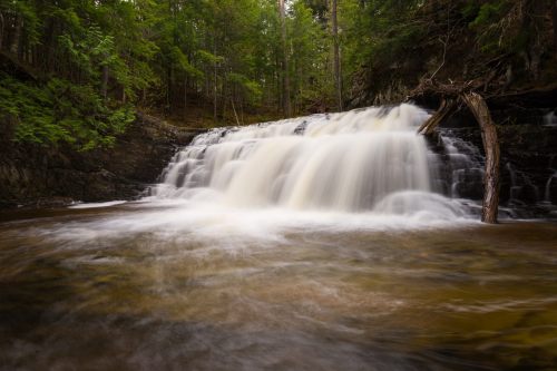
Saturday Morning Stroll, photo by Mark Miller

Recently there have been several reports of black bear sightings in Michigan, in traditional ranges like Leelanau County where these bear were photographed and even as far south as the state line in southwest Michigan and Washtenaw County, where  The Hastings Banner shared that while some are escapees from private facilities, others are ranging south:

“We’re interested in learning more about how they use the landscape in southern Michigan,” explained DNR wildlife research biologist Dwayne Etter. “The landscape in southern Michigan is very different from traditional bear habitat further north.”

…The Saginaw County bear is the southernmost collared bear in Michigan. Other collared bears south of traditional Michigan bear country include a male that was trapped and collared outside of Whitehall in orchard country, as well as a sow with cubs in Newaygo County, and a male in Oceana County. “We got a good break getting this bear collared this far south,” said Etter, who is studying how bears disperse in southern Michigan.

In recent years, bears have been documented in Washtenaw, Ionia and Ingham counties. “There was a bear sighted just north of Lansing several years ago,” Etter said. “We have photos of tracks from Sleepy Hollow State Park in April.

Read on for more including how they tranquilized and collared the Saginaw in an effort to learn more about bear movements. The DNR’s Living with Bears page shares some good tips for staying safe:

With the exception of baiting for hunting purposes in remote areas, placing food to attract bear near homes, cottages, parks, campgrounds and picnic areas may teach them to associate people with food. This may place them and people at risk of injury.

Black bear have enormous appetites and an excellent sense of smell, and are capable of remembering the locations of reliable food sources from year to year. They will travel great distances to find food. When natural foods such as tender vegetation, nuts, berries and insects are scarce, bear are likely to come into contact with people. Problems occur when bear attempt to feed or actually feed on human foods, garbage, pet foods or birdseeds.

Although most bear are secretive and shy by nature, they will tolerate contact with people when their natural food is scarce. Because they are large and powerful animals, they must be respected.

Black bear are generally fearful of humans and will leave if they are aware of your presence. In the rare circumstance that you encounter a bear that does not turn and leave, first try to scare it off by yelling while leaving a clear, unobstructed escape route for the bear. If the bear stands its ground, makes threatening sounds or bluff charges, you are too close. Take slow steps backward while continuing to talk to the bear in a stern tone. In the rare event of an attack, fight back with a backpack, stick or your bare hands. Black bears have retreated in similar situations.

Mark took this photo on the Leelanau Peninsula and wrote: When my neighbor called me early on a Saturday morning to tell me a bear was heading my way, I had to go looking for him. View his photo bigger and see more in his In My Backyard slideshow.

Want to know more about bear cubs with triple the bear cuteness? Check out Bear Triplets on Michigan in Pictures!


Kirtland’s Warbler on the Rebound

Kirtland Warbler at Tawas Point, 5-15-2010

Kirtland Warbler at Tawas Point, 5-15-2010, photo by John Britt

The Michigan Department of Natural Resources completed their annual June survey of Kirtland’s warbler, one of the rarest members of the wood warbler family that nests almost exclusively in Michigan’s northern Lower and Upper peninsulas, with a few locations in Wisconsin and the province of Ontario. They explain:

“We have a great group of DNR, U.S. Forest Service and U.S. Fish and Wildlife Service staff members, as well as volunteers, who are trudging through young, thick jack pine in the early morning hours,” said Department of Natural Resources wildlife supervisor Keith Kintigh. “The reward is getting to hear that singing male Kirtland’s warbler, which is the way we actually census the population.”

The Kirtland’s warbler census is a tool managers use to compare population numbers relative to recovery goals by listening for the male’s song. Kirtland’s warbler numbers had been very low, under 200 nesting pairs, in the mid-1980s. Michigan became the focus for habitat management, since it has been a primary location for the birds’ reproduction.

Kirtland’s warblers spend eight months wintering in the Bahamas. The males arrive back in Michigan between May 3 and May 20, a few days ahead of the females. The males establish and defend territories and then court the females when they arrive. The males’ song is loud, yet low-pitched, ending with an upward inflection – easily recognized to identify the presence of a Kirtland’s warbler.

Additionally, the presence or absence of Kirtland’s warblers determines if protection of that area is needed and allows evaluation of different habitat management techniques. The habitat requirements for Kirtland’s warbler are very specific; they prefer large blocks of young jack pine, usually hundreds of acres in size. The Kirtland’s warbler is a ground-nester, often using the living branches of 5- to 20-foot-tall jack pine trees to conceal their nests, so jack pine trees must be actively managed. Large areas of sandy soils are planted with jack pine and then cut decades later, on specific intervals, to achieve the perfect-aged stands.

Lots more about this rare songbird, including census results that show a steadily increasing population on the DNR’s Kirtland’s Warbler (Dendroica kirtlandii) page.

View John’s photo from May of 2010 background big and see more in his Animals & Wildlife slideshow.

#TBT: Atop Miners Castle

Atop Miners Castle

Atop Miners Castle, photo by Roger Dinda

On April 13, 2006 one of the most recognizable rock formations in the Pictured Rocks National Lakeshore, Miners Castle collapsed. The Lakeshore explains:

On Thursday morning, April 13, 2006, the northeast turret of Miners Castle collapsed. One turret remains on Miners Castle, the best-known feature of Pictured Rocks National Lakeshore. The collapse was reported via cell phone by fisherman in the area, according to chief ranger Larry Hach. Most of the rock fell north and into Lake Superior, and there were no injuries. The lower overlook platform near Miners Castle appears to be unaffected.

While the rockfall at Miners Castle on April 13 was startling, such events are not rare along the Pictured Rocks escarpment. At least five major falls have occurred over the past dozen years: 1) two different portions of Grand Portal Point, 2) the eastern side of Indian Head just east of Grand Portal Point, 3) Miners Falls just below the (now modified) viewing platform, and 4) beneath the lip of Munising Falls (along the former trail that went behind the cascade).

All the rockfalls involved the same rock unit, the Miners Castle Member of the Munising Formation. Rock units are named for places where they were first technically described. The Miners Castle Member consists of crumbly cross-bedded sandstone that is poorly cemented by secondary quartz, according to U.S. Geological Survey Research Ecologist Walter Loope.

Rockfalls along the cliffs typically occur in the spring and fall due to freezing and thawing action of Mother Nature.

Joel says that this photo was taken Roger Dinda in 1961 or ’62 “…before Pictured Rocks was a National Lakeshore, before Miners Castle lost its second turret, before they put up the boardwalks and railings. In this photo I’m just as tense as I look. I am deathly afraid of heights and this was (still is) about the scariest place I’ve ever been.”

View his photo background big more in his Lake Superior slideshow.

There’s more Throwback Thursdays, more Miners Castle & more from the Pictured Rocks National Lakeshore on Michigan in Pictures!

Waterfall (and Wayback) Wednesday: Potawatami Falls & Michigan’s Potawatami Tribe

24 Potawatomi Falls

24 Potawatomi Falls, photo by David Hedquist

GoWaterfalling’s page on Potawatomi Falls shares:

A very scenic waterfall along an especially scenic part of the Black River. An added plus is the close proximity of the equally impressive Gorge Falls. These are two of the most impressive falls on the Black River and are also the two easiest to access.

Potawatomi Falls is just upstream of Gorge Falls and is reached from the same parking area. Potawatomi is the name of one of the native tribes. This waterfall is wheelchair accessible. Gorge Falls is just a short walk away.

In low water, the waterfall is segmented, with most of the water going to the right. In high water the river covers the entire rock separating the two segments with a sheet of white water.

Head over to GoWaterfalling for directions and more. In case you were wondering (as I was), here’s a bit of Potawatomi history from Lee Sultzman that explains (in part):

In 1600 the Potawatomi lived in the northern third of lower Michigan. Threatened by the Ontario tribes trading with the French (Neutrals, Tionontati, Ottawa, and Huron) during the late 1630s, the Potawatomi began leaving their homeland in 1641 and moved to the west side of Lake Michigan in northern Wisconsin. This was completed during the 1650s after the Iroquois defeated the French allies and swept into lower Michigan. By 1665 all of the Potawatomi were living on Wisconsin’s Door Peninsula just east of Green Bay. They remained there until 1687 when the French and Great Lakes Algonquin began driving the Iroquois back to New York. As the Iroquois retreated, the Potawatomi moved south along the west shore of Lake Michigan reaching the south end by 1695. At about the same time, one band settled near Jesuit mission on the St. Joseph River in southwest Michigan. Shortly after the French built Fort Ponchartrain at Detroit in 1701, groups of Potawatomi settled nearby. By 1716 most Potawatomi villages were located in an area between Milwaukee to Detroit. During the 1760s they expanded into northern Indiana and central Illinois.

Land cessions to the Americans began in 1807 and during the next 25 years drastically reduced their territory. Removal west of the Mississippi occurred between 1834 and 1842. The Potawatomi were removed in two groups: the Prairie and Forest Bands from northern Illinois and southern Wisconsin went to Council Bluffs in southwest Iowa; and the Potawatomi of the Woods (Michigan and Indian bands) were relocated to eastern Kansas near Osawatomie.

View David’s photo background bigtacular and see many more photos and some videos in his Potawatomi Falls slideshow.

PS: David is the author of Waterfalling in Wisconsin: The Complete Guide to Waterfalls in the Badger State. I’m seeing a bunch of photos of Michigan waterfalls, so (maybe) stay tuned!