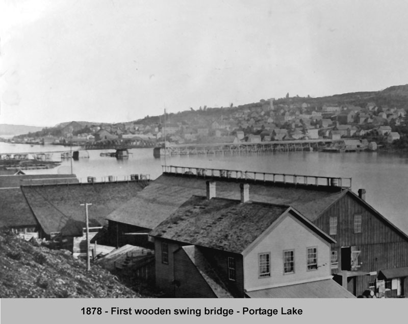
In 1897, the Mineral Range Railroad Company built a new iron swing type bridge, replacing the old wooden bridge. This bridge also featured a two lane roadway, with a railroad crossing underneath. New reconstructed support cribs were also sunk. But on August 15, 1905, disaster struck, when the steamer Northern Wave (Mutual Transit Lines), en route to the Quincy Smelter to pick up copper ingots, smashed into the center section, destroying much of it. The mishap was apparently caused by a mixup in signals.
Original Portage Wooden Swing Bridge Taken from the north side of Ruppe Dock and Warehouse in Hancock, 1878
The bridge would be replaced one year later, again with an iron bridge, and center swing section, and a control house above the roadway, over the center turnstile. This new bridge would have 118 ft. of clearance on the north maritime passage, and 108 ft. on the south side passage. (Newspaper accounts of the period, gave maritime traffic at 6,000 bridge openings per year, and up to 40 daily train crossings per day, both of which began to taper off by 1920). Although almost struck again in 1940 by the Steamer Maritana (Hutchenson Lines), it narrowly avoided the collision by dropping its anchors which caught the submarine telephone cables, stopping it just short of the bridge. (This would happen again 20 years later). Light signaling was added during WWII, to augment the steam whistles already in use. The bridge served the communities until 1960.
In the late 1950s, the Michigan Department of Transportation began studies on how best to replace the aging bridge, with a more modern one, that would accommodate the now much larger ships plying the waterway. It was decided to build what would be become the worlds heaviest aerial lift bridge, which was under construction by 1959, just to the West of the then current bridge. This new bridge, with 4 traffic lanes above, and a railroad crossing below, had its ribbon cutting on Saturday, June 25, 1960. But it almost didn’t happen. During the night before, the Steamer J.F. Schoelkoff (American Steamship Company), traveling westward, signaled for the bridge to open, but the signals were not acted on. Dropping all their anchors, they snagged the submarine telephone cables in an eerie repeat of 20 years previously. Onlookers for the ribbon cutting ceremonies were treated to the spectacle of a large freighter jammed crossways in the waterway, just a quarter mile from the Bridge. Area phone service was disrupted for nearly three days. Telephone service to the bridge, and marine radios were installed shortly. That incident not withstanding, the new Portage Lake Lift Bridge continues to well serve the area, as the possibility of adding yet another new bridge may be explored.
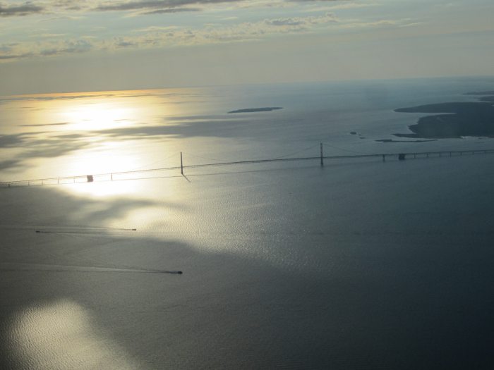
Vinny took this photo on Christmas Eve of 2005. If you want to check in with the current scene, the Mackinac Bridge Authority webcams have you covered with three different views.
Fun fact of the day: I have a mild fear of heights! While it’s not crippling enough to stop me from being able to drive over the Mighty Mac, I can definitely see where some people aren’t able to do that. For all of you, here’s a story (with a good video) about a little known service: The Mackinac Bridge Authority will drive you across!
The Mackinac Bridge Authority has a “Driver’s Assistance Program” that provides drivers for those uncomfortable with driving across the Mackinac Bridge. If you are traveling northbound, there is a phone at the south end of the bridge. Instructions for using the phone are posted in the phone box. If you are southbound, just ask a fare collector for assistance. There is no additional fee for this service.
The phone is located on the shoulder of I-75 just north of the Jamet Street exit to Mackinaw City (near Audies Restaurant). You do not need to exit the freeway. Just past the exit, you can pull over to the right and park on the shoulder. The phone box is located on the right-of-way fencing. The box is green and easily spotted. If this is still unclear, please call us at 906-643-7600.
The website Michigan History was produced by someone at MSU. While I have no idea who or why they gave up on what was shaping up to be a cool website, the history checks out. The page on Port Huron’s Blue Water Bridge says:
Perhaps Port Huron’s greatest claim to fame is the Blue Water Bridge, a historic arcing bridge that serves as a means of transportation between Canada and the United States. The bridge is located over the St. Clair River, and connects Port Huron, Michigan, to Sarnia, Ontario. In 2013 the Blue Water Bridge celebrated its 75th anniversary, and a closer look at its history show why Port Huron residents take pride in the structure.
The original Blue Water Bridge was constructed in 1938, and was built by the American Bridge Company of New York, and the Hamilton Bridge Company of Ontario. The original bridge is an arch cantilever bridge, which was designed to not only support large amounts of traffic, but also to have an aesthetic arching look. In the late 1980s the border crossing became so popular that plans for a new bridge were brought up. However, instead of demolishing the old bridge, a new one was built in 1997 beside the old bridge, to support eastbound traffic.
The Michigan cost for building the new bridge, and renovating the old one was $62.6 million dollars. (Michigan Department of Transportation) The project was considered an enormous success and won awards from the American Society of Civil Engineers, the Ontario Institution of Steel Construction, and the Federal Highway Administration. For Port Huron residents the bridge signifies the close connection with Canada, and the willingness of the two sides to work closely together.
There’s more Michigan bridges on Michigan in Pictures, and since you’ve read this far, Boatnerd’s page on the Saginaw has everything you’ll want to know about the self-unloading bulk carrier that was launched May 9th, 1953 as the John J. Boland. It’s one of three near sister vessels built by this shipyard: The John G. Munson which is still plying the lakes and the Detroit Edison that suffered a career-ending grounding in Lake Michigan in December of 1980.
We had been out to the island and were returning via ferry when the captain announced a slight detour in our route. There was some kind of a special group aboard and as a treat, our boat went under the Mighty Mac, something they hardly ever do. It was pretty neat. The five mile long bridge is no longer the longest suspension bridge in the world, but to me it’s still the prettiest. I’ve personally seen several other suspension bridges, including the Golden Gate, and I’ll pick the Mac every time.
It is hereby declared to be the policy of the United States that certain selected rivers of the Nation which, with their immediate environments, possess outstandingly remarkable scenic, recreational, geologic, fish and wildlife, historic, cultural or other similar values, shall be preserved in free-flowing condition, and that they and their immediate environments shall be protected for the benefit and enjoyment of present and future generations.
~Wild & Scenic Rivers Act, October 2, 1968
Visitors to the Pine River Corridor continue to enjoy a variety of recreation experiences in natural appearing settings. Visitors may encounter both non-motorized and motorized recreation on land within the Pine River corridor (such as hiking, mountain biking, hunting, and auto touring) while only non-motorized recreation is encountered in the river channel. High quality commercial services are available for recreation activities, particularly for boating and fishing.
Watercraft use, particularly canoeing, is an important recreation activity on the Pine River. The river character provides watercraft users with a moderate challenge in practicing boating and water safety skills and a high degree of interaction with the natural environment.
…Fishing on the Pine River is another popular recreation activity. The Pine River is considered a “blue ribbon” trout fishery and many anglers take advantage of the early morning and evening hours and weekdays to fish with some degree of solitude.
PS: Marilyn Wilkie shared that this is the Mortimer E Cooley Bridge on M-55. It’s a Metal Cantilever 12 Panel Rivet-Connected Pratt Deck Truss bridge built in 1935.
Known for its spectacular waterfalls, idyllic beaches, scenic hiking trails and tranquil campground, the Black River Harbor Recreation Area is a popular destination throughout the year. Originating in Wisconsin, the Black River flows through forested areas of large pine, hemlock and hardwood trees. The River has a series of scenic waterfalls as it drops in elevation to meet Lake Superior. Tannin (tannic acids) from hemlock trees is what gives it its unique color.
The Harbor offers one of the area’s few access points to Lake Superior, with boating being a major summer time activity. The boat ramp can accommodate almost any craft trailered in. There is no launching fee. Boat fuel and snacks are available through the concessionaire. Parking for trucks and boat trailers is ample.
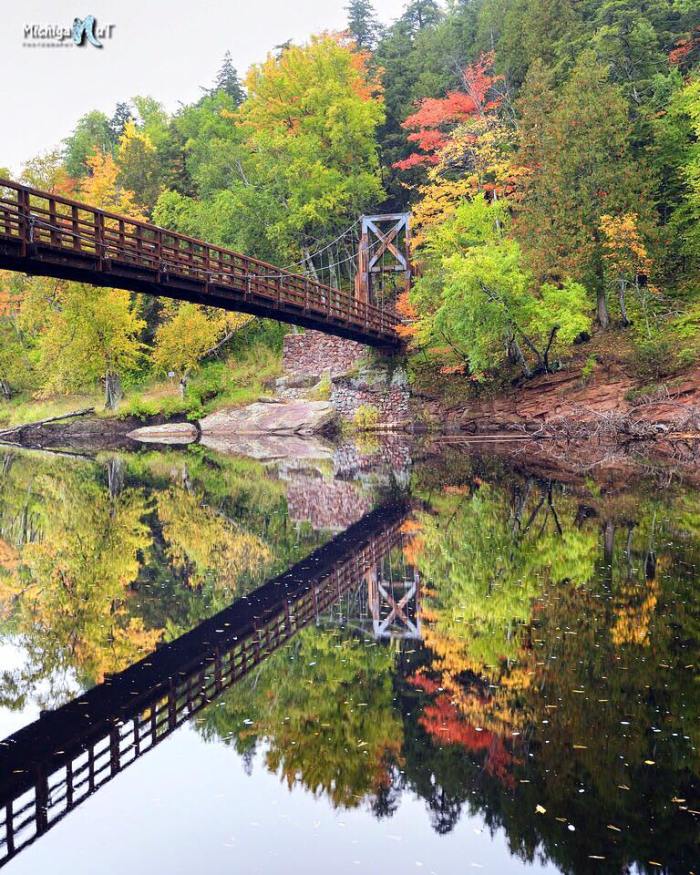
John took this photo a few days ago. Check it out bigger and definitely follow Michigan Nut Photography on Facebook for more great fall color and lots more of Michigan at its best!