
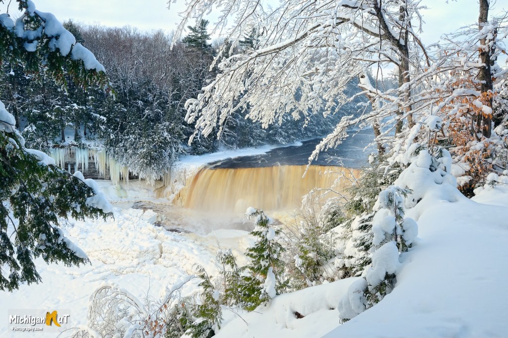
Snow Storm at Tahquamenon Falls by Michigan Nut Photography
Yesterday afternoon mLive meteorologist Mark Torregrossa shared that the National Weather Service is so confident about inbound heavy snow that they issued a winter storm watch with a possibility of up to a foot of snow from 7pm today to 7pm Thursday — more than 24 hours before any flakes fall!
In Lower Michigan the winter storm watch stretches from the Kalamazoo area northward through the Grand Rapids area and up the western shoreline through Muskegon, Grand Traverse area and Charlevoix. Cadillac is also in the winter storm watch. The western Lake Superior shoreline counties in the Upper Peninsula are also in the winter storm watch.
You can find this shot from Michigan’s largest waterfall & many others in the Winter in Michigan gallery on the Michigan Nut Photography website. John also shares much more on his Facebook!
Here’s a fall pic by John from the same spot and there is much more Tahquamenon Falls on Michigan in Pictures!
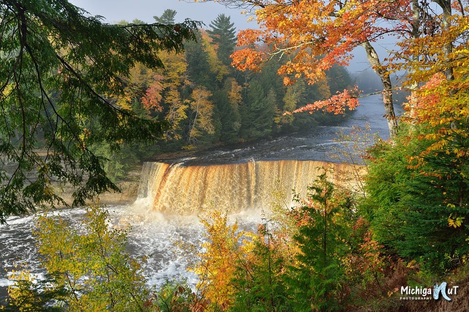
Autumn morning at Tahquamenon Falls by Michigan Nut Photography


no snow predicted for Lenawee Cty ☹️Sent from my iPad
LikeLiked by 1 person
Yes it seems to be very west coast, north coast :/
LikeLike
The picture of the Falls is exquisite! I think we’ll make up for last year’s lack of snow. And it will be brutally cold Thursday as well.
LikeLike